Listed on the National Register of Historic Places in
1975. A historic map-sheet match is not published yet. The record needs a coordinate-quality review before it can be joined to a sheet boundary.
From the record
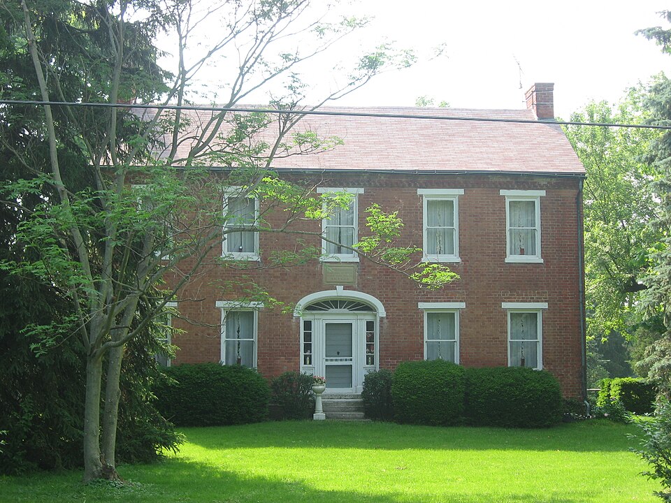
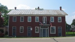
“The Berryhill-Morris House is a historic farmhouse near the city of Bellbrook in Greene County, Ohio, United States. Built in the 1830s for an elderly veteran, it has changed little since its early years, and it has been named a historic site.”
Wikipedia article Berryhill-Morris House, CC BY-SA 4.0.
one of 30 National Register listings in Greene County · listed in 1975 · category: Building · one of 1 National Historic Landmarks in Greene County.
National Register reference number.75001407- the number the National Park Service assigned this property when it was listed, and the key its nomination file is catalogued under at the National Archives.
Regional context, not property-specific
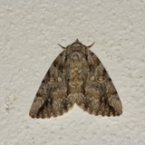
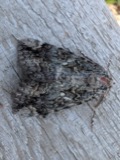
evidence. Museums hold 101 specimens
collected within 10 miles of Berryhill-Morris House between 1896 and
1975: 100 Animalia, 1 Protozoa. 12 distinct Species records are shown.
Collected by C CROFT AND W DUELLMAN, Cooke, W. B.; Cooke, V. G., Coovert, G.A. and others. Each is a
physical object with a catalogue
number, and each entry opens the museum's record. This is what was
collected and kept, not a survey of what lives here - nothing can be
concluded from a species being absent.
Regional context, not property-specific
evidence. The federal mineral resources record lists
8 workings within 5 miles of Berryhill-Morris House: 4 past producers, 3 producers, 1 plant.
4 still produce. What was taken out: Sand and Gravel, Construction, Stone, Crushed/Broken. Distance is straight-line from the
map coordinates, so a quarry counted here may appear on a neighbouring
settlement's page as well.
Regional context, not property-specific
evidence. The National Weather Service names
Bellbrook, the town this property stands in, in 28 storm reports between 1994 and 2025: 11 thunderstorm wind, 8 flood, 6 hail, 2 heavy rain.
No death or injury is recorded in these reports. Each account below is quoted exactly as the forecast office
filed it, from the NOAA Storm Events Database, and each date
opens the federal record of that event.
No historic map-sheet match is published
for this property yet. That does not mean no map exists. This record needs
a coordinate-quality review before it can be joined to a sheet boundary.
Browse the county's mapped places while that work is
pending.
From the nomination file
1,580 words on record
When this property was proposed for the
National Register, someone wrote the case for it: what the building is,
and why it matters. That document is a federal record in the public domain.
It is quoted below word for word, never summarised. The text was read off the scanned case file by machine, so the
occasional stray character is the recogniser's and the 1970s
typewriter's.
Description of the property
hood mold with keystone, eight light flush fan transom, side lights, molded pilasters and six tier paneled door. A stone Born June 26, 1799 Built This House A.D. 1832 stone of the south end is inscribed with the name "Polly," 105 acres in a rural setting south of Bellbrook, Ohio. JUN 2 O 1975 CONDITION REGISTER NATIONAL Ruins Samuel Berryhill The additions have been modified any historical interest. has an ornate Adams style doorway with a semi-eliptical stone Some wood trim shows evidence of extensive termite damage. out frieze. There are extensive remnants of the Adams style wood- diagonal courses plus a vertical ogee shaped course.
The A rectangular central hall Federal style Ohio farmhouse with flat arch basement windows and cut stone steps lead decorative brick frieze is constructed from corbelled and stack double brick chimneys are interior end at the ridge line. lintels with ornamental end blocks and stone sills.A (Check One) The rectangular l/l double hung sash windows have stone The unimportant additions to the rear are late l9th Samuel Berryhillrs wife.The eaves and gables verge close with The house is now as it was in 1832,a farm house on century and 1930's vintage. - Excellent X Good Moved windowless sides are five course American bond.The gable The main stairway has ornamental brackets. The five bay Flemish bond brick facade Fair work and mantels.
plaque over the door reads: so heavily by modernization both inside and out as to destroy up to the entrance. Pre-Columbian ! - 20th Century SPECIFIC DATE(S) (If Applicable and Known) - Urban Planning - Historic - Other (Specify) Indus try LJ Agriculture - Invention - Science - Landscape - Sculpture - Theater - Transportation STATEMENT OF
Statement of significance
Revolution, being wounded and captured at Gulford's Iollowed his father in farming until his death and burial Family, forebears of the present owner, in 1858. JUN 2 0 1975 1832 Conservation Commerce Engineering Communications Architecture NATIONAL losophy Military Aboriginal Religion/Phi REGISTER Literature SIGNIFICANCE Music itarian Social/Human- Political Ohio.
any notable achievements on his part except the construction create a tasteful cultural environment as well as economic Education The house and farm passed into the hands of the Morris the craftsmanship and prosperity of the early settlers Samuel Berryhill!s Federal style home is significant as a visual reminder of the early settlers striving to Alexander was an Irish immigrant who served in the of his handsome home which stands as visible evidence to Samuel Berryhill was the sixth child of Alexander and forebears of one of its most noted old families. of southwestern ohio. PERIOD (Check One or More as Appropriate) Rachel Berryhill, pioneers in Sugar Creek township Court House, moved to Ohio in 1814.
Alexander died prosperous farmer at age 59 in 1823 and is buried with his wife in Bellbrook's Pioneer Cemetery. Samuel Berryhill Art in the Pioneer Cemetery in 1840.History does not disclose prosperity out of the course fiber of early southwestern Illinois; S. J. Clarke Publishing Company, 1902.
Quoted from the National Register nomination
for reference 75001407, 13 pages, held by the National Archives in Record
Group 79. See the
catalogue record.
Listed places nearby
2 within 8 miles
Other National Register properties close
enough to walk or drive between, ordered by distance from this one. Both
positions come from the same geocoding pass that matched these properties
to their map sheets.
Listing record. National Park Service National Register of Historic Places, listed-properties dataset, current to 2026-05-22.
Map join. Address geocoded through the United States Census geocoder, then tested against the published boundary of every sheet in the USGS Historical Topographic Map Collection.
How this page is made. Listing fields come from federal records; map-sheet coverage is a labelled coordinate-to-boundary calculation, not a source-field claim.
Specimens. Global Biodiversity Information Facility (GBIF), https://www.gbif.org/. Only records licensed CC0 or CC BY are used. Records licensed CC BY-NC are excluded because this site carries advertising. Images are checked individually and any whose licence is non-commercial, no-derivatives or unreadable is refused.
Mines and quarries. USGS Mineral Resources Data System (MRDS) https://mrdata.usgs.gov/mrds/ A work of the United States government, no copyright under 17 U.S.C. 105.
Storms. NOAA National Centers for Environmental Information, Storm Events Database https://www.ncei.noaa.gov/stormevents/ A work of the United States government, no copyright under 17 U.S.C. 105. Narratives are quoted verbatim from the National Weather Service report and are not edited or summarised.
 Block
Block