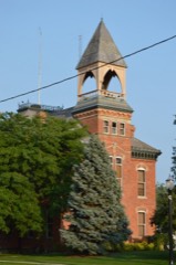
Listed on the National Register of Historic Places in
1975. A historic map-sheet match is not published yet. The record needs a coordinate-quality review before it can be joined to a sheet boundary.
From the record
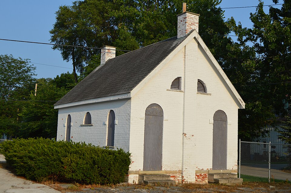
“The Old School Privy is a historic outhouse in the village of Genoa, Ohio, United States. Constructed in the 1870s, it has the unusual distinction of being both a public toilet and an official historic site.”
Wikipedia article Old School Privy, CC BY-SA 4.0.
one of 21 National Register listings in Ottawa County · listed in 1975 · category: Building.
National Register reference number.75001515- the number the National Park Service assigned this property when it was listed, and the key its nomination file is catalogued under at the National Archives.
Specimens collected near this property
12 of 733 shown
Regional context, not property-specific
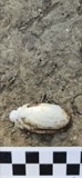
evidence. Museums hold 733 specimens
collected within 10 miles of Old School Privy between 1825 and
1975: 722 Animalia, 8 Plantae, 3 Fungi. 12 distinct Species records are shown.
Collected by Al Szuch, Albiet, P., Berra, T. M. (Tim M.) & Class and others. Each is a
physical object with a catalogue
number, and each entry opens the museum's record. This is what was
collected and kept, not a survey of what lives here - nothing can be
concluded from a species being absent.
Regional context, not property-specific
evidence. The federal mineral resources record lists
10 workings within 5 miles of Old School Privy: 5 past producers, 5 producers.
5 still produce. What was taken out: Calcium, Stone, Crushed/Broken, Limestone, General, Beryllium. Distance is straight-line from the
map coordinates, so a quarry counted here may appear on a neighbouring
settlement's page as well.
Regional context, not property-specific
evidence. The National Weather Service names
Genoa, the town this property stands in, in 29 storm reports between 1998 and 2023: 16 thunderstorm wind, 12 hail, 1 lightning.
No death or injury is recorded in these reports. Each account below is quoted exactly as the forecast office
filed it, from the NOAA Storm Events Database, and each date
opens the federal record of that event.
Numerous trees, power lines, and power poles downed from thunderstorm winds. One tree was reported to have fallen on a house. Two semi trucks were also blown over.
Thunderstorm winds caused widespread wind damage in the area. Numerous trees and limbs were downed. Several power lines were downed during this event as well.
No historic map-sheet match is published
for this property yet. That does not mean no map exists. This record needs
a coordinate-quality review before it can be joined to a sheet boundary.
Browse the county's mapped places while that work is
pending.
From the nomination file
2,029 words on record
When this property was proposed for the
National Register, someone wrote the case for it: what the building is,
and why it matters. That document is a federal record in the public domain.
It is quoted below word for word, never summarised. The text was read off the scanned case file by machine, so the
occasional stray character is the recogniser's and the 1970s
typewriter's.
Description of the property
War, when the Northwest Territory was becoming a such as the water table, slab steps, thresholds, and sills. The ornamental characteristics are the rusticated four separate toilet rooms, two for students and two arches that contained wooden louvers for ventilation. Each elevation is symmetrically balanced. This Michael R. Barthold, Landmark designer CONDITION Excellent Ruins Fair Landmark Survey is a simple but elegant building orange brick with rusticated stone trim, probably round arched openings often in brick and rusticated dressing of the stone surface and its use say as the The major recognizable elements of this style are building reflects the stong pride that the Genoa area late Victorian architectural period known as area in the prosperous period following the Civil stone work.
This example is built of the local soft designed in all the detail and high style of the social and economic influence in the nation. two doors in each of the gabled ends of the building, false chimney on the opposite end from the usable one The fine quality of design in this rather humble symmetry was carried to the extent of constructing a that vented the pot belly stove. Higher in each gable are two quarter part round spring blocks of the arches over the doors. and practical because of its use in heavy wear areas each with a five paneled door and fan light transom (Check One) had in building its civic buildings in the l87o's The "old School Privy",Building #8 on the Genoa Good Romanesque Revival. The style was popular in our from local limestone quarries.
The stone is ornamental for faculty, each with a separate door. There are and 80's. The straight forward rectangular plan was divided into - 16th Century - Urban Planning - Other (Specify) STATEMENT OF
Statement of significance
most elegant privy in the county, if not the region, of civic pride in Genoa, incorporated in 1868. original use as a rest stop, and thus draw Commerce Architecture Communications Military Conservation SIGNIFICANCE Aboriginal Engineering losophy Religion/Phi Science Literature Transportation Art Prehistoric Pre-Columbian Agriculture itarian Theater Music at major crossroads throughout the Northwest Landscape in the school district. This structure is significant as the largest and architecture which reflects the early development Sculpture Industry Social/Human- Bicentennial Commission plans to put it to its Invention community attention to the beauty and significance one in Genoa.
In restoring this little building the Genoa Area Although small comfort stations were once erected The paternal priority of thinking of the village Territory, few were ever as significant as this of the oldest and smallest brick public structure fathers is implied by the order of building Political The privy is representative of the quality by a newer building on the same site. brick school which was built in 1870,now replaced Mill in1872 and the Town Hall in 1885. PERIOD (Check One or More as Appropriate) SPECIFIC DATE(S) (If Applicable and Known) Education "Illustrated Historical Atlas of Ottawa County, 1874"
Quoted from the National Register nomination
for reference 75001515, 14 pages, held by the National Archives in Record
Group 79. See the
catalogue record.
Listed places nearby
2 within 8 miles
Other National Register properties close
enough to walk or drive between, ordered by distance from this one. Both
positions come from the same geocoding pass that matched these properties
to their map sheets.
Listing record. National Park Service National Register of Historic Places, listed-properties dataset, current to 2026-05-22.
Map join. Address geocoded through the United States Census geocoder, then tested against the published boundary of every sheet in the USGS Historical Topographic Map Collection.
How this page is made. Listing fields come from federal records; map-sheet coverage is a labelled coordinate-to-boundary calculation, not a source-field claim.
Specimens. Global Biodiversity Information Facility (GBIF), https://www.gbif.org/. Only records licensed CC0 or CC BY are used. Records licensed CC BY-NC are excluded because this site carries advertising. Images are checked individually and any whose licence is non-commercial, no-derivatives or unreadable is refused.
Mines and quarries. USGS Mineral Resources Data System (MRDS) https://mrdata.usgs.gov/mrds/ A work of the United States government, no copyright under 17 U.S.C. 105.
Storms. NOAA National Centers for Environmental Information, Storm Events Database https://www.ncei.noaa.gov/stormevents/ A work of the United States government, no copyright under 17 U.S.C. 105. Narratives are quoted verbatim from the National Weather Service report and are not edited or summarised.
 Block
Block