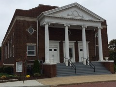
Listed on the National Register of Historic Places in
1975. A historic map-sheet match is not published yet. The record needs a coordinate-quality review before it can be joined to a sheet boundary.
From the record
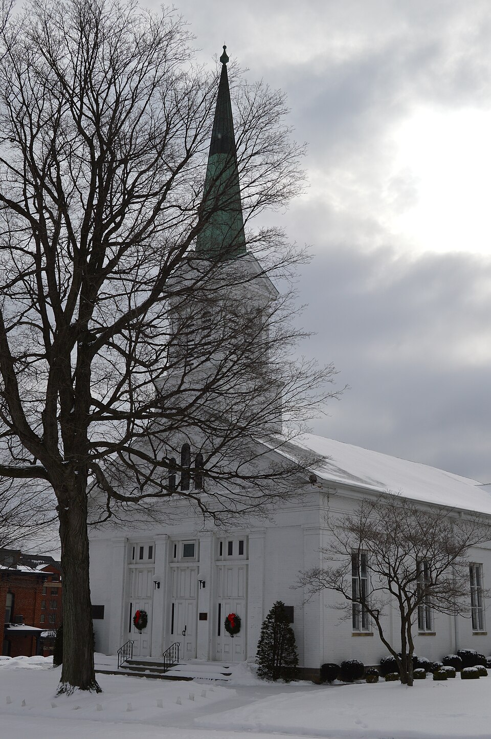
“First Congregational Church of Cuyahoga Falls is a historic church at 130 Broad Boulevard in Cuyahoga Falls, Ohio.”
Wikipedia article First Congregational Church of Cuyahoga Falls, CC BY-SA 4.0.
one of 137 National Register listings in Summit County · listed in 1975 · category: Building · one of 1 National Historic Landmarks in Summit County.
National Register reference number.75001538- the number the National Park Service assigned this property when it was listed, and the key its nomination file is catalogued under at the National Archives.
William Wetmore was born in Middletown, Conn., September 15, 1771. He was a descendant of Thomas Wetmore, one of the proprietors of Middletown, who purchased the site of the Indians in 1662. He removed to Ohio in July, 1804, and built the second house that was erected in what was afterward Stow Township. It stood about twenty rods eastwardly of the northeast corner of Lot 36. In 1808, Stow Township was organized, and he was elected a Justice of the Peace. In August of that year, the county of Portage being organized he was appointed Clerk of the Court at Kavenna. He afterward resigned the office, moved back to Stow and settled on his farm. He died at his residence on the east bank of Silver Lake, October 27, 1827. Henry Newberry was born in Windsor, Conn., in January, 1783. In 1814, soon after the death of his father, he came to Ohio, as before stated, to look at his possessions in the Western wilds. He first lived at Silver Lake two years, having moved there, as previously mentioned, in 1824, and then took up his residence at the Falls. He died in 1854, in the stone house, afterward the residence of James H. Cooke. Such, in brief, are the biographies of the founders of Cuyahoga Falls.*
The town of Cuyahoga Falls was first laid out in 1825, by Elkanah Richardson. It was subsequently re-surveyed, platted and recorded by Birdsey Booth. It was located in the townships of Stow and Tallmadge, and included all of the present platted village except so much as has since been platted east of the Cuyahoga River and north of the Tallmadge Township line. The part last mentioned was platted and recoi'ded by R. A. Ashman, Count}' Surveyor, in 1837. The original proprietors were Henr^' Newberr}', Joshua Stow and William Wetmore. The proprietor of the addition was Joseph Hale. No allotment has been made to the original plat except the one of 1837. That part lying in the township of Stow was owned b}' Stow and Wetmore ; that part included in Tallmadge was the propert}' of Newberr^'.
Regional context, not property-specific
evidence. The
federal wildfire occurrence database
lists 2 fires within 5 miles of First Congregational Church of Cuyahoga Falls between
1999 and 2014, burning about 2 acres in total. 1 started naturally. None was recorded as arson.
Distance is straight-line from the map coordinates, so a fire counted
here may appear on a neighbouring settlement's page as well.
Reported cause
Fires
Missing data/not specified/undetermined
1
Natural
1
The most recent of
them, most recent first, with the day each was reported and the service
that recorded it.
Regional context, not property-specific
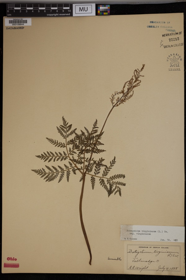
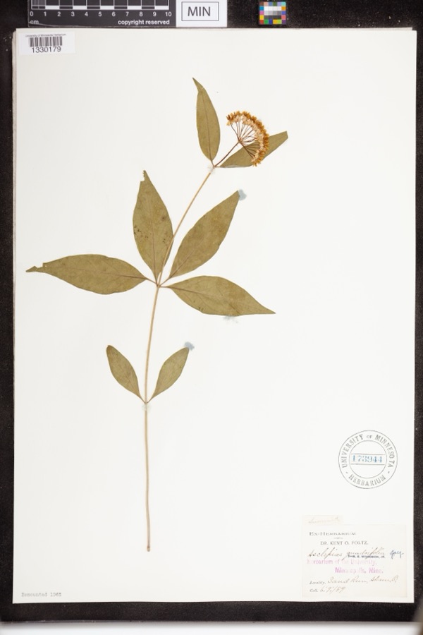
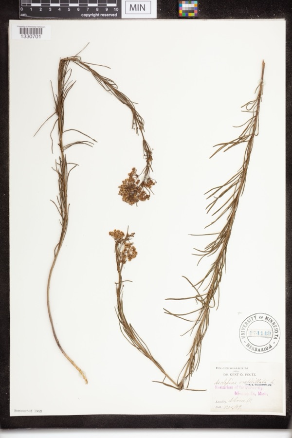
evidence. Museums hold 830 specimens
collected within 10 miles of First Congregational Church of Cuyahoga Falls between 1867 and
1975: 709 Animalia, 72 Plantae, 47 Fungi, 1 Unrecorded, 1 Bacteria. 12 distinct Species records are shown.
Collected by (no collector listed), A. Black, A. Woolman and others. Each is a
physical object with a catalogue
number, and each entry opens the museum's record. This is what was
collected and kept, not a survey of what lives here - nothing can be
concluded from a species being absent.
Regional context, not property-specific
evidence. The federal mineral resources record lists
14 workings within 5 miles of First Congregational Church of Cuyahoga Falls: 11 past producers, 3 producers.
3 still produce. What was taken out: Sand and Gravel, Construction. Distance is straight-line from the
map coordinates, so a quarry counted here may appear on a neighbouring
settlement's page as well.
Regional context, not property-specific
evidence. The National Weather Service names
Cuyahoga Falls, the town this property stands in, in 48 storm reports between 1997 and 2025: 25 hail, 20 thunderstorm wind, 1 lightning, 1 flash flood.
No death or injury is recorded in these reports. Each account below is quoted exactly as the forecast office
filed it, from the NOAA Storm Events Database, and each date
opens the federal record of that event.
Thunderstorms dumped two to three inches of rain on Cuyahoga Falls in a short period of time. Lowland and street flooding occurred with water as much as three feet deep on some roads. Several cars were stranded in the flood waters and a few buildings sustained minor damage.
Tree fell onto garage just southwest of downtown Cuyahoga Falls. A large tree limb was snapped near the intersection of Howe Avenue and Tallmadge Road, just southeast of downtown Cuyahoga Falls.
Three locations on Howe Rd in Cuyahoga falls flooded with roads closed and barricaded. Street flooding was also reported in Tallmadge. Rainfall up to 5/hr over Tallmadge, with 1.64 in 35 minutes.
No historic map-sheet match is published
for this property yet. That does not mean no map exists. This record needs
a coordinate-quality review before it can be joined to a sheet boundary.
Browse the county's mapped places while that work is
pending.
From the nomination file
1,721 words on record
When this property was proposed for the
National Register, someone wrote the case for it: what the building is,
and why it matters. That document is a federal record in the public domain.
It is quoted below word for word, never summarised. The text was read off the scanned case file by machine, so the
occasional stray character is the recogniser's and the 1970s
typewriter's.
Description of the property
plastered, and because of documentary evidence discussed in (8). ior, the threesouthernmost bays show the Romanesque Revival windows facade pediment. divided chancel focussed on the communion table. Nevertheless, the library, a new office and storage space. A third addition was complet- a library, choir rehearsal rooms and twenty Church School rooms. CONDITION sanctuary. Moved Ruins The interior of the sanctuary retains the original woodwork carved Gothic pattern.
At the same time the earlier clear glass interior retains the character of a mid to late nineteenth century bly room in which several classes met simultaneously.On the exter- and quoins.A three-part Romanesque window was inserted in the that there was originally a recessed porch, because the interior wall block with four bays on the side elevations and three on the north This is a brick church built in the Greek Revival style and later original structure, consisting of a gymnasium with a stage, a small of this addition. At the same time the tower was altered so that the the church.
It contained a study, a parlor and a Sunday school assem The three entrances are placed between brick piers.It seems certain sanctuary in 1892.In 1934 the center pulpit was replaced bya The exterior brick of the church has been painted white. casings with Greek eared"architraves. In 1883 the gallery over the facade.On the sides shallow brick piers and pilasters stand in relief.
This is a well-preserved example of a church embodying the century. More important, it is credited with being the oldest church in continuous use in Summit County, now that the famous Tallmadge was a separate village on the Cuyahoga River, named because the created in 1840 from portions of three other counties, Cuyahoga 1846 and dedicated in 1847. Commerce Architecture Conservation Akron.
Transportation Communications SIGNIFICANCE losophy Aboriginal Education Literature itarian Engineering Industry Agriculture Military Religion/Phi Music Landscape Sculpture Political Social/Human- The power provided by this fall caused innumerable industries to Rosse Hall at Kenyon College in Gambier, contained a recessed porch with two columns.They were designed by Charles Romanoff from nearby Middlebury and Tallmadge.It met for several months Cuyahoga Falls, now virtually a part of metropolitan Akron, present building were commenced, the building was completed in ceed in installments because of limited means.He states that the pastors from Western Reserve College.In 1845 plans for the The Congregational Church stands on the proposed site of the in a schoolhouse and then in a public Lyceum, and was supplied by changes in architectural taste of the second half of the nineteenth 1869 and considerably remodeled in1883.After the gymnasium was Prczriminsky, a Polish teacher of languages at Kenyon in 1834-1835.
The merger as the United Church of Christ took place in 1957. chapel of Western Reserve Academy (l835),formerly Western Res- added in 1927, the church served as a community social center. erve College, in Hudson. In an existing letter dated August 4,1845,one of the members The Cuyahoga Falls church was enlarged and "improved"in similar to the Episcopal Church at Columbus."That Falls was a rival for the location of the county seat which went to river descends about 240 feet over a distance of only two miles.
Quoted from the National Register nomination
for reference 75001538, 10 pages, held by the National Archives in Record
Group 79. See the
catalogue record.
Listed places nearby
6 within 8 miles
Other National Register properties close
enough to walk or drive between, ordered by distance from this one. Both
positions come from the same geocoding pass that matched these properties
to their map sheets.
Listing record. National Park Service National Register of Historic Places, listed-properties dataset, current to 2026-05-22.
Map join. Address geocoded through the United States Census geocoder, then tested against the published boundary of every sheet in the USGS Historical Topographic Map Collection.
How this page is made. Listing fields come from federal records; map-sheet coverage is a labelled coordinate-to-boundary calculation, not a source-field claim.
Wildfire. Short, Karen C. 2022. Spatial wildfire occurrence data for the United States, 1992-2020 [FPA_FOD_20221014]. 6th Edition. Fort Collins, CO: Forest Service Research Data Archive. https://doi.org/10.2737/RDS-2013-0009.6 Collected with United States Government funding and usable without additional permissions or fees.
Specimens. Global Biodiversity Information Facility (GBIF), https://www.gbif.org/. Only records licensed CC0 or CC BY are used. Records licensed CC BY-NC are excluded because this site carries advertising. Images are checked individually and any whose licence is non-commercial, no-derivatives or unreadable is refused.
Mines and quarries. USGS Mineral Resources Data System (MRDS) https://mrdata.usgs.gov/mrds/ A work of the United States government, no copyright under 17 U.S.C. 105.
Storms. NOAA National Centers for Environmental Information, Storm Events Database https://www.ncei.noaa.gov/stormevents/ A work of the United States government, no copyright under 17 U.S.C. 105. Narratives are quoted verbatim from the National Weather Service report and are not edited or summarised.
 Block
Block