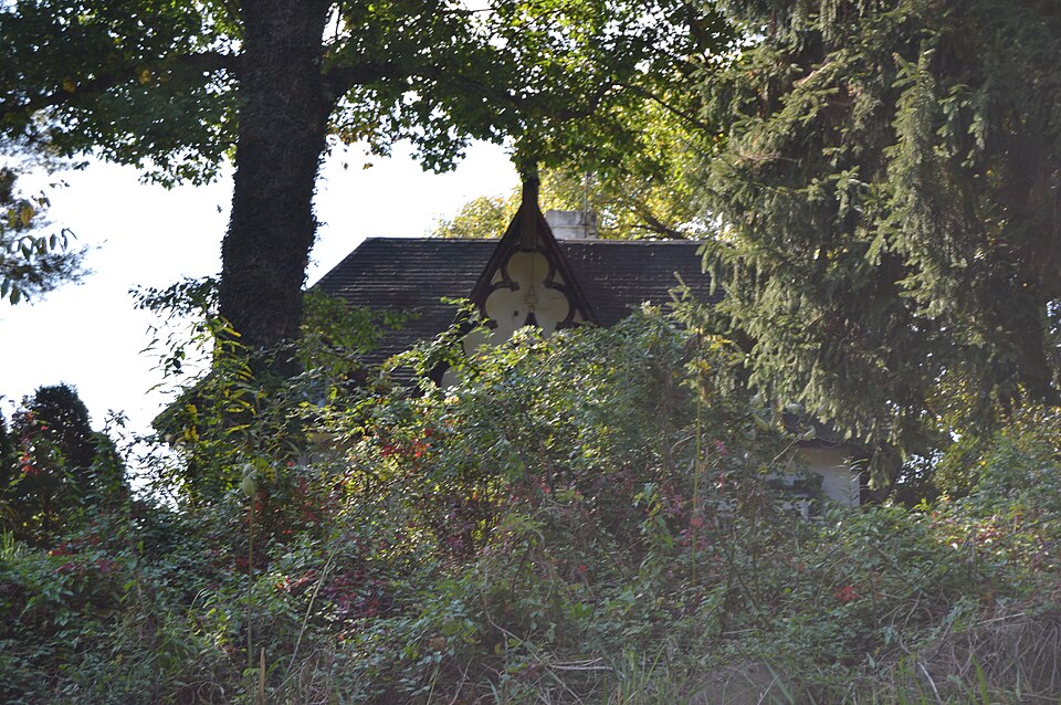
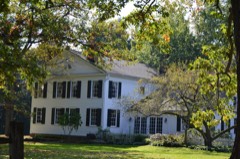
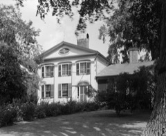
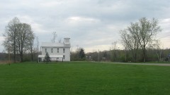
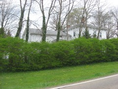
Listed on the National Register of Historic Places in
1975. A historic map-sheet match is not published yet. The record needs a coordinate-quality review before it can be joined to a sheet boundary.
From the record
one of 32 National Register listings in Trumbull County · listed in 1975 · category: Building · one of 1 National Historic Landmarks in Trumbull County.
National Register reference number.75001545- the number the National Park Service assigned this property when it was listed, and the key its nomination file is catalogued under at the National Archives.
Specimens collected near this property
12 of 101 shown
Regional context, not property-specific
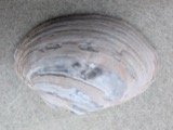
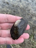
evidence. Museums hold 101 specimens
collected within 10 miles of Brown, Charles, Gothic Cottage between 1901 and
1975: 95 Animalia, 6 Plantae. 12 distinct Species records are shown.
Collected by Armbruster, D. C. (Daniel C.), CAROOTS, JAMES, Collector(s): Bruce Wathall and others. Each is a
physical object with a catalogue
number, and each entry opens the museum's record. This is what was
collected and kept, not a survey of what lives here - nothing can be
concluded from a species being absent.
Regional context, not property-specific
evidence. The federal mineral resources record lists
2 workings within 5 miles of Brown, Charles, Gothic Cottage: 1 past producer, 1 producer.
1 still produces. What was taken out: Sand and Gravel, Construction. Distance is straight-line from the
map coordinates, so a quarry counted here may appear on a neighbouring
settlement's page as well.
Regional context, not property-specific
evidence. The National Weather Service names
North Bloomfield, the town this property stands in, in 4 storm reports between 2001 and 2011: 3 thunderstorm wind, 1 flash flood.
No death or injury is recorded in these reports. Each account below is quoted exactly as the forecast office
filed it, from the NOAA Storm Events Database, and each date
opens the federal record of that event.
Torrential rain fell over Trumbull County on the evening of the 14th, this after three preceding days of flooding. The saturated ground could not handle additional rainfall, so the one to two inches that fell on this evenig resulted in flash flooding. Several creeks mainly in northern portions of the county came out of their banks. Basements flooded in the Howland Township area. Several roads were impassable including OH 193.
No historic map-sheet match is published
for this property yet. That does not mean no map exists. This record needs
a coordinate-quality review before it can be joined to a sheet boundary.
Browse the county's mapped places while that work is
pending.
From the nomination file
1,665 words on record
When this property was proposed for the
National Register, someone wrote the case for it: what the building is,
and why it matters. That document is a federal record in the public domain.
It is quoted below word for word, never summarised. The text was read off the scanned case file by machine, so the
occasional stray character is the recogniser's and the 1970s
typewriter's.
Description of the property
picturesque outline to.the various elevations. An unusual construc- than the front of the house.The south side had two parlors divided ornament of the bays and dormers is emphatic. The roof is high Nevertheless, enough of the original interior material is intact and steep, almost a mansard.The dormers give an unusually Revival style.The facade has the symmetrical disposition of an The floors have been sanded and finished with a high-gloss varnish. is on the short end of a long rectangle.The crenellated and turreted PERIOD (Check One or More as Appropriate) - Pre-Columbian| - 16th Century SPECIFIC DATE(S) (If Applicable and Known) - Urban Planning - Prehistoric - Invention Landscape - - Literature - Military STATEMENT OF
Statement of significance
Brown, builder of "Brownwood" directly across the road (National notes that "its suggestion of inner recesses and angles, raised the John S. McAdoo purchased the tract of land known as the "Lester Peace and a farmer, and had served in the Civil War from 1861 to 1865.
FREIB2 8 1975 Commerce Conservation Communications Transportation Science losophy Engineering SIGNIFICANCE Religion/Phi Education Architecture Aboriginal Theater REGISTER NATIONAL itarian Music Agriculture Sculpture Charles Brown was also the son-in-law of Leicester King, Social/Human- Industry iments of both Ephraim Brown and Leicester King.George Clary therein, where runaway slaves might be stowed and harbored on Register).It is a notable and well preserved example of the Early Political their journey north." This house was built by Charles Brown, the son of Ephraim station, no doubt partly because of the known anti-slavery sent- The house, which Campen suggests may have been built in 1846,is reputed to have been used as an underground railroad Gothic Revival, with an unusual solid plank wall construction.
a granddaughter of Ephraim Brown.McAdoo was a justice of the Other(Specify) on whose property the house was built.King was a promoter and Wing, who refers to the house as Charles Brown's Gothic Cottage, ardent Abolitionist who worked for the repeal of the"Black Laws. King died in the North Bloomfield home of his son-in-law in 1856. 1846(?) president of the Pennsylvania and Ohio Canal, a State Senator and legend of a specially constructed, secret vault or compartment Charles Brown was born in 1814 and died in 1880. In 1882 Art RECEIVED (sic) King and Brown farms." McAdoo had married Mary H. Wing,
Quoted from the National Register nomination
for reference 75001545, 10 pages, held by the National Archives in Record
Group 79. See the
catalogue record.
Listed places nearby
4 within 8 miles
Other National Register properties close
enough to walk or drive between, ordered by distance from this one. Both
positions come from the same geocoding pass that matched these properties
to their map sheets.
Listing record. National Park Service National Register of Historic Places, listed-properties dataset, current to 2026-05-22.
Map join. Address geocoded through the United States Census geocoder, then tested against the published boundary of every sheet in the USGS Historical Topographic Map Collection.
How this page is made. Listing fields come from federal records; map-sheet coverage is a labelled coordinate-to-boundary calculation, not a source-field claim.
Specimens. Global Biodiversity Information Facility (GBIF), https://www.gbif.org/. Only records licensed CC0 or CC BY are used. Records licensed CC BY-NC are excluded because this site carries advertising. Images are checked individually and any whose licence is non-commercial, no-derivatives or unreadable is refused.
Mines and quarries. USGS Mineral Resources Data System (MRDS) https://mrdata.usgs.gov/mrds/ A work of the United States government, no copyright under 17 U.S.C. 105.
Storms. NOAA National Centers for Environmental Information, Storm Events Database https://www.ncei.noaa.gov/stormevents/ A work of the United States government, no copyright under 17 U.S.C. 105. Narratives are quoted verbatim from the National Weather Service report and are not edited or summarised.
 Block
Block