BlockBefore
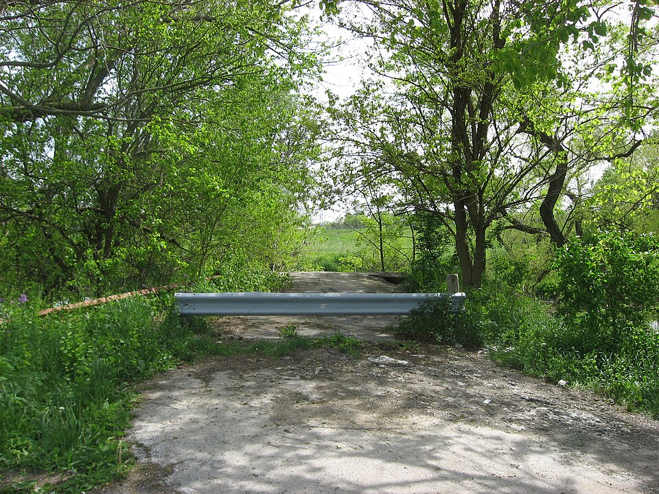
Photograph of Reed Covered Bridge
Photograph by Nyttend, Public domain. Via Wikimedia Commons.

Reed Covered Bridge

Built in 1884. Listed on the National Register of Historic Places in 1975. A historic map-sheet match is not published yet. The record needs a coordinate-quality review before it can be joined to a sheet boundary.

From the record

“The Reed Bridge, near Marysville, Ohio, United States, was a Partridge truss covered bridge. It was listed on the National Register of Historic Places in 1975.”

Wikipedia article Reed Bridge, CC BY-SA 4.0.

one of 4 National Register listings in Union County · listed in 1975 · category: Structure · built in 1884.

Sources: the Wikipedia article · the case file at the National Archives · the National Register database, National Park Service

The listing

  • What is counted as historic. The nomination lists 1 structure as contributing to the listing.
  • Address. 3.5 mi. S of Marysville off SR 38, Marysville, 43040
  • When was it listed? 1975-03-04
  • Category. structure
  • Township. Darby township
  • When was it built? 1884
  • National Register reference number. 75001547 - the number the National Park Service assigned this property when it was listed, and the key its nomination file is catalogued under at the National Archives.

Specimens collected near this property

12 of 362 shown

Regional context, not property-specific evidence. Museums hold 362 specimens collected within 10 miles of Reed Covered Bridge between 1918 and 1975: 352 Animalia, 6 Plantae, 4 Fungi. 12 distinct Species records are shown. Collected by A. Spreitzer, A. Spreitzer & W. LeGrande, Andrew R. Moldenke and others. Each is a physical object with a catalogue number, and each entry opens the museum's record. This is what was collected and kept, not a survey of what lives here - nothing can be concluded from a species being absent.

Image SpeciesYear Collected by Where, as recorded
A photograph of the species Empoasca fabae, not of this specimenEmpoasca fabae (Harris, 1841)1918H.T. Osborn
A photograph of the species Hydnum erinaceus, not of this specimenHydnum erinaceus Bull.1918Weir J. R.Marysville
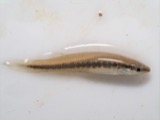
A photograph of the species Erimyzon oblongus, not of this specimenErimyzon oblongus claviformis (Girard, 1856)1928Trautman, M. B. (Milton Bernard)Sugar Run, within Jerome township, near Plain City, Jerome township
A photograph of the species Etheostoma spectabile, not of this specimenEtheostoma spectabile (Agassiz, 1854)1928Trautman, M. B. (Milton Bernard)Sugar Run, within Jerome township, near Plain City, Jerome township
A photograph of the species Fundulus notatus, not of this specimenFundulus notatus (Rafinesque, 1820)1928Trautman, M. B. (Milton Bernard)Sugar Run, within Jerome township, near Plain City, Jerome township
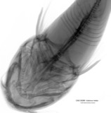
A photograph of the species Ictalurus melas, not of this specimenIctalurus melas (Linnaeus, 1758)1928Trautman, M. B. (Milton Bernard)Sugar Run, within Jerome township, near Plain City, Jerome township
A photograph of the species Lepomis cyanellus, not of this specimenLepomis cyanellus Rafinesque, 18191928Trautman, M. B. (Milton Bernard)Sugar Run, within Jerome township, near Plain City, Jerome township
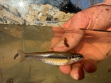
A photograph of the species Pimephales notatus, not of this specimenPimephales notatus (Rafinesque, 1820)1928Trautman, M. B. (Milton Bernard)Sugar Run, within Jerome township, near Plain City, Jerome township
A photograph of the species Pimephales promelas, not of this specimenPimephales promelas promelas Rafinesque, 18201928Trautman, M. B. (Milton Bernard)Sugar Run, within Jerome township, near Plain City, Jerome township
A photograph of the species Ameiurus melas, not of this specimenAmeiurus melas (Rafinesque, 1820)1930MB TrautmanBuck Creek, N Union Township
A photograph of the species Catostomus commersonnii, not of this specimenCatostomus commersonnii commersonnii (Lacepède, 1803)1930MB TrautmanBuck Creek, N Union Township
A photograph of the species Etheostoma nigrum, not of this specimenEtheostoma nigrum Rafinesque, 18201930MB TrautmanBuck Creek, N Union Township

All 362 specimens within 10 miles, at the Global Biodiversity Information Facility.

Storms near this property

60 of 67 shown

Regional context, not property-specific evidence. The National Weather Service names Marysville, the town this property stands in, in 67 storm reports between 1994 and 2025: 35 thunderstorm wind, 20 hail, 7 flood, 2 flash flood. No death or injury is recorded in these reports. Each account below is quoted exactly as the forecast office filed it, from the NOAA Storm Events Database, and each date opens the federal record of that event.

WhenEvent Place namedHarm What the report says
June 2022Thunderstorm WindMarysville$250,000Numerous trees and power lines were downed throughout Union County, including in the Marysville area.
June 2010Tornado (EF0)West Marysville$64,000Damage from the tornado consisted of several large tree limbs and trees down. Light structural damage occurred to several homes near State Route 38 and Timberview Drive. This damage included the loss of shingles and siding. The most significant damage occurred to a home along State Route 38 which suffered near total roof loss. Based on the damage, wind speeds were estimated to be around 85 miles per hour.
June 1999Thunderstorm WindMarysville$20,000Large trees were downed. A well constructed tool shed was heavily damaged and a corn bin was blown across a road.
December 2024Tornado (EF0)West Marysville$15,000The weak tornado began on a property near Payne Road just west of Marysville, Ohio. The tornado toppled a small silo, several small to medium-sized trees, and caused minor damage to an older barn and a few roof shingles. Additional damage occurred to a large metal barn located around a third of a mile to the north. This barn sustained uplift of the roof along with partial collapse of the metal walls. In addition, several trees were snapped in the woods adjacent to the barn.
May 2011Thunderstorm WindMarysville$15,000A barn and roof was damaged due to thunderstorm winds.
May 2005Thunderstorm WindMarysville$15,000Several trees and large limbs were knocked down. Fallen trees caused damage to two homes in town, and a business lost part of its roof.
July 2023Thunderstorm WindMarysville$10,000A large oak tree snapped and fell onto a house.
March 2012Thunderstorm WindMarysville$10,000Part of a roof was blown of a barn and damage occurred to a garage due to damaging thunderstorm winds.
January 2008Thunderstorm WindMarysville$10,000A mobile home roof became partially loose in the Hillcrest Mobile Home Park. Large tree limbs were downed as well.
August 2004Thunderstorm WindMarysville$8,000Several trees were knocked down. One tree fell onto a house on Raymond Road, causing minor damage.
June 2016Thunderstorm WindMarysville$5,000Multiple trees and limbs were knocked down in the area.
May 2002Thunderstorm WindMarysville$5,000Numerous trees were downed across the southeast portion fo the county.
July 2002Thunderstorm WindMarysville$5,000Trees and powerlines were blown down across town.
July 2000Thunderstorm WindMarysville$5,000Several trees downed.
April 1999Thunderstorm WindMarysville$5,000Trees were blown down along state route 245.
May 1997Thunderstorm WindMarysville$5,000Numerous trees downed.
August 1994Thunderstorm WindMarysville$5,000no account filed
June 2025Thunderstorm WindWest Marysville$3,000A large tree fell on a house.
September 2016Thunderstorm WindMarysville$3,000Several trees were downed in Marysville.
May 2013Thunderstorm WindMarysville$3,000Several two foot diameter trees were downed in Marysville due to thunderstorm winds.
June 2012Thunderstorm WindMarysville$3,000Trees were downed due to damaging thunderstorm winds.
July 2011Thunderstorm WindMarysville$3,000A few trees and power lines were reported down due to damaging thunderstorm winds.
June 2010Thunderstorm WindMarysville$3,000Trees were reported down due to damaging thunderstorm winds.
August 2007Thunderstorm WindMarysville$3,000Trees were knocked down.
March 2007FloodMarysville$3,000A few roads were flooded across the county.
July 2006HailMarysville$3,000Trees were also knocked down.
June 2003Thunderstorm WindMarysville$3,000Several trees were downed along State Route 31.
June 2002Thunderstorm WindMarysville$3,000Large limbs were downed along State Route 4. Three power poles fell along US Route 42 southeast of Marysville.
June 2002Thunderstorm WindMarysville$3,000Trees were blown over on Kaiser Road.
June 2025Thunderstorm WindWest Marysville$2,000A large tree fell onto a house on Bent Tree Drive.
May 2017Thunderstorm WindMarysville$2,000A few trees were downed.
July 2003Thunderstorm WindMarysville$2,000Several large limbs were downed.
August 2020Thunderstorm WindMarysville$1,000A large tree split in half.
June 2017Thunderstorm WindWest Marysville$1,000A large branch was reported down on a wire.
July 2013Flash FloodWest Marysville$1,000High water was moving over State Route 245 at Poling Road, Wilbur Road was closed due to high moving water, and Bear Swamp Road at Allen Center Road was covered by water due to heavy rainfall.
June 2012Thunderstorm WindMarysville$1,000Large tree limbs were downed due to thunderstorm winds.
July 2022FloodWest Marysville-High water was reported on Collins and Raymond Roads.
May 2019FloodMarysville-Several roads were flooded in Allen and Union Townships.
May 2018FloodMarysville-High water was reported on several rural roads across the county.
June 2018FloodMarysville-A small stream overflowed it banks, causing water, eight inches deep, to flow over the road at County Home Road and Navin Road.
June 2018FloodMarysville-A foot of water was reported over a roadway.
December 2013FloodMarysville-Several roads remained closed across the county due to high water caused by earlier heavy rainfall.
March 2012Heavy RainMarysville-Drainage ditches were reported to be overflowing in the area due to heavy rainfall.
July 1999Flash FloodMarysville-Heavy rain caused roads to be closed due to flood waters.
July 1999Thunderstorm WindMarysville-Winds gusted to 70 mph.
May 1994Thunderstorm WindMarysville-Winds reported at 60 mph.
June 2020HailMarysville-no account filed
March 2016HailMarysville-no account filed
May 2014HailMarysville-no account filed
June 2012HailMarysville-no account filed
May 2011HailMarysville-no account filed
August 2011HailMarysville-no account filed

Every storm recorded in Union County

Newspapers printed here

0 digitised pages

1 paper published in this town, digitised by the Library of Congress and free to read: 0 issues, 0 pages. Every page is searchable, so a name or a street can be looked for directly in what the town printed about itself at the time.

NewspaperPublished
The Union County Journal1875 to 1951

Map coverage status

No historic map-sheet match is published for this property yet. That does not mean no map exists. This record needs a coordinate-quality review before it can be joined to a sheet boundary. Browse the county's mapped places while that work is pending.

From the nomination file

1,889 words on record

When this property was proposed for the National Register, someone wrote the case for it: what the building is, and why it matters. That document is a federal record in the public domain. It is quoted below word for word, never summarised. The text was read off the scanned case file by machine, so the occasional stray character is the recogniser's and the 1970s typewriter's.

Description of the property

boarded, with roofed windows running the length of the span on both truss plan patented in 1872 by Reuban Partridge of Marysville, Ohio. posts, the chords in 2 sections and the bifurcated iron footpieces. covered bridges, 1" steel rods have been added from upper to lower of the bridge, but were undoubtedly cut out later to improve vision with DEC31 1974 CONDITION NATIONAL Excellent abutments are stone. Moved Good Ruins RECEIVED Fair Original Site sprung together andbolted so their ends rest against the posts and white paint on the portals.

The structure under consideration is a one-span wooden truss covered the advent of the automobile.The Reed Bridge is unpainted except for (Check One) chords.Mr.Partridge claimed as new his angling df the braces and The 2 braces of each end are parallel with each other and pass upon bridge spanning Big Darby Creek 3z miles south of Marysville in Darby In all the Partridge trusses standing today, the braces are double and and lower chords and all truss diagonals are pine, while the end posts span of 150'. The overall width is 20'3" with a roadway width of 16'2".

REGISTER the counterbraces are triple.In the 5 Union County Partridge truss and the one vertical in the center of the bridge are oak.The floor and 2 sections, the ties or posts are securely bolted to the chords and are interposed between the ends of the braces and the posts and the chord between each truss panel.The trusses of the Reed Bridge are 15 chords.These footpieces may be omitted and the ends of the braces arranged in pairs and stand at an angle of 45with the horizontal plane.

Read the complete 1,889-word case file.

Statement of significance

Art Theater in the Columbus Bridge Company.Mr.Partridge has the unhappy distinc- landmark is a fitting monument to kindly old Reuban Partridge who built County and was quite well-known there.He built covered bridges in 1963,the State rerouted SR 38,by-passing the Reed Bridge which reverted 9.

The whole case file for this property - 1,889 words, 11 pages, reproduced complete.

Quoted from the National Register nomination for reference 75001547, 11 pages, held by the National Archives in Record Group 79. See the catalogue record.

Listed places nearby

2 within 8 miles

Other National Register properties close enough to walk or drive between, ordered by distance from this one. Both positions come from the same geocoding pass that matched these properties to their map sheets.

Photograph PropertyDistance Listed
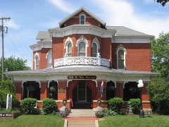
Gilcrist House5.3 miles1976
Henderson, Dr. David W., House6.1 miles2001

Sources for this property

National Archives recordThe nomination case file for reference 75001547 in Record Group 79.
Wikipedia articleCommunity-written account of this property, licensed CC BY-SA.
Union CountyAll 4 listed properties in this county.

Provenance

  • Listing record. National Park Service National Register of Historic Places, listed-properties dataset, current to 2026-05-22.
  • Map join. Address geocoded through the United States Census geocoder, then tested against the published boundary of every sheet in the USGS Historical Topographic Map Collection.
  • How this page is made. Listing fields come from federal records; map-sheet coverage is a labelled coordinate-to-boundary calculation, not a source-field claim.
  • Specimens. Global Biodiversity Information Facility (GBIF), https://www.gbif.org/. Only records licensed CC0 or CC BY are used. Records licensed CC BY-NC are excluded because this site carries advertising. Images are checked individually and any whose licence is non-commercial, no-derivatives or unreadable is refused.
  • Storms. NOAA National Centers for Environmental Information, Storm Events Database https://www.ncei.noaa.gov/stormevents/ A work of the United States government, no copyright under 17 U.S.C. 105. Narratives are quoted verbatim from the National Weather Service report and are not edited or summarised.