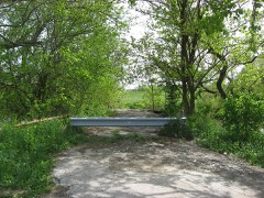
Listed on the National Register of Historic Places in
1976. A historic map-sheet match is not published yet. The record needs a coordinate-quality review before it can be joined to a sheet boundary.
From the record
one of 4 National Register listings in Union County · listed in 1976 · category: Building.
National Register reference number.76001537- the number the National Park Service assigned this property when it was listed, and the key its nomination file is catalogued under at the National Archives.
Specimens collected near this property
12 of 524 shown
Regional context, not property-specific
evidence. Museums hold 524 specimens
collected within 10 miles of Gilcrist House between 1880 and
1975: 510 Animalia, 10 Fungi, 4 Plantae. 12 distinct Species records are shown.
Collected by A. Spreitzer, A. Spreitzer & K. Borror, A. Spreitzer & W. LeGrande and others. Each is a
physical object with a catalogue
number, and each entry opens the museum's record. This is what was
collected and kept, not a survey of what lives here - nothing can be
concluded from a species being absent.
Regional context, not property-specific
evidence. The National Weather Service names
Marysville, the town this property stands in, in 67 storm reports between 1994 and 2025: 35 thunderstorm wind, 20 hail, 7 flood, 2 flash flood.
No death or injury is recorded in these reports. Each account below is quoted exactly as the forecast office
filed it, from the NOAA Storm Events Database, and each date
opens the federal record of that event.
Damage from the tornado consisted of several large tree limbs and trees down. Light structural damage occurred to several homes near State Route 38 and Timberview Drive. This damage included the loss of shingles and siding. The most significant damage occurred to a home along State Route 38 which suffered near total roof loss. Based on the damage, wind speeds were estimated to be around 85 miles per hour.
The weak tornado began on a property near Payne Road just west of Marysville, Ohio. The tornado toppled a small silo, several small to medium-sized trees, and caused minor damage to an older barn and a few roof shingles. Additional damage occurred to a large metal barn located around a third of a mile to the north. This barn sustained uplift of the roof along with partial collapse of the metal walls. In addition, several trees were snapped in the woods adjacent to the barn.
High water was moving over State Route 245 at Poling Road, Wilbur Road was closed due to high moving water, and Bear Swamp Road at Allen Center Road was covered by water due to heavy rainfall.
1 paper published in this town,
digitised by the Library of Congress and free to read: 0 issues,
0 pages. Every page is searchable, so a name or a street can be
looked for directly in what the town printed about itself at the time.
No historic map-sheet match is published
for this property yet. That does not mean no map exists. This record needs
a coordinate-quality review before it can be joined to a sheet boundary.
Browse the county's mapped places while that work is
pending.
From the nomination file
1,602 words on record
When this property was proposed for the
National Register, someone wrote the case for it: what the building is,
and why it matters. That document is a federal record in the public domain.
It is quoted below word for word, never summarised. The text was read off the scanned case file by machine, so the
occasional stray character is the recogniser's and the 1970s
typewriter's.
Description of the property
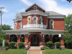
residential architecture. Built in the 1870's on a brick foundation, the "I" shaped sixth course) two stories plus the gabled asphalt shingle roof in height, with closed bays with 2/2 double hung wood windows, plain wood trim, stone sills and wood storm shingle shed roof (gabled at the center), turned wood columns, wood scroll brackets, wood tongue and groove floor, beaded wood ceiling, bracketed frieze, and wood lattice smaller of the two, which contains an inside stairway to the cellar, appears to be an Originally, there was a large veranda on the north and west sides of the primary tongue and groove oak flooring. Central heating, electrical wiring, and plumbing CONDITION UNEXPOSED DETERIORATED EXCELLENT UNALTERED sash.
FAIR devices have changed the original architectural feeling of the interior. The second floor ceilings are somewhat lower than the first floor and the ground floor measures approximately thirty-four feet in each direction.The main Exterior:The Gilcrist House is a typical example of mid-l9th century rural original bedrooms were converted to offices at some earlier date. Although this appendage has been removed, it has been determined from an old CHECK ONE described above except for a flat seam metal roof and chamfered square columns. skirt.Leading into the house is a five panel one-lite door with glazed part of the building is constructed with common bond brick walls (header courses each -RUINS early addition, while the larger has been recently added.
He engaged in the pursuits of agriculture, and the rearing of fine stock, and ranked serene, way of life enjoyed here in the past.
1500-1599 1700-1799 1600-1699 COMMERCE X1800-1899 ART ARCHEOLOGY-HISTORIC EDUCATION PERIOD ECONOMICS INDUSTRY PHILOSOPHY 1900- XARCHITECTURE SCULPTURE ARCHEOLOGY-PREHISTORIC AGRICULTURE THEATER SIGNIFICANCE SCIENCE LITERATURE MILITARY _1400-1499 PREHISTORIC MUSIC _CONSERVATION INVENTION been razed to make way for the modern twentieth century industrial plants now found _EXPLORATION/SETTLEMENT The Gilcrist House is a typical example of mid-nineteenth century rural residen- _POLITICS/GOVERNMENT _COMMUNICATIONS _ENGINEERING as one of the successful farmers of the county.He served four years as Master of the _TRANSPORTATION Samuel G.Gilcrist was a teacher during the winter months for ten years, and in on part of the farm complex.
1865 he located on the 226 acre farm which he purchased in 187l and owmed until 1915. -LAW local Grange and was also a member of the Board of Township Trustees. O. M. Scott & Sons Company, present owners, built their fertilizer manufacturing plant architecture. Many of the neighboring farm buildings, including residences, have restoration, will serve to remind the community of its heritage and of a simpler, more BUILDER/ARCHITECT 1. History of Union County, Ohio (Part 5) Beers, 1883 2. Marysville, Ohio 1819-1969, Willella Shearer Kennedy, 10
Quoted from the National Register nomination
for reference 76001537, 16 pages, held by the National Archives in Record
Group 79. See the
catalogue record.
Listed places nearby
2 within 8 miles
Other National Register properties close
enough to walk or drive between, ordered by distance from this one. Both
positions come from the same geocoding pass that matched these properties
to their map sheets.
Listing record. National Park Service National Register of Historic Places, listed-properties dataset, current to 2026-05-22.
Map join. Address geocoded through the United States Census geocoder, then tested against the published boundary of every sheet in the USGS Historical Topographic Map Collection.
How this page is made. Listing fields come from federal records; map-sheet coverage is a labelled coordinate-to-boundary calculation, not a source-field claim.
Specimens. Global Biodiversity Information Facility (GBIF), https://www.gbif.org/. Only records licensed CC0 or CC BY are used. Records licensed CC BY-NC are excluded because this site carries advertising. Images are checked individually and any whose licence is non-commercial, no-derivatives or unreadable is refused.
Storms. NOAA National Centers for Environmental Information, Storm Events Database https://www.ncei.noaa.gov/stormevents/ A work of the United States government, no copyright under 17 U.S.C. 105. Narratives are quoted verbatim from the National Weather Service report and are not edited or summarised.
 Block
Block