Built in 1891. Listed on the National Register of Historic Places in
1976. A historic map-sheet match is not published yet. The record needs a coordinate-quality review before it can be joined to a sheet boundary.
From the record
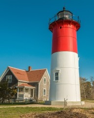
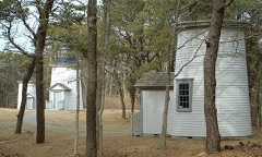
“The French Cable Hut is a historic building in Cape Cod National Seashore, near the Nauset Beach Light in Eastham, Massachusetts. Built in 1891, the hut formed a linkage point in the transatlantic telegraph cable of the French Cable Company connecting the cable, where it came ashore near the present site to its main station in Orleans.”
Wikipedia article French Cable Hut, CC BY-SA 4.0.
one of 145 National Register listings in Barnstable County · listed in 1976 · category: Building · built in 1891.
National Register reference number.76000153- the number the National Park Service assigned this property when it was listed, and the key its nomination file is catalogued under at the National Archives.
Regional context, not property-specific
evidence. The
federal wildfire occurrence database
lists 71 fires within 5 miles of French Cable Hut between
1992 and 2020, burning about 38 acres in total. 7 started naturally. 1 was recorded as arson.
Distance is straight-line from the map coordinates, so a fire counted
here may appear on a neighbouring settlement's page as well.
Reported cause
Fires
Missing data/not specified/undetermined
25
Recreation and ceremony
11
Debris and open burning
9
Equipment and vehicle use
7
Natural
7
Fireworks
4
Smoking
3
Power generation/transmission/distribution
2
Misuse of fire by a minor
1
Other causes
1
Arson/incendiarism
1
The most recent of
them, most recent first, with the day each was reported and the service
that recorded it.
Regional context, not property-specific
evidence. Museums hold 2,417 specimens
collected within 10 miles of French Cable Hut between 1819 and
1975: 1,264 Animalia, 836 Plantae, 135 Fungi, 67 Bacteria, 64 Chromista, 51 Unrecorded. 12 distinct Species records are shown.
Collected by A. R. Alan Hodgdon Hodgdon, A. R. Hodgdon, A. R. Hodgdon; G. B. Rossbach and others. Each is a
physical object with a catalogue
number, and each entry opens the museum's record. This is what was
collected and kept, not a survey of what lives here - nothing can be
concluded from a species being absent.
Regional context, not property-specific
evidence. The federal mineral resources record lists
1 working within 5 miles of French Cable Hut: 1 past producer.
None of them still produces. What was taken out: Sand and Gravel, Construction. Distance is straight-line from the
map coordinates, so a quarry counted here may appear on a neighbouring
settlement's page as well.
Regional context, not property-specific
evidence. The National Weather Service names
North Eastham, the town this property stands in, in 1 storm report between 2017 and 2017: 1 flash flood.
No death or injury is recorded in these reports. Each account below is quoted exactly as the forecast office
filed it, from the NOAA Storm Events Database, and each date
opens the federal record of that event.
At 1138 PM EST, Cable Road near Nauset Regional High School in Eastham was flooded and impassable. At 1154 PM EST, there were multiple reports of flooded basements on Jennie Clark Road. There were also reports of flooded basements on Kingswood Drive and Cestaro Way. At 1204 AM EST a car on Gail's Way was trapped in flood waters in a road washout. At 1252 AM EST there was three feet of water on Old Orchard Road near Kettle Hole Road. At 111 AM EST, two cars were trapped in flood waters on Brackett Road. At 6 AM EST, a Cocorahs observer in Eastham reported a storm total rainfall of 8.25 inches.
No historic map-sheet match is published
for this property yet. That does not mean no map exists. This record needs
a coordinate-quality review before it can be joined to a sheet boundary.
Browse the county's mapped places while that work is
pending.
From the nomination file
3,514 words on record
When this property was proposed for the
National Register, someone wrote the case for it: what the building is,
and why it matters. That document is a federal record in the public domain.
It is quoted below word for word, never summarised. The text was read off the scanned case file by machine, so the
occasional stray character is the recogniser's and the 1970s
typewriter's.
Description of the property
The little French Cable Hut, a few yards south of Nauset Lighthouse, and less than a hundred yards west of the Nauset cliffs overlooking the Atlantic, is a simple shed structure, wooden planking with grayish wood panelling inside. The front portion (East side) is original--the back and kitchen area later additions to provide room for its owners as a beach cottage. Externally, the hut has traditional Cape shingled sides. It has an asphalt shingle roof. The front half, inside, has its original wooden walls and panels with inscribed and pencilled names and dates written by Cable personnel. Cable shematics (circuitry) also occupy wall space. The old cables' ends are immediately under the floor of the hut. JuNcTioN print where cable changed from orean to land.
This hut was a, relay station utilized by the French Cable Co. from 1891 after the station's equipment was moved to the new building at Orleans, Mass., the line connecting the latter through the hut to st. Pierre, Miquelon. This cable line was abandoned in 1932. (The original large French Cable station building near this hut burned years ago). c,1890 çudy +/11/1 Significance--3rd Order Acreage: l acre Long. and Lat.: See Section 10 Recommended Freatment: Former owner has a two year lease. A decision as to restoration to its original appearance will be made after the NPS assumes control. The removal of existing modern features will probably suffice: Exterior and Interior:$2500.
<1 RECEIVED APR1 1915 NATIONAL REGISTER -8 RU ICTIONS Form 10-300a UNITED STATES DEPARTMENT OF THE INTERIOR (July 1969) NATIONAL PARK SERVICE NATIONAL REGISTER OF HISTORIC PLACES INVENTORY - NOMINATION FORM STATE COUNTY (Continuation Sheet) FOR NPS USE ONLY ENTRY NUMBER APR 22 1978 DATE (Number all entries) 7.
In 1869, the French Atlantic Cable Company laid a telegraph cable from Brest, France, to St. Pierre, Miquelon, and on to Duxbury, Mass., the first time an Atlantic cable reached U.S. shores. Cyrus Field's AngLo-American telegraph Company absorbed this French Company in 1873. A second French Company laid a in 1879 from Brest via St. Pierre to a new North Eastham, Mass. station on this spot (or in this immediate area). This hut, all that remains of the old station, was presumably built about 1891. Due to isolation of the North Eastham Station, the Station's facilities (but not the big building) were moved to Orleans, Mass. in 1891 and operated until 1959. However, the St. Pierre cable, which ran through this hut to Orleans, was abandoned in 1932.
Old pieces of this cable may be seen on the cliff side (Ocean side) today, and ends of the cable still lie under the floor of the hut. This small cottage, now NPS property, will be a valuable adjunct to interpretive use in the area which contains other historical elements (lighthouses and USCG activities) besides the cable. Preceding Marconi's wireless station on Cape Cod (1903) by some 24 years, the French Cable performed a valuable service in communications, both before and after wireless. The French Station in Orleans is now the French Cable Museum, and this N. Eastham hut is a direct link with the fine museum to the south. RECEIVED APR 1 1975 NATIONAL REGISTER 9.
Quoted from the National Register nomination
for reference 76000153, 16 pages, held by the National Archives in Record
Group 79. See the
catalogue record.
Listed places nearby
6 within 8 miles
Other National Register properties close
enough to walk or drive between, ordered by distance from this one. Both
positions come from the same geocoding pass that matched these properties
to their map sheets.
Listing record. National Park Service National Register of Historic Places, listed-properties dataset, current to 2026-05-22.
Map join. Address geocoded through the United States Census geocoder, then tested against the published boundary of every sheet in the USGS Historical Topographic Map Collection.
How this page is made. Listing fields come from federal records; map-sheet coverage is a labelled coordinate-to-boundary calculation, not a source-field claim.
Wildfire. Short, Karen C. 2022. Spatial wildfire occurrence data for the United States, 1992-2020 [FPA_FOD_20221014]. 6th Edition. Fort Collins, CO: Forest Service Research Data Archive. https://doi.org/10.2737/RDS-2013-0009.6 Collected with United States Government funding and usable without additional permissions or fees.
Specimens. Global Biodiversity Information Facility (GBIF), https://www.gbif.org/. Only records licensed CC0 or CC BY are used. Records licensed CC BY-NC are excluded because this site carries advertising. Images are checked individually and any whose licence is non-commercial, no-derivatives or unreadable is refused.
Mines and quarries. USGS Mineral Resources Data System (MRDS) https://mrdata.usgs.gov/mrds/ A work of the United States government, no copyright under 17 U.S.C. 105.
Storms. NOAA National Centers for Environmental Information, Storm Events Database https://www.ncei.noaa.gov/stormevents/ A work of the United States government, no copyright under 17 U.S.C. 105. Narratives are quoted verbatim from the National Weather Service report and are not edited or summarised.
 Block
Block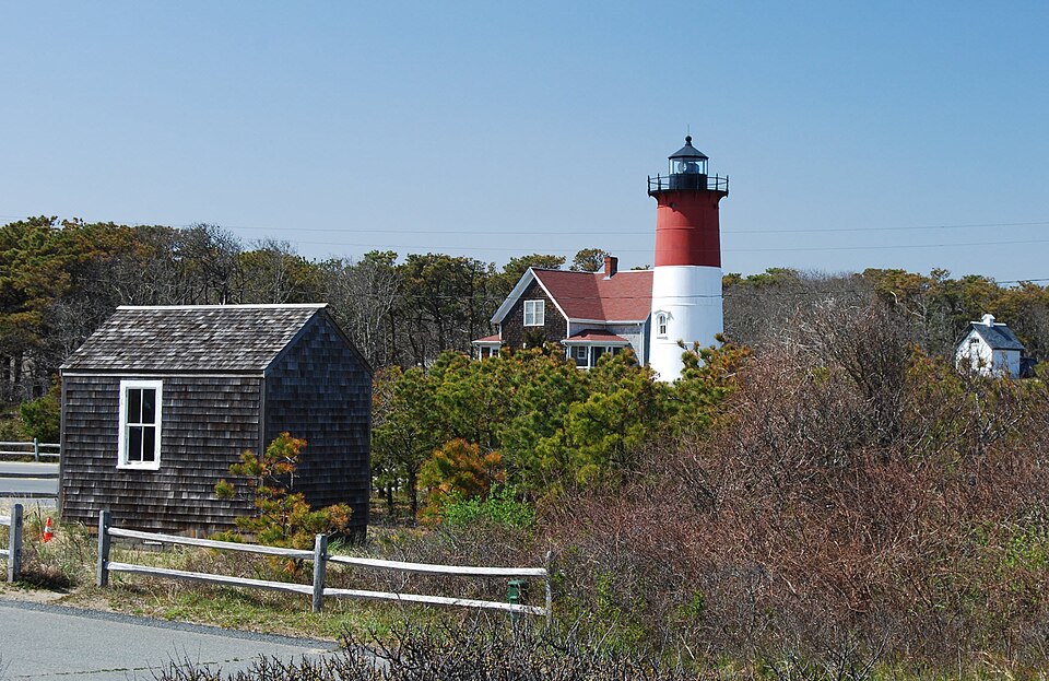

_native_range.jpg)