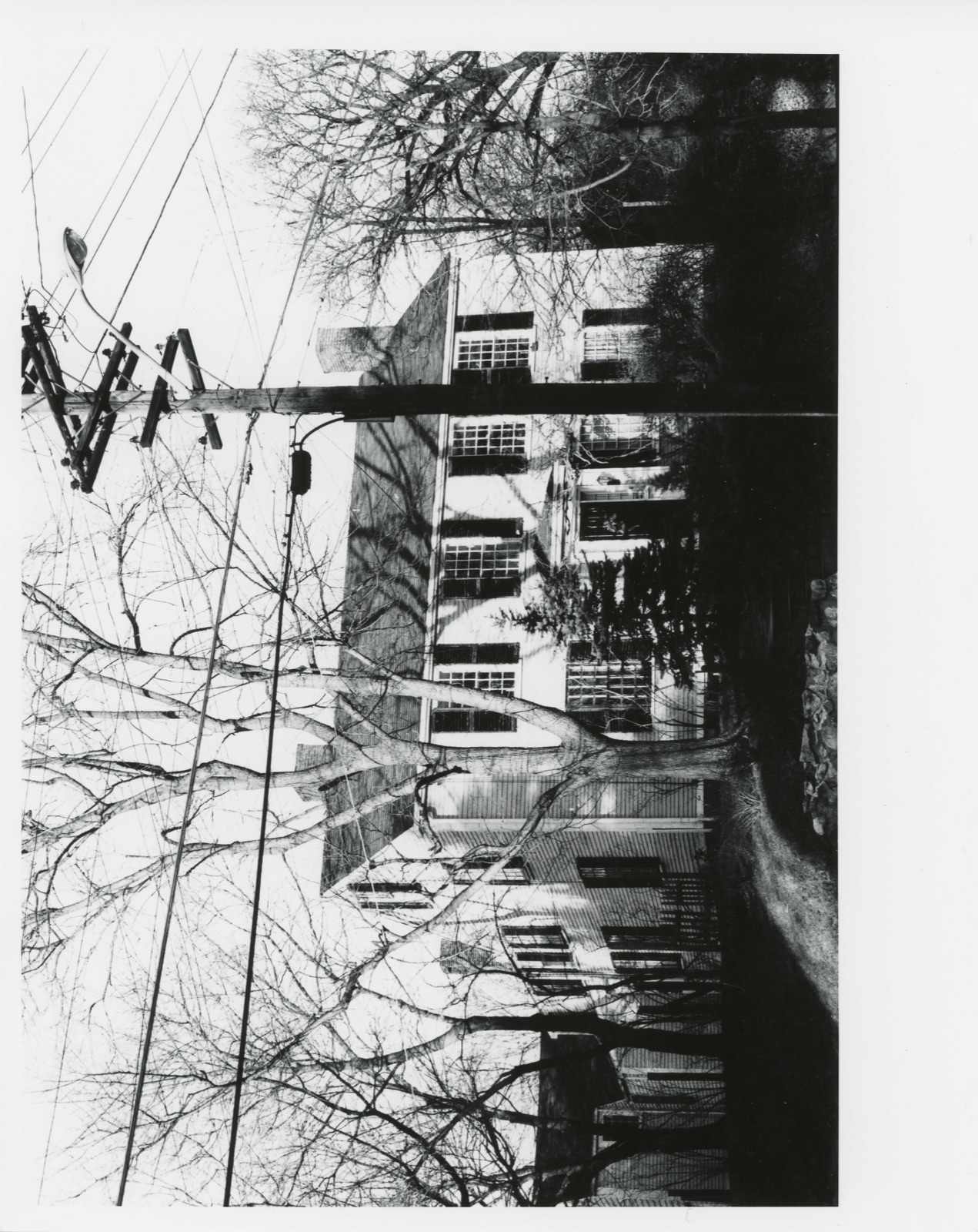
Photographs from the nomination case file, National Park Service records.
Albree-Hall-Lawrence House
Listed on the National Register of Historic Places in
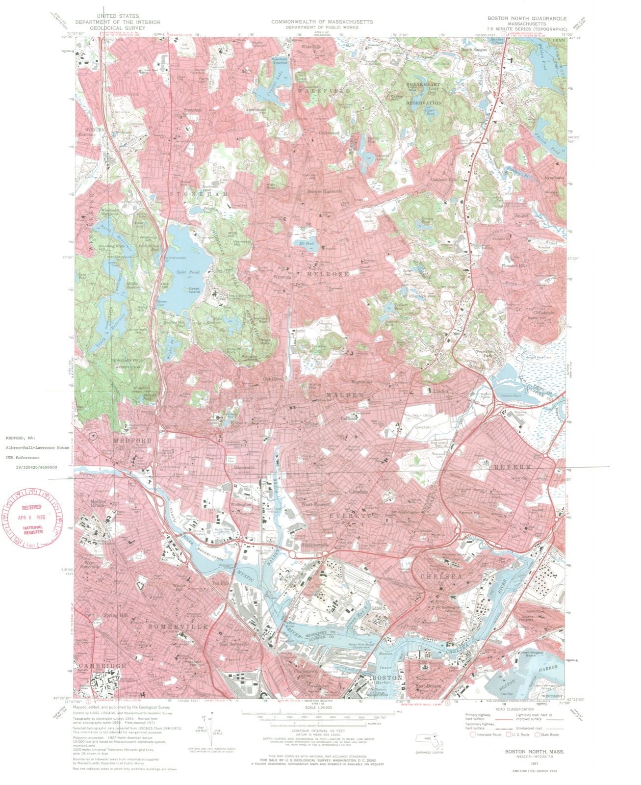
1976. A historic map-sheet match is not published yet. The record needs a coordinate-quality review before it can be joined to a sheet boundary.
From the record
“Medford owes its first settlement to the influence of Governor Cradock and Governor Winthrop. The first gentleman was the richest individual attached to the New England Company; and he gave his money with the freedom of an enthusiast.”
History of the Town of Medford, Middlesex County, Massachusetts : from Its First Settlement, in 1630, to the Present Time, 1855 (1855). Machine-read text.
one of 1100 National Register listings in Middlesex County · listed in 1976 · category: Building · one of 3 National Historic Landmarks in Middlesex County.
National Register reference number.76000256- the number the National Park Service assigned this property when it was listed, and the key its nomination file is catalogued under at the National Archives.
In writing this History, it has been my -wish to secure Medford such territory in time as its acres are territory in space. The gathering of these annals has been too long delayed. Time, moth, and rust have done thenfatal work on many valuable materials ; and some gentlemen, who felt a deep interest in their native town, have died without leaving any manuscript testimonies. When the history of New England shall be written, the true data will be drawn from the records of its towns. Now, therefore, in humble imitation of those States in our Union which have contributed each its block of granite, marble, or copper to the National Monument at Washington, I ask leave to offer Medford's historical contribution to the undecaying pyramidic monument which justice and genius will hereafter raise to the character and institutions of New England.
The records of the first forty years are lost. I have reproduced them, as far as I could, from documents in the General Court relating to our earliest history ; from several monuments of the first settlers, which are yet standing among us ; from authentic traditions which were early recorded ; and from collateral histories of the neighboring towns. To find the lost, and remember the forgotten, seems to be the province of the local annalist. From the moment I reached the first town-records of Medford (1674), I implicitly followed those excellent guides. Where I could save space by abbreviations, without altering the sense, I have occasionally done so in my quotations, and have used our modern orthography. The spirit of antiquarian research, now beginning to show itself, will lead to the discovery of many facts concerning the early history of Medford which are beyond my reach. These may soon render necessary a new history of the town ; and I hope it may be undertaken by a person whose ability and leisure will enable him to do far greater justice to the subject than has been within my power.
Regional context, not property-specific
evidence. The
federal wildfire occurrence database
lists 78 fires within 5 miles of Albree-Hall-Lawrence House between
2015 and 2020, burning about 101 acres in total. None started naturally. 28 were recorded as arson.
Distance is straight-line from the map coordinates, so a fire counted
here may appear on a neighbouring settlement's page as well.
Reported cause
Fires
Arson/incendiarism
28
Missing data/not specified/undetermined
21
Debris and open burning
13
Recreation and ceremony
10
Smoking
3
Misuse of fire by a minor
2
Equipment and vehicle use
1
The most recent of
them, most recent first, with the day each was reported and the service
that recorded it.
Regional context, not property-specific
evidence. Museums hold 1,790 specimens
collected within 10 miles of Albree-Hall-Lawrence House between 1898 and
1975: 788 Animalia, 559 Plantae, 377 Fungi, 28 Protozoa, 17 Bacteria, 12 Chromista, 9 Unrecorded. 12 distinct Species records are shown.
Collected by ?, A B Seymour, A B. Proper and others. Each is a
physical object with a catalogue
number, and each entry opens the museum's record. This is what was
collected and kept, not a survey of what lives here - nothing can be
concluded from a species being absent.
Regional context, not property-specific
evidence. The federal mineral resources record lists
13 workings within 5 miles of Albree-Hall-Lawrence House: 7 plants, 4 past producers, 2 producers.
9 still produce. What was taken out: Iron, Lead, Stone, Crushed/Broken, Gypsum-Anhydrite. Distance is straight-line from the
map coordinates, so a quarry counted here may appear on a neighbouring
settlement's page as well.
Regional context, not property-specific
evidence. The National Weather Service names
Medford, the town this property stands in, in 20 storm reports between 1994 and 2025: 14 thunderstorm wind, 3 flood, 1 flash flood, 1 hail.
No death or injury is recorded in these reports. Each account below is quoted exactly as the forecast office
filed it, from the NOAA Storm Events Database, and each date
opens the federal record of that event.
Trees were downed on Corey Street and Riverside Avenue. A telephone pole was downed onto Massachusetts Avenue and wires on Lawrence Street were downed, all by thunderstorm winds.
At 12:52 AM EST, a large tree was down on a car and laying across Auburn Street in Medford. At the same time, a tree was reported down on Summer Street and a large tree was down on George Street.
In Winchester, a large tree was down on a house, which took the chimney off the house on Alden Lane. A tree was down on Cambridge Street by the boat club. A tree was down on wires on wires on the 30 block of Allen Road. Trees and wires were down on Ledyard Road. A tree was down on the 70 block of Lawson Road.
In Medford, multiple trees were reported downed. In Somerville, a tree was down on a house on Vernon Street and a large branch was down on power lines on Walker Street.
No historic map-sheet match is published
for this property yet. That does not mean no map exists. This record needs
a coordinate-quality review before it can be joined to a sheet boundary.
Browse the county's mapped places while that work is
pending.
From the nomination file
2,732 words on record
When this property was proposed for the
National Register, someone wrote the case for it: what the building is,
and why it matters. That document is a federal record in the public domain.
It is quoted below word for word, never summarised. The text was read off the scanned case file by machine, so the
occasional stray character is the recogniser's and the 1970s
typewriter's.
Description of the property
The Albree-Hall-Lawrence House is a two-story timber frame house of irregular plan re- sulting from its several periods of construction. Examination of the structure suggests that the earliest section, built before 1785 according to the Historic American Buildings Survey, was a two-story center chimney house, one room deep, now surviving as the rear ell of the present house. Historical sources suggest that this ell could have been part of an earlier house that was moved to this site and joined to the front section. The front section appears to have been constructed in the late eighteenth century and origin- ally was one bay deep and three bays long. The facade was then symmetrical with an en- trance porch and one window on either side.
Sometime around the turn of the eighteenth century the east wall of the front section was extended about five feet eastward, and a fourth window was added to the front facade. Between 1830-1840 the north half of the house's east end was enlarged to the present two room depth. All other ells and the al- terations of the stable were carried out after 1930 when the property was purchased by the father of the present owner. The two-story yellow clapboarded front section is set on a foundation of granite blocks except at its northeast corner where one bay of the east wall and two bays of the north wall are set on slate foundation.
The front facade is four bays wide, irregularly spaced with twelve-over-twelve windows, all with black louvred shutters, and an enclosed entrys porch with a half hip roof. The entry is framed by two pilasters supporting a plain entablature and a boxed cornice at the porch's eave.
/ARCHITECT STATEMENT OF SIGNIFICANCE In 1720 John Albree, an English immigrant, purchased from Parcival Hall a thirty-two acre tract of land containing at least one dwelling house, outbuildings, and a mill in which Hall retained a one quarter interest. By 1777, when his grandson John took over the prop- erty, the acreage totaled sixty-seven acres. Previous to his ownership Albree served in the Revolution in two different regiments, and also contributed financially to its support. The property remained in the Albree family until 1799 when John's brother Samuel sold the property, then containing seventy-two acres, to Nathaniel Hall. Suffering from financial reverses, Hall mortgaged and then deeded the property to his brother-in-law Peter Chardon Brooks.
In 1817 Brooks made a gift of the property to his sister Joanna Hall, Nathaniel's wife. In 1819 Hall had moved from his house in Medford Square to the farm, th which, in 1831, his grandson, Francis Parkman was seat to'recover from an illness. During his four years in Medford, Parkman attended John Angier's school which Parkman thought to be of "high but undeserved reputation." It seems possible that the enthusiasm of Parkman's father for the work of Alexander Jackson Davis may have influenced Angier's later choice of Davis as the architect for his home at 129 High Street, Medford. Both the historian Parkman and his several biographers place great importance on his "exploration" of the Middlesex Fells as a major influence on Parkman's writing and point of view.
In the mid-nineteenth century the house was owned by Peter C. Hall, whose heirs leased the property to a pig farmer. Offended by this use of the property, Samuel Lawrence pur- chased the farm by 1889 and incorporated it into his neighboring estate.
Quoted from the National Register nomination
for reference 76000256, 10 pages, held by the National Archives in Record
Group 79. See the
catalogue record.
Listed places nearby
6 within 8 miles
Other National Register properties close
enough to walk or drive between, ordered by distance from this one. Both
positions come from the same geocoding pass that matched these properties
to their map sheets.
Listing record. National Park Service National Register of Historic Places, listed-properties dataset, current to 2026-05-22.
Map join. Address geocoded through the United States Census geocoder, then tested against the published boundary of every sheet in the USGS Historical Topographic Map Collection.
How this page is made. Listing fields come from federal records; map-sheet coverage is a labelled coordinate-to-boundary calculation, not a source-field claim.
Wildfire. Short, Karen C. 2022. Spatial wildfire occurrence data for the United States, 1992-2020 [FPA_FOD_20221014]. 6th Edition. Fort Collins, CO: Forest Service Research Data Archive. https://doi.org/10.2737/RDS-2013-0009.6 Collected with United States Government funding and usable without additional permissions or fees.
Specimens. Global Biodiversity Information Facility (GBIF), https://www.gbif.org/. Only records licensed CC0 or CC BY are used. Records licensed CC BY-NC are excluded because this site carries advertising. Images are checked individually and any whose licence is non-commercial, no-derivatives or unreadable is refused.
Mines and quarries. USGS Mineral Resources Data System (MRDS) https://mrdata.usgs.gov/mrds/ A work of the United States government, no copyright under 17 U.S.C. 105.
Storms. NOAA National Centers for Environmental Information, Storm Events Database https://www.ncei.noaa.gov/stormevents/ A work of the United States government, no copyright under 17 U.S.C. 105. Narratives are quoted verbatim from the National Weather Service report and are not edited or summarised.
 Block
Block