Listed on the National Register of Historic Places in
1976. A historic map-sheet match is not published yet. The record needs a coordinate-quality review before it can be joined to a sheet boundary.
From the record
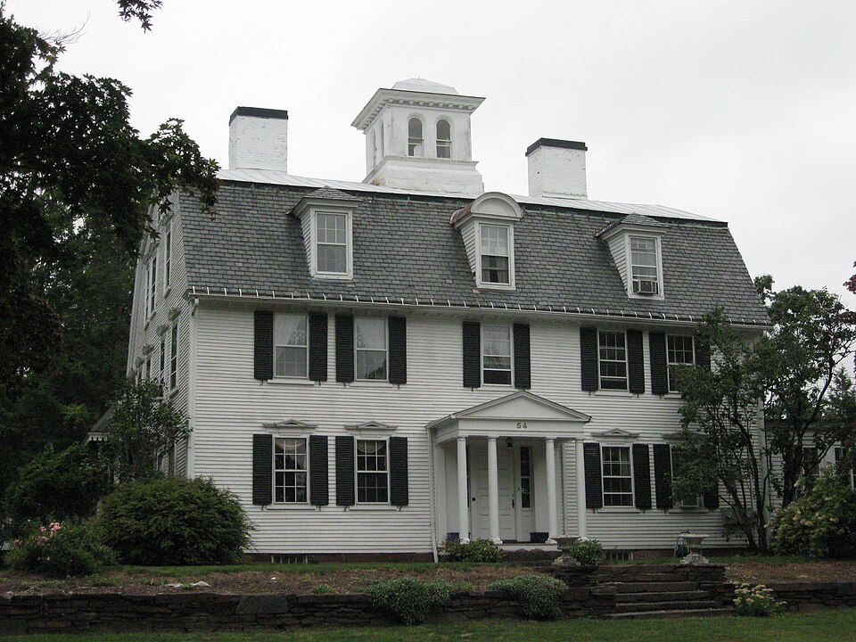
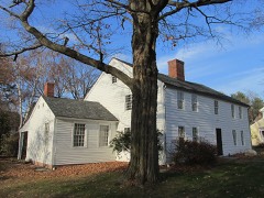
“The Manse is a historic church manse in Northampton, Massachusetts. With a construction history dating to 1744, it is in part a good example of vernacular mid-18th century architecture.”
Wikipedia article The Manse (Northampton, Massachusetts), CC BY-SA 4.0.
one of 32 National Register listings in Hampshire County · listed in 1976 · category: Building.
National Register reference number.76000263- the number the National Park Service assigned this property when it was listed, and the key its nomination file is catalogued under at the National Archives.
The city of Northampton has for several years established its cruslaing works near the north line of the town and at a distance from railroads, and works the Hatfield tonalite or hornblendic granite, which is a partly decomposed rock, more brittle than the trap, and in many ways an inferior rock for road ballast. The city has access beside the road or railroad within its own limits to several better ledges than the one it works now. In 1897 the city of Ware opened a quarry on the Coys Hill dike on the mountain side east of the railroad station. The dike is here 5 rods wide, favorably situated for quanying, and will furnish the best material in inexhaustible quantity.
Regional context, not property-specific
evidence. The
federal wildfire occurrence database
lists 87 fires within 5 miles of Manse, The between
2001 and 2020, burning about 325 acres in total. 8 started naturally. 5 were recorded as arson.
Distance is straight-line from the map coordinates, so a fire counted
here may appear on a neighbouring settlement's page as well.
Reported cause
Fires
Missing data/not specified/undetermined
28
Equipment and vehicle use
22
Debris and open burning
14
Recreation and ceremony
10
Natural
8
Arson/incendiarism
5
The most recent of
them, most recent first, with the day each was reported and the service
that recorded it.
Regional context, not property-specific
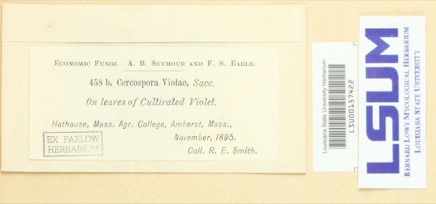
evidence. Museums hold 6,185 specimens
collected within 10 miles of Manse, The between 1781 and
1975: 3,174 Plantae, 1,564 Fungi, 1,239 Animalia, 134 Chromista, 64 Protozoa, 9 Unrecorded, 1 Bacteria. 12 distinct Species records are shown.
Collected by A V Osmun, A., A. Albee and others. Each is a
physical object with a catalogue
number, and each entry opens the museum's record. This is what was
collected and kept, not a survey of what lives here - nothing can be
concluded from a species being absent.
Regional context, not property-specific
evidence. The federal mineral resources record lists
22 workings within 5 miles of Manse, The: 11 producers, 11 past producers.
11 still produce. What was taken out: Brick Clay, Clay, Stone, Dimension, Sand and Gravel, Construction. Distance is straight-line from the
map coordinates, so a quarry counted here may appear on a neighbouring
settlement's page as well.
Regional context, not property-specific
evidence. The National Weather Service names
Northampton, the town this property stands in, in 36 storm reports between 1995 and 2025: 18 thunderstorm wind, 6 flood, 4 hail, 4 lightning.
The reports record 1 injury. Each account below is quoted exactly as the forecast office
filed it, from the NOAA Storm Events Database, and each date
opens the federal record of that event.
Record flooding along the Mill River caused extensive flooding in Northampton. The river crested at 15.6 feet on the 16th, which was the highest crest on record, and well above the previous record crest of 13.7 feet which occurred in October, 2005. Many roads near the river were closed and some evacuations took place as flood waters threatened nearby homes and businesses.|Minor flooding also affected the mainstem Connecticut River through Northampton. A crest of 119 feet was recorded at 430 pm on the 17th (flood stage is 112 feet).
After receiving roughly four and a half inches of rain from Tropical Storm Irene, an overtopped dike resulted in the closure of West Street in Northampton. At exit 24 on Route 5, there was five to six feet of water flooding the road, with two cars floating down the road.
In the Florence section of Northampton, a 50 foot by 50 foot wooden permanent pavilion structure was blown crooked at a landmark restaurant/tavern. The footings, which were lifted and bent, were attached by a metal bracket to concrete. The pavilion can accomodate 18 tables with 4 people per table. The building inspector classified the damage as $20,000. Slightly farther to the southeast, a 50 ft by 75 ft. section of roofing, including insulation and rubber membrane, was peeled off of the Smith Vocational and Agricultural High School. There was little in the way of water damage inside the school. The Northampton building inspector rated the roof damage as $30,000. Still farther to the southeast, a tree was down on Washington Avenue, as reported by amateur radio.
Numerous trees were downed in Northampton, including several on Summer Street and one on Massasoit Street which fell on wires. Large trees also were downed in Easthampton, including one that fell on a house and a car on Chestnut Street.
No historic map-sheet match is published
for this property yet. That does not mean no map exists. This record needs
a coordinate-quality review before it can be joined to a sheet boundary.
Browse the county's mapped places while that work is
pending.
From the nomination file
2,466 words on record
When this property was proposed for the
National Register, someone wrote the case for it: what the building is,
and why it matters. That document is a federal record in the public domain.
It is quoted below word for word, never summarised. The text was read off the scanned case file by machine, so the
occasional stray character is the recogniser's and the 1970s
typewriter's.
Description of the property
The Manse stands on Round Hill in Northampton, overlooking the city, toward the Holyoke Range, and the Connecticut River. It is set back from the road, behind a row of maple trees, on an acre of land in a residential district. Ihe house 1s 4½ stories high with a gambrel root and gables to the side. The facade, on Prospect Street, is five bays wide with a center entry. This entrance is protected by a pedimented porch supported by four slender columns. The two interior chimneys are painted white as is the clapboard sheathing. At the attic level are three dormers; the center one has a segmental pediment, and the other two have hipped roofs.
Fenestration, through- out, is six-over-six sash and capped by a projecting triangular pediment, except on the second floor facade, where the lintels of the windows are flush with the frieze of the cornice. The cornice projects and is supported by modillions. An entrance on the south elevation is protected by a flat roofed porch which is ornamented by delicate Gothic tracery. To the rear of the house, on the west elevation, is a 2½ story ell. On the north elevation is a one story modern porch that extends the width of the side. On the ridge of the roof is a square cupola, with double round arched windows and a hipped roof. Like the Gothic porch, the cupola is a 19th century addition. Also on the well kept grounds is an octagonal, lattice-enclosed gazebo of about 1880.
In 1685, the Reverend Solomon Stoddard built on this site a house which is no longer extant. The rear ell of the present house was built in 1744. This house was enlarged when the front gambrel roofed section was built by Solomon Stoddard in 1782.
/ARCHITECT STATEMENT OF SIGNIFICANCE The Manse is significant architecturally as one of the last remaining examples of an eighteenth century house built in the Connecticut Valley Georgian vernacular style. Historically, the house has been associated with individuals prominent in the history of western Massachusetts. The Reverend Solomon Stoddard, Northampton's second minister, built a house on this site in 1685, from which the name, The Manse, is derived. This 1685 house is no longer believed to be extant. The Reverend Solomon Stoddard, a learned and influential reli- gious figure often referred to as "Pope" Stoddard, was involyed in theological disputes with Cotton and Increase Mather. At the time of his death in 1792, his library con- tained 462 volumes.
Jonathan Edwards, grandson of Reverend Stoddard, was ordained in Northampton in 1727. He served as a colleague pastor with his grandfather and lived with him for a short time. Reverend Solomon's son, Colonel John Stoddard, was an important figure in the colonial history of Massachusetts. John Stoddard built a house in 1744, which is the ell of the present house. One local historian noted about Col. Stoddard: "...the history of the times is a biography of the man..." He served as a town selectman, moderator, represen- tative to the General Court, member of his Majesty's council, Commissioner to treat with the Indlans, Agent to redeem prisoners in Canada, Judge of Probate, Chief Jus- tice of the Court of Common Pleas, Colonel of the Militia, and Commander on the Western Frontier.
His nephew, Jonathan Edwards, stated at his funeral, "Upon the whole, everything in him was great, and perhaps there never was a man in New England to whom the denomination of a great man did more plainly belong." The main section of the present house was built by Solomon Stoddard in 1782.
Quoted from the National Register nomination
for reference 76000263, 15 pages, held by the National Archives in Record
Group 79. See the
catalogue record.
Listed places nearby
6 within 8 miles
Other National Register properties close
enough to walk or drive between, ordered by distance from this one. Both
positions come from the same geocoding pass that matched these properties
to their map sheets.
Listing record. National Park Service National Register of Historic Places, listed-properties dataset, current to 2026-05-22.
Map join. Address geocoded through the United States Census geocoder, then tested against the published boundary of every sheet in the USGS Historical Topographic Map Collection.
How this page is made. Listing fields come from federal records; map-sheet coverage is a labelled coordinate-to-boundary calculation, not a source-field claim.
Wildfire. Short, Karen C. 2022. Spatial wildfire occurrence data for the United States, 1992-2020 [FPA_FOD_20221014]. 6th Edition. Fort Collins, CO: Forest Service Research Data Archive. https://doi.org/10.2737/RDS-2013-0009.6 Collected with United States Government funding and usable without additional permissions or fees.
Specimens. Global Biodiversity Information Facility (GBIF), https://www.gbif.org/. Only records licensed CC0 or CC BY are used. Records licensed CC BY-NC are excluded because this site carries advertising. Images are checked individually and any whose licence is non-commercial, no-derivatives or unreadable is refused.
Mines and quarries. USGS Mineral Resources Data System (MRDS) https://mrdata.usgs.gov/mrds/ A work of the United States government, no copyright under 17 U.S.C. 105.
Storms. NOAA National Centers for Environmental Information, Storm Events Database https://www.ncei.noaa.gov/stormevents/ A work of the United States government, no copyright under 17 U.S.C. 105. Narratives are quoted verbatim from the National Weather Service report and are not edited or summarised.
 Block
Block