Listed on the National Register of Historic Places in
1976. A historic map-sheet match is not published yet. The record needs a coordinate-quality review before it can be joined to a sheet boundary.
From the record
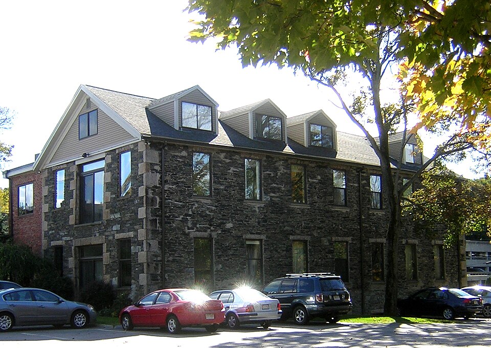
“The Eaton-Moulton Mill is a historic industrial building at 37 Walnut Street in the Wellesley Lower Falls village of Wellesley, Massachusetts. The granite mill building was built c. 1853 by the firm of Reuben Ware and William Clark, manufacturers of papermaking machinery.”
Wikipedia article Eaton-Moulton Mill, CC BY-SA 4.0.
one of 249 National Register listings in Norfolk County · listed in 1976 · category: Building · one of 2 National Historic Landmarks in Norfolk County.
National Register reference number.76000294- the number the National Park Service assigned this property when it was listed, and the key its nomination file is catalogued under at the National Archives.
There has been a very steady growth of the town in buildings of a more or less public character, as witness the various dormitories and other buildings in the College grounds and vicinity, the Town Hall - the generous gift of Mr. Hunnewell - school buildings erected, the different business blocks at Wellesley and the Hills, also St. Andrew's church in Wellesley, and the Unitarian and Congregational church buildings in the Hills. Different residential sections have developed very attractively, as along Dover and Grove Streets in Wellesley, and Abbott Road, Belvedere, and Cliff Road, Wellesley Hills, and clusters of humbler homes on no less attractive sites, as on River Ridge, Newton Lower Falls and Garfield Farm, near the Boston and Worcester car station.
The town has shared with the rest of the world in improvements in transportation of goods and persons and facility of communication. In 1881 the only public conveyances to Boston, the workshop of most of our men, was over the Boston and Albany Railroad, but in 1896 the Natick and Cochituate began running, and in 1903, the Boston and Worcester, giving the inhabitants of Wellesley innumerable daily opportunities of reaching the city.
Regional context, not property-specific
evidence. The
federal wildfire occurrence database
lists 99 fires within 5 miles of Eaton-Moulton Mill between
2003 and 2020, burning about 372 acres in total. None started naturally. None was recorded as arson.
Distance is straight-line from the map coordinates, so a fire counted
here may appear on a neighbouring settlement's page as well.
Reported cause
Fires
Recreation and ceremony
56
Missing data/not specified/undetermined
33
Debris and open burning
6
Smoking
2
Other causes
1
Power generation/transmission/distribution
1
The most recent of
them, most recent first, with the day each was reported and the service
that recorded it.
Regional context, not property-specific
evidence. Museums hold 13,804 specimens
collected within 10 miles of Eaton-Moulton Mill between 1805 and
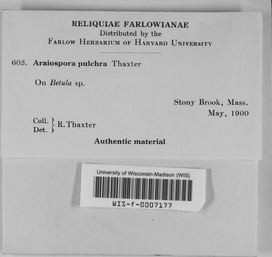
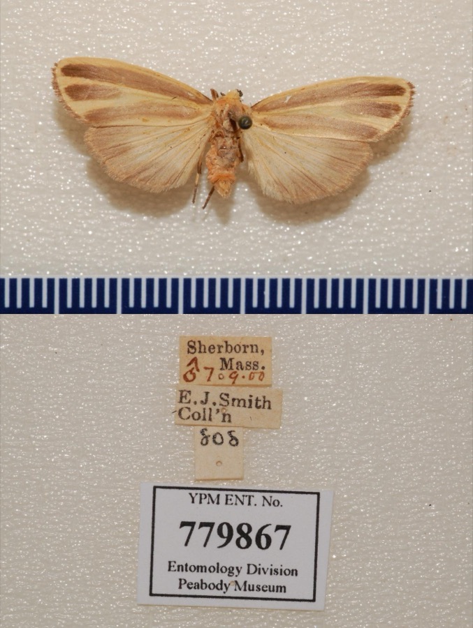
1975: 5,862 Animalia, 3,794 Fungi, 3,708 Plantae, 192 Protozoa, 169 Chromista, 46 Unrecorded, 33 Bacteria. 12 distinct Species records are shown.
Collected by ?, ? ex Herb. W.G. Farlow, A C Gibson and others. Each is a
physical object with a catalogue
number, and each entry opens the museum's record. This is what was
collected and kept, not a survey of what lives here - nothing can be
concluded from a species being absent.
Regional context, not property-specific
evidence. The federal mineral resources record lists
11 workings within 5 miles of Eaton-Moulton Mill: 8 past producers, 2 producers, 1 plant.
3 still produce. What was taken out: Sand and Gravel, Construction, Stone, Crushed/Broken, Stone, Tantalum. Distance is straight-line from the
map coordinates, so a quarry counted here may appear on a neighbouring
settlement's page as well.
Regional context, not property-specific
evidence. The National Weather Service names
Wellesley, the town this property stands in, in 17 storm reports between 1998 and 2023: 10 thunderstorm wind, 3 hail, 1 heavy rain, 1 flood.
No death or injury is recorded in these reports. Each account below is quoted exactly as the forecast office
filed it, from the NOAA Storm Events Database, and each date
opens the federal record of that event.
Trees and branches on Dewing Path, Route 16, Brooke Street, Leighton Road, and Weston Road were downed by thunderstorm winds. One of the trees fell onto a house and another broke a utility pole.
A tree on Route 135 East near Wellesley College was downed by thunderstorm winds. Another tree on Chatham Circle and power lines on Howe Street also were downed by thunderstorm winds.
No historic map-sheet match is published
for this property yet. That does not mean no map exists. This record needs
a coordinate-quality review before it can be joined to a sheet boundary.
Browse the county's mapped places while that work is
pending.
From the nomination file
1,855 words on record
When this property was proposed for the
National Register, someone wrote the case for it: what the building is,
and why it matters. That document is a federal record in the public domain.
It is quoted below word for word, never summarised. The text was read off the scanned case file by machine, so the
occasional stray character is the recogniser's and the 1970s
typewriter's.
Description of the property
The Eaton Moulton Mill, located at 37 Walnut Street, was erected in 1853. It is set back about 250 feet from Walnut Street and runs parallel to the Charles River. Al- though the area is now heavily congested with new construction,the mill is topograph- ically isolated by the ancient Proprietors Way, the rising terrain to the south and the curve of the river to the north and west. The site for the property was originally chosen for its proximity to the readily available water power harnessed by the Upper and Iower Falls, which run for two miles on this section of the Charles. The mill is located at right angles to the Cordingly Dam, one of the two dams on this portion of the River, which is spanned by an iron footbridge.
The rectangular building is two stories high, with a full basement and attic story with seven dormers. It is constructed of coursed rubble with distinctive granite quoins and lintels, and is seven bays long and three wide. A brick addition, two stories high, was added to the southeast elevation in 1944, and a large chimney stack rises at the intersection of the addition and the main building. The building, always used for industrial purposes, has recently been rehabilitated for office space. The change in use has caused quite a few alterations to the build- ing, but it still retains its integrity of materials, mass, and location. All of the windows, originally 12/12 sash, have been replaced with single pane tinted glass but the regular spacing and granite lintels have been retained.
The dormers and both gable ends have been covered with aluminum siding, and new single pane tinted glass windows have been added.
/ARCHITECT The Newton Lower Falls settlement on the Charles River was the earliest industrial development in what is now the Town of Wellesley. The Eaton Moulton Mill is one of the only remaining intact buildings in Wellesley of that period, and has sur- vived the numerous changes that have occurred around it. At different periods, various kinds of businesses requiring the aid of water power have been carried on in this area, but during most of the nineteenth century the manufacture of paper was the leading industry. Eight or ten paper mills, the first built in 1798 by John Ware, were in constant operation and produced paper for books and newspapers. In 1828 these paper mills began to change from the hand-making process to machines which produced a continuous sheet.
The first machine of this kind in the United States was placed in a mill at Lower Falls. This conversion required a properly equipped plant to cproduce and repair these machines, and as a result Reuben Ware, son of John Ware, and William Clark erected a wooden machine shop in 1832 on the present site of the Eaton Moulton Mill. After the building was damaged by fire and flood in 1834 it was rebuilt, and the wooden structure was bought in 1846 by Joseph Stowe. In 1850 Henry and Harvey Eaton and Rufus Moulton formed a partnership and bought the building, which burned again in 1853, precipitating the construction of the present stone building.
Until the turn of this century the machine shop in the stone mill was one of the leading builders of paper machinery in America, even exporting machines to foreign countries. In 1876 Adam Beck bought the building and continued the flourishing business which had been conducted by Eaton and Moulton.
Quoted from the National Register nomination
for reference 76000294, 9 pages, held by the National Archives in Record
Group 79. See the
catalogue record.
Listed places nearby
6 within 8 miles
Other National Register properties close
enough to walk or drive between, ordered by distance from this one. Both
positions come from the same geocoding pass that matched these properties
to their map sheets.
Listing record. National Park Service National Register of Historic Places, listed-properties dataset, current to 2026-05-22.
Map join. Address geocoded through the United States Census geocoder, then tested against the published boundary of every sheet in the USGS Historical Topographic Map Collection.
How this page is made. Listing fields come from federal records; map-sheet coverage is a labelled coordinate-to-boundary calculation, not a source-field claim.
Wildfire. Short, Karen C. 2022. Spatial wildfire occurrence data for the United States, 1992-2020 [FPA_FOD_20221014]. 6th Edition. Fort Collins, CO: Forest Service Research Data Archive. https://doi.org/10.2737/RDS-2013-0009.6 Collected with United States Government funding and usable without additional permissions or fees.
Specimens. Global Biodiversity Information Facility (GBIF), https://www.gbif.org/. Only records licensed CC0 or CC BY are used. Records licensed CC BY-NC are excluded because this site carries advertising. Images are checked individually and any whose licence is non-commercial, no-derivatives or unreadable is refused.
Mines and quarries. USGS Mineral Resources Data System (MRDS) https://mrdata.usgs.gov/mrds/ A work of the United States government, no copyright under 17 U.S.C. 105.
Storms. NOAA National Centers for Environmental Information, Storm Events Database https://www.ncei.noaa.gov/stormevents/ A work of the United States government, no copyright under 17 U.S.C. 105. Narratives are quoted verbatim from the National Weather Service report and are not edited or summarised.
 Block
Block