Listed on the National Register of Historic Places in
1976. A historic map-sheet match is not published yet. The record needs a coordinate-quality review before it can be joined to a sheet boundary.
From the record
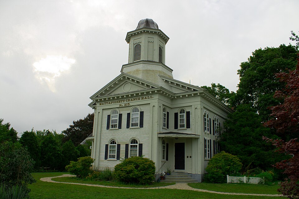
“The Third Meetinghouse is an historic church, community meeting house and Grange Hall at 1 Fairhaven Road in Mattapoisett, Massachusetts. Built in 1816, it is the town's oldest surviving public building, and the one in which the meeting leading to its separation from Rochester took place.”
Wikipedia article Third Meetinghouse, CC BY-SA 4.0.
one of 93 National Register listings in Plymouth County · listed in 1976 · category: Building · one of 1 National Historic Landmarks in Plymouth County.
National Register reference number.76000956- the number the National Park Service assigned this property when it was listed, and the key its nomination file is catalogued under at the National Archives.
Especially should recognition here be given to the direct aid given by the Mattapoisett Historical Committee, under whose commission this work has been performed, an aid without which these chapters on Old Rochester history could scarcely have been completed within the limited time that was available for this work.
In a similar spirit and with similar emotions we are assembled on this our municipal, or town, Thanksgiving Day. Although for a century and three quarters Mattapoisett was in existence as a part of Rochester, and since then has been for a half of a century a town "on its own hook," yet we have never had such a holiday. We have, however, seen the error of our ways. and in this respect we intend to make amends. "We propose to enjoy ourselves, (at least after this address is delivered) to cherish and honor the memory of those who are gone, to renew our friendship with those still here, and in this way to be led to a greater love of the town and all for which it stands.
Regional context, not property-specific
evidence. The
federal wildfire occurrence database
lists 30 fires within 5 miles of Third Meetinghouse between
2015 and 2020, burning about 18 acres in total. None started naturally. None was recorded as arson.
Distance is straight-line from the map coordinates, so a fire counted
here may appear on a neighbouring settlement's page as well.
Reported cause
Fires
Debris and open burning
13
Missing data/not specified/undetermined
9
Smoking
3
Recreation and ceremony
2
Misuse of fire by a minor
2
Power generation/transmission/distribution
1
The most recent of
them, most recent first, with the day each was reported and the service
that recorded it.
Regional context, not property-specific
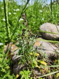
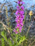
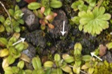
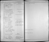
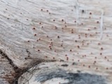
evidence. Museums hold 2,222 specimens
collected within 10 miles of Third Meetinghouse between 1824 and
1975: 754 Plantae, 727 Fungi, 584 Animalia, 129 Chromista, 24 Bacteria, 4 Unrecorded. 12 distinct Species records are shown.
Collected by A. B. Gridley, A. B. Seymour, A. C. Mathieson and others. Each is a
physical object with a catalogue
number, and each entry opens the museum's record. This is what was
collected and kept, not a survey of what lives here - nothing can be
concluded from a species being absent.
Regional context, not property-specific
evidence. The federal mineral resources record lists
4 workings within 5 miles of Third Meetinghouse: 2 past producers, 1 unknown, 1 producer.
1 still produces. What was taken out: Stone, Crushed/Broken, Sand and Gravel, Construction. Distance is straight-line from the
map coordinates, so a quarry counted here may appear on a neighbouring
settlement's page as well.
Regional context, not property-specific
evidence. The National Weather Service names
Mattapoisett, the town this property stands in, in 4 storm reports between 1998 and 2006: 2 thunderstorm wind, 1 hail, 1 heavy rain.
No death or injury is recorded in these reports. Each account below is quoted exactly as the forecast office
filed it, from the NOAA Storm Events Database, and each date
opens the federal record of that event.
No historic map-sheet match is published
for this property yet. That does not mean no map exists. This record needs
a coordinate-quality review before it can be joined to a sheet boundary.
Browse the county's mapped places while that work is
pending.
From the nomination file
2,467 words on record
When this property was proposed for the
National Register, someone wrote the case for it: what the building is,
and why it matters. That document is a federal record in the public domain.
It is quoted below word for word, never summarised. The text was read off the scanned case file by machine, so the
occasional stray character is the recogniser's and the 1970s
typewriter's.
Description of the property
The Third Meetinghouse, built in 1816, faces south onto Route 6, and is one of the last remaining buildings which once faced the old town common. The building sits on a quarter of an acre of lawn and is surrounded by a few small nineteenth century buildings and the twentieth century commercial development which has grown up along Route 6. The Meetinghouse, in spite of these commercial intrusions, retains its rural, small town feeling and associations and is a visual landmark on the highway. The Meetinghouse was originally built with a steeple and flush facade. The building was remodeled in the Italianate manner in 1857 for use by the Mattapoisett Academy.
Except for the loss of the rounded Italianate dome and banneret weathervane, both destroyed by the hurricane of 1938, the building 1ooks now essentially as it did in 1857. The 2 story rectangular clapboarded building rests on a cut granite foundation. It is four bays wide and four bays deep, with a pedimented 2 story central pavilion on the facade. The central pavilion, one bay in depth, is articulated by wide cornerboards each containing a slender 2 story recessed panel with a round arch at the top. The cornerboards and panels are repeated on the four corners of the main body of the meetinghouse. The pediment of the pavilion and the larger pediment of the facade behind it have the same heavy triangular boxed cornice incorporating modillions interspersed by dentils.
This decorative cornice continues all the way around the building. Above the pediment of the facade rests the base and the first stage of the tower. The first stage of the tower is octagonal, with louvered roundheaded arched openings in four sides and recessed rectangular panels in the alternate sides.
/ARCHITECT STATEMENT OF SIGNIFICANCE The Third Meetinghouse is significant not only for its architectural importance to Mattapoisett, but also for the contributions it has made to the political development of the town and in the field of education. The Meetinghouse is situated on what is now Route 6, which was the major route between Cape Cod and New York before the construction of Interstate 195. Most of Route 6 has been developed and commercialized; the Third Meetinghouse is one of the few buildings of architectural quality remaining in the area.
The meetinghouse, with its decorated double pediments and round arched windows stands out as a After the roof of the Second Meetinghouse was destroyed woy dthe ojed 1815 hurricane and because the town's occupation was turning from farming to ship building, the congregation decided to locate the Third Meetinghouse closer to the sea. The Third Meetinghousewas used by the congregation for twenty-eight years until the parish outgrew the building and moved to the present Congregational The meetinghouse was also used for town meetings during this time, and housed a memorable session lasting from March 6, 1837 to July 10, during which the issue of separation from Rochester was discussed.
This separation was finally carried out in 1857 when Mattapoisett was incorporated, and the old town of In 1854 the building was taken over by the Mattapoisett Academy, founded by interested citizens of the community. The school started with 133 pupils, 36 from other towns and 7 from other states, a male principal and two female teachers. The Academy closed in 1862, but the building was opened as the public Barstow member of the school board during this time was Charles Bryant, who had been instrumental in helping Seward convince the U.S.
Quoted from the National Register nomination
for reference 76000956, 10 pages, held by the National Archives in Record
Group 79. See the
catalogue record.
Listed places nearby
3 within 8 miles
Other National Register properties close
enough to walk or drive between, ordered by distance from this one. Both
positions come from the same geocoding pass that matched these properties
to their map sheets.
Listing record. National Park Service National Register of Historic Places, listed-properties dataset, current to 2026-05-22.
Map join. Address geocoded through the United States Census geocoder, then tested against the published boundary of every sheet in the USGS Historical Topographic Map Collection.
How this page is made. Listing fields come from federal records; map-sheet coverage is a labelled coordinate-to-boundary calculation, not a source-field claim.
Wildfire. Short, Karen C. 2022. Spatial wildfire occurrence data for the United States, 1992-2020 [FPA_FOD_20221014]. 6th Edition. Fort Collins, CO: Forest Service Research Data Archive. https://doi.org/10.2737/RDS-2013-0009.6 Collected with United States Government funding and usable without additional permissions or fees.
Specimens. Global Biodiversity Information Facility (GBIF), https://www.gbif.org/. Only records licensed CC0 or CC BY are used. Records licensed CC BY-NC are excluded because this site carries advertising. Images are checked individually and any whose licence is non-commercial, no-derivatives or unreadable is refused.
Mines and quarries. USGS Mineral Resources Data System (MRDS) https://mrdata.usgs.gov/mrds/ A work of the United States government, no copyright under 17 U.S.C. 105.
Storms. NOAA National Centers for Environmental Information, Storm Events Database https://www.ncei.noaa.gov/stormevents/ A work of the United States government, no copyright under 17 U.S.C. 105. Narratives are quoted verbatim from the National Weather Service report and are not edited or summarised.
 Block
Block