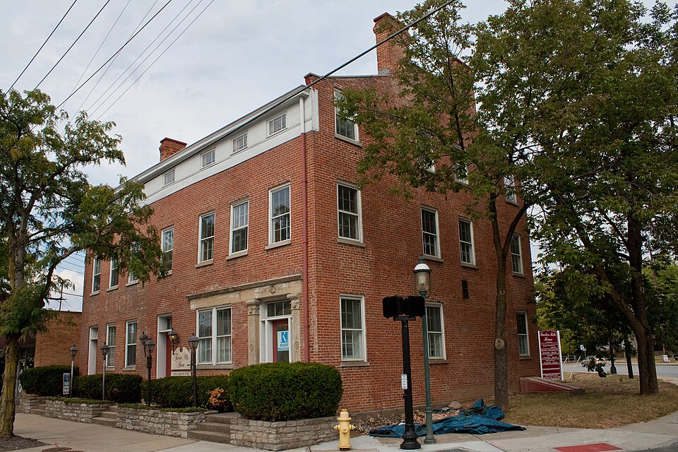
Listed on the National Register of Historic Places in
1976. A historic map-sheet match is not published yet. The record needs a coordinate-quality review before it can be joined to a sheet boundary.
From the record
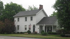
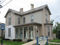
“Twelve Mile House is a registered historic building in Sharonville, Ohio. It is an L-shaped, story Greek revival building that was built in 1842 as an inn and tavern.”
Wikipedia article Twelve Mile House, CC BY-SA 4.0.
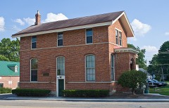
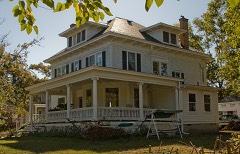
one of 314 National Register listings in Hamilton County · listed in 1976 · category: Building · one of 9 National Historic Landmarks in Hamilton County.
National Register reference number.76001452- the number the National Park Service assigned this property when it was listed, and the key its nomination file is catalogued under at the National Archives.
In the spring of 1868, after suffering from a disease he had contracted in addition to his wound in the service, he removed to a farm in Butler county, where he remained until 1870, when he moved to his valuable farm in Sycamore township, his present and no doubt future residence. During the last eleven years he has been largely engaged in farming. Beyond question Colonel Hill has grown more wheat per acre on his farm for the last three years than any other farmer in his township. In August, 1873, he assisted in organizing Eden Grange, No. 97 ^Patrons of Husbandry, being one of the charter members. When the Hamilton County council was instituted Colonel Hill was chosen as its first business agent, without compensation for the first year; and so well were its operations organized by him that on the twenty-ninth of July, 1874, after the council had become thoroughly organized, he was appointed financial business manager of the Ohio State grange by the State grange executive committee. He accepted the trust under protest, after having repeatedly declined and requesting others to be appointed. Locating his office at Sharonville, m a room but eight by ten feet in dimensions, business increased so rapidly that it became necessary to open another house in Cincinnati, which was done April I, 187s, with local agents in various parts of the State. On the first day of October, 1875, the business had become so extensive, running over millions of dollars, a large warehouse was opened at No. 63 Walnut street, after which a still larger house had to be secured at 22 and 24 East Third street, with business so largely on the increase that he had to enlarge his clerical force until he retired with an increased salary offered him, February 11, 188 1.
Colonel William H. Hill, of Sharonville, was born January. 21, 1826, in Humilstown, Dauphin county, Pennsylvania, and is of German descent. His father, Michael. was a merchant; having a store of general merchandise. He died in the east, when William was quite young. about nine vears old. The widowed mother, a noble woman, moved with her family of five children from Fort Hunter, Dauphin county, to Winchester, Randolph county, Indiana; in 1839, by team. Here she gave her children the best education in her power, that afforded by the common school. His first effort in business was when ne was quite young, under nine years of age, in the selling of candies. His capital was twenty-five cents, which, by selling and reinvesting, in a little over one year he increased to more than one hundred dollars. This sum, after removing to the west, his mother invest- where the colonel to this day is knowneby the old citizens as "the garden spader," because he was regularly employed by them nearly every spring to spade their gardens. 1845, his first step upon leaving school was to learn the carding and spinning trade, in which he was engaged until the fall of 1850, when he commenced for himself the mercantile and milling business, which was prosecuted with the great energy characteristic of Colonel Hill. During his mercantile life he was connected with and had the management of three different mercantile houses, and purchased for two others in the eastern cities. During the same period he was the owner and manager of two mercantile houses in the same place, running one house against the other, and so well was this managed that his own family was not aware that he owned both. This singular business freak was in order to have competition and draw trade to his own town, which old citizens, after learning of it, admitted was a complete success.
Regional context, not property-specific
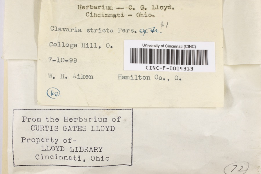
evidence. Museums hold 5,540 specimens
collected within 10 miles of Twelve Mile House between 1819 and
1975: 3,757 Fungi, 938 Animalia, 494 Plantae, 304 Protozoa, 27 Unrecorded, 19 Chromista, 1 Bacteria. 12 distinct Species records are shown.
Collected by 14753, A. Braun, A. Gaufin and others. Each is a
physical object with a catalogue
number, and each entry opens the museum's record. This is what was
collected and kept, not a survey of what lives here - nothing can be
concluded from a species being absent.
Regional context, not property-specific
evidence. The National Weather Service names
Sharonville, the town this property stands in, in 21 storm reports between 2001 and 2022: 9 hail, 4 flash flood, 4 thunderstorm wind, 2 heavy rain.
No death or injury is recorded in these reports. Each account below is quoted exactly as the forecast office
filed it, from the NOAA Storm Events Database, and each date
opens the federal record of that event.
No historic map-sheet match is published
for this property yet. That does not mean no map exists. This record needs
a coordinate-quality review before it can be joined to a sheet boundary.
Browse the county's mapped places while that work is
pending.
From the nomination file
1,488 words on record
When this property was proposed for the
National Register, someone wrote the case for it: what the building is,
and why it matters. That document is a federal record in the public domain.
It is quoted below word for word, never summarised. The text was read off the scanned case file by machine, so the
occasional stray character is the recogniser's and the 1970s
typewriter's.
Description of the property
The building originally had a central hall plan flanked by two rooms the rooms on the second and third floors were altered by the addition The part. and one bedroom over the brick addition.The third floor originally The front facade (west) consisting of seven bays is generally symmetri- DATE. on either side-the dining rooms and the barrooms.T appears to have been a small wooden addition added to the brick The front entrance on the south and the large window -RUINS AREAS OF
Statement of significance
for travelers and townspeople alike, and the rooms on the upper floors In 1841 the road between Cincinnati, Lebanon and Springfield, Ohio was enterprise, being located approximately twelve miles from the heart X1800-1899 1600-1699 ECONOMICS ENGINEERING ARCHEOLOGY-HISTORIC PERIOD SIGNIFICANCE ART CONSERVATION BUILDER/ARCHITECT THEATER COMMUNICATIONS AGRICULTURE POLITICS/GOVERNMENT INDUSTRY SCULPTURE MILITARY XARCHITECTURE provided overnight lodging. this time the main activity was in the inn offering refreshments.
XCOMMERCE role the commercial activity located in it played within the present City This subdivision of land led to the establishment of the town of Sharon, The building is significant because of its architectural history and the During the 1870's, with the coming of the railroads, the Twelve Mile _EXPLORATION/SETTLEMENT completed.At Springfield it connected with the National Road. LITERATURE time the town of Sharon had evolved into a stagecoach and freight stop community on the westward overland and northern routes. _TRANSPORTATION The building is a good example of the Greek Revival style utilized for 100 residents. _SOCIAL/HUMANITARIAN of Sharonville. -PHILOSOPHY In the 1920's and 30's the building was converted into some apartments.
-1400-1499 and travelers.The building remained in the Mills family until 1861 -1500-1599 - EDUCATION As traffic on the road grew, Daniel Mills realized the need to establish and served as a hotel with restaurant and bar until after l9l2.After -1700-1799 - RELIGION Hagerman in1796.It was sold to Joseph Meyers and subdivided in 1818. David D.Mills in the land from Philemon Mills.At this -MUSIC -1900- ARCHEOLOGY-PREHISTORIC COMMUNITY PLANNING SPECIFIC DATES C.1842 In later years the bar and restaurant ceased to exist and commercial reflected an unpretentious but imposing building.The interior arrange- an inn and tavern.
Quoted from the National Register nomination
for reference 76001452, 11 pages, held by the National Archives in Record
Group 79. See the
catalogue record.
Listed places nearby
6 within 8 miles
Other National Register properties close
enough to walk or drive between, ordered by distance from this one. Both
positions come from the same geocoding pass that matched these properties
to their map sheets.
Listing record. National Park Service National Register of Historic Places, listed-properties dataset, current to 2026-05-22.
Map join. Address geocoded through the United States Census geocoder, then tested against the published boundary of every sheet in the USGS Historical Topographic Map Collection.
How this page is made. Listing fields come from federal records; map-sheet coverage is a labelled coordinate-to-boundary calculation, not a source-field claim.
Specimens. Global Biodiversity Information Facility (GBIF), https://www.gbif.org/. Only records licensed CC0 or CC BY are used. Records licensed CC BY-NC are excluded because this site carries advertising. Images are checked individually and any whose licence is non-commercial, no-derivatives or unreadable is refused.
Storms. NOAA National Centers for Environmental Information, Storm Events Database https://www.ncei.noaa.gov/stormevents/ A work of the United States government, no copyright under 17 U.S.C. 105. Narratives are quoted verbatim from the National Weather Service report and are not edited or summarised.
 Block
Block