Listed on the National Register of Historic Places in
1975. A historic map-sheet match is not published yet. The record needs a coordinate-quality review before it can be joined to a sheet boundary.
From the record
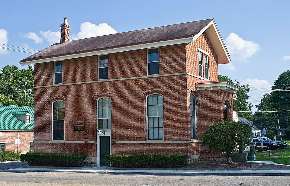
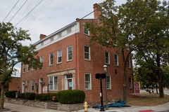
“Glendale Police Station, also known as Council House and Jail, is a historic building in Glendale, Ohio. It was listed in the National Register on March 27, 1975.”
Wikipedia article Glendale Police Station, CC BY-SA 4.0.
one of 314 National Register listings in Hamilton County · listed in 1975 · category: Building · one of 9 National Historic Landmarks in Hamilton County.
National Register reference number.75001425- the number the National Park Service assigned this property when it was listed, and the key its nomination file is catalogued under at the National Archives.
Specimens collected near this property
12 of 4,652 shown
Regional context, not property-specific
evidence. Museums hold 4,652 specimens
collected within 10 miles of Glendale Police Station between 1819 and
1975: 2,699 Fungi, 1,157 Animalia, 586 Plantae, 174 Protozoa, 19 Chromista, 16 Unrecorded, 1 Bacteria. 12 distinct Species records are shown.
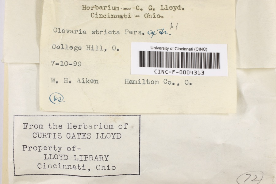
Collected by 14753, A Schwartz, A. Braun and others. Each is a
physical object with a catalogue
number, and each entry opens the museum's record. This is what was
collected and kept, not a survey of what lives here - nothing can be
concluded from a species being absent.
Regional context, not property-specific
evidence. The National Weather Service names
Glendale, the town this property stands in, in 7 storm reports between 2013 and 2023: 3 flood, 3 flash flood, 1 hail.
No death or injury is recorded in these reports. Each account below is quoted exactly as the forecast office
filed it, from the NOAA Storm Events Database, and each date
opens the federal record of that event.
Eight to ten inches of water were reported inside the business of Cincinnati Pool and Patio with about 3 feet of water in the parking lot. This flooding height corresponds to the height of the river gauge of nearby Mill Creek.
No historic map-sheet match is published
for this property yet. That does not mean no map exists. This record needs
a coordinate-quality review before it can be joined to a sheet boundary.
Browse the county's mapped places while that work is
pending.
From the nomination file
1,811 words on record
When this property was proposed for the
National Register, someone wrote the case for it: what the building is,
and why it matters. That document is a federal record in the public domain.
It is quoted below word for word, never summarised. The text was read off the scanned case file by machine, so the
occasional stray character is the recogniser's and the 1970s
typewriter's.
Description of the property
the east bay on the first level has wood infill. portion at right angles to the main building. there is additional detail on the door and window casings and base- CONDITION boards. Interior: Exterior: porch with simple brackets and round arch opening in front of the pan- the building at the sill level on both the first and second levels. There is a continuous band of trimmed limestone which surrounds This is a one and two story painted American bond brick building with at the second level, one on either side of the interior end chimney. ed cap and a chimney pot.The foundation is uncoursed limestone rub- by segmental arch windows with 6/6 double hung sash and gauged brick casement windows with original arrow head wrought iron bars.
ions have horizontal wood siding with simple brackets at the first level roof cornice.At the second level there is a small gable roof rooms are include the Council Office The north facade has three bays.The first and second level windows comodate a door at ground level.The upper portion of the window in gable roof and interior end chimney at the east end that has a corbel- (Check One) window and the one to the left is a door reached by a concrete stair- X Good to the south. are two openings at the foundation level. The one to the right is a is located in the frame addition. Original flooring, plaster walls Excellent lintels. ble.
ment of the C. H. & D. railroad depot. also prominent in County, State, and National affairs. that functioning of the Police Department would be improved if the condition. Restoration work is scheduled to begin in late 1974. step in the development of a preservation plan for the village. DEC 31 1974 Conservation Transportation Commerce Communications Architecture losophy Aboriginal REGISTER Theater RECEIVED NATIONAL Religion/Phi Sculpture Social/Human- architectural heritage.
Since its completion in building has been continuously the remaining structure restored to its original the living quarters.The Council serving as a restoration of the Police Station is a preliminary reflect the various changes in function and especially the increase in village affairs.Several Councilmen who served the village here were building were stripped of its various frame additions and internal This building is significant to the local history of the Village of size of the families of the several Police Chiefs who have occupied monthly Mayor's for a number of decades the center of AREAS OF SIGNIFICANCE (Check One or More as Appropriate) occupied by local government.
The alterations that have been made Art itarian Glendale.It was designed by Harry Neill Wilson and built by Charles S.Sundry to replace the Council Room and Jail located in the base- group of citizens has formed to work for the future of Glendale's
Quoted from the National Register nomination
for reference 75001425, 12 pages, held by the National Archives in Record
Group 79. See the
catalogue record.
Listed places nearby
6 within 8 miles
Other National Register properties close
enough to walk or drive between, ordered by distance from this one. Both
positions come from the same geocoding pass that matched these properties
to their map sheets.
Listing record. National Park Service National Register of Historic Places, listed-properties dataset, current to 2026-05-22.
Map join. Address geocoded through the United States Census geocoder, then tested against the published boundary of every sheet in the USGS Historical Topographic Map Collection.
How this page is made. Listing fields come from federal records; map-sheet coverage is a labelled coordinate-to-boundary calculation, not a source-field claim.
Specimens. Global Biodiversity Information Facility (GBIF), https://www.gbif.org/. Only records licensed CC0 or CC BY are used. Records licensed CC BY-NC are excluded because this site carries advertising. Images are checked individually and any whose licence is non-commercial, no-derivatives or unreadable is refused.
Storms. NOAA National Centers for Environmental Information, Storm Events Database https://www.ncei.noaa.gov/stormevents/ A work of the United States government, no copyright under 17 U.S.C. 105. Narratives are quoted verbatim from the National Weather Service report and are not edited or summarised.
 Block
Block