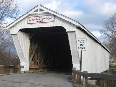
Listed on the National Register of Historic Places in
1976. A historic map-sheet match is not published yet. The record needs a coordinate-quality review before it can be joined to a sheet boundary.
From the record
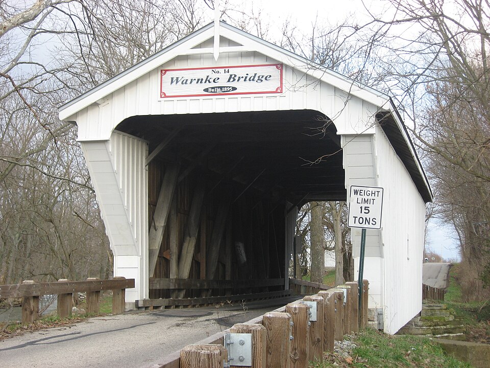
“The Warnke Covered Bridge, also known as Warnke Bridge, is a historic covered bridge crossing Swamp Creek in Harrison Township, Preble County, Ohio, northeast of Lewisburg. It was listed on the National Register of Historic Places in 1976.”
Wikipedia article Warnke Covered Bridge, CC BY-SA 4.0.
one of 16 National Register listings in Preble County · listed in 1976 · category: Structure.
National Register reference number.76001518- the number the National Park Service assigned this property when it was listed, and the key its nomination file is catalogued under at the National Archives.
What happened here
An account from the chapter on Harrison township, The inset identifies its exact
source book and publication year.
The subject of this sketch was born in Rockingham county, Virginia, on the seventeenth day of May, 1792, and with his father, Jacob Kesler, who served as a soldier in the Revolution, emigrated to Preble county, Ohio, and settled on a farm about one mile south of Lewisburgh, in the year 1811. In the following year, 1812, reports having reached the settlements that the Indians were becoming troublesome, and that several families had been massacred near Greenville, Ohio, a company under Captain Fleming, in which he acted as a private, was sent out against them, but on arriving at their destination, they found that the Indians, after having murdered several persons, had fled.
Price creek, with its source also in Darke county northwest of Eldorado, flows southeasterly across section 31, of Harrison township, across Twin township and into Twin creek. The outcrop of stone along the banks of Twin creek, and where the small tributaries break down from the higher land to " the creek, from the earliest times have been a source of profit to many people. Down to within the last fifteen years many quarries furnished building stone for houses and public work, and from the quarry northwest of Euphemia much stone was shipped to other counties for such constructions, while there was a considerable home demand for the stone from all quarries; also south and east of Lewisburg and northwest of Euphemia were built and operated large lime kilns that burned great quantities of lime of the very best quality, which was hauled and shipped to many of the neighboring towns and cities. This burning of lime for many years furnished a ready market for the wood cut by the farmers. But times and business changed, and now the lime kilns are all blown out; many of the quarries abandoned as quarries, while the larger ones, notably the ones northwest of Euphemia, have installed large stonecrushing plants, into which the stone is fed, crushed, dumped into waiting cars and sent out, some to distant cities, for concrete or macadam work and road construction.
In 1816 John Etzler, from Maryland ; John Brown, from North Carolina; William Swisher, from Pennsylvania; Henry Cassell, from Virginia, with others, now not remembered, settled in the township. Within the next five to fifteen years John Schlosser, Peter Studybaker, Christian Disher, Daniel Wolf and Peter Homan became citizens. Christian Disher was the father of Capt. Mathias Disher, and of Christian Disher who ran a quarry and lime kiln for many years on the old homestead, in section 35, near Lewisburg.
Regional context, not property-specific
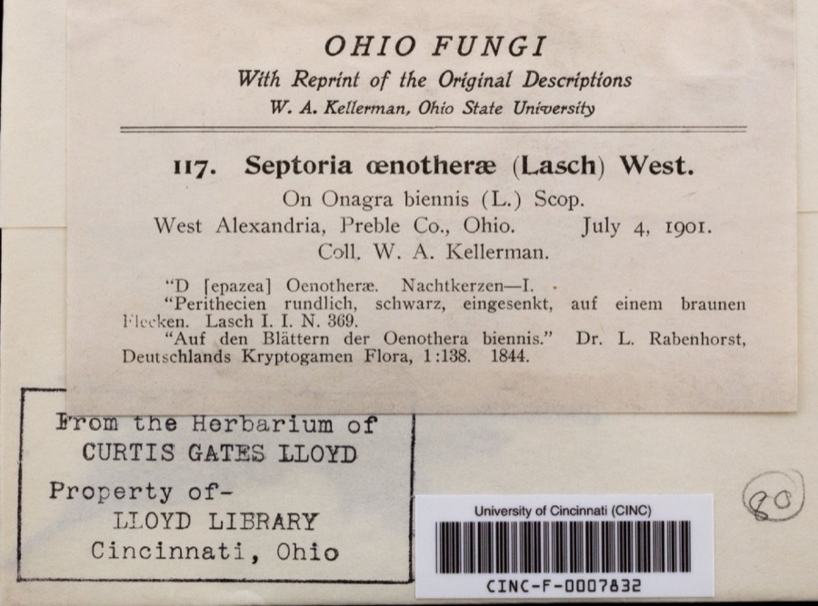
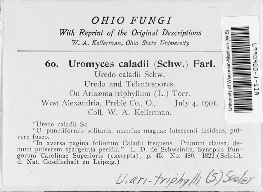
evidence. Museums hold 135 specimens
collected within 10 miles of Warnke Covered Bridge between 1901 and
1970: 117 Animalia, 16 Fungi, 2 Plantae. 12 distinct Species records are shown.
Collected by H.H. Ross, Kellerman, W.A., Kellerman, William and others. Each is a
physical object with a catalogue
number, and each entry opens the museum's record. This is what was
collected and kept, not a survey of what lives here - nothing can be
concluded from a species being absent.
Regional context, not property-specific
evidence. The federal mineral resources record lists
3 workings within 5 miles of Warnke Covered Bridge: 2 producers, 1 past producer.
2 still produce. What was taken out: Stone, Crushed/Broken, Limestone, General. Distance is straight-line from the
map coordinates, so a quarry counted here may appear on a neighbouring
settlement's page as well.
Regional context, not property-specific
evidence. The National Weather Service names
Lewisburg, the town this property stands in, in 5 storm reports between 1996 and 2014: 3 hail, 2 thunderstorm wind.
No death or injury is recorded in these reports. Each account below is quoted exactly as the forecast office
filed it, from the NOAA Storm Events Database, and each date
opens the federal record of that event.
No historic map-sheet match is published
for this property yet. That does not mean no map exists. This record needs
a coordinate-quality review before it can be joined to a sheet boundary.
Browse the county's mapped places while that work is
pending.
From the nomination file
1,891 words on record
When this property was proposed for the
National Register, someone wrote the case for it: what the building is,
and why it matters. That document is a federal record in the public domain.
It is quoted below word for word, never summarised. The text was read off the scanned case file by machine, so the
occasional stray character is the recogniser's and the 1970s
typewriter's.
Description of the property
The structure under consideration is a one-span wooden truss covered bridge sparing own truss plan and it was not until 1874 that such a bridge was built here in Ohio of his bridges from the lower chords on iron stirrups that measured either 3/4" or bridges, using some new beams and some salvaged from bridges that had been removed. Preble County maintenance engineer, Seth S, Schlotterbeck, was almost surely re- UNEXPOSED CONDITION UNALTERED XEXCELLENT made.Preble County takes excellent care of this bridge which is quite evident CHECK ONE truss is the iron rods which are used as counterbraces.The Warnke Bridge isa 6 1".
These later proved to be inadequate when heavier threshing rigs began to use The outward appearance of the Warnke Bridge is mgch the same today as when it was finished in 1895.An arson attempt was made in January 1972 that damaged stone was used and concrete wingwalls were added on each the three coats of white lead and linseed oil specified for all the other Sherman- and trash.The original roof was of red cedar shingles and according to former Childs of Henniker, New Hampshire. Mr. Childs was a master carpenter who built traffic,the county doubled the number of these oak floor beams in all the covered suffer severe damage in the l9l3 flood and had to be rebuilt.The original cut- in its appearance.
replaced them with white in 196l.Stone for the abutments of the bridge came from a quarry near by E.S. Sherman.The Childs truss is very like the basic multiple king-and queen Long truss in l830.For some reason, Mr.
stroyed so many of the county's b ridges.Mr.Sherman came here from.Delaware The.bridge takes its name from John Warnke who owned the land on the north side of -COMMERCE truss bridge that was washed out in a flood. As explained in section 7o, the AGRICULTURER -_1400-1499 -1900- _COMMUNITY PLANNING County, Ohio, where he had lived and worked since coming to Ohio after the Civil county referred to this as a "repair" job, and therefore, no formal specifications bridge built by master bridge-builder Evrett S. Sherman. 1895 RELIGION is the shortest covered span in the county and was built to replace an iron, pony County Commissioners and they were so impressed that he was awarded several con- bridge and the Warnkes and subsequent owners maintained a park and picnic area Mr.
Sherman lost a bid to build another covered bridge in 1896 and moved to her family to the Salt Lick.Her family then proceeded to sell their owm land and War.Mr.Sherman brought a model of his Childs truss bridge to show the Preble SCARCHEOLOGY-PREHISTORIC
Quoted from the National Register nomination
for reference 76001518, 14 pages, held by the National Archives in Record
Group 79. See the
catalogue record.
Listed places nearby
1 within 8 miles
Other National Register properties close
enough to walk or drive between, ordered by distance from this one. Both
positions come from the same geocoding pass that matched these properties
to their map sheets.
Listing record. National Park Service National Register of Historic Places, listed-properties dataset, current to 2026-05-22.
Map join. Address geocoded through the United States Census geocoder, then tested against the published boundary of every sheet in the USGS Historical Topographic Map Collection.
How this page is made. Listing fields come from federal records; map-sheet coverage is a labelled coordinate-to-boundary calculation, not a source-field claim.
Specimens. Global Biodiversity Information Facility (GBIF), https://www.gbif.org/. Only records licensed CC0 or CC BY are used. Records licensed CC BY-NC are excluded because this site carries advertising. Images are checked individually and any whose licence is non-commercial, no-derivatives or unreadable is refused.
Mines and quarries. USGS Mineral Resources Data System (MRDS) https://mrdata.usgs.gov/mrds/ A work of the United States government, no copyright under 17 U.S.C. 105.
Storms. NOAA National Centers for Environmental Information, Storm Events Database https://www.ncei.noaa.gov/stormevents/ A work of the United States government, no copyright under 17 U.S.C. 105. Narratives are quoted verbatim from the National Weather Service report and are not edited or summarised.
 Block
Block