Listed on the National Register of Historic Places in
1976. A historic map-sheet match is not published yet. The record needs a coordinate-quality review before it can be joined to a sheet boundary.
From the record
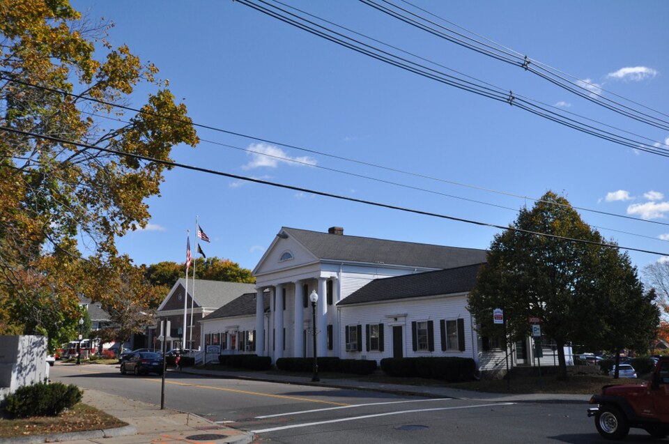
“The Peter Pierce Store is a historic commercial building at 99 North Main Street in Middleborough, Massachusetts. The Greek Revival structure was built in 1808 by Colonel Peter Pierce, one of the town's leading businessmen of the mid 19th century.”
Wikipedia article Peter Pierce Store, CC BY-SA 4.0.
one of 93 National Register listings in Plymouth County · listed in 1976 · category: Building · one of 1 National Historic Landmarks in Plymouth County.
National Register reference number.76001611- the number the National Park Service assigned this property when it was listed, and the key its nomination file is catalogued under at the National Archives.
Fires near this property
111 since 2015
Regional context, not property-specific
evidence. The
federal wildfire occurrence database
lists 111 fires within 5 miles of Pierce, Peter, Store between
2015 and 2020, burning about 105 acres in total. None started naturally. 2 were recorded as arson.
Distance is straight-line from the map coordinates, so a fire counted
here may appear on a neighbouring settlement's page as well.
Reported cause
Fires
Debris and open burning
59
Missing data/not specified/undetermined
33
Misuse of fire by a minor
13
Recreation and ceremony
3
Arson/incendiarism
2
Smoking
1
The most recent of
them, most recent first, with the day each was reported and the service
that recorded it.
Regional context, not property-specific
evidence. Museums hold 827 specimens
collected within 10 miles of Pierce, Peter, Store between 1855 and
1975: 371 Plantae, 251 Animalia, 186 Fungi, 15 Protozoa, 4 Unrecorded. 12 distinct Species records are shown.
Collected by A. B. Seymour, A. Humes, A. K. Harrison and others. Each is a
physical object with a catalogue
number, and each entry opens the museum's record. This is what was
collected and kept, not a survey of what lives here - nothing can be
concluded from a species being absent.
Regional context, not property-specific
evidence. The federal mineral resources record lists
14 workings within 5 miles of Pierce, Peter, Store: 7 past producers, 5 producers, 2 unknowns.
5 still produce. What was taken out: Sand and Gravel, Construction, Clay. Distance is straight-line from the
map coordinates, so a quarry counted here may appear on a neighbouring
settlement's page as well.
Regional context, not property-specific
evidence. The National Weather Service names
Middleboro, the town this property stands in, in 14 storm reports between 1994 and 2025: 9 thunderstorm wind, 3 hail, 1 flash flood, 1 flood.
No death or injury is recorded in these reports. Each account below is quoted exactly as the forecast office
filed it, from the NOAA Storm Events Database, and each date
opens the federal record of that event.
Multiple trees were downed on the School Street extension. A tree was downed onto a building on North Street. Multiple large trees were downed on Precinct and Thompson Streets.
Wareham Street was closed at the Herring Run due to flooding in Middleboro. In Brockton, a car was stuck in water at North Montello Street and Howard Street.
Police reported several trees and branches blown down. In the adjoining town of Lakeville, a tree branch went through a truck windshield. No injuries were reported.
No historic map-sheet match is published
for this property yet. That does not mean no map exists. This record needs
a coordinate-quality review before it can be joined to a sheet boundary.
Browse the county's mapped places while that work is
pending.
Named in the fire insurance atlases
Sanborn surveyors printed an index of the
town's establishments at the front of each atlas. This property is named in
one, read straight off the scanned sheet.
When this property was proposed for the
National Register, someone wrote the case for it: what the building is,
and why it matters. That document is a federal record in the public domain.
It is quoted below word for word, never summarised. The text was read off the scanned case file by machine, so the
occasional stray character is the recogniser's and the 1970s
typewriter's.
Description of the property
The Peter Peirce Store is located on the corner of North Main and Jackson Streets in the center of Middleborough. There are few buildings of this period remaining on Main Street, which is the major commercial street in town and contains a few late nineteenth century and many twentieth century buildings. The store is more monumental than other buildings on that section of Main Street, but does not overwhe1m the streetscape in massing or height. The construction date of the building has not been conclusively proven but appears, by stylistic evidence, to have been c. 1825-30. The building is composed of a large two-story rectangular structure, gable end to the street, flanked by two smaller, one and one-half story wings with ridge roofs perpen- dicular to the main block.
The gable end of the center part of the building has a monumental two-story tetrastyle portico with Greek Doric columns. The pediment above the portico contains a segmental fanlight. The center door under the portico is reached by two granite steps, and is flanked by slender fluted pilasters and topped by a plain entablature. A wash drawing executed about 1840 shows the main portion of the building just as it is today- The left wing, however, is portrayed as having two windows flanking a center door, while the right wing is shown as a stables with three wide segmental arched open- ings.
When the building was acquired by the town in 1935, the left wing was changed so that four windows flanked the doorway, which remained the same; the right wing was altered into a mirror image of the left wing. Great care was taken in this alteration, and the new windows, 6/6 with a cornice, match the original windows in the main block.
/ARCHITECT STATEMENT OF SIGNIFICANCE The 'Peter Peirce Store, a significant architectural focal point in Middleborough, has great historical significance in the development of the community because of its close association with Peter Peirce, a central figure in nineteenth century Middleborough. The Store has retained its integrity of location and design, and is one of the few original commercial buildings still standing in the community.e: Peter Hoar Peirce, who lived from 1788 to 1861, was a leading figure in Middleborough society. By 1810 Peirce was operating a store on the site of the present building but left to fight in the War of 1812. After the war Peirce returned to Middleborough and became involved with many aspects of. life in the community.
His store was a large one, and by 1825-30 the present building was constructed to house all his retail func- tions. Records show that large numbers of customers came from outlying towns to shop at the Peirce store and that Peirce was constantly traveling to Boston to buy goods to keep his store well-stocked. Peirce was a money lender, owned a cotton mill and shovel works, and was elected to serve in the state legislature from 1826 to 1828. He was also a pioneer in bringing the railroad to Middleborough and was appointed from time to time to serve on a three member board of arbitration for the settlement of civil disputes. Because of his many financial interests, Peirce was a wealthy man and owned a great deal of land in Middleborough.
The store continued in operation as a retail store under the ownership of the Peirce family until 1901 when the last of Peter's sons, Thomas S. Peirce, died.
Quoted from the National Register nomination
for reference 76001611, 12 pages, held by the National Archives in Record
Group 79. See the
catalogue record.
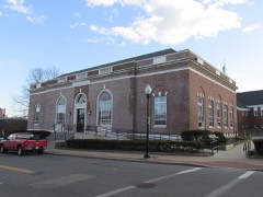
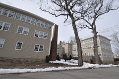
Listed places nearby
6 within 8 miles
Other National Register properties close
enough to walk or drive between, ordered by distance from this one. Both
positions come from the same geocoding pass that matched these properties
to their map sheets.
Listing record. National Park Service National Register of Historic Places, listed-properties dataset, current to 2026-05-22.
Map join. Address geocoded through the United States Census geocoder, then tested against the published boundary of every sheet in the USGS Historical Topographic Map Collection.
How this page is made. Listing fields come from federal records; map-sheet coverage is a labelled coordinate-to-boundary calculation, not a source-field claim.
Wildfire. Short, Karen C. 2022. Spatial wildfire occurrence data for the United States, 1992-2020 [FPA_FOD_20221014]. 6th Edition. Fort Collins, CO: Forest Service Research Data Archive. https://doi.org/10.2737/RDS-2013-0009.6 Collected with United States Government funding and usable without additional permissions or fees.
Specimens. Global Biodiversity Information Facility (GBIF), https://www.gbif.org/. Only records licensed CC0 or CC BY are used. Records licensed CC BY-NC are excluded because this site carries advertising. Images are checked individually and any whose licence is non-commercial, no-derivatives or unreadable is refused.
Mines and quarries. USGS Mineral Resources Data System (MRDS) https://mrdata.usgs.gov/mrds/ A work of the United States government, no copyright under 17 U.S.C. 105.
Storms. NOAA National Centers for Environmental Information, Storm Events Database https://www.ncei.noaa.gov/stormevents/ A work of the United States government, no copyright under 17 U.S.C. 105. Narratives are quoted verbatim from the National Weather Service report and are not edited or summarised.
 Block
Block