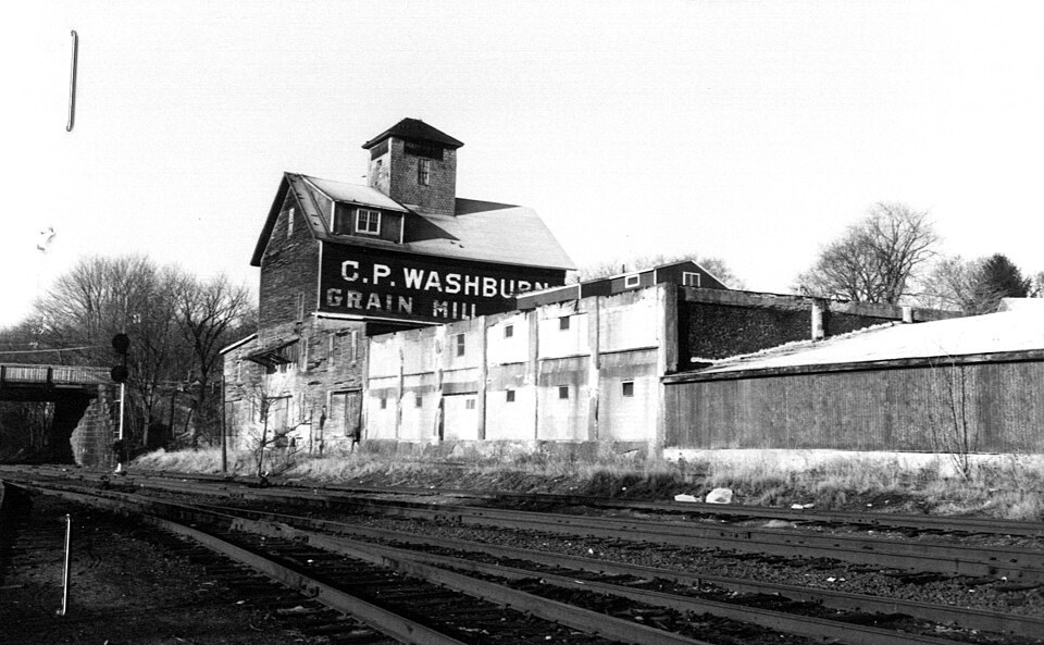
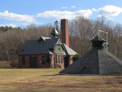
Photograph by Unknown author Unknown author, Public domain. Via
Wikimedia Commons.
Washburn, C.P., Grain Mill
Built in 1899. Listed on the National Register of Historic Places in
1980. A historic map-sheet match is not published yet. The record needs a coordinate-quality review before it can be joined to a sheet boundary.
From the record
“Washburn Grain Mill was a historic mill on Center and Cambridge Streets in Middleboro, Massachusetts.”
Wikipedia article C.P. Washburn Grain Mill, CC BY-SA 4.0.
one of 93 National Register listings in Plymouth County · listed in 1980 · category: Building · built in 1899 · one of 1 National Historic Landmarks in Plymouth County.
National Register reference number.80000667- the number the National Park Service assigned this property when it was listed, and the key its nomination file is catalogued under at the National Archives.
Fires near this property
113 since 2015
Regional context, not property-specific
evidence. The
federal wildfire occurrence database
lists 113 fires within 5 miles of Washburn, C.P., Grain Mill between
2015 and 2020, burning about 106 acres in total. None started naturally. 2 were recorded as arson.
Distance is straight-line from the map coordinates, so a fire counted
here may appear on a neighbouring settlement's page as well.
Reported cause
Fires
Debris and open burning
59
Missing data/not specified/undetermined
34
Misuse of fire by a minor
13
Recreation and ceremony
4
Arson/incendiarism
2
Smoking
1
The most recent of
them, most recent first, with the day each was reported and the service
that recorded it.
Regional context, not property-specific
evidence. Museums hold 838 specimens
collected within 10 miles of Washburn, C.P., Grain Mill between 1855 and
1975: 381 Plantae, 251 Animalia, 187 Fungi, 15 Protozoa, 4 Unrecorded. 12 distinct Species records are shown.
Collected by A. B. Seymour, A. Humes, A. K. Harrison and others. Each is a
physical object with a catalogue
number, and each entry opens the museum's record. This is what was
collected and kept, not a survey of what lives here - nothing can be
concluded from a species being absent.
Regional context, not property-specific
evidence. The federal mineral resources record lists
14 workings within 5 miles of Washburn, C.P., Grain Mill: 7 past producers, 5 producers, 2 unknowns.
5 still produce. What was taken out: Sand and Gravel, Construction, Clay. Distance is straight-line from the
map coordinates, so a quarry counted here may appear on a neighbouring
settlement's page as well.
Regional context, not property-specific
evidence. The National Weather Service names
Middleboro, the town this property stands in, in 14 storm reports between 1994 and 2025: 9 thunderstorm wind, 3 hail, 1 flash flood, 1 flood.
No death or injury is recorded in these reports. Each account below is quoted exactly as the forecast office
filed it, from the NOAA Storm Events Database, and each date
opens the federal record of that event.
Multiple trees were downed on the School Street extension. A tree was downed onto a building on North Street. Multiple large trees were downed on Precinct and Thompson Streets.
Wareham Street was closed at the Herring Run due to flooding in Middleboro. In Brockton, a car was stuck in water at North Montello Street and Howard Street.
Police reported several trees and branches blown down. In the adjoining town of Lakeville, a tree branch went through a truck windshield. No injuries were reported.
No historic map-sheet match is published
for this property yet. That does not mean no map exists. This record needs
a coordinate-quality review before it can be joined to a sheet boundary.
Browse the county's mapped places while that work is
pending.
From the nomination file
2,435 words on record
When this property was proposed for the
National Register, someone wrote the case for it: what the building is,
and why it matters. That document is a federal record in the public domain.
It is quoted below word for word, never summarised. The text was read off the scanned case file by machine, so the
occasional stray character is the recogniser's and the 1970s
typewriter's.
Description of the property
The C.P. Washburn Grain Mill stands at the northwest corner of Cambridge and Center Streets, adjoining the former Old Colony Railroad line. The Grain Mill occupies a Grain Mill (1902) an office (1904) and a re-inforced concrete wing (1918). The Grain Mill and two sheds on the west elevation are set on a rubble foundation and are covered with clapboard. The Grain Mill, itself is three stories high with a pitched roof above which rises a square-plan elevator penthouse covered with shingles and enclosed by a hip roof. The two sheds which flank the Grain Mill are each one-story high and are enclosed by low-pitched shed roofs. The Grain Mill's east elevation contains a concrete loading platform and shed roof supported by wooden braces and iron tension rods, at the first story.
Set beneath this root, on the main body of the bullding, are an eight-panel sliding door flanked by two tripartite windows! "Each tripartite window contains a tall 6/6 window flanked by two smaller 6/6 windows. The east elevation of the south shed is concealed by the office addition, while that of the north shed contains a sliding panelled door and Andersen window. In addition, the north shed contains an angled wall, correspond- ing to the angle of Center Street; this wall is blank except for one Andersen window. Above the first story, the Grain Mill's east elevation 1s blank except for one 0/6 window set in the peak of the gable. The Grain Mill's south elevation is entirely concealed at the basement and first story.
the mill's wall is blank and is painted with à sign bearing the words "C.P. Washburn Above the first Grain Mill"! Above the eaves at the southwest corner is a'shed dormer with paired 6/1 sash.
/Architect C. P. Washburn Statement of Significance (in one paragraph) The C. P. Washburn Grain Mill possesses integrity of location, design, setting and materials and possesses historical associations with a locally important agricultural business. The Grain Mill and its two flanking sheds contain the only grain elevator of timber-crib construction of its period extant in Massachusetts and, perhaps, in New England. Although similar, small-scale grain elevators once existed throughout New England, including Acton, Bridgewater and Fitchburg, Massachusetts, the decline of local agriculture has led to the closure and demolition of most other examples.
In addition to its structure, which remains essentially unaltered, the Grain Mill pre- serves a variety of original machinery which provides rare examples of turn-of-the- century industrial engineering. Designed to serve as a country grain elevator, the Washburn Grain Mill was originally used to store, mix and distribute grain to farmers from Plymouth, Massachu- setts to Providence Rhode Island and as far away as Provincetown. Planned by Charles Parker Washburn, the mill was fully automated, making use of electricity and gravity as sources of power At Washburn's expense, a spur of the old Colony Railroad line was extended along the mill's west elevation.
Grain entered the building through a loading platform in the basement where it was dumped into a pit from which a bucket elevator carried it up twenty-two feet to the first storey. At the first storey, grain was weighed and then dropped back to the basement where a cleaner winnowed it of debris. A second bucket-chain elevator then lifted grain to the elevator penthouse where the grain entered a turnhead and was directed through chutes past screw conveyors into bins. Finally, as needed, grain was poured through chutes to the first storey where it was passed through attrition mills and packaged.
Quoted from the National Register nomination
for reference 80000667, 15 pages, held by the National Archives in Record
Group 79. See the
catalogue record.
Listed places nearby
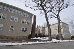
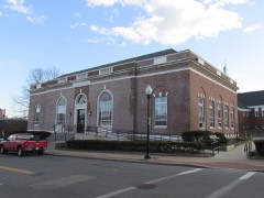
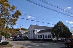
6 within 8 miles
Other National Register properties close
enough to walk or drive between, ordered by distance from this one. Both
positions come from the same geocoding pass that matched these properties
to their map sheets.
Listing record. National Park Service National Register of Historic Places, listed-properties dataset, current to 2026-05-22.
Map join. Address geocoded through the United States Census geocoder, then tested against the published boundary of every sheet in the USGS Historical Topographic Map Collection.
How this page is made. Listing fields come from federal records; map-sheet coverage is a labelled coordinate-to-boundary calculation, not a source-field claim.
Wildfire. Short, Karen C. 2022. Spatial wildfire occurrence data for the United States, 1992-2020 [FPA_FOD_20221014]. 6th Edition. Fort Collins, CO: Forest Service Research Data Archive. https://doi.org/10.2737/RDS-2013-0009.6 Collected with United States Government funding and usable without additional permissions or fees.
Specimens. Global Biodiversity Information Facility (GBIF), https://www.gbif.org/. Only records licensed CC0 or CC BY are used. Records licensed CC BY-NC are excluded because this site carries advertising. Images are checked individually and any whose licence is non-commercial, no-derivatives or unreadable is refused.
Mines and quarries. USGS Mineral Resources Data System (MRDS) https://mrdata.usgs.gov/mrds/ A work of the United States government, no copyright under 17 U.S.C. 105.
Storms. NOAA National Centers for Environmental Information, Storm Events Database https://www.ncei.noaa.gov/stormevents/ A work of the United States government, no copyright under 17 U.S.C. 105. Narratives are quoted verbatim from the National Weather Service report and are not edited or summarised.
 Block
Block