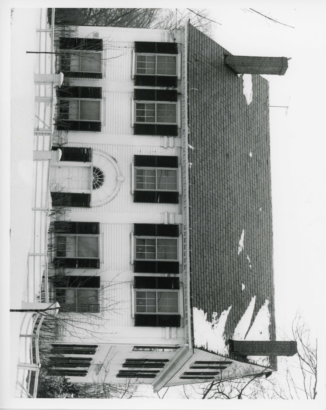
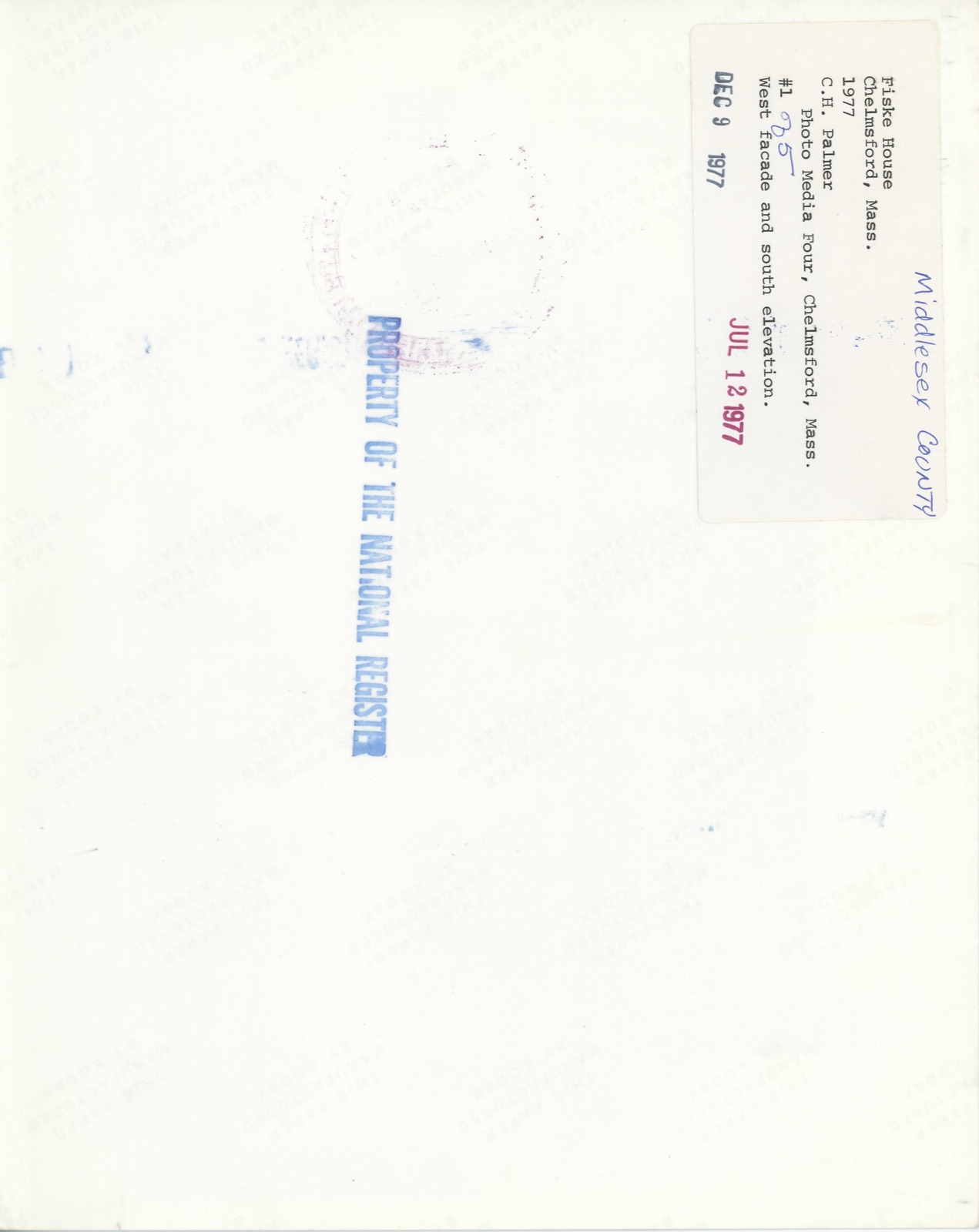
Photographs from the nomination case file, National Park Service records.
Fiske House
Listed on the National Register of Historic Places in
1977. A historic map-sheet match is not published yet. The record needs a coordinate-quality review before it can be joined to a sheet boundary.
From the record
one of 1100 National Register listings in Middlesex County · listed in 1977 · category: Building · one of 3 National Historic Landmarks in Middlesex County.
National Register reference number.77000171- the number the National Park Service assigned this property when it was listed, and the key its nomination file is catalogued under at the National Archives.
Regional context, not property-specific
evidence. The
federal wildfire occurrence database
lists 67 fires within 5 miles of Fiske House between
2002 and 2020, burning about 33 acres in total. 2 started naturally. 6 were recorded as arson.
Distance is straight-line from the map coordinates, so a fire counted
here may appear on a neighbouring settlement's page as well.
Reported cause
Fires
Missing data/not specified/undetermined
24
Debris and open burning
22
Recreation and ceremony
6
Arson/incendiarism
6
Natural
2
Railroad operations and maintenance
2
Smoking
2
Equipment and vehicle use
1
Power generation/transmission/distribution
1
Other causes
1
The most recent of
them, most recent first, with the day each was reported and the service
that recorded it.
Regional context, not property-specific
evidence. Museums hold 746 specimens
collected within 10 miles of Fiske House between 1898 and
1975: 454 Plantae, 193 Animalia, 66 Fungi, 29 Protozoa, 3 Chromista, 1 Unrecorded. 12 distinct Species records are shown.
Collected by A. B. Seymour, A. C. Mathieson, A. F. Newton and others. Each is a
physical object with a catalogue
number, and each entry opens the museum's record. This is what was
collected and kept, not a survey of what lives here - nothing can be
concluded from a species being absent.
Regional context, not property-specific
evidence. The federal mineral resources record lists
23 workings within 5 miles of Fiske House: 12 past producers, 7 producers, 4 plants.
11 still produce. What was taken out: Sand and Gravel, Construction, Granite, Stone, Crushed/Broken, Graphite. Distance is straight-line from the
map coordinates, so a quarry counted here may appear on a neighbouring
settlement's page as well.
Regional context, not property-specific
evidence. The National Weather Service names
Chelmsford Center, the town this property stands in, in 12 storm reports between 1998 and 2024: 7 thunderstorm wind, 2 hail, 2 flood, 1 flash flood.
No death or injury is recorded in these reports. Each account below is quoted exactly as the forecast office
filed it, from the NOAA Storm Events Database, and each date
opens the federal record of that event.
Boston Road was closed near Brian Road due to flooding. A culvert clogged, resulting in backwater flooding and a subsequent collapse of the culvert and the nearby section of road. News reports indicated at least 1 flooded basement, and flood waters went into the backyards of some homes. This area of road was closed for several of days during repairs.
At 3:10 PM EST, a tree was reported down on wires at the intersection of Boston Road and Hazen Street in Chelmsford. Also at 3:10 PM EST, a tree was down on Bridge Street blocking half the road.
No historic map-sheet match is published
for this property yet. That does not mean no map exists. This record needs
a coordinate-quality review before it can be joined to a sheet boundary.
Browse the county's mapped places while that work is
pending.
From the nomination file
2,266 words on record
When this property was proposed for the
National Register, someone wrote the case for it: what the building is,
and why it matters. That document is a federal record in the public domain.
It is quoted below word for word, never summarised. The text was read off the scanned case file by machine, so the
occasional stray character is the recogniser's and the 1970s
typewriter's.
Description of the property
The Fiske House built in 1798, occupies a prominent location in the center of Chelmsford, on the corner of Billerica Road and Chelmsford Street. The house faces west toward Central Square. The 1 3/4 acres of house lot is well land- scaped. To the south of the house, the grounds are terraced down. A delicate low wooden fence built in 1839 separates the house from the road on the north and west sides. The area surrounding the house is mixed residential and commercial buildings of the town center. The Fiske House is a square plan, brick ended, 2 k story ridge roof house with gables to the side. There is a continuous dentilated cornice and plain wide cornerboards. There are four end chimneys. Fenestration is 6/6 with projecting cornices and sills, framed by shutters.
The facade is five bays wide with a center entry. The bays are defined by graceful, tapering pilasters with plain blocks above the molded capitals. The eight panel center entry door is framed by side lights and shutters and topped by a fanlight and molded round arch with key, a highly unusual entrance treatment in New England. The side elevations are three bays deep and are relieved by a projecting brick belt bisecting the first and second stories. There are two windows on the attic story gable pediment which is separated from the second story by an overhanging entablature. On the south elevation is a center entry capped by a projecting flat cornice. On the north elevation, a center entry is crowned by a fanlight with key and headed by a wide dentilated cornice.
Extending from the center of the rear (east) elevation is a one story ridge roofed ell with a slight extension at the second story level. The roof is slate.
/ARCHITECT STATEMENT OF SIGNIFICANCE The Fiske House is significant as one of the first Federal style houses in Northern Midalesex county, for its prominent position in the center of Chelmsford, and for its 137 years of association with the Fiske family of Chelmsford. The house also has an interesting ownership history. The Fiske House occupies the site of an earlier house owned and occupied by Major John Minot. In 1784 Major Minot deeded to William Bridge ½ acre of land and buildings located south of the present house. The well of the Bridge House may still be seen on the terrace just south of the Fiske House. In 1784 Simeon Spaulding, Jr., merchant bought the Minot land and in 1798 built the new house. Because of its high cost, he was forced to mortgage it in 1807 and sell it in 1812.
He repurchased it in 1818, however, and kept it until 1830, when he sold it to his brother. He is said to have loved the house and was anxious to keep it in the family to be handed down to posterity. There were then frequent changes in ownership. In 1835 Thomas Moore bought the house and ran it as the Lafayettee House. The bar has been replaced in the bar-room (s.W. room) by the present owners. In 1839 Mr. & Mrs. John Minot Fiske visited Chelmsford intending to buy his great-grand- father's old house. Mrs. Fiske admired the Tavern where they were staying, the Lafayette House, and Mr. Fiske bought it instead. The rail fence in frant of the house was built it this time. The house remained in the Fiske family from that time until 1977.
Quoted from the National Register nomination
for reference 77000171, 15 pages, held by the National Archives in Record
Group 79. See the
catalogue record.
Listed places nearby
6 within 8 miles
Other National Register properties close
enough to walk or drive between, ordered by distance from this one. Both
positions come from the same geocoding pass that matched these properties
to their map sheets.
Listing record. National Park Service National Register of Historic Places, listed-properties dataset, current to 2026-05-22.
Map join. Address geocoded through the United States Census geocoder, then tested against the published boundary of every sheet in the USGS Historical Topographic Map Collection.
How this page is made. Listing fields come from federal records; map-sheet coverage is a labelled coordinate-to-boundary calculation, not a source-field claim.
Wildfire. Short, Karen C. 2022. Spatial wildfire occurrence data for the United States, 1992-2020 [FPA_FOD_20221014]. 6th Edition. Fort Collins, CO: Forest Service Research Data Archive. https://doi.org/10.2737/RDS-2013-0009.6 Collected with United States Government funding and usable without additional permissions or fees.
Specimens. Global Biodiversity Information Facility (GBIF), https://www.gbif.org/. Only records licensed CC0 or CC BY are used. Records licensed CC BY-NC are excluded because this site carries advertising. Images are checked individually and any whose licence is non-commercial, no-derivatives or unreadable is refused.
Mines and quarries. USGS Mineral Resources Data System (MRDS) https://mrdata.usgs.gov/mrds/ A work of the United States government, no copyright under 17 U.S.C. 105.
Storms. NOAA National Centers for Environmental Information, Storm Events Database https://www.ncei.noaa.gov/stormevents/ A work of the United States government, no copyright under 17 U.S.C. 105. Narratives are quoted verbatim from the National Weather Service report and are not edited or summarised.
 Block
Block