Photographs from the nomination case file, National Park Service records.
Gay Farm
Listed on the National Register of Historic Places in
1977. A historic map-sheet match is not published yet. The record needs a coordinate-quality review before it can be joined to a sheet boundary.
From the record
“The spirit of old Petersham, the spirit of this occasion, should be projected into the future. What is the mission of your public library, with its treasures of literature and other means of ministration to the higher life of the community?”
1754-1904. One Hundred and Fiftieth Anniversary of the Incorporation of the Town of Petersham, Massachusetts, Wednesday, August the Tenth, 1904 (1904). Machine-read text.
one of 500 National Register listings in Worcester County · listed in 1977 · category: Building · one of 1 National Historic Landmarks in Worcester County.
National Register reference number.77000201- the number the National Park Service assigned this property when it was listed, and the key its nomination file is catalogued under at the National Archives.
YOU will permit me to express my pleasure in being present on this occasion, commemorative of the one hundred and fiftieth anniversary of my native town. I am glad to be here, and, in saying so, I surely voice the feeling of the inhabitants of Petersham, as well as of others who, either once identified with the town or tracing their ancestry here, have returned to join in this celebration.
Old Petersham, enthroned on her picturesque hills in the heart of our beloved Commonwealth of Massachusetts! " Here where the peace of the Creator lies"! Beautiful in her natural aspect, with a "charm of landscape and of sky" of which even the stranger owns the spell! What, then, does it mean to us who first opened our eyes upon these scenes, passing here the impressionable years of childhood and growing up to manhood and womanhood ? What fairer setting could we wish for the annals and traditions of our ancestors ? It was a profound truth uttered by the old classic, Humani nihil alienum (nothing is foreign to me). It is humanity that interests us, and it is the human element that to us invests these familar scenes with an especial attraction and significance.
Regional context, not property-specific
evidence. The
federal wildfire occurrence database
lists 21 fires within 5 miles of Gay Farm between
2015 and 2018, burning about 18 acres in total. None started naturally. None was recorded as arson.
Distance is straight-line from the map coordinates, so a fire counted
here may appear on a neighbouring settlement's page as well.
Reported cause
Fires
Debris and open burning
15
Recreation and ceremony
3
Missing data/not specified/undetermined
2
Misuse of fire by a minor
1
The most recent of
them, most recent first, with the day each was reported and the service
that recorded it.
Regional context, not property-specific
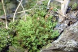
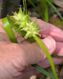
evidence. Museums hold 1,694 specimens
collected within 10 miles of Gay Farm between 1839 and
1975: 927 Animalia, 455 Fungi, 288 Plantae, 15 Unrecorded, 9 Protozoa. 12 distinct Species records are shown.
Collected by A. C. V. Schott, A. Melander, A. Melander & A. Melander and others. Each is a
physical object with a catalogue
number, and each entry opens the museum's record. This is what was
collected and kept, not a survey of what lives here - nothing can be
concluded from a species being absent.
Regional context, not property-specific
evidence. The federal mineral resources record lists
1 working within 5 miles of Gay Farm: 1 past producer.
None of them still produces. What was taken out: Sand and Gravel, Construction. Distance is straight-line from the
map coordinates, so a quarry counted here may appear on a neighbouring
settlement's page as well.
Regional context, not property-specific
evidence. The National Weather Service names
Petersham, the town this property stands in, in 8 storm reports between 2001 and 2018: 4 hail, 3 thunderstorm wind, 1 lightning.
No death or injury is recorded in these reports. Each account below is quoted exactly as the forecast office
filed it, from the NOAA Storm Events Database, and each date
opens the federal record of that event.
Quarter to ping pong ball size hail fell for 8 minutes across Petersham. Accumulated hail reached depths up to 6 inches in spots. Some roof damage was reported as well as a few dented cars. Hail could still be seen in spots up to 14 hours after it fell.
No historic map-sheet match is published
for this property yet. That does not mean no map exists. This record needs
a coordinate-quality review before it can be joined to a sheet boundary.
Browse the county's mapped places while that work is
pending.
From the nomination file
2,355 words on record
When this property was proposed for the
National Register, someone wrote the case for it: what the building is,
and why it matters. That document is a federal record in the public domain.
It is quoted below word for word, never summarised. The text was read off the scanned case file by machine, so the
occasional stray character is the recogniser's and the 1970s
typewriter's.
Description of the property
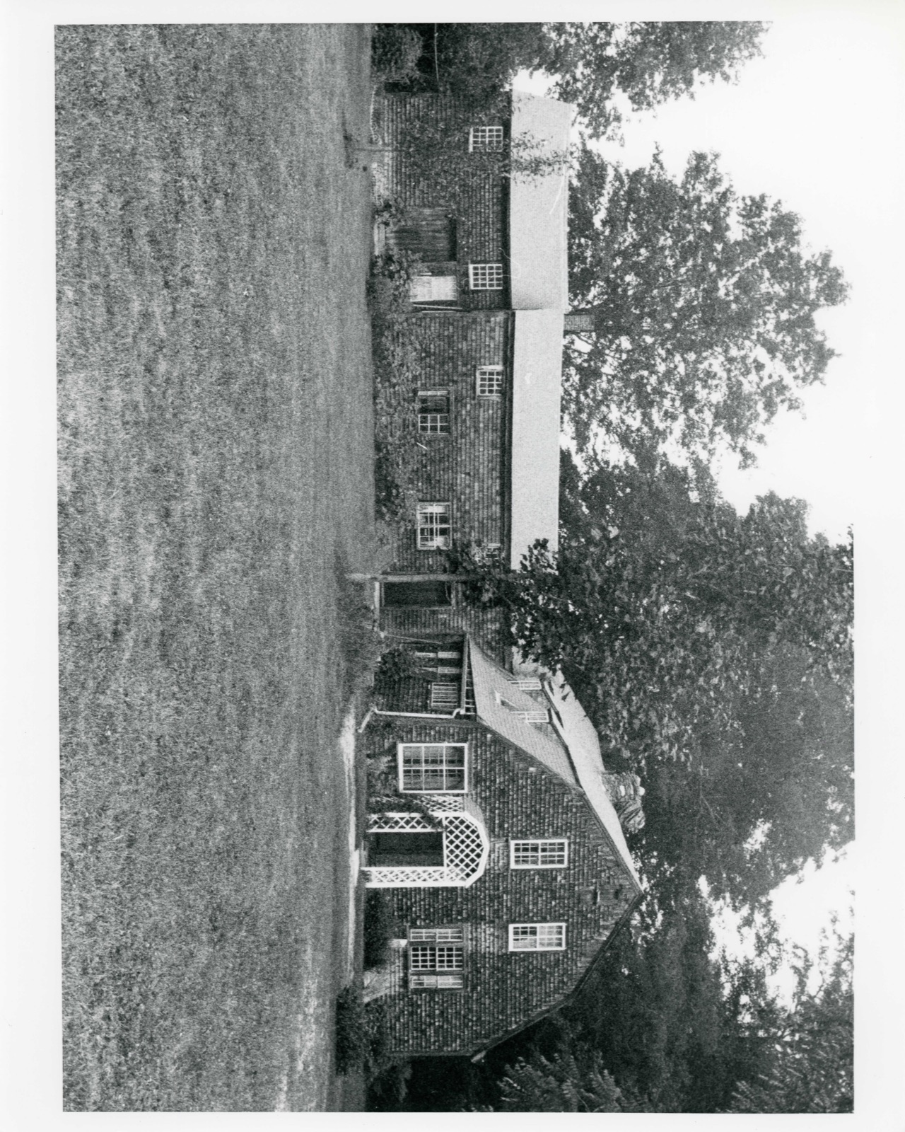
Gay Farm is located off Nichewaug Road in Petersham on a town road known as Gay Drive. A beautiful old stone wall lines the property in front of the house along the road. The house is set on a slight rise in a well landscaped lawn. The property originally encompassed 96 acres, 30 of which remain. The other 60 acres comprise a wildlif e sanctuary given to the Town of Petersham by Corinne Howe Babbitt in memory of her husband Lewis Hall Babbitt, a naturalist. The two story house with ell was built between 1740 and 1742. It is a gambre1 roofed structure with a central stone chimney and a stone founda- tion. The original wide shiplap boards on the exterior walls remain, but were entirely covered with shingles in about 1880.
Sections of the sheathing were reshingled after 1926, and in the process the shiplap was exposed, but retained. The corner boards are plain. The facade faces east toward Gay Drive. A simple wooden door is placed slightly off center, and is no longer used. One window to the left of the door and two windows to the right are 12/12 framed by simple flat archi- traves. There is a simple molded cornice on the overhanging eave. The second story contains three shed roof dormers with 8/8 fenestration. The south elevation contains the present main entrance in the west end bay. This entrance is covered by a shallow gambrel roofed porch with open lat tice work sides. There is a small bay window in the east end bay and a large small paned window directly to the left of the entry porch.
In the second story there are two symmetrically placed 12/12 windows.
/ARCHITECT William Negus Gay Farm is significant as the oldest remaining house in Petersham and as a building which housed the same family, the Negus family and descendants, for 234 years. The house was built between 1740 and 1742 by William Negus, who had come to Petersham during the 1730s. His son Joseph, born in Worcester in 1742, was deeded the house and 96 acres in 1769. Joseph was a soldier in the Revolutionary War. His regiment left Petersham in April, 1775 en route to camp at Cambridge. He was stationed at General Washington's Hudson River headquarters and superintended the building of Fort Clinton at West Point. After the Battle of Bennington, August 1777, he joined Captain Wing Spooner's Company which participated in the taking of British posts on Lake George in September 1777.
Joseph was commissioned Captain by Governor John Hancock in 1789 and Major by Governor Samuel Adams in 1794. He was the father of five daughters and four sons. Joseph deeded the' farm to his son Joel who was a Militia Captain, Justice of the Peace, Town Clerk, school teacher, land surveyor, appraiser, builder of hand looms, designer, decorator, painter, and master of hand lettering. Joel's eldest daughter, Arathusa Negus, was married to Jonas Howe. The couple lived in the Joel Negus home in town. When their son Thomas grew up and married, he moved back to his great-great grandfather William Negus' property. Here Thomas' daughter, Elizabeth Arathusa Howe, was born.
She inherited her father's home and, upon her death in 1926, willed the property to Lewis Hall Babbitt whose widow Corinne Howe Babbitt still lives in the house.
Quoted from the National Register nomination
for reference 77000201, 15 pages, held by the National Archives in Record
Group 79. See the
catalogue record.
Listed places nearby
4 within 8 miles
Other National Register properties close
enough to walk or drive between, ordered by distance from this one. Both
positions come from the same geocoding pass that matched these properties
to their map sheets.
Listing record. National Park Service National Register of Historic Places, listed-properties dataset, current to 2026-05-22.
Map join. Address geocoded through the United States Census geocoder, then tested against the published boundary of every sheet in the USGS Historical Topographic Map Collection.
How this page is made. Listing fields come from federal records; map-sheet coverage is a labelled coordinate-to-boundary calculation, not a source-field claim.
Wildfire. Short, Karen C. 2022. Spatial wildfire occurrence data for the United States, 1992-2020 [FPA_FOD_20221014]. 6th Edition. Fort Collins, CO: Forest Service Research Data Archive. https://doi.org/10.2737/RDS-2013-0009.6 Collected with United States Government funding and usable without additional permissions or fees.
Specimens. Global Biodiversity Information Facility (GBIF), https://www.gbif.org/. Only records licensed CC0 or CC BY are used. Records licensed CC BY-NC are excluded because this site carries advertising. Images are checked individually and any whose licence is non-commercial, no-derivatives or unreadable is refused.
Mines and quarries. USGS Mineral Resources Data System (MRDS) https://mrdata.usgs.gov/mrds/ A work of the United States government, no copyright under 17 U.S.C. 105.
Storms. NOAA National Centers for Environmental Information, Storm Events Database https://www.ncei.noaa.gov/stormevents/ A work of the United States government, no copyright under 17 U.S.C. 105. Narratives are quoted verbatim from the National Weather Service report and are not edited or summarised.
 Block
Block