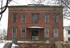
Listed on the National Register of Historic Places in
1977. A historic map-sheet match is not published yet. The record needs a coordinate-quality review before it can be joined to a sheet boundary.
From the record
“When Andrew Crooks came to Zanesville, there was but one house at Cambridge and one near Lancaster, and they were the homes of his nearest neighbors. His daughter, Nancy Crooks, was the first white girl that came to Zanesville.”
History of Muskingum County, Ohio, with Illustrations and Biographical Sketches of Prominent Men and Pioneers (1882). Machine-read text.
one of 70 National Register listings in Muskingum County · listed in 1977 · category: Building.
National Register reference number.77001081- the number the National Park Service assigned this property when it was listed, and the key its nomination file is catalogued under at the National Archives.
Exvection Day. - The first regular election, in Newton Township, was held at the house of William Fellows, west of Newtonville, in the designation of to-day. William Lawrence was the acting constable, and Jacob Crooks became the first Justice of the Peace. No record of these events has been found in the records in Zanesville, or in the township. Tradition further says, Isaac Carter was a Justice of the Peace in an early day, and William Anderson was elected a Justice of the Peace in 1823, and continued to
When Andrew Crooks came to Zanesville, there was but one house at Cambridge and one near Lancaster, and they were the homes of his nearest neighbors. His daughter, Nancy Crooks, was the first white girl that came to Zanesville. He remembers that his uncle Henry had his wife with him, and that they had no children. And when his mother came to Newton township, she had not seen the face of a white woman for nine months. And that his parents came to this region on horseback, camping at night, and turning their horses loose after belling them. His uncle Henry went west, while Jacob was sheriff, (1808-12). He remembers that William McCullock, who married the halfbreed daughter of Isaac Zane, was killed during the war of 1812, '' out west.'' And that there were no settlers here when Andrew Crooks came to Newton, ie., those who were here did not mean to stay, and called themselves squatters. Joseph Carpenter and Mathew Gillespie were of this class, and they moved off as the country settled. George M. Crooks was born May gth, 1795, and was "three years old when his parents arrived at Zanesville. Lewis Nye built the first hewed log house in this section, about 1809, on ground now a part of Newtonville. He cleared the first field and planted corn on section nine, in 1804, now the G. W. Rankin estate. Mrs. Eliza Rankin, consort of G. W. Rankin, deceased, whose maiden name was Nye, says her father and David Olive bought the half section that Jennings had entered, but could not pay for in the time allotted by the Government. David Olive died from the bite of a rattlesnake, the same year, (1804), and he had a coffin, a very unusual thing in this region in those days; people being buried, nearly always, in elm bark, lined with grass, and the ends stuffed with moss. This was the case with a man named Davis, and another, and a woman named Palmer, and three children, who came over the Falls in a canoe and were drowned, and were buried in elm bark slips.
Regional context, not property-specific
evidence. The
federal wildfire occurrence database
lists 21 fires within 5 miles of Five Mile House between
2012 and 2019, burning about 34 acres in total. None started naturally. 2 were recorded as arson.
Distance is straight-line from the map coordinates, so a fire counted
here may appear on a neighbouring settlement's page as well.
Reported cause
Fires
Debris and open burning
13
Arson/incendiarism
2
Equipment and vehicle use
2
Power generation/transmission/distribution
2
Smoking
1
Missing data/not specified/undetermined
1
The most recent of
them, most recent first, with the day each was reported and the service
that recorded it.
Regional context, not property-specific
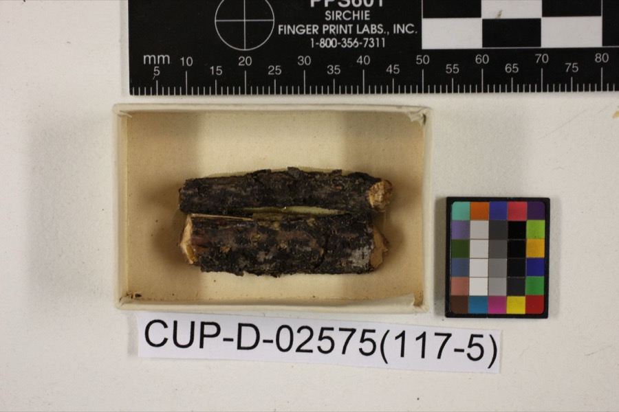
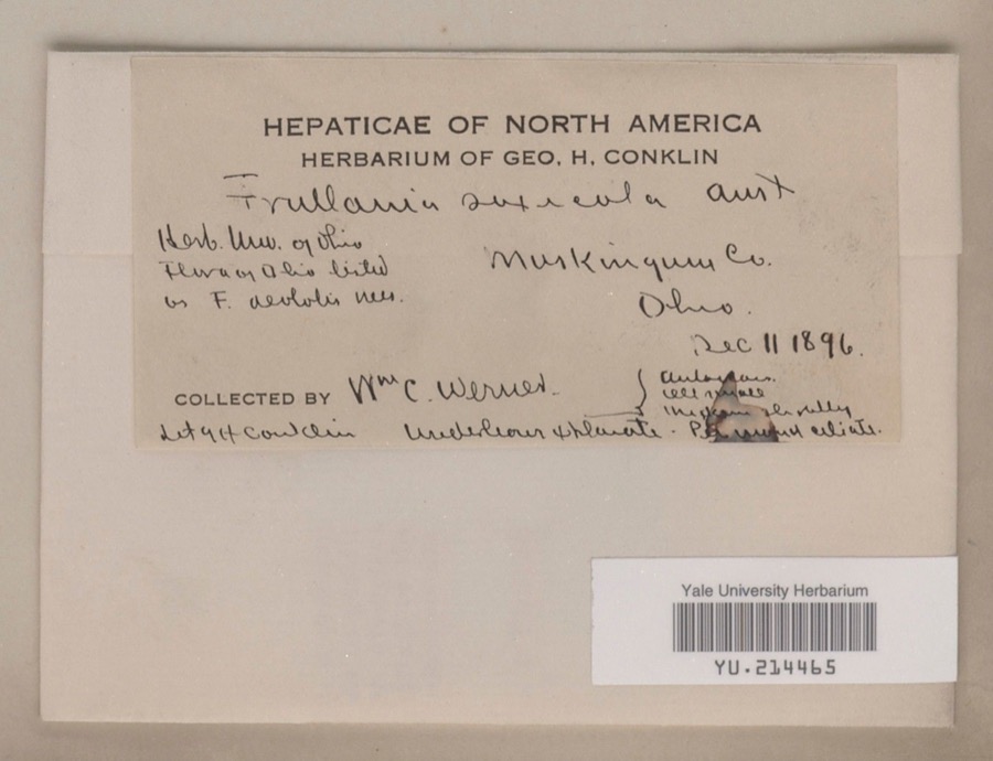
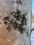
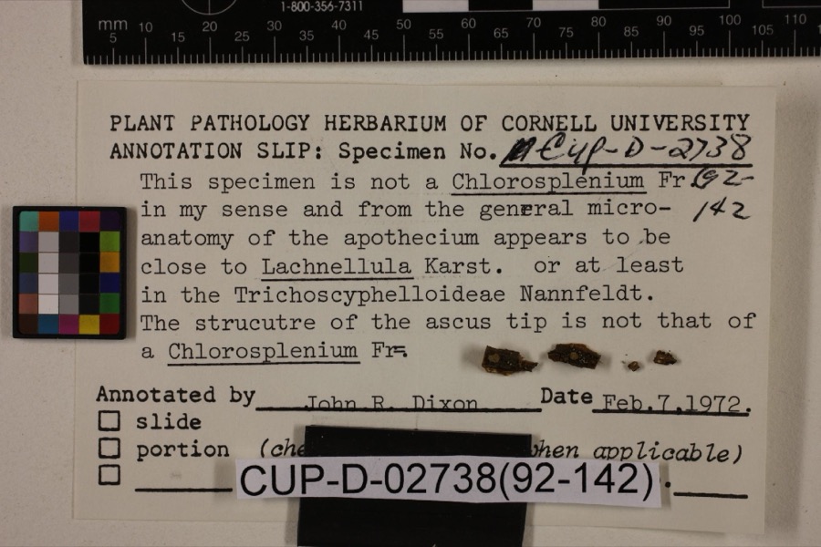
evidence. Museums hold 695 specimens
collected within 10 miles of Five Mile House between 1873 and
1973: 633 Animalia, 37 Plantae, 15 Fungi, 5 Protozoa, 4 Unrecorded, 1 Chromista. 12 distinct Species records are shown.
Collected by A.E. Miller, Adams, W. M., Adams, William and others. Each is a
physical object with a catalogue
number, and each entry opens the museum's record. This is what was
collected and kept, not a survey of what lives here - nothing can be
concluded from a species being absent.
Regional context, not property-specific
evidence. The federal mineral resources record lists
9 workings within 5 miles of Five Mile House: 6 producers, 3 past producers.
6 still produce. What was taken out: Clay, Limestone, General, Stone, Crushed/Broken, Sand and Gravel, Construction. Distance is straight-line from the
map coordinates, so a quarry counted here may appear on a neighbouring
settlement's page as well.
Regional context, not property-specific
evidence. The National Weather Service names
Zanesville, the town this property stands in, in 113 storm reports between 1994 and 2026: 62 thunderstorm wind, 26 hail, 17 flash flood, 5 flood.
The reports record 1 death. Each account below is quoted exactly as the forecast office
filed it, from the NOAA Storm Events Database, and each date
opens the federal record of that event.
Thunderstorm winds blew down four power poles and power lines just north of Zanesville. Several trees were also reported down across the eastern part of the county.
Street flooding was reported in and near Zanesville after 1.30 inches fell in 20 minutes. Large branches were downed east of Zanesville. One branch fell on a passing motorist's car. There was no mention of any injuries.
No historic map-sheet match is published
for this property yet. That does not mean no map exists. This record needs
a coordinate-quality review before it can be joined to a sheet boundary.
Browse the county's mapped places while that work is
pending.
From the nomination file
3,358 words on record
When this property was proposed for the
National Register, someone wrote the case for it: what the building is,
and why it matters. That document is a federal record in the public domain.
It is quoted below word for word, never summarised. The text was read off the scanned case file by machine, so the
occasional stray character is the recogniser's and the 1970s
typewriter's.
Description of the property
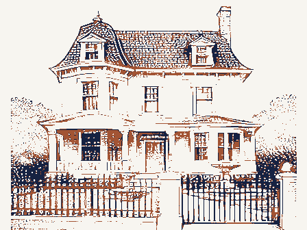
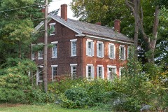
stucture, which rests on a stone foundation, has a nine bay facade which is visually have alternating paired and single brackets, while the right section and remainder The rear section is also two stories, but shorter than the main portion. In this section were built, as the datestone suggests, in 1839 to take advantage of traffic on the There is a shed-roofed, frame addition in the angle of the "L". Windows across the rear ridgeline; the left gable end has a central inside chimney; and, as mentioned, there CONDITION MOVED UNEXPOSED DESCRIPTION DETERIORATED UNALTERED EXCELLENT FAIR CHECK ONE The gable roof is covered with shingles in alternating bands of fish-scale and plain There is a one-story, three bay porch which protects the center and rightmost entrances.
is a center chimney between right and center sections. for the difference in window spacing and the slightly off-center chimney in the of the house have single brackets. and the roofline is supported by wood brackets.Similar brackets are found supporting center and right sections is a datestone inscribed 1839. The main portion of the structure is four bays deep and all windows are the same as those Maysville Pike which was built about that date.This construction sequence would account XORIGINAL SITE are more widely spaced than in the other two sections and the entrance is in the of the main section match those used throughou the second story of this section.
a tavern was operated at this site by 1818 and it is perhaps the right section of the ridgeline would have been along the outside wall prior to the 1839 section).
excellent example of an early Ohio Stone structure used fora roadhouse-tavern and is Moses James brought his family to Muskingum County in 1808. It is likely that the rear George Highfield - 1839". following owner was George Hall, and Englishman, and an inventor of farm machinery. 1400-1499 XARCHITECTURE PERIOD LAW ENGINEERING BUILDER/ARCHITECT PREHISTORIC SCULPTURE CONSERVATION X1800-1899 INDUSTRY SIGNIFICANCE The _POLITICS/GOVERNMENT AGRICULTURE ART _EXPLORATION/SETTLEMENT early route for explorers and settlers. _PHILOSOPHY _ECONOMICS _COMMUNICATIONS X-TRANSPORTATION In 1847 it was placed for sale.
About that time the Underground Railroad was transporting property indicates, indeed, that there were many good hiding places in the cavernous -1500-1599 LITERATURE By 1829 the National Road was being built and threatened to take business and trade -1600-1699 The Five Mile House is significant in at least three areas of Ohio history:it is an X-SOCIAL/HUMANITARIAN portion of the present structure was built by 1812 and perhaps the rightmost three bay - EDUCATION house is used as a Country Store and gift shop adjacent to Mohahala Park.The present Underground Railroad during the 1840's and 1850's.
saw an opportunity for more business and expanded the Five Mile House in 1839-a important asa part of two important Ohio transportation systems-Zane's - 1700-1799 18l8 date is found in Taverns on Zane's Trace and this site given as a location as a In the 1950's the Maysville Pike was changed to run west of the Five Mile House and now the 1ate 1790's from Wheeling,W.Va.through Ohio to Maysville,Kentucky,was an important section by 18l8 and used as a five-mile house for the Zane's Trace.A reference to the in his diary that the Five-Mile House was a station on the route.Examination of the was added in the 1920's has now been removed. - MILITARY -RELIGION -MUSIC -1900- _COMMUNITY PLANNING During the 1850's Martin Berkey was owner.
Quoted from the National Register nomination
for reference 77001081, 21 pages, held by the National Archives in Record
Group 79. See the
catalogue record.
Listed places nearby
6 within 8 miles
Other National Register properties close
enough to walk or drive between, ordered by distance from this one. Both
positions come from the same geocoding pass that matched these properties
to their map sheets.
Listing record. National Park Service National Register of Historic Places, listed-properties dataset, current to 2026-05-22.
Map join. Address geocoded through the United States Census geocoder, then tested against the published boundary of every sheet in the USGS Historical Topographic Map Collection.
How this page is made. Listing fields come from federal records; map-sheet coverage is a labelled coordinate-to-boundary calculation, not a source-field claim.
Wildfire. Short, Karen C. 2022. Spatial wildfire occurrence data for the United States, 1992-2020 [FPA_FOD_20221014]. 6th Edition. Fort Collins, CO: Forest Service Research Data Archive. https://doi.org/10.2737/RDS-2013-0009.6 Collected with United States Government funding and usable without additional permissions or fees.
Specimens. Global Biodiversity Information Facility (GBIF), https://www.gbif.org/. Only records licensed CC0 or CC BY are used. Records licensed CC BY-NC are excluded because this site carries advertising. Images are checked individually and any whose licence is non-commercial, no-derivatives or unreadable is refused.
Mines and quarries. USGS Mineral Resources Data System (MRDS) https://mrdata.usgs.gov/mrds/ A work of the United States government, no copyright under 17 U.S.C. 105.
Storms. NOAA National Centers for Environmental Information, Storm Events Database https://www.ncei.noaa.gov/stormevents/ A work of the United States government, no copyright under 17 U.S.C. 105. Narratives are quoted verbatim from the National Weather Service report and are not edited or summarised.
 Block
Block