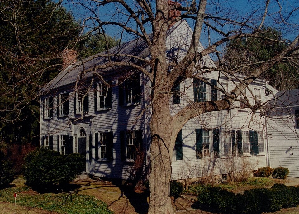
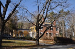
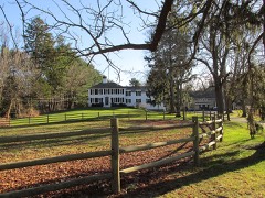
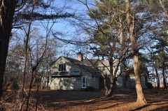
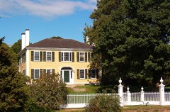
Photograph by Historical Perspective, Public domain. Via
Wikimedia Commons.
Bradford, Capt. Gershom, House
Built in 1807 in the Federal architecture. Listed on the National Register of Historic Places in
1978. A historic map-sheet match is not published yet. The record needs a coordinate-quality review before it can be joined to a sheet boundary.
From the record
“Gershom Bradford House is an historic house in Duxbury, Massachusetts. The two-story wood-frame house was built in 1807 by Captain Gershom Bradford, who lived there with his family, included his daughter Charlotte Bradford, a nurse in the American Civil War.”
Wikipedia article Capt. Gershom Bradford House, CC BY-SA 4.0.
one of 93 National Register listings in Plymouth County · listed in 1978 · category: Building · built in 1807, Federal architecture · one of 1 National Historic Landmarks in Plymouth County.
National Register reference number.78001403- the number the National Park Service assigned this property when it was listed, and the key its nomination file is catalogued under at the National Archives.
These notes should be added here, - Mr. Kent was colleague to Dr. Allyn, but was to all intents pastor from 1826 to 1833, the former being the greater part of this time incapacitated. Mr. Knapp fully supplied the pulpit a number of years before Mr. Moore's death, coming over from Plymouth, where he had a private school, as Mr. Moore became too enfeebled to officiate. After the hitter's death, Mr. knapp continued to fill it, until the society could decide upon a resident minister. This was done in 1882 by the settlement of Mr. Burr. It is a curious fact that in this long list of ministers only three are buried in the town, to any one's knowledge, these being Mr. Wisewall, Dr. Allyn and Mr. Moore. To the first there is a stone in the old burial ground, the second in age within the enclosure, bearing the date of 1700. It is of some significance to the religious inquirer to learn that all the colonial churches of the Old Colony but one turned Unitarian when that movement began early in the last century, namely: Plymouth, Duxbury, Scituate, Cohasset and Hingham, the exception being Marshfield.
A character almost totally unlike the preceding, but which may be thought scarcely less interesting, is that of the subject of this sketch. Mr. Bailey began his life, not as the others in the Old Colony, but among the vine-clad hills of France, and in the French colonies, where he lived until after the Battle of Waterloo, in which he participated as one of Napoleon's officers. Later he came here and settled at the cross-roads, where Tremont, Chestnut, Evergreen and Tobey Garden Streets meet; and this place has since been called Bailey's Corner. He lived in the house now owned by Mr. James H. Peterson, where he brought up a large family of attractive daughters, and a son who now lives in an adjoining house. The latter preserves the sword that was on the world's eventful battlefield of Waterloo, where his father received a saber cut on his head, necessitating the trepanning of his skull and the insertion of a piece of silver, a surgical operation that could not, at that time, have been long practiced. Mr. Bailey's life in Duxbury was as quiet as it had formerly been eventful. He was a cigar-maker by occupation, and carrying his wares to Boston by vehicle must have been his most exciting diversion. He died at his home in 1864.
Regional context, not property-specific
evidence. The
federal wildfire occurrence database
lists 181 fires within 5 miles of Bradford, Capt. Gershom, House between
2015 and 2020, burning about 63 acres in total. 1 started naturally. 3 were recorded as arson.
Distance is straight-line from the map coordinates, so a fire counted
here may appear on a neighbouring settlement's page as well.
Reported cause
Fires
Debris and open burning
112
Missing data/not specified/undetermined
48
Misuse of fire by a minor
11
Arson/incendiarism
3
Recreation and ceremony
2
Smoking
2
Natural
1
Equipment and vehicle use
1
Power generation/transmission/distribution
1
The most recent of
them, most recent first, with the day each was reported and the service
that recorded it.
Regional context, not property-specific
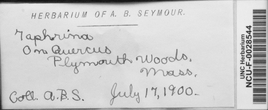
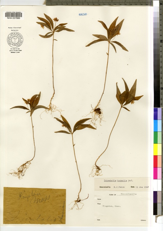
evidence. Museums hold 1,511 specimens
collected within 10 miles of Bradford, Capt. Gershom, House between 1816 and
1975: 935 Animalia, 267 Plantae, 167 Fungi, 100 Unrecorded, 28 Chromista, 14 Protozoa. 12 distinct Species records are shown.
Collected by -- Russell, A., A. C. Mathieson and others. Each is a
physical object with a catalogue
number, and each entry opens the museum's record. This is what was
collected and kept, not a survey of what lives here - nothing can be
concluded from a species being absent.
Regional context, not property-specific
evidence. The federal mineral resources record lists
2 workings within 5 miles of Bradford, Capt. Gershom, House: 2 past producers.
None of them still produces. What was taken out: Sand and Gravel, Construction. Distance is straight-line from the
map coordinates, so a quarry counted here may appear on a neighbouring
settlement's page as well.
Regional context, not property-specific
evidence. The National Weather Service names
Duxbury, the town this property stands in, in 14 storm reports between 1997 and 2024: 8 thunderstorm wind, 4 hail, 2 lightning.
No death or injury is recorded in these reports. Each account below is quoted exactly as the forecast office
filed it, from the NOAA Storm Events Database, and each date
opens the federal record of that event.
No historic map-sheet match is published
for this property yet. That does not mean no map exists. This record needs
a coordinate-quality review before it can be joined to a sheet boundary.
Browse the county's mapped places while that work is
pending.
From the nomination file
2,035 words on record
When this property was proposed for the
National Register, someone wrote the case for it: what the building is,
and why it matters. That document is a federal record in the public domain.
It is quoted below word for word, never summarised. The text was read off the scanned case file by machine, so the
occasional stray character is the recogniser's and the 1970s
typewriter's.
Description of the property
The Captain Gershom Bradford House is located at 931 Tremont Street in Duxbury. Tremont Street (Route 3A) was one of the earliest roads between Boston and the southern part of the state. The property is comprised of 9-3/4 acres of wel1- landscaped grounds. The land surrounding the house is occupied by modest flower beds and low stone walls. Lilacs, boxtrees, and dogwoods planted by early members of the Bradford family remain. Acreage more distant from the house includes horse chestnut, Silver beech, and spruce trees. The building stands opposite the house of Gamaliel Bradford, Gershom's brother and fellow sea captain. The property is bordered by Harrison Street to the north, a golf course to the east, and large lot residential structures to the south and west.
The two story Federal style building was constructed in 1807-1808 by Captain Ger- shom Bradford. The original house has an L-shaped plan. The main five bay wide by two bay deep ridge roof section has an inside end chimney at each gable peak. The two story hip roof ell extends from the southern end of the rear (east) eleva- tion. It has a tall inside end chimey on its north elevation. A two story, ridge roof addition extends from the rear (east) elevation of the ell. This addition projects southward and replaces a barn which was originally attached to the ell. This deteriorated barn was removed in 1893. The entire structure is sheathed in clapboards painted blue-gray. The north and south elevations of the main section have rough brick beneath the clapboards.
Fenestration is 6/6 with slightly projecting lintels and sills framed by louvered shutters. The water table, entablature, and corner boards are plain. The symmetri- cal facade faces west.
The Captain Gershom Bradford House is significant for the simple quality of its early 19th century Federal design and for its association with the Bradford family, who retained ownership of the house from 1807 to 1968. oft desiguse fron Gershom Bradford was born in 1774. He was the grandson of a Representative to the General Court and the son of a Revolutionary Was colonel. Gershom went to sea at age 17 and sailed under his older brothers Gamaliel and Daniel, both of whom were shipmasters. He became a mate in 1796 and a master some four years later. The three brothers built houses at about the same time.
Gamaliel's home (National Register nomination) is directly across the road from Gershom's; Daniel's is a third of a mile away: Jerusha Bradford, their sister, married Ezra Weston II, Duxbury's leading shipbuilder and owner of the King Caesar House (National Register nomination). Gershom sailed as mate with Captain Gamaliel on the ship Mary in 1799 and helped resist the attack of a French privateer. A similar encounter on the ship "Industry" occurred the following year. While manning a stern gun, Gershom learned that Gamaliel had been seriously wounded. He assumed command, and after a 2½ hour battle, drove off the adversary. Gershom then brought the vessel safely into Lisbon under a jury rig.
Captain Gershom was fully qualified to handle any vessel, but preferred smaller ships and shorter voyages. He conmanded at least ten vessels before retiring in 1826, after 35 years at sea. Bradford died in 1844. The Captain Gershom Bradford House is important to the heritage of the town of Duxbury. The house belonged to Captain Gershom and his descendants for a period of 161 years. It was entrusted to the Duxbury Rural and Historical Society, Inc.
Quoted from the National Register nomination
for reference 78001403, 9 pages, held by the National Archives in Record
Group 79. See the
catalogue record.
Listed places nearby
6 within 8 miles
Other National Register properties close
enough to walk or drive between, ordered by distance from this one. Both
positions come from the same geocoding pass that matched these properties
to their map sheets.
Listing record. National Park Service National Register of Historic Places, listed-properties dataset, current to 2026-05-22.
Map join. Address geocoded through the United States Census geocoder, then tested against the published boundary of every sheet in the USGS Historical Topographic Map Collection.
How this page is made. Listing fields come from federal records; map-sheet coverage is a labelled coordinate-to-boundary calculation, not a source-field claim.
Wildfire. Short, Karen C. 2022. Spatial wildfire occurrence data for the United States, 1992-2020 [FPA_FOD_20221014]. 6th Edition. Fort Collins, CO: Forest Service Research Data Archive. https://doi.org/10.2737/RDS-2013-0009.6 Collected with United States Government funding and usable without additional permissions or fees.
Specimens. Global Biodiversity Information Facility (GBIF), https://www.gbif.org/. Only records licensed CC0 or CC BY are used. Records licensed CC BY-NC are excluded because this site carries advertising. Images are checked individually and any whose licence is non-commercial, no-derivatives or unreadable is refused.
Mines and quarries. USGS Mineral Resources Data System (MRDS) https://mrdata.usgs.gov/mrds/ A work of the United States government, no copyright under 17 U.S.C. 105.
Storms. NOAA National Centers for Environmental Information, Storm Events Database https://www.ncei.noaa.gov/stormevents/ A work of the United States government, no copyright under 17 U.S.C. 105. Narratives are quoted verbatim from the National Weather Service report and are not edited or summarised.
 Block
Block