Listed on the National Register of Historic Places in
1978. A historic map-sheet match is not published yet. The record needs a coordinate-quality review before it can be joined to a sheet boundary.
From the record
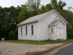
“Mount Zion Presbyterian Church is a historic church in Chandlersville, Ohio.”
Wikipedia article Mount Zion Presbyterian Church (Chandlersville, Ohio), CC BY-SA 4.0.
one of 70 National Register listings in Muskingum County · listed in 1978 · category: Building.
National Register reference number.78002152- the number the National Park Service assigned this property when it was listed, and the key its nomination file is catalogued under at the National Archives.
The first road surveyed through any part of the township, was the Zanesville and Marietta road, which passes through the southwest corner of the same. The next was the Salt Creek and Guernsey road, from Chandlersville to Cambridge. Thomas Brady says this road was surveyed in 1810.
Regional context, not property-specific
evidence. The
federal wildfire occurrence database
lists 14 fires within 5 miles of Mount Zion Presbyterian Church between
2013 and 2019, burning about 51 acres in total. None started naturally. None was recorded as arson.
Distance is straight-line from the map coordinates, so a fire counted
here may appear on a neighbouring settlement's page as well.
Reported cause
Fires
Debris and open burning
8
Missing data/not specified/undetermined
4
Equipment and vehicle use
2
The most recent of
them, most recent first, with the day each was reported and the service
that recorded it.
Regional context, not property-specific
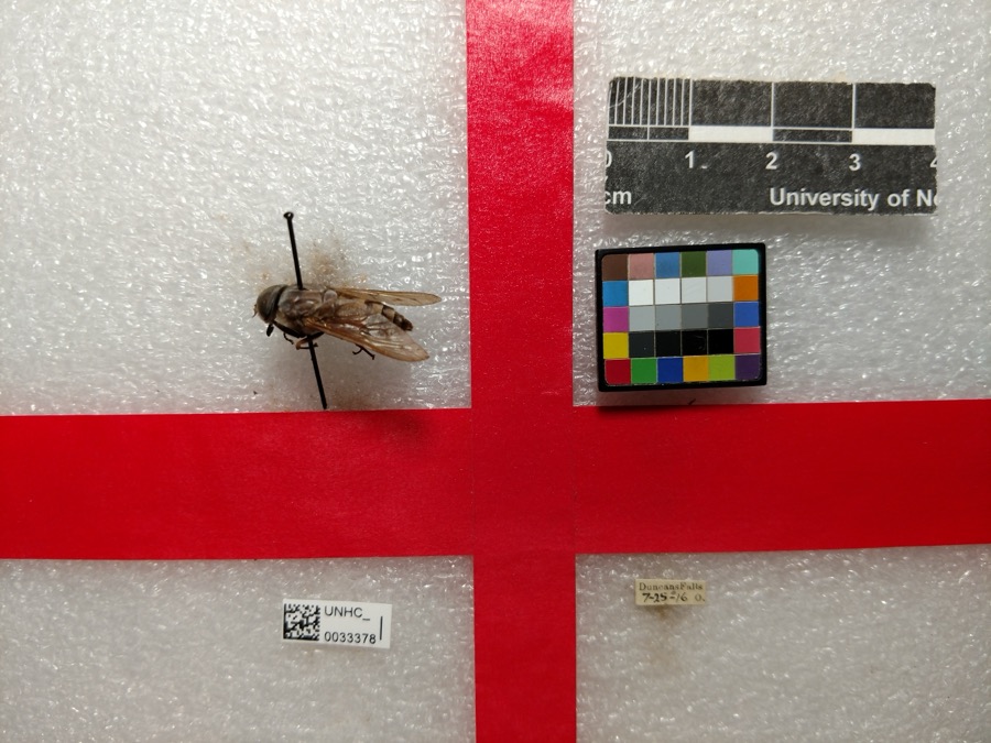
evidence. Museums hold 999 specimens
collected within 10 miles of Mount Zion Presbyterian Church between 1908 and
1975: 941 Animalia, 55 Plantae, 3 Unrecorded. 12 distinct Species records are shown.
Collected by A. H. Wright, Adams, W., Adams, W. (William), Trautman, M. B. (Milton Bernard) et al. and others. Each is a
physical object with a catalogue
number, and each entry opens the museum's record. This is what was
collected and kept, not a survey of what lives here - nothing can be
concluded from a species being absent.
Regional context, not property-specific
evidence. The federal mineral resources record lists
3 workings within 5 miles of Mount Zion Presbyterian Church: 3 producers.
All of them still produce. What was taken out: Stone, Crushed/Broken. Distance is straight-line from the
map coordinates, so a quarry counted here may appear on a neighbouring
settlement's page as well.
Regional context, not property-specific
evidence. The National Weather Service names
Chandlersville, the town this property stands in, in 4 storm reports between 2004 and 2022: 2 thunderstorm wind, 1 flash flood, 1 tornado.
No death or injury is recorded in these reports. Each account below is quoted exactly as the forecast office
filed it, from the NOAA Storm Events Database, and each date
opens the federal record of that event.
Damage began near Chandlersville Rd and Coon Ridge Rd and |continued to points along Claysville Rd. The tornado grew to its |widest and strongest along Chandlersville Rd, where farm buildings|were considerably damaged, including a cement silo. Several homes|and non-residential business buildings sustained varying degrees |of roof and fascia damage, and several homes had windows blown in |or broken. Considerable damage to trees was noted, including |uproots and trunk snappage. Roof debris from farm buildings was |discovered up to a mile downwind.||The cement silo identified above was reported to have survived |the 2012 derecho. Since silos are not official Damage Indicators, |we are consulting with experts to identify the potential wind |speed leading to the indicated damage.|Estimated Maximum Wind Speed...95 mph.
At 355 PM EDT, roads were flooded in Chandlersville. By 620 PM, flooding was reported 7 miles east of Duncan Falls, along Route 146. By 735 PM, flooded occurred in Madison Twp, in the northeast corner of the county. At 1 AM on 19th, Route 16 near Adams Mills flooded. By 2 AM on 19th, Route 146 near Spratt flooded.
No historic map-sheet match is published
for this property yet. That does not mean no map exists. This record needs
a coordinate-quality review before it can be joined to a sheet boundary.
Browse the county's mapped places while that work is
pending.
Named in the fire insurance atlases
Sanborn surveyors printed an index of the
town's establishments at the front of each atlas. This property is named in
one, read straight off the scanned sheet.
When this property was proposed for the
National Register, someone wrote the case for it: what the building is,
and why it matters. That document is a federal record in the public domain.
It is quoted below word for word, never summarised. The text was read off the scanned case file by machine, so the
occasional stray character is the recogniser's and the 1970s
typewriter's.
Description of the property
bell tower. The tower was erected in 1912 at a cost of $800 as a memorial to deceased an intact, functioning bell. It is capped with a tin roof complete with a lightning triple-hung sash, with colored panes giving the effect of stained glass. The win- of the church. The general lines of the building are unbroken, except for the inclusion ing is covered by a gable roof. Tin sheeting covers the roof today, although the and has completely obliterated much of the cultural landscape oi the area. A pre-fabricated, house stands to the east of the church, on the site of the parsonage. once stood beside the community house.
No extant outbuildings are associated with UNEXPOSED CONDITION UNALTERED EXCELLENT FAIR CHECK ONE rod at its apex.The overall architectural character of the church is restrained. the church. There are five bays in each side.Fenestration is accomplished through the use of - DETERIORATED church members.It is basically a square structure, with an open arched belfry and benches probably installed at the time of the building's construction.There is hard Mount Zion Presbyterian Church is a frame building measuring 44'x56'in dimentions. The church is located in rural Rich Hill Township, several miles east of the wood flooring present on the interior. The interior of Mt.
Zion Church appears to be little altered from its original tilate two wood burning heating stoves at either side of the sanctuary.The build- state.At the front end of the sanctuary is a dias upon which sits the pulpit dows.are set in.plain.wooden casings.There are no voids at the rear(north)side X.GOOD village of Chandlersville. Extensive coal stripping, now reclaimed, is in evidence, Mt. Zion Ce etery lies approximately three hundred yards east of the church building.
While the building itself is not representative of any particular elite archi- new church was ready for the congregation's occupation, the older building was used as istence today, although repeated attempts have been made on the part of the presbytery to have the group disbanded and the church abandoned. Further, the group has resisted offers from coal companies to sell the building in order to strip the land whereon the High Hill Church, in order to keep both congregations in existence.
1500-1599 1700-1799 1864 INVENTION ART ENGINEERING PREHISTORIC ARCHEOLOGY-HISTORIC EDUCATION PERIOD BUILDER/ARCHITECT TRANSPORTATION MILITARY SCIENCE AGRICULTURE SIGNIFICANCE 1900- THEATER INDUSTRY X1800-1899 LITERATURE SCULPTURE _EXPLORATION/SETTLEMENT POLITICS/GOVERNMENT _COMMUNICATIONS church sits.No.full-time pastor serves the group;rather services are alternated with _PHILOSOPHY agrarian congregation of the mid-nineteenth century.The interior of the church is -1600-1699 _CONSERVATION Presbyterian Church dates its congregation from 1839,and was organized under the -1400-1499 auspices of the Presbytery of Lancaster under the pastorate of the Rev.
Mr.William -COMMERCE Rich Hill Township was first settled in 1805,but was not officially organized significant unto itself due to its apparent lack of alteration. -MUSIC -LANDSCAPE ARCHITECTURE tectural style, it is a rather typical vernacular building erected by a working-class faith, in time being joined by Baptists and Reformed Presbyterians. The Mt. Zion LAW a parsonage.It has long-since been razed.The Mt. Zion congregation continues in ex- X_RELIGION unknown
Quoted from the National Register nomination
for reference 78002152, 11 pages, held by the National Archives in Record
Group 79. See the
catalogue record.
Listed places nearby
2 within 8 miles
Other National Register properties close
enough to walk or drive between, ordered by distance from this one. Both
positions come from the same geocoding pass that matched these properties
to their map sheets.
Listing record. National Park Service National Register of Historic Places, listed-properties dataset, current to 2026-05-22.
Map join. Address geocoded through the United States Census geocoder, then tested against the published boundary of every sheet in the USGS Historical Topographic Map Collection.
How this page is made. Listing fields come from federal records; map-sheet coverage is a labelled coordinate-to-boundary calculation, not a source-field claim.
Wildfire. Short, Karen C. 2022. Spatial wildfire occurrence data for the United States, 1992-2020 [FPA_FOD_20221014]. 6th Edition. Fort Collins, CO: Forest Service Research Data Archive. https://doi.org/10.2737/RDS-2013-0009.6 Collected with United States Government funding and usable without additional permissions or fees.
Specimens. Global Biodiversity Information Facility (GBIF), https://www.gbif.org/. Only records licensed CC0 or CC BY are used. Records licensed CC BY-NC are excluded because this site carries advertising. Images are checked individually and any whose licence is non-commercial, no-derivatives or unreadable is refused.
Mines and quarries. USGS Mineral Resources Data System (MRDS) https://mrdata.usgs.gov/mrds/ A work of the United States government, no copyright under 17 U.S.C. 105.
Storms. NOAA National Centers for Environmental Information, Storm Events Database https://www.ncei.noaa.gov/stormevents/ A work of the United States government, no copyright under 17 U.S.C. 105. Narratives are quoted verbatim from the National Weather Service report and are not edited or summarised.
 Block
Block