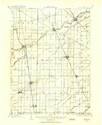
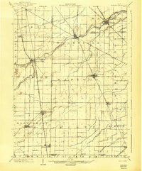
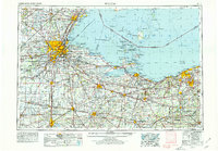
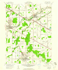
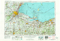
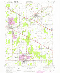
Listed on the National Register of Historic Places in 1978. 7 historic topographic surveys show this location, the earliest from 1901.
From the record
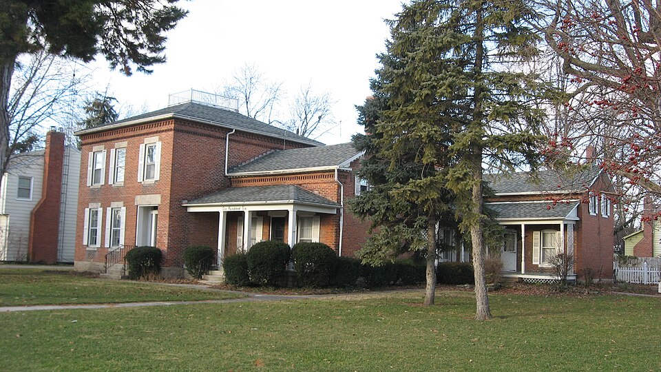
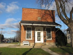
“The Georg Cronenwett House is a historic residence in the village of Woodville, Ohio, United States. Located along Main Street on the village's western side, the house has been designated a historic site because of its historic architecture and because of a famous former resident.”
Wikipedia article Georg Cronenwett House, CC BY-SA 4.0.
One of 12 National Register listings published here for Sandusky County · listed in 1978 · category: Building.
National Register reference number.78002184- the number the National Park Service assigned this property when it was listed, and the key its nomination file is catalogued under at the National Archives.
The ground it stands on
12,443 words
The chapter on Woodville Township in History of Sandusky County, Ohio, published 1882 names Woodville. This is what it says, exactly as the scans read.
At a special session of the county commissioners held April i, 1840, it was ordered that so much of original surveyed township number six, range thirteen as is within the boundaries of Sandusky county, and all that part of original surveyed township number five, range thirteen north of the centreline, running east and west through the center of sections seven, eight, nine, ten and twelve be organized and constituted a new township by the name of Woodville, and that the first election for township officers be holden at the house of Amos E, Wood in said township on the 14th day of April ne.xt, between the hours required by law.
There were at that time a great many more electors than were necessary to effect the organization. The earliest township records have not been preserved so that the exact date of the first election cannot be given. However, it is known that during the summer of 1840 the voting for the first officers took place at the old Wood tavern which stood on the land now owned by members of the Price family, just east of the present village of Woodville. This was, perhaps, the first public gathering of the members of the new community, and as the election was merely of local interest with no political signifi- cance, it was very harmonious, and everybody had a good time, such a time as only a pioneer tavern can furnish. The name of the township is in honor of Amos E. Wood, who was one of the leading citizens at the time of its organization. The election resulted as follows: David Dunham, Lester Allen, and Archibald Rice, trustees; Ira Benedict and Jared Plumb, justices of the peace; Ira Benedict, clerk. These men, who were the most substantial citizens of the new township, succeeded in their honest endeavors to further the best interests of the people, and their merit was recognized by frequent re-elections. Any one taking an interest in the local history of Woodville would be amused at some of the old records kept by the clerk, in which are carefully noted indentures, accounts of stray cattle, and the record of the marks by which hogs and sheep were recognized. Sometimes the unfortunate animal was branded, sometimes painted, but the most popular way was the rather sanguinary process of slitting and otherwise mutilating the auricular appendages of the poor animals. Happily, since the days of fences this barbarous custom is unnecessary, and the ears of the head are intact. The elections have always been held at Woodville village. The officers elected in 1881 are as follows: R. Hartman, J. H. Hurralbrink, and Henry Blausey, trustees; George Wehrung, justice of the peace; Dr. Henry Bush, treasurer; George Wehrung, clerk; Jonathan Faler and B. D. Enoch, constables.
Regional context, not property-specific
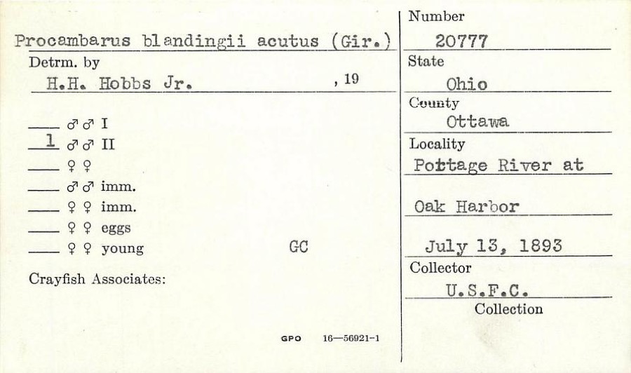
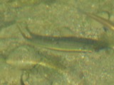
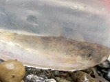
evidence. Museums hold 681 specimens
collected within 10 miles of Georg Cronenwett House between 1825 and 1975: 661 Animalia, 15 Plantae, 5 Fungi.
12 distinct Species records are shown.
Collected by Albiet, P., Beatty, B. (Brett), Hoke, B. & Norrocky, M. J. (Michael J.), Beatty, B. (Brett), Norrocky, M. J. (Michael J.) & Hoke, B. and others. Each is a
physical object with a catalogue
number, and each entry opens the museum's record. This is what was
collected and kept, not a survey of what lives here - nothing can be
concluded from a species being absent.
Regional context, not property-specific
evidence. The federal mineral resources record lists
12 workings within 5 miles of Georg Cronenwett House: 7 past producers, 5 producers.
5 still produce. What was taken out: Calcium, Stone, Crushed/Broken, Limestone, General, Beryllium. Distance is straight-line from the
map coordinates, so a quarry counted here may appear on a neighbouring
settlement's page as well.
Regional context, not property-specific
evidence. The National Weather Service names
Woodville, the town this property stands in, in 26 storm reports between 1996 and 2022: 14 thunderstorm wind, 8 hail, 3 flood, 1 flash flood.
No death or injury is recorded in these reports. Each account below is quoted exactly as the forecast office
filed it, from the NOAA Storm Events Database, and each date
opens the federal record of that event.
Radar estimated around two to over three inches of rain fell over portions of Sandusky and Seneca Counties on the afternoon of November 18. 911 centers reported widespread flooding in the counties with dozens of road closures in each county. Over 48 hours after the initial overland flooding mentioned here, the Portage and Sandusky Rivers flooded. The Portage River reached moderate flood stage and the Sandusky River reached minor flood stage. This lead to continued road closures for known spots along the rivers. No properties were inundated. ||In Seneca County as of 7:30 p.m., there were reports of at least 19 roads that were flooded. These roads included US 224 east of SR 67; CR 50 near the 2000 block; SR 4 near SR 162; CR 48 near SR 18 at the viaduct; the 4000, 5000 and 7000 blocks of South SR 53; SR 231 North of CR 6; CR 37 between CR 38 and CR 15; CR 58 between SR 19 and SR 4; and the westbound lane of US 224 in the 11000 block east of Attica. There also was flooding or closures at CR 43 and CR 38; CR 48 and TR 123; SR 635 south of CR 592; TR 15 between SR 18 and CR 50; Lelar Street in Clinton Township; the 7000 block of East SR 18; Euclid Avenue between Sandusky Street and Hopewell Avenue; and CR 592 west of SR 635, she said. The spokeswoman said three-fourths of a mile north of Izakk Walton League CR 33 had gravel wash out on the shoulder and SR 101 near Clinton Township Volunteer Fire Department was flooded. ||In Sandusky County as of 830 pm the roads flooded included:|County Road 128 between Turnpike and Cr 127 (signs posted)|County Road 183 approximately mile east of State Rte 101|County Road 223 between 242 and 232 also between 260 and 268(2 Places)|County Road 223 between Woodland Ave. and State Rte 510|COUNTY ROAD 201 AND BUCHANAN (signs posted)|CR 117 (FINDLEY RD) AND CR 48 WOODVILLE|CR 164 between CR 215 and OTTAWA CO LINE (SIGNS POSTED) CLOSED|STATE RTE 412 AND STATE RTE 101|COUNTY ROAD 260 BETWEEN 183 AND 177 ALSO BETWEEN 183 AND 175|Finefrock Rd. Near CR 213 (signs will be posted)|CR 229 @ CR 214 (signs posted)|Oakwood Near River St.|FINEFROCK BEFORE STATE RTE 19 (AT THE DIP)|CR 205 BETWEEN 308 AND NORTHWEST ROAD|CR 288 BETWEEN 101 AND 175|CR 205 BETWEEN CR 302 AND CR 308|CR 13 BETWEEN 635 AND CR 58|CR 168 BETWEEN 173 AND COUNTY LINE|Co. Rd 13 between St. Rte. 635 and Co. Rd. 58|CR 90 between CR 55 and CR 59|CR 59 and CR 65|CR 65 TO STATE RTE 590 to CR 74|CR 250 BETWEEN CR 247 AND STATE RTE 6|Christy Rd. CLOSED between St. Rte. 19 and Commerce Drive.
Heavy rain fell over Sandusky County on the morning of the 13th. The heavy rain fell onto already saturated ground conditions from previously heavy rainfall during the week. Most small stream and creeks overflowed their banks across the County. Flooding caused extensive road closures across the county, but no inundation of homes or businesses. A few of the road closures: County Roads 164, 146,153 flooded. SR 19 closed near Muddy Creek in Kingsway.
Several rounds of heavy rain fell across the area beginning during the morning hours of the 20th. At 8:00 am on the 20th, the river stage at Woodville was 2.87 feet. The river quickly reacted to the heavy rain across the area and rose between 1 and 3 feet per hour during the afternoon of the 20th. The river exceeded flood stage of 9.0 feet during the evening hours of the 20th. The river remained in flood through the 21st, and crested at around 11.6 feet at around 11:00 pm on the 21st. Despite the rain tapering off in northwest portions of Sandusky County, another round of heavy rain moved through southern Wood and Hancock Counties during the overnight hours and into the morning of the 21st. This second round of heavy rain impacted the upstream runoff basins that drain into the Portage River. Additionally, another short period of heavy rain fell during the morning hours of the 22nd. The significant amount of runoff draining into the Portage River well upstream kept the river in flood for several days. It did not fall below flood stage until nearly three and a half days later, during the early morning hours of the 24th.
United States Geological Survey topographic
sheets whose coverage includes this point. Matched by taking the coordinate the National Park Service records for this property, then
testing that coordinate against the published boundary of every sheet.
When this property was proposed for the
National Register, someone wrote the case for it: what the building is,
and why it matters. That document is a federal record in the public domain.
It is quoted below word for word, never summarised. The text was read off the scanned case file by machine, so the
occasional stray character is the recogniser's and the 1970s
typewriter's.
Description of the property
The wing additions are carried out in brick, using some details from the main block, but adding arched lintels and porches. The CONDITION XEXCELLENT DETERIORATED RUINS DESCRIPTION UNALTERED FAIR GOOD its segmentally arched windows and gabled roof. 1874.The construction is brick masonry on a cut stone foundation. the Greek Revival Style.The sympathetic additions were made before The original block has the three bay facade, with a recessed The final addition, at the Northeast end of the house was built sometime almost exactly as the house does today. with a classically fluted cap.
after 1874,but is also executed in brick.It matches the other additions with CHECK ONE additions were probably done in two phase; however, the illustration of the house in the l874 Historical Atlas of Sandusky County appears _UNEXPOSED The central block of the house was built in the late 1850'sin DATE 1975 MOVED The windows have stone courses and wood dentil blocks under the soffit.The roof is hipped entrance to the side, typical of Greek Revival. AREAS OF
Statement of significance
Cronenwett, a Lutheran home missionary who was active throughout the Georg Cronenwett (1814-1888) was born in Langensteinbach, Germany September 26, 1841. Pastor Cronenwett's ministry was centered in Woodville. He established some thirteen churches in the region, of which he retained Pastor Cronenwett's house was Woodville's first parsonage. In 1974 Soloman Lutheran Church which he founded, dedicated a new building 1400-1499 Cronenwett. ECONOMICS PERIOD ENGINEERING 1700-1799 XEDUCATION XRELIGION XARCHITECTURE SIGNIFICANCE LAW PHILOSOPHY ARCHEOLOGY-HISTORIC AGRICULTURE THEATER ART LITERATURE INDUSTRY MILITARY Lutheran liturgy and hymnbook.
_COMMUNICATIONS _EXPLORATION/SETTLEMENT This structure is significant because it was built by Georg Soloman Lutheran in Woodville, Salem Lutheran in Wood County, and _TRANSPORTATION for church and school activities in memory of their ville's parish school in l862,and co-founded Woodville Seminary in style of architecture. X.1800-1899 -CONSERVATION _SOCIAL/HUMANITARIAN -1600-1699 -1500-1599 The building is also significant as a good local example of the Greek Revival dence was probably not built until the late l850's. -SCIENCE -MUSIC -1900. INVENTION BUILDER/ARCHITECT Unknown Immanuel Lutheran in Hessville as his own parishes.
He founded Wood- "Black Swamp"area of Northwestern Ohio.He arrived in Woodville in December of 184l.Although the land was acquired in 1853,this resi- November immigrated to in 1832 after
Quoted from the National Register nomination
for reference 78002184, 15 pages, held by the National Archives in Record
Group 79. See the
catalogue record.
Listed places nearby
1 within 8 miles
Other National Register properties close
enough to walk or drive between, ordered by distance from this one. Both
positions come from the same geocoding pass that matched these properties
to their map sheets.
Listing record. National Park Service National Register of Historic Places, listed-properties dataset, current to 2026-05-22.
Map join. Address geocoded through the United States Census geocoder, then tested against the published boundary of every sheet in the USGS Historical Topographic Map Collection.
How this page is made. Listing fields come from federal records; map-sheet coverage is a labelled coordinate-to-boundary calculation, not a source-field claim.
Specimens. Global Biodiversity Information Facility (GBIF), https://www.gbif.org/. Only records licensed CC0 or CC BY are used. Records licensed CC BY-NC are excluded because this site carries advertising. Images are checked individually and any whose licence is non-commercial, no-derivatives or unreadable is refused.
Mines and quarries. USGS Mineral Resources Data System (MRDS) https://mrdata.usgs.gov/mrds/ A work of the United States government, no copyright under 17 U.S.C. 105.
Storms. NOAA National Centers for Environmental Information, Storm Events Database https://www.ncei.noaa.gov/stormevents/ A work of the United States government, no copyright under 17 U.S.C. 105. Narratives are quoted verbatim from the National Weather Service report and are not edited or summarised.
 Block