Listed on the National Register of Historic Places in
1986. A historic map-sheet match is not published yet. The record needs a coordinate-quality review before it can be joined to a sheet boundary.
From the record
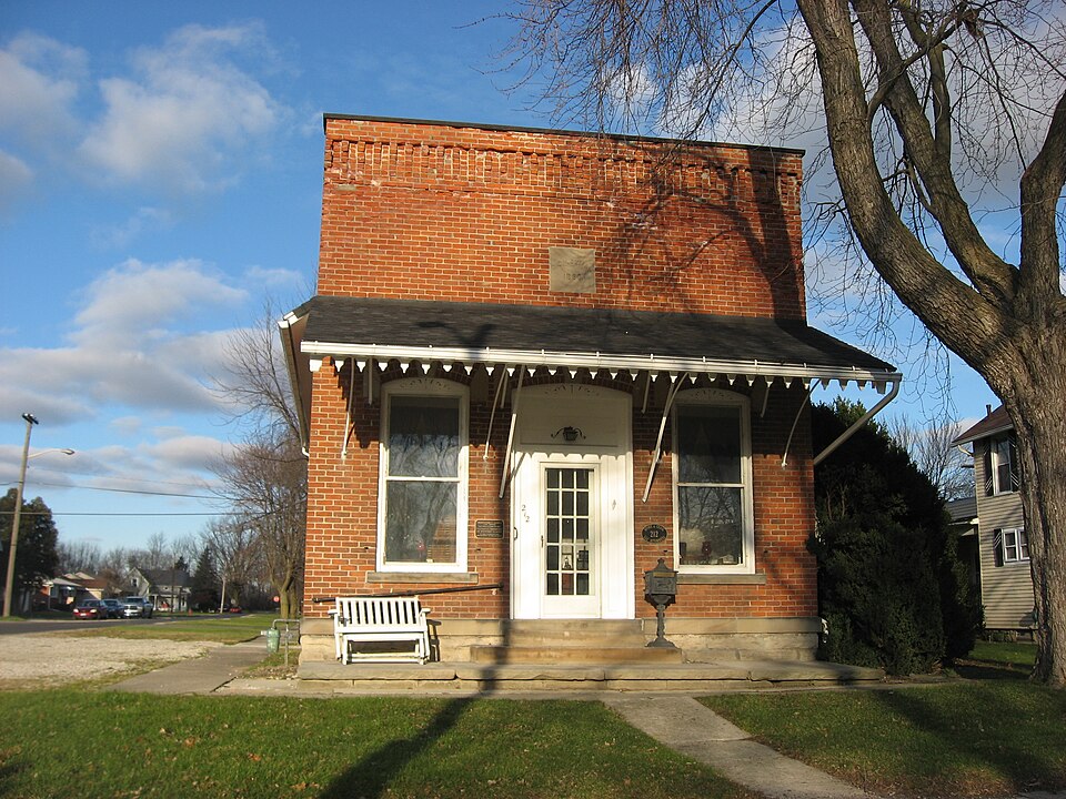
“Layman Law Office is a historic commercial building in the village of Woodville in the northern part of the U.S. state of Ohio. Built in the late nineteenth century, it has been used for multiple purposes, and it has been designated a historic site.”
Wikipedia article Christopher C. Layman Law Office, CC BY-SA 4.0.
one of 9 National Register listings in Sandusky County · listed in 1986 · category: Building.
National Register reference number.86001062- the number the National Park Service assigned this property when it was listed, and the key its nomination file is catalogued under at the National Archives.
Specimens collected near this property
12 of 717 shown
Regional context, not property-specific
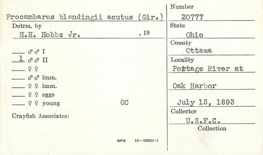
evidence. Museums hold 717 specimens
collected within 10 miles of Layman, Christopher C., Law Office between 1825 and
1975: 697 Animalia, 15 Plantae, 5 Fungi. 12 distinct Species records are shown.
Collected by Albiet, P., Beatty, B. (Brett), Hoke, B. & Norrocky, M. J. (Michael J.), Beatty, B. (Brett), Norrocky, M. J. (Michael J.) & Hoke, B. and others. Each is a
physical object with a catalogue
number, and each entry opens the museum's record. This is what was
collected and kept, not a survey of what lives here - nothing can be
concluded from a species being absent.
Regional context, not property-specific
evidence. The federal mineral resources record lists
11 workings within 5 miles of Layman, Christopher C., Law Office: 7 past producers, 4 producers.
4 still produce. What was taken out: Stone, Crushed/Broken, Calcium, Limestone, General, Beryllium. Distance is straight-line from the
map coordinates, so a quarry counted here may appear on a neighbouring
settlement's page as well.
Regional context, not property-specific
evidence. The National Weather Service names
Woodville, the town this property stands in, in 26 storm reports between 1996 and 2022: 14 thunderstorm wind, 8 hail, 3 flood, 1 flash flood.
No death or injury is recorded in these reports. Each account below is quoted exactly as the forecast office
filed it, from the NOAA Storm Events Database, and each date
opens the federal record of that event.
Radar estimated around two to over three inches of rain fell over portions of Sandusky and Seneca Counties on the afternoon of November 18. 911 centers reported widespread flooding in the counties with dozens of road closures in each county. Over 48 hours after the initial overland flooding mentioned here, the Portage and Sandusky Rivers flooded. The Portage River reached moderate flood stage and the Sandusky River reached minor flood stage. This lead to continued road closures for known spots along the rivers. No properties were inundated. ||In Seneca County as of 7:30 p.m., there were reports of at least 19 roads that were flooded. These roads included US 224 east of SR 67; CR 50 near the 2000 block; SR 4 near SR 162; CR 48 near SR 18 at the viaduct; the 4000, 5000 and 7000 blocks of South SR 53; SR 231 North of CR 6; CR 37 between CR 38 and CR 15; CR 58 between SR 19 and SR 4; and the westbound lane of US 224 in the 11000 block east of Attica. There also was flooding or closures at CR 43 and CR 38; CR 48 and TR 123; SR 635 south of CR 592; TR 15 between SR 18 and CR 50; Lelar Street in Clinton Township; the 7000 block of East SR 18; Euclid Avenue between Sandusky Street and Hopewell Avenue; and CR 592 west of SR 635, she said. The spokeswoman said three-fourths of a mile north of Izakk Walton League CR 33 had gravel wash out on the shoulder and SR 101 near Clinton Township Volunteer Fire Department was flooded. ||In Sandusky County as of 830 pm the roads flooded included:|County Road 128 between Turnpike and Cr 127 (signs posted)|County Road 183 approximately mile east of State Rte 101|County Road 223 between 242 and 232 also between 260 and 268(2 Places)|County Road 223 between Woodland Ave. and State Rte 510|COUNTY ROAD 201 AND BUCHANAN (signs posted)|CR 117 (FINDLEY RD) AND CR 48 WOODVILLE|CR 164 between CR 215 and OTTAWA CO LINE (SIGNS POSTED) CLOSED|STATE RTE 412 AND STATE RTE 101|COUNTY ROAD 260 BETWEEN 183 AND 177 ALSO BETWEEN 183 AND 175|Finefrock Rd. Near CR 213 (signs will be posted)|CR 229 @ CR 214 (signs posted)|Oakwood Near River St.|FINEFROCK BEFORE STATE RTE 19 (AT THE DIP)|CR 205 BETWEEN 308 AND NORTHWEST ROAD|CR 288 BETWEEN 101 AND 175|CR 205 BETWEEN CR 302 AND CR 308|CR 13 BETWEEN 635 AND CR 58|CR 168 BETWEEN 173 AND COUNTY LINE|Co. Rd 13 between St. Rte. 635 and Co. Rd. 58|CR 90 between CR 55 and CR 59|CR 59 and CR 65|CR 65 TO STATE RTE 590 to CR 74|CR 250 BETWEEN CR 247 AND STATE RTE 6|Christy Rd. CLOSED between St. Rte. 19 and Commerce Drive.
Heavy rain fell over Sandusky County on the morning of the 13th. The heavy rain fell onto already saturated ground conditions from previously heavy rainfall during the week. Most small stream and creeks overflowed their banks across the County. Flooding caused extensive road closures across the county, but no inundation of homes or businesses. A few of the road closures: County Roads 164, 146,153 flooded. SR 19 closed near Muddy Creek in Kingsway.
Several rounds of heavy rain fell across the area beginning during the morning hours of the 20th. At 8:00 am on the 20th, the river stage at Woodville was 2.87 feet. The river quickly reacted to the heavy rain across the area and rose between 1 and 3 feet per hour during the afternoon of the 20th. The river exceeded flood stage of 9.0 feet during the evening hours of the 20th. The river remained in flood through the 21st, and crested at around 11.6 feet at around 11:00 pm on the 21st. Despite the rain tapering off in northwest portions of Sandusky County, another round of heavy rain moved through southern Wood and Hancock Counties during the overnight hours and into the morning of the 21st. This second round of heavy rain impacted the upstream runoff basins that drain into the Portage River. Additionally, another short period of heavy rain fell during the morning hours of the 22nd. The significant amount of runoff draining into the Portage River well upstream kept the river in flood for several days. It did not fall below flood stage until nearly three and a half days later, during the early morning hours of the 24th.
No historic map-sheet match is published
for this property yet. That does not mean no map exists. This record needs
a coordinate-quality review before it can be joined to a sheet boundary.
Browse the county's mapped places while that work is
pending.
From the nomination file
3,064 words on record
When this property was proposed for the
National Register, someone wrote the case for it: what the building is,
and why it matters. That document is a federal record in the public domain.
It is quoted below word for word, never summarised. The text was read off the scanned case file by machine, so the
occasional stray character is the recogniser's and the 1970s
typewriter's.
Description of the property
and wooden side panels which in.1933 replaced.the original wooden double doors.A metal storm tains a stone with the date of construction (1890) and is topped with a decorative cornice. The west (side) facade contains a single centrally located shuttered window capped by an arched brick lentil, a sandstone keystone, corner blocks and sill that match those found on part became the doctor's office with a small room on the west for storage of medical supplies. of the dropped ceiling. The doorway between the secretary and the lawyer's office has decora- X good which stands one block off the main street on the northeast corner of First and Cherry Streets in the Village of Woodville, Ohio. Constructed in 1890 for Mr.
Layman, the village's first the entire front facade and creates a roof over the four huge grey sandstone slabs that form room. He completely partitioned off the lavatory and added air conditioning. Currently the Layman as a coal shed. It is currently used for storage. ruins deteriorated the street but is obstructed from view bya large brick false front.The false front con- Areas of SignificanceCheck and justify below -archeology-historic _ conservation _economics X architecture -education . music - 1800-1899 . exploration/settlement - - philosophy - politics/government _ invention The Christopher C. Layman Law Office is significant as an example of modest Italinate architecture and because of its association with Christopher C.
Layman, who was the first resident lawyer in the Village of Woodville. Ohio. Christopher Layman received his early education at public schools in Webster Township, Bowling Green and Perrysburg. On August 18, 1861, he enlisted in the Army of Termessee and Iought as a soldier in the Civil War until he was discharged on July 15, 1065. Mr.
(in one paragraph) after his death. -agriculture Annual Commencement on March 29,1882.After graduation he went to Lansing,Michigan and - other(specify) -1900- -science Criterion B and C _ landscape architecture.. Mr. Layman (originiallyspelled Lehman) was born in Canton Berne, Switzerland on May 5, 1845. he came toohio with his parents, Johnn, a carpenter/farmer, and Magdalena Jacobs Lehmann They settled near Luckey on 80 acres of land in Webster Township, Wood County fluential in the organization of the Woodville School District. In 1890 he built the law medicine here until 1964. The building remained vacant for two years when in 1966 it was Builder/Architect art unknown In 1933,upon the death of Emma Layman,Dr.Egger purchased the office.He practiced ... religion X_law 9.
Quoted from the National Register nomination
for reference 86001062, 28 pages, held by the National Archives in Record
Group 79. See the
catalogue record.
Listed places nearby
1 within 8 miles
Other National Register properties close
enough to walk or drive between, ordered by distance from this one. Both
positions come from the same geocoding pass that matched these properties
to their map sheets.
Listing record. National Park Service National Register of Historic Places, listed-properties dataset, current to 2026-05-22.
Map join. Address geocoded through the United States Census geocoder, then tested against the published boundary of every sheet in the USGS Historical Topographic Map Collection.
How this page is made. Listing fields come from federal records; map-sheet coverage is a labelled coordinate-to-boundary calculation, not a source-field claim.
Specimens. Global Biodiversity Information Facility (GBIF), https://www.gbif.org/. Only records licensed CC0 or CC BY are used. Records licensed CC BY-NC are excluded because this site carries advertising. Images are checked individually and any whose licence is non-commercial, no-derivatives or unreadable is refused.
Mines and quarries. USGS Mineral Resources Data System (MRDS) https://mrdata.usgs.gov/mrds/ A work of the United States government, no copyright under 17 U.S.C. 105.
Storms. NOAA National Centers for Environmental Information, Storm Events Database https://www.ncei.noaa.gov/stormevents/ A work of the United States government, no copyright under 17 U.S.C. 105. Narratives are quoted verbatim from the National Weather Service report and are not edited or summarised.
 Block
Block