Listed on the National Register of Historic Places in
1978. A historic map-sheet match is not published yet. The record needs a coordinate-quality review before it can be joined to a sheet boundary.
From the record
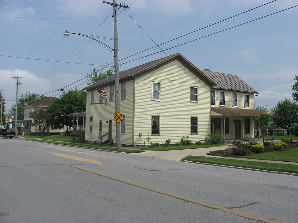
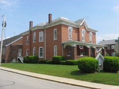
“The Shelby House is a historic building in Botkins, Ohio, United States. Built in 1864, it was constructed by local businessman Philip Sheets as a hotel for railroad passengers originating from or destined for northern Shelby County and southern Auglaize County.”
Wikipedia article Shelby House (Botkins, Ohio), CC BY-SA 4.0.
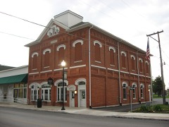
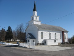
one of 19 National Register listings in Shelby County · listed in 1978 · category: Building · one of 1 National Historic Landmarks in Shelby County.
National Register reference number.78002188- the number the National Park Service assigned this property when it was listed, and the key its nomination file is catalogued under at the National Archives.
The ground it stands on
90,739 words
The chapter on Dinsmore Township in History of Shelby County, Ohio, published 1883 names Botkins. This is what it says, exactly as the scans read.
The township is bounded north by Auglaize County, east by Jackson, south by Franklin, and west by Van Buren townships. It contains an area of thirty-six square miles. It is crossed north and south within two miles of the west line by the Dayton and Michigan Railroad. Within one mile of the north line Botkins station is located, while Anna station is on the south-line, the village extending into Franklin Township. Small streams take their rise in the township, and, flowing west by south, afford drainage and an outlet to Loramie Reservoir in Van Buren and McLean townships.
The surface of the township is level throughout, and the soil is of an excellent quality. Improvements have gone on apace, and although the township was a late organization, it has enjoyed a rapid and satisfactory development. The people are industrious, frugal, and energetic, as shown by the houses and farms of the people. School-houses and churches, saw-mills and tile factories are seen throughout the township, while institutions and enterprises of various characters are properly represented. Two live and thriving villages, Anna and Botkins, are within the township, the former at the south line, and the latter near the north side of the township. Both are important stations on the Dayton and Michigan Railroad, and both enjoy an extensive local trade. Another village, Northumberland, was laid out in the township years ago, but proved too transitory for continued growth and life.
Regional context, not property-specific
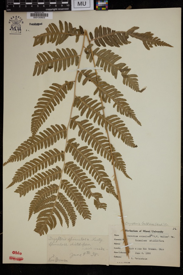
evidence. Museums hold 122 specimens
collected within 10 miles of Shelby House between 1800 and
1970: 99 Animalia, 15 Fungi, 7 Plantae, 1 Unrecorded. 12 distinct Species records are shown.
Collected by Ballenstedt, B., Baßmann, C. Clark and others. Each is a
physical object with a catalogue
number, and each entry opens the museum's record. This is what was
collected and kept, not a survey of what lives here - nothing can be
concluded from a species being absent.
Regional context, not property-specific
evidence. The National Weather Service names
Botkins, the town this property stands in, in 27 storm reports between 1996 and 2025: 10 thunderstorm wind, 7 hail, 7 flood, 3 flash flood.
No death or injury is recorded in these reports. Each account below is quoted exactly as the forecast office
filed it, from the NOAA Storm Events Database, and each date
opens the federal record of that event.
Two power poles and a silo were blown over. One tree was reported down and another was broken. These occurrences were due to damaging thunderstorm winds.
Five homes sustained roof damage and a barn was destroyed to the southwest of Botkins. A semi-trailer was flipped on its side and numerous trees were knocked down, including a few on houses. The damage was from a possible microburst.
Roads were covered with water due to heavy rainfall in the area and previous snow melt. Flooding began around 0215 EST on February 28th and ended around 0900 EST on March 2nd. Damage estimates from February were around five-thousand dollars.
Roads were covered with water due to heavy rainfall in the area and previous snow melt. Flooding began around 0215 EST on February 28th and ended around 0900 EST on March 2nd. Damage estimates from March were around five-thousand dollars.
No historic map-sheet match is published
for this property yet. That does not mean no map exists. This record needs
a coordinate-quality review before it can be joined to a sheet boundary.
Browse the county's mapped places while that work is
pending.
From the nomination file
1,843 words on record
When this property was proposed for the
National Register, someone wrote the case for it: what the building is,
and why it matters. That document is a federal record in the public domain.
It is quoted below word for word, never summarised. The text was read off the scanned case file by machine, so the
occasional stray character is the recogniser's and the 1970s
typewriter's.
Description of the property
shingle roof was installed with funds appropriatedby the Shelby County Commissioners CONDITION EXCELLENT UNALTERED DETERIORATED GOOD individual hotel rooms upstairs, several dining rooms and a saloon area downstairs tently for storage and as a business. 7DESCRIPTION CHECK ONE century when the access to automobile transportation lured train passengers away, the By 1975,thought was given to the demolition of the deteriorated structure. through in 1858.It is typical of the large hotels that served the early travelers in a cut limestone foundation.A wide friezeboard under the ample overhang accents the moved to the rear of the hotel property when it was recently donated to the Botkins to restore and rehabilitate the building for a museum.
the Civil War.This plain frame hotel that is situated directly on the Main Street Historical Society. imposing dimensions of this building.Pairs of windows on each story of the gable ends for an overnight stay as they journeyed to larger towns in the area.By the turn of the The Botkins Historical Society purchased the building in 1975 and began work on its Four 6/6 windows are evenly spaced on the second story of the facade.Two match those in front.To the rear are multiple additions bult at various stages of A log cabin from 1838 that was located a few blocks west on Main Street has been centrally located paneled doors are flanked by 6/6windows on the first this part of Ohio.
The Shelby House was built between 1864-65 when Philip Sheets, Sr.returned from hotel becamea rooming house until World War II.At that time itbecame used intermit- XFAIR Inside it can be seen that In 1977, a wooden paned windows that were found in the upstairs.Repair and replacement of rotting siding on the weatherbeaten western exposure was carefully undertaken.
an overnight stop for travelers, and in 1865 the property on Lot 7 had a tax valuation of The third generation of Sheets continued their fathers business interests. 1500-1599 1700-1799 ART ARCHEOLOGY-HISTORIC ENGINEERING SCIENCE SIGNIFICANCE POLITICS/GOVERNMENT BUILDER/ARCHITECT AGRICULTURE PHILOSOPHY PERIOD INDUSTRY MILITARY SCULPTURE EXPLORATION/SETTLEMENT LITERATURE Rude dwellings had formerly lined the railroad tracks which caused the village to be terminus from many parts of Auglaize County by hack lines which caused a flourish of business activity of the railroad.
The economy of the town today reflects the presence of the Sheets family and the nearest railroad-station hotel for many towns in both Shelby and Auglaize Counties until Shelby County Bank at Botkins which he established, was the director of the First National _COMMUNICATIONS Bank at Sidney, General Assemblyman from Shelby County, and was nominated for Congressman elevator in Botkins and five other neighboring towns. mill complex that is one of the largest feed mills in the area with branch offices The second generation of Sheets was also named Philip.He was president of the affect the economy in Botkins and Shelby County for over a century..
and served in the Texas army, the Mexican War in 1846 and then as a Texas Ranger until 1900, and it was built and operated by an important Sheets family which continued to Philip Sheets Sr.was a colorful personality in an era when opportunity for Botkin's farm, this settler requested that a town be platted named Botkinsville. business was profitable.
Quoted from the National Register nomination
for reference 78002188, 11 pages, held by the National Archives in Record
Group 79. See the
catalogue record.
Listed places nearby
5 within 8 miles
Other National Register properties close
enough to walk or drive between, ordered by distance from this one. Both
positions come from the same geocoding pass that matched these properties
to their map sheets.
Listing record. National Park Service National Register of Historic Places, listed-properties dataset, current to 2026-05-22.
Map join. Address geocoded through the United States Census geocoder, then tested against the published boundary of every sheet in the USGS Historical Topographic Map Collection.
How this page is made. Listing fields come from federal records; map-sheet coverage is a labelled coordinate-to-boundary calculation, not a source-field claim.
Specimens. Global Biodiversity Information Facility (GBIF), https://www.gbif.org/. Only records licensed CC0 or CC BY are used. Records licensed CC BY-NC are excluded because this site carries advertising. Images are checked individually and any whose licence is non-commercial, no-derivatives or unreadable is refused.
Storms. NOAA National Centers for Environmental Information, Storm Events Database https://www.ncei.noaa.gov/stormevents/ A work of the United States government, no copyright under 17 U.S.C. 105. Narratives are quoted verbatim from the National Weather Service report and are not edited or summarised.
 Block
Block