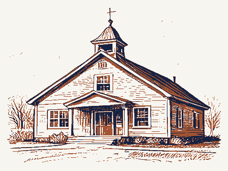
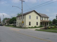
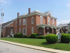
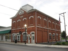
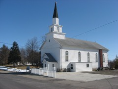
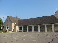
Listed on the National Register of Historic Places in
1979. A historic map-sheet match is not published yet. The record needs a coordinate-quality review before it can be joined to a sheet boundary.
From the record
“was born in Baden, Germany, on the 27th of October, 1817. He immigrated to America in 1835 or '36, and after visiting New York City, Buffalo, Pittsburgh, Cleveland, and St.”
History of Shelby County, Ohio (1883). Machine-read text.
one of 19 National Register listings in Shelby County · listed in 1979 · category: Building · one of 1 National Historic Landmarks in Shelby County.
National Register reference number.79002851- the number the National Park Service assigned this property when it was listed, and the key its nomination file is catalogued under at the National Archives.
The ground it stands on
90,739 words
The chapter on Dinsmore Township in History of Shelby County, Ohio, published 1883 names Botkins. This is what it says, exactly as the scans read.
The township is bounded north by Auglaize County, east by Jackson, south by Franklin, and west by Van Buren townships. It contains an area of thirty-six square miles. It is crossed north and south within two miles of the west line by the Dayton and Michigan Railroad. Within one mile of the north line Botkins station is located, while Anna station is on the south-line, the village extending into Franklin Township. Small streams take their rise in the township, and, flowing west by south, afford drainage and an outlet to Loramie Reservoir in Van Buren and McLean townships.
The surface of the township is level throughout, and the soil is of an excellent quality. Improvements have gone on apace, and although the township was a late organization, it has enjoyed a rapid and satisfactory development. The people are industrious, frugal, and energetic, as shown by the houses and farms of the people. School-houses and churches, saw-mills and tile factories are seen throughout the township, while institutions and enterprises of various characters are properly represented. Two live and thriving villages, Anna and Botkins, are within the township, the former at the south line, and the latter near the north side of the township. Both are important stations on the Dayton and Michigan Railroad, and both enjoy an extensive local trade. Another village, Northumberland, was laid out in the township years ago, but proved too transitory for continued growth and life.
Regional context, not property-specific
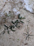
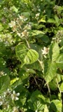
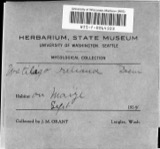
evidence. Museums hold 121 specimens
collected within 10 miles of Botkins Elementary School between 1800 and
1970: 99 Animalia, 15 Fungi, 6 Plantae, 1 Unrecorded. 12 distinct Species records are shown.
Collected by Ballenstedt, B., Baßmann, C. Clark and others. Each is a
physical object with a catalogue
number, and each entry opens the museum's record. This is what was
collected and kept, not a survey of what lives here - nothing can be
concluded from a species being absent.
Regional context, not property-specific
evidence. The National Weather Service names
Botkins, the town this property stands in, in 27 storm reports between 1996 and 2025: 10 thunderstorm wind, 7 hail, 7 flood, 3 flash flood.
No death or injury is recorded in these reports. Each account below is quoted exactly as the forecast office
filed it, from the NOAA Storm Events Database, and each date
opens the federal record of that event.
Two power poles and a silo were blown over. One tree was reported down and another was broken. These occurrences were due to damaging thunderstorm winds.
Five homes sustained roof damage and a barn was destroyed to the southwest of Botkins. A semi-trailer was flipped on its side and numerous trees were knocked down, including a few on houses. The damage was from a possible microburst.
Roads were covered with water due to heavy rainfall in the area and previous snow melt. Flooding began around 0215 EST on February 28th and ended around 0900 EST on March 2nd. Damage estimates from February were around five-thousand dollars.
Roads were covered with water due to heavy rainfall in the area and previous snow melt. Flooding began around 0215 EST on February 28th and ended around 0900 EST on March 2nd. Damage estimates from March were around five-thousand dollars.
No historic map-sheet match is published
for this property yet. That does not mean no map exists. This record needs
a coordinate-quality review before it can be joined to a sheet boundary.
Browse the county's mapped places while that work is
pending.
From the nomination file
433 words on record
When this property was proposed for the
National Register, someone wrote the case for it: what the building is,
and why it matters. That document is a federal record in the public domain.
It is reproduced in full on its own page, word for word and never summarised. The text was read off the scanned case file by machine, so the
occasional stray character is the recogniser's and the 1970s
typewriter's.
Quoted from the National Register nomination
for reference 79002851, 5 pages, held by the National Archives in Record
Group 79. See the
catalogue record.
Listed places nearby
5 within 8 miles
Other National Register properties close
enough to walk or drive between, ordered by distance from this one. Both
positions come from the same geocoding pass that matched these properties
to their map sheets.
Listing record. National Park Service National Register of Historic Places, listed-properties dataset, current to 2026-05-22.
Map join. Address geocoded through the United States Census geocoder, then tested against the published boundary of every sheet in the USGS Historical Topographic Map Collection.
How this page is made. Listing fields come from federal records; map-sheet coverage is a labelled coordinate-to-boundary calculation, not a source-field claim.
Specimens. Global Biodiversity Information Facility (GBIF), https://www.gbif.org/. Only records licensed CC0 or CC BY are used. Records licensed CC BY-NC are excluded because this site carries advertising. Images are checked individually and any whose licence is non-commercial, no-derivatives or unreadable is refused.
Storms. NOAA National Centers for Environmental Information, Storm Events Database https://www.ncei.noaa.gov/stormevents/ A work of the United States government, no copyright under 17 U.S.C. 105. Narratives are quoted verbatim from the National Weather Service report and are not edited or summarised.
 Block
Block