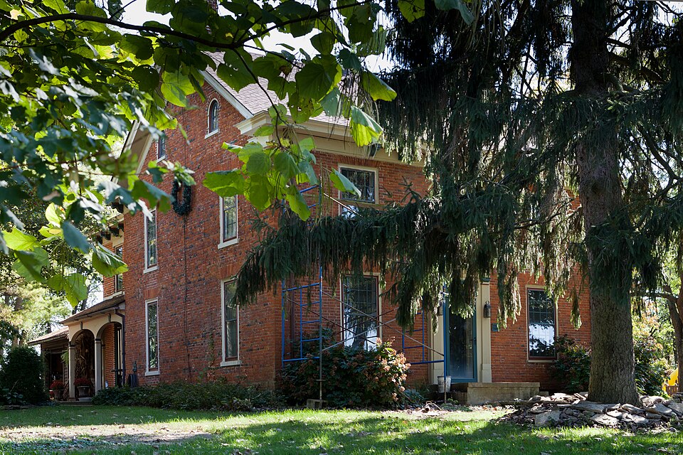
Listed on the National Register of Historic Places in
1978. A historic map-sheet match is not published yet. The record needs a coordinate-quality review before it can be joined to a sheet boundary.
From the record
one of 30 National Register listings in Warren County · listed in 1978 · category: Building.
National Register reference number.78002202- the number the National Park Service assigned this property when it was listed, and the key its nomination file is catalogued under at the National Archives.
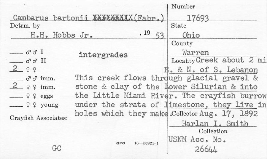
Specimens collected near this property
12 of 2,915 shown
Regional context, not property-specific
evidence. Museums hold 2,915 specimens
collected within 10 miles of Crane, Jonathan, Farm between 1844 and
1975: 2,851 Animalia, 48 Plantae, 16 Fungi. 12 distinct Species records are shown.
Collected by A Schwartz, A. R. Gaufin, A.C. Borror and others. Each is a
physical object with a catalogue
number, and each entry opens the museum's record. This is what was
collected and kept, not a survey of what lives here - nothing can be
concluded from a species being absent.
Regional context, not property-specific
evidence. The federal mineral resources record lists
2 workings within 5 miles of Crane, Jonathan, Farm: 1 plant, 1 past producer.
1 still produces. What was taken out: Sand and Gravel, Construction. Distance is straight-line from the
map coordinates, so a quarry counted here may appear on a neighbouring
settlement's page as well.
Regional context, not property-specific
evidence. The National Weather Service names
Franklin, the town this property stands in, in 26 storm reports between 1994 and 2022: 17 thunderstorm wind, 4 hail, 4 flood, 1 flash flood.
The reports record 2 injuries. Each account below is quoted exactly as the forecast office
filed it, from the NOAA Storm Events Database, and each date
opens the federal record of that event.
Strong winds took a chair into the air, striking a person. The metal roof from a car wash in Springboro was torn off. Also, scaffolding and several trees were knocked down.
A portion of the roof was removed by the wind at the Townsend Auto Sales building along State Route 122. Several automobiles on the lot sustained minor damage.
No historic map-sheet match is published
for this property yet. That does not mean no map exists. This record needs
a coordinate-quality review before it can be joined to a sheet boundary.
Browse the county's mapped places while that work is
pending.
From the nomination file
2,209 words on record
When this property was proposed for the
National Register, someone wrote the case for it: what the building is,
and why it matters. That document is a federal record in the public domain.
It is quoted below word for word, never summarised. The text was read off the scanned case file by machine, so the
occasional stray character is the recogniser's and the 1970s
typewriter's.
Description of the property
Greek Revival touches. Originally the south side of the house was all brick, since it receives There are two quaint, smaller attic windows below these numbers. The house has had its windows lengthened, gingerbread added, a peak at CONDITION MOVED UNALTERED DATE DETERIORATED original house with a crawl-space under the addition. XALTERED on this side, (from knives, forks found in the ground and the presence of and 2 below (9 panes over 9 panes). Each window on the north and west XORIGINAL SITE in l8ll, it appears to have been federal in style with later attempts at faces west.
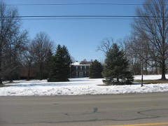
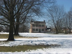
along the sides.There are 2 long windows on the first floor east side of the house.This building does not seem very old and is in The house is a two story "T" shape, made of 3-course brick formed on front hosts a central door with 7 panes of glass across the top and simple EXCELLENT a well). side is topped with a row of 7 inch vertical bricks (soldiers). On both to be only 2-course, and is set in 7 rows and then a row of headers.It the north - open and the southern one - screened. only two exist.A brick smokehouse built about the same time as the - UNEXPOSED were bricked up and windows enlarged.Two porches on each side were added: _FAIR new addition added 2 rooms - one down and one up. The brick used seems The Jonathan Crane home is a fine example of rural architecture.
ENGINEERING ART and 1700-1799 X1800-1899 SCIENCE RELIGION BUILDER/ARCHITECT SIGNIFICANCE ARCHEOLOGY-HISTORIC 1900- POLITICS/GOVERNMENT EXPLORATION/SETTLEMENT PERIOD MILITARY INDUSTRY THEATER LAW in the Grange, School, Post Office, General store, Literary Club and PREHISTORIC INVENTION LITERATURE the prominent farmers of the community, Director of the County Infirmary, series of irrigation ditches and a mill dam on his property, by which he MUSIC spected for his knowledge and strength of character. TRANSPORTATION XARCHITECTURE XAGRICULTURE The Todd family, who inhabited this home for some 82 years also made wide ing, devising one of the first systems of irrigation in the area.
The SOCIAL/HUMANITARIAN _CONSERVATION _COMMUNICATIONS _PHILOSOPHY - EDUCATION great flooding, his fields were saved when others were not so fortunate. Tavern, being keeper in 1820.Letters written to John Crane (now in the 18ll (2 foot high numbers were bricked into the top northern wall). traveled from Essex County, New Jersey with his 4 brothers,2 sisters, - ECONOMICS In 1798,Jonathan Crane was living in Butler County with relatives having -1500-1599 which was held by the British.He died in 1778.Jonathan was greatly In the spring of 1832,John Todd and his family bought the Jonathan Crane -1600-1699 Judge Symmes.He was later compelled to pay for it a second time in 1814.
the center of Red founded the city of Westfield the first brick mill and the first Master of the Grange in the l870's.
Quoted from the National Register nomination
for reference 78002202, 13 pages, held by the National Archives in Record
Group 79. See the
catalogue record.
Listed places nearby
6 within 8 miles
Other National Register properties close
enough to walk or drive between, ordered by distance from this one. Both
positions come from the same geocoding pass that matched these properties
to their map sheets.
Listing record. National Park Service National Register of Historic Places, listed-properties dataset, current to 2026-05-22.
Map join. Address geocoded through the United States Census geocoder, then tested against the published boundary of every sheet in the USGS Historical Topographic Map Collection.
How this page is made. Listing fields come from federal records; map-sheet coverage is a labelled coordinate-to-boundary calculation, not a source-field claim.
Specimens. Global Biodiversity Information Facility (GBIF), https://www.gbif.org/. Only records licensed CC0 or CC BY are used. Records licensed CC BY-NC are excluded because this site carries advertising. Images are checked individually and any whose licence is non-commercial, no-derivatives or unreadable is refused.
Mines and quarries. USGS Mineral Resources Data System (MRDS) https://mrdata.usgs.gov/mrds/ A work of the United States government, no copyright under 17 U.S.C. 105.
Storms. NOAA National Centers for Environmental Information, Storm Events Database https://www.ncei.noaa.gov/stormevents/ A work of the United States government, no copyright under 17 U.S.C. 105. Narratives are quoted verbatim from the National Weather Service report and are not edited or summarised.
 Block
Block