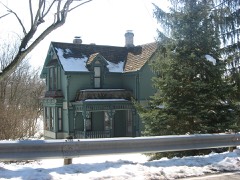
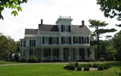
Listed on the National Register of Historic Places in
1984. A historic map-sheet match is not published yet. The record needs a coordinate-quality review before it can be joined to a sheet boundary.
From the record
one of 30 National Register listings in Warren County · listed in 1984 · category: Building.
National Register reference number.84003810- the number the National Park Service assigned this property when it was listed, and the key its nomination file is catalogued under at the National Archives.
Regional context, not property-specific
evidence. Museums hold 2,672 specimens
collected within 10 miles of Deardoff, Daniel L., House between 1881 and
1975: 2,619 Animalia, 44 Plantae, 9 Fungi. 12 distinct Species records are shown.
Collected by A Schwartz, A.C. Borror, A.R. Gaufin, H.H. Ross and others. Each is a
physical object with a catalogue
number, and each entry opens the museum's record. This is what was
collected and kept, not a survey of what lives here - nothing can be
concluded from a species being absent.
Regional context, not property-specific
evidence. The federal mineral resources record lists
3 workings within 5 miles of Deardoff, Daniel L., House: 2 producers, 1 plant.
All of them still produce. What was taken out: Sand and Gravel, Construction. Distance is straight-line from the
map coordinates, so a quarry counted here may appear on a neighbouring
settlement's page as well.
Regional context, not property-specific
evidence. The National Weather Service names
Franklin, the town this property stands in, in 26 storm reports between 1994 and 2022: 17 thunderstorm wind, 4 hail, 4 flood, 1 flash flood.
The reports record 2 injuries. Each account below is quoted exactly as the forecast office
filed it, from the NOAA Storm Events Database, and each date
opens the federal record of that event.
Strong winds took a chair into the air, striking a person. The metal roof from a car wash in Springboro was torn off. Also, scaffolding and several trees were knocked down.
A portion of the roof was removed by the wind at the Townsend Auto Sales building along State Route 122. Several automobiles on the lot sustained minor damage.
No historic map-sheet match is published
for this property yet. That does not mean no map exists. This record needs
a coordinate-quality review before it can be joined to a sheet boundary.
Browse the county's mapped places while that work is
pending.
From the nomination file
3,060 words on record
When this property was proposed for the
National Register, someone wrote the case for it: what the building is,
and why it matters. That document is a federal record in the public domain.
It is quoted below word for word, never summarised. The text was read off the scanned case file by machine, so the
occasional stray character is the recogniser's and the 1970s
typewriter's.
Description of the property
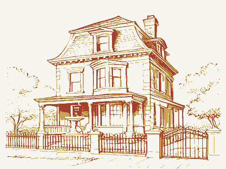
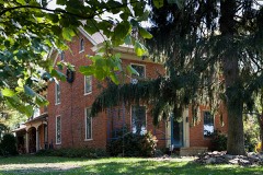
over the narrow segmental arch windows.Metal cresting in a circle-and-diamond design A small two-story wing on the east side of the house is partially constructed of Check one The central pavilion on the front facade contains a segmental-arched entry which for bathroom and kitchen alterations. The Daniel L.Deardoff House isa three-story Second Empire style brick farmhouse small one-story addition,ca.1975,is the only alteration to the building's original contains small brackets which alternate with longer ones located at the top of the posts. lintels,a feature shared by the entrance on the wing*s east side which also has a transom. .deteriorated _ unaltered Both the residence and its setting, with large expanses of fields to the south and east appearance.
The interior of the house retains its original integrity as well, except two identical dormers, while the south side contains three; on both sides the dormer supported by slender posts with large delicate brackets. The frieze area ofthe porch bricks from an earlier Deardoff farmhouse near this site, Although it is from the same and is reminiscent of an earlier farmhouse. Its 2/2 windows have plain rectangular stone with simple wood surrounds. The interior of the house is basically untouched, with two into the central hall from the flanking rooms. Smaller; sasymmetrically-placed rooms are X good Tow; a few of the top courses are missing from both chimneys. date fair a different piece of property, is situated about 300 feet east of the connected barns.
which have plain rectangular stone lintels. The full-width porch on the front facade is dominated by a large truncated gable which is topped by a finial in a scroll design. has an ornate hoodmold which features a keystone and scroll designs.All of the windows NPS Form 10-900-a OMB No. 1024-0018 Exp.
(in one paragraph) The Daniel L. Deardoff House is significant architecturally as a modest version modest when compared to high style interpretations, this residence is actually one of During the ninteenth century, the residents of Franklin Township were primarily engaged in farming activities, with pork and grain as their principal products. These cinnati and Dayton Turnpike and two railroads to the town of Franklin in the northern with its more modest contemporaries in the rural southern region of the township, hands including the nominated structure, which was built around 1883.
The transportation advantages which contributed to the farmers' prosperity and town's transformation to an important industrial center, particularly for paper mills, twentieth century (with the annexation of rural areas for suburban residential develop- ment) has resulted in its boundaries, and those of Carlisle, an adjacent town, to en- compass most of théspreviously rural areas in the northern part of the township. The south of the Deardoff House, which leads into Middletown, an industrial center..
New integrity in both its setting and structures, however, that makes it outstanding in township, primarily in the city of Franklin; which are quite substantial in appearance; township in the late ninteenth century, the Deardoff House is rare in both 1700-1799 1600-1699 1500-1599 1400-1499 economics transportation (CONTINUED) education 8. Significance Period humanitarian music industry Specific dates few decades. the family farm from his father, David, in 1869, who had acquired it in 1855 from his sculpture the township; along some of these roads, short lanes containing suburban residences residential developments have cropped up around Rte. 122,which is about a half-mile original acreage has diminished through the years, some of this land is still in family the township.
Although other farmhouses were constructed in the southern part of the this area.
Quoted from the National Register nomination
for reference 84003810, 21 pages, held by the National Archives in Record
Group 79. See the
catalogue record.
Listed places nearby
6 within 8 miles
Other National Register properties close
enough to walk or drive between, ordered by distance from this one. Both
positions come from the same geocoding pass that matched these properties
to their map sheets.
Listing record. National Park Service National Register of Historic Places, listed-properties dataset, current to 2026-05-22.
Map join. Address geocoded through the United States Census geocoder, then tested against the published boundary of every sheet in the USGS Historical Topographic Map Collection.
How this page is made. Listing fields come from federal records; map-sheet coverage is a labelled coordinate-to-boundary calculation, not a source-field claim.
Specimens. Global Biodiversity Information Facility (GBIF), https://www.gbif.org/. Only records licensed CC0 or CC BY are used. Records licensed CC BY-NC are excluded because this site carries advertising. Images are checked individually and any whose licence is non-commercial, no-derivatives or unreadable is refused.
Mines and quarries. USGS Mineral Resources Data System (MRDS) https://mrdata.usgs.gov/mrds/ A work of the United States government, no copyright under 17 U.S.C. 105.
Storms. NOAA National Centers for Environmental Information, Storm Events Database https://www.ncei.noaa.gov/stormevents/ A work of the United States government, no copyright under 17 U.S.C. 105. Narratives are quoted verbatim from the National Weather Service report and are not edited or summarised.
 Block
Block