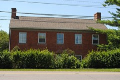
Listed on the National Register of Historic Places in
1979. A historic map-sheet match is not published yet. The record needs a coordinate-quality review before it can be joined to a sheet boundary.
From the record
“There has not yet been any flouring mill erected in this township, but several saw mills - some that have done a good business, and others that appeared to do well for a time, but were then suffered to run down. Amongst the former, are Dean's old mill, erected over thirty years ago, and now owned by Judge Heyl, and Park's mill ; and amongst the latter, was one erected by Mr.”
History of Franklin County [Ohio]: (1858). Machine-read text.
one of 295 National Register listings in Franklin County · listed in 1979 · category: Building · one of 3 National Historic Landmarks in Franklin County.
National Register reference number.79001841- the number the National Park Service assigned this property when it was listed, and the key its nomination file is catalogued under at the National Archives.
The ground it stands on
829 words
The chapter on Mifflin Township in History of Franklin County [Ohio]:, published 1858 names Gahanna. This is what it says, exactly as the scans read.
There has not yet been any flouring mill erected in this township, but several saw mills - some that have done a good business, and others that appeared to do well for a time, but were then suffered to run down. Amongst the former, are Dean's old mill, erected over thirty years ago, and now owned by Judge Heyl, and Park's mill ; and amongst the latter, was one erected by Mr. Janney, on Walnut Creek, about the year 1835 or '36, and afterward owned by J. M. Walcutt, Esq., and one erected by A. McElvain, on Alum Creek, about the year 1838 or '39. There is but one town or village in this township, and that is Gahanna, or Bridgeport, laid out part by John Clark, Esq., in 1848 or '49, and called Gahanna, and part by Jesse Baughman, Esq., in 1853, and called Bridgeport. There is a post office in this place, established in August, 1849. Thos. Young, Esq., was the first postmaster, and continued until July, 1853 ; w^hen John T. Baughman, the present incumbent, was appointed. There is another post office on Alum Creek, at Park's saw mill. This was established in 1851. The first postmaster was Jeremiah Lasure, who continued until 1853, when he was succeded by James Parks, Esq., the present incumbent.
Regional context, not property-specific
evidence. The
federal wildfire occurrence database
lists 1 fire within 5 miles of Shepard Street School between
2007 and 2007, burning about 0 acres in total. None started naturally. None was recorded as arson.
Distance is straight-line from the map coordinates, so a fire counted
here may appear on a neighbouring settlement's page as well.
Reported cause
Fires
Debris and open burning
1
The most recent of
them, most recent first, with the day each was reported and the service
that recorded it.
Regional context, not property-specific
evidence. Museums hold 10,352 specimens
collected within 10 miles of Shepard Street School between 1804 and
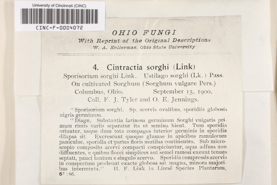
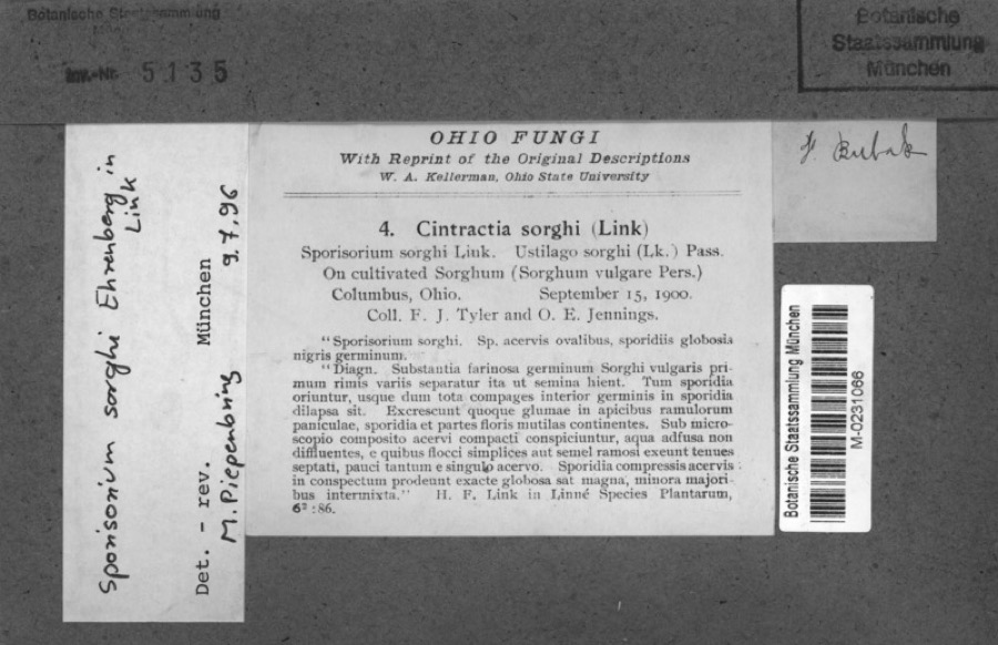
1975: 8,365 Animalia, 1,275 Fungi, 567 Plantae, 117 Chromista, 27 Unrecorded, 1 Protozoa. 12 distinct Species records are shown.
Collected by 19 V 1938 in original publication, Knull, =, ? and others. Each is a
physical object with a catalogue
number, and each entry opens the museum's record. This is what was
collected and kept, not a survey of what lives here - nothing can be
concluded from a species being absent.
Regional context, not property-specific
evidence. The federal mineral resources record lists
2 workings within 5 miles of Shepard Street School: 1 producer, 1 past producer.
1 still produces. What was taken out: Clay. Distance is straight-line from the
map coordinates, so a quarry counted here may appear on a neighbouring
settlement's page as well.
Regional context, not property-specific
evidence. The National Weather Service names
Gahanna, the town this property stands in, in 36 storm reports between 1994 and 2025: 20 thunderstorm wind, 9 hail, 4 flood, 2 flash flood.
No death or injury is recorded in these reports. Each account below is quoted exactly as the forecast office
filed it, from the NOAA Storm Events Database, and each date
opens the federal record of that event.
Hail up to hen egg size fell for up to 15 minutes across the eastern Columbus suburbs, causing extensive widespread damage to vehicles, homes and other structures. The hail accumulated up to several inches deep in spots, and remained on the ground well after the thunderstorm had passed.
Golf ball size hail fell for five to ten minutes across eastern Franklin county and covered the ground. Several homes and structures sustained damage from the hail.
No historic map-sheet match is published
for this property yet. That does not mean no map exists. This record needs
a coordinate-quality review before it can be joined to a sheet boundary.
Browse the county's mapped places while that work is
pending.
From the nomination file
2,024 words on record
When this property was proposed for the
National Register, someone wrote the case for it: what the building is,
and why it matters. That document is a federal record in the public domain.
It is quoted below word for word, never summarised. The text was read off the scanned case file by machine, so the
occasional stray character is the recogniser's and the 1970s
typewriter's.
Description of the property
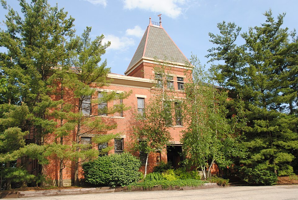
rising on it's own bearing walls, and housing the entry, then formed the southwest corner of the building much like a Victorian turret. The exterior walls, and majority of interior walls are made up of exposed red brick. this time had louvered dormers. The bell was rung by a rope which hung down into the principal's office. at the center of the now near symetrical front elevation, a detail associated with public buildings of that period. trim that was beyond repair was replaced with new wood carved to match the original. basement of the addition eliminating the need for the exterior well dug in 191'the removal of the out buildings with the advent of interior plumbing, and applying the Ist coat of paint to the exterior surface (which has since been chemically removed). CONDITION interior.
XALTERED CHECK ONE century schoolhouse architecture. The interior is presently being remodeled into offices by partitioning off the 6class- 19th century schoolhouse with Victorian influence.The square 55'high bell tower The school was designed to provide the community with an instructional facility and the structural spanning of doors and windows is done with wood. the architectural features express this.
Ornamentation and decorations are used The rest of the building jogs once on each side to meet the space required on the _UNEXPOSED The elevations are broken up with three foot wide and seven foot high windows grouped _EXCELLENT foundation walls.The 2 story structure is supported by 16"brick bearing wa1ls these elements.The school's bell was housed in the third floor of the at The top of the bell tower was capped with a weathervane and adjoining metal ornamenta- -RUINS case which makes a 90o turn half-way up.
The building, designed by F. L. Packard and constructed by Siegel & Ganz, sits on one of the highest points in Old Gahanna, with a scale that yields importance In 1915 the Gahanna Special School District was overrun with financial difficulties front elevation it's present, near symetrical appearance. In 1928 the School District built a new, modern high school. From that time until to private investors who remodeled it into a thirty-bed nursing home where elderly members of the community resided until 1975. The building was resold in 1976. By this time, the structure showed signs of neglect and was in jeopardy of being example of late 19th century school architecture, aided in it's preservation with petitions to the Zoning Board.
The Shepard Street School, at one time was where many of Gahanna's political, 1400-1499 1600-1699 1700-1799 residents. ART INVENTION ARCHEOLOGY-HISTORIC PHILOSOPHY X1800-1899 AGRICULTURE PERIOD RELIGION SCIENCE SCULPTURE ARCHITECTURE SIGNIFICANCE TRANSPORTATION ARCHEOLOGY-PREHISTORIC THEATER LITERATURE INDUSTRY _COMMUNICATIONS MUSIC MILITARY _CONSERVATION ENGINEERING EXPLORATION/SETTLEMENT POLITICS/GOVERNMENT XEDUCATION the second floor.
_PREHISTORIC the significance of the old schoolhouse to their city's history and as a prime 19th century schoolhouse has had a significant effect on Gahanna and it's business and scholastic leaders were educated.To others the building was a Jefferson Twp.Rural School District.By 1918 this merger created conditions which 1948,the Shepard Street School served as one of the district's elementary facilities. bell tower is still a visible landmark in the surrounding area. consisted of four classrooms with an auditorium and principal's office on In 1889 the Gahanna Special School District erected the Shepard Street School. The schoolhouse soon became a major focal point for the residents of Gahanna. _COMMERCE -_1500-1599 - 1900- It's physical stature and location were of prime importance.
Quoted from the National Register nomination
for reference 79001841, 22 pages, held by the National Archives in Record
Group 79. See the
catalogue record.
Listed places nearby
6 within 8 miles
Other National Register properties close
enough to walk or drive between, ordered by distance from this one. Both
positions come from the same geocoding pass that matched these properties
to their map sheets.
Listing record. National Park Service National Register of Historic Places, listed-properties dataset, current to 2026-05-22.
Map join. Address geocoded through the United States Census geocoder, then tested against the published boundary of every sheet in the USGS Historical Topographic Map Collection.
How this page is made. Listing fields come from federal records; map-sheet coverage is a labelled coordinate-to-boundary calculation, not a source-field claim.
Wildfire. Short, Karen C. 2022. Spatial wildfire occurrence data for the United States, 1992-2020 [FPA_FOD_20221014]. 6th Edition. Fort Collins, CO: Forest Service Research Data Archive. https://doi.org/10.2737/RDS-2013-0009.6 Collected with United States Government funding and usable without additional permissions or fees.
Specimens. Global Biodiversity Information Facility (GBIF), https://www.gbif.org/. Only records licensed CC0 or CC BY are used. Records licensed CC BY-NC are excluded because this site carries advertising. Images are checked individually and any whose licence is non-commercial, no-derivatives or unreadable is refused.
Mines and quarries. USGS Mineral Resources Data System (MRDS) https://mrdata.usgs.gov/mrds/ A work of the United States government, no copyright under 17 U.S.C. 105.
Storms. NOAA National Centers for Environmental Information, Storm Events Database https://www.ncei.noaa.gov/stormevents/ A work of the United States government, no copyright under 17 U.S.C. 105. Narratives are quoted verbatim from the National Weather Service report and are not edited or summarised.
 Block
Block