BlockBefore
Decorative drawing: a nineteenth-century public building. Not a photograph of this place.

Kahiki, The

Built in 1961. Listed on the National Register of Historic Places in 1997. A historic map-sheet match is not published yet. The record needs a coordinate-quality review before it can be joined to a sheet boundary.

From the record

“The Kahiki Supper Club was a Polynesian-themed restaurant in Columbus, Ohio. The supper club was one of the largest tiki-themed restaurants in the United States, and for a time, the only one in Ohio.”

Wikipedia article Kahiki Supper Club, CC BY-SA 4.0.

one of 295 National Register listings in Franklin County · listed in 1997 · category: Building · built in 1961 · one of 3 National Historic Landmarks in Franklin County.

Sources: the Wikipedia article · the case file at the National Archives · the National Register database, National Park Service

The listing

  • What is counted as historic. The nomination lists 2 buildingss, 1 site as contributing to the listing.
  • Address. 3583 E. Broad St., Columbus, 43213
  • When was it listed? 1997-12-08
  • Category. building
  • Township. Whitehall city
  • When was it built? 1961
  • National Register reference number. 97001461 - the number the National Park Service assigned this property when it was listed, and the key its nomination file is catalogued under at the National Archives.

Fires near this property

1 since 2007

Regional context, not property-specific evidence. The federal wildfire occurrence database lists 1 fire within 5 miles of Kahiki, The between 2007 and 2007, burning about 0 acres in total. None started naturally. None was recorded as arson. Distance is straight-line from the map coordinates, so a fire counted here may appear on a neighbouring settlement's page as well.

Reported cause Fires
Debris and open burning1

The most recent of them, most recent first, with the day each was reported and the service that recorded it.

DateCause SizeReported by Name on the report
10 October 2007Debris and open burningunder an acreOhio Department of Natural Resourcesnot named

Every fire recorded in Franklin County

Specimens collected near this property

12 of 10,473 shown

Regional context, not property-specific evidence. Museums hold 10,473 specimens collected within 10 miles of Kahiki, The between 1804 and 1975: 8,486 Animalia, 1,272 Fungi, 567 Plantae, 117 Chromista, 30 Unrecorded, 1 Protozoa. 12 distinct Species records are shown. Collected by 19 V 1938 in original publication, Knull, =, ? and others. Each is a physical object with a catalogue number, and each entry opens the museum's record. This is what was collected and kept, not a survey of what lives here - nothing can be concluded from a species being absent.

Image SpeciesYear Collected by Where, as recorded
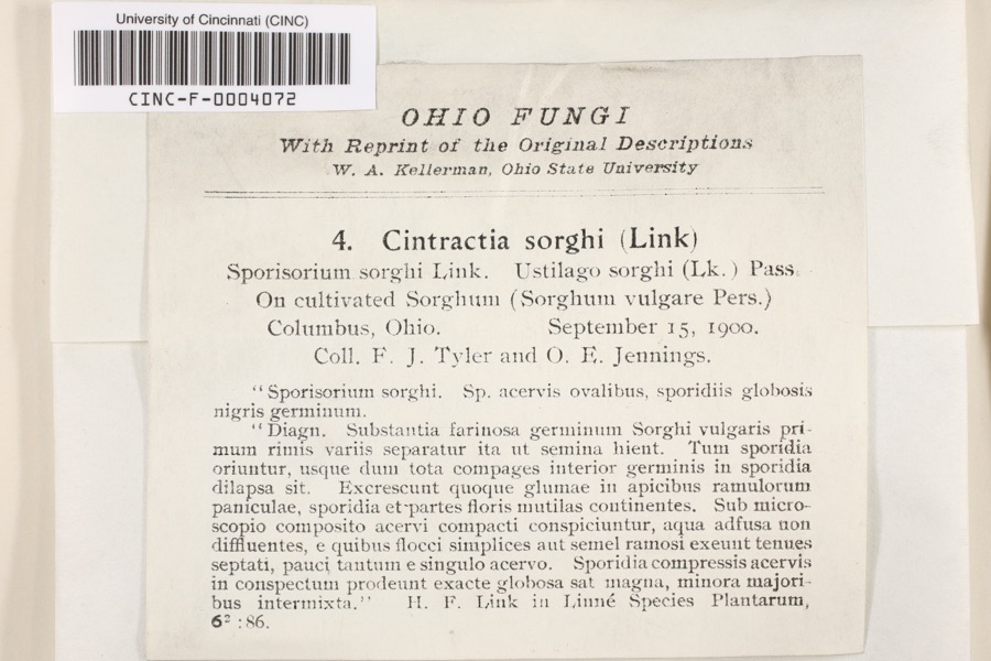
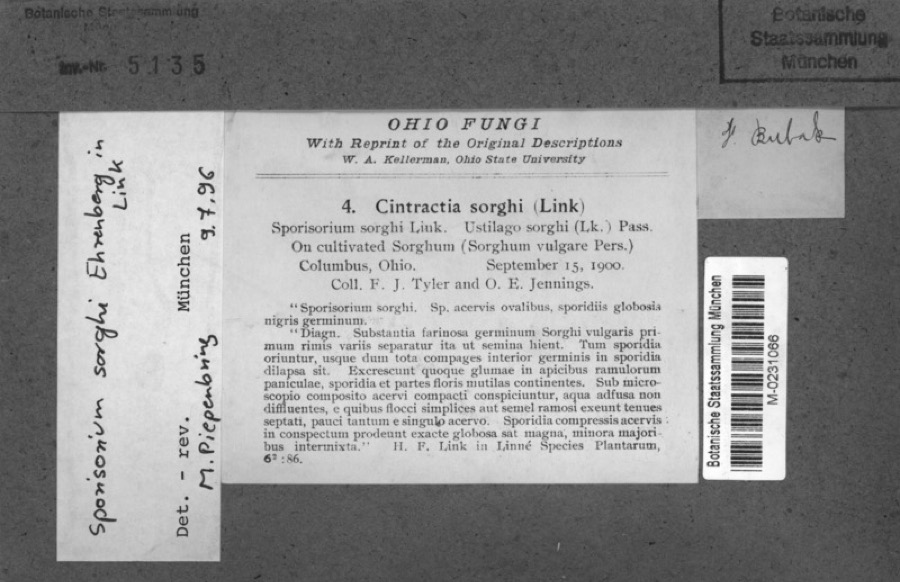
Specimen of Cintractia sorghi (Sorokn) De ToniCintractia sorghi (Sorokn) De Toni1900Tyler, F.J.; O. E. JenningsColumbus
Specimen of Sorghum bicolor (L.) MoenchSorghum bicolor (L.) Moench1900Jennings, O.E.Columbus, Ohio.
A photograph of the species Juniperus virginiana, not of this specimenJuniperus virginiana var. virginiana1804Dr. PaddockWorthington
A photograph of the species Platanthera psycodes, not of this specimenPlatanthera psycodes (L.) Lindl.1805J. R. PaddockWorthington
A photograph of the species Carex comosa, not of this specimenCarex comosa Boott1809Collector unknownWorthington, O. [Inferred county from precise loc.]
A photograph of the species Hirundo Linnaeus, not of this specimenHirundo Linnaeus, 17581814not recordedColumbus Ohio, Franklin, Ohio, USA
A photograph of the species Callimome strobiloides, not of this specimenCallimome strobiloides Huber, 19271821C. HuberColumbus
A photograph of the species Solidago riddellii, not of this specimenSolidago riddellii Frank1832W. A. KellermanA few miles N of Columbus.
A photograph of the species Carex lupulina, not of this specimenCarex lupulina Muhl. ex Willd.1834AnonymousColumbus.
A photograph of the species Anomodon viticulosus, not of this specimenAnomodon viticulosus (Hedw.) Hook. & Taylor1837W. S. SullivantNear Columbus
A photograph of the species Acris crepitans, not of this specimenAcris crepitans blanchardi Harper, 19471897not recordedNo Further Locality Data
Albugo candida (Pers. ex J.F.Gmel.) Roussel1897Clevenger, J. F.Columbus

All 10,473 specimens within 10 miles, at the Global Biodiversity Information Facility.

Mines and quarries near this property

2 within 5 miles

Regional context, not property-specific evidence. The federal mineral resources record lists 2 workings within 5 miles of Kahiki, The: 1 producer, 1 past producer. 1 still produces. What was taken out: Clay. Distance is straight-line from the map coordinates, so a quarry counted here may appear on a neighbouring settlement's page as well.

Where SiteCommodity StatusRecorded
Claycraft No 4 & 5 PitsClayProducer
Claycraft PitClayPast ProducerSedimentary

Every working recorded in Franklin County

Storms near this property

60 of 107 shown

Regional context, not property-specific evidence. The National Weather Service names Columbus, the town this property stands in, in 107 storm reports between 1993 and 2026: 56 thunderstorm wind, 26 hail, 13 flash flood, 11 flood. The reports record 9 injuries. Each account below is quoted exactly as the forecast office filed it, from the NOAA Storm Events Database, and each date opens the federal record of that event.

WhenEvent Place namedHarm What the report says
July 1994Thunderstorm WindColumbus4 hurt, $5,000Trees were downed, some on power lines. Four golfers were injured after lightning struck the shelter house they entered to take shelter from the storm.
August 1994Thunderstorm WindColumbus4 hurt, $5,000Trees were downed at several locations. Winds were measured at 59 mph at Port Columbus Airport. Four men were injured at an outdoor amphitheater when the tent they occupied was blown over.
April 1995Thunderstorm WindColumbus1 hurt, $50,000A microburst, with winds estimated to be between 80 and 100 mph, struck the west side of Columbus, destroying roofs of two industrial buildings. The debris from the roofs stretched 600 yards. A tractor-semitrailer was also blown over, injuring one male.
June 2016Tornado (EF0)Columbus$100,000Damage was first observed on Deserette Court. The west-facing|side of several housing units had shutters torn off and also|experienced minor siding damage. This is where it appears the|tornado first touched down.||On the opposite side of Deserette Court, additional shutter and|siding damage was observed, and primarily affected the east-facing|side of the housing units.||Damage continued to the east onto Boyleston Boulevard, with the|garage door of one home completely destroyed and walls of the|garage experiencing significant damage. Siding and roof damage was|also observed on this home, and damage is assessed to be in the|EF0 category, with winds around 80 mph. An eyewitness also stated|that she was looking west and saw a tornado moving toward|Boyleston Boulevard.||A swath of damage continued to the east, affecting homes along|Niantic Drive and Hingham Lane. Much of the damage was associated|with trees, where large tree branches in the back yards of|several homes on both Niantic Drive and Hingham Lane were snapped.|A convergent pattern was observed from 10 to 12 inch diameter tree|branches. Some damage to homes was also observed, including a|large portion of siding being stripped off the east-facing side of|a two story home. Minor roof damage was also noted on several|homes.||Damage became more sparse further east along Hingham Lane and was|confined to a few large hardwood tree branches being snapped off.
June 1994HailColumbus$50,000Lightning struck several buildings causing fires and destroying one home.
July 2011Flash FloodSouth Columbus$30,000Cars were stalled in moving water with water up to hoods of some cars on High Street due to heavy rain.
July 2002Flash FloodColumbus$22,000Two to three feet of water on some roads submerged some cars and caused others to float. On Leonard Street and 5th Avenue, a foot of water was entering the main level of some homes.
July 2013Thunderstorm WindSouth Columbus$20,000Several large old growth hardwood trees were blown down in Schiller Park due to thunderstorm winds. Large branches also fell on vehicles.
April 2013Thunderstorm WindColumbus$20,000Roofing materials were removed from several buildings, a gutter was blown down, power lines were downed, and fencing was partially blown over in northeastern Columbus due to damaging thunderstorm winds. These winds also blew a large tree down onto a house on Schleppi Road.
July 2011Flash FloodColumbus$20,000Several people were rescued from their vehicles at the intersection of Karl Road and Norris Drive.
April 2007HailColumbus$20,000Penny to golf ball size hail fell from downtown Columbus into the eastern suburbs.
June 2010Thunderstorm WindColumbus$10,000Damage occurred to the roof of a grocery store and trees were uprooted due to damaging thunderstorm winds.
May 2002HailColumbus$10,000Event occurred on the southeast side of town.
May 2002Thunderstorm WindColumbus$10,000Numerous trees and utility poles were downed across the county.
June 2002Thunderstorm WindColumbus$10,000Trees up to one foot in diameter and a few power poles were blown down near the intersection of Interstate 71 and North Broadway.
May 1997Thunderstorm WindColumbus$10,000Several trees and large limbs downed. Barn destroyed.
May 2007Thunderstorm WindColumbus$8,000A few structures sustained minor damage. Large tree limbs were downed as well.
June 2011Thunderstorm WindColumbus$7,000A tree was reported down on a house. Large tree limbs were also reported down in the area. These occurrences were due to damaging thunderstorm winds.
July 1995Thunderstorm WindColumbus$7,000Awnings were blown off two buildings in north Columbus, while several large tree limbs were blown down across the city.
February 2002HailColumbus$7,000no account filed
August 2022Thunderstorm WindSouth Columbus$5,000Several trees were downed in Green Lawn Cemetery.
July 2020Thunderstorm WindColumbus$5,000Several power poles and wires were downed onto 19th Avenue.
May 2015Thunderstorm WindSouth Columbus$5,000A tree fell onto a house in German Village.
June 2008Thunderstorm WindSouth Columbus$5,000Trees were uprooted just north of downtown in the Short North area. Large trees were also downed in German Village.
March 2007FloodColumbus$5,000Numerous roads were flooded throughout the Columbus metro area.
May 2000Flash FloodColumbus$5,000A second batch of heavy rainfall within several hours caused flooding of streets and overpasses.
August 2000Flash FloodColumbus$5,000Heavy rainfall caused flooded roads across the city.
October 1999Thunderstorm WindColumbus$5,000Trees and powerlines were knocked down in the Blendon Township area northeast of the city.
September 1998Thunderstorm WindColumbus$5,000Several power lines were knocked down on the south side of Columbus.
June 1998Thunderstorm WindColumbus$5,000Trees downed.
July 1997Thunderstorm WindColumbus$5,000Tree and power lines downed.
June 1994Thunderstorm WindColumbus$5,000Large trees were downed at Route 40 and Darbydale.
May 2006Thunderstorm WindColumbus$4,000Several ten inch diameter trees were downed.
March 2025Thunderstorm WindSouth Columbus$3,000Several trees were downed.
March 2025Thunderstorm WindSouth Columbus$3,000Several large softwood trees were snapped.
July 2019Thunderstorm WindSouth Columbus$3,000A few large trees were downed.
July 2018Thunderstorm WindColumbus$3,000A tree was downed onto some power lines.
May 2015Thunderstorm WindColumbus$3,000Several trees were downed on Kenlawn Street.
July 2013Thunderstorm WindColumbus$3,000The roof of a garage was partially detached from the rest of its structure due to thunderstorm winds.
July 2010Thunderstorm WindEast Columbus$3,000Trees and large limbs were reported down due to damaging thunderstorm winds. A billboard was also bent in half due to the storms.
August 2008Thunderstorm WindColumbus$3,000Three trees were knocked down, one in Clintonville and two in Westerville.
June 2008Thunderstorm WindSouth Columbus$3,000Large tree limbs were downed. Dumpsters were being blown down the street.
October 2006HailColumbus$3,000Several trees and large limbs were downed as well in downtown Columbus.
May 2001Flash FloodColumbus$3,000Child rescued from creek which was in flood. Several roads with high water.
November 1998Thunderstorm WindColumbus$3,000Trees down on the south side of Columbus.
July 1996Thunderstorm WindColumbus$3,000no account filed
July 1996Flash FloodColumbus$3,000no account filed
March 2025Thunderstorm WindSouth Columbus$2,000Large softwood trees were snapped.
August 2018FloodSouth Columbus$2,000Underpasses were flooded on the south side of Columbus, with some cars stuck in the water.
August 2016Thunderstorm WindSouth Columbus$2,000Trees were reported knocked down.
April 2011Thunderstorm WindSouth Columbus$2,000Trees and power lines were reported down due to damaging thunderstorm winds.
July 2010Flash FloodColumbus$2,000Six inches of water was running across high street due to heavy rainfall.
August 2007Thunderstorm WindColumbus$2,000Large tree limbs were downed.
August 2007Thunderstorm WindColumbus$2,000A few large tree limbs were knocked down.
July 2007Thunderstorm WindColumbus$2,000One tree and power lines were downed near the intersection of State Route 104 and Frank Road.
October 2006Flash FloodColumbus$2,000Several roads were flooded in and around downtown Columbus.
October 2006Thunderstorm WindColumbus$2,000Four large trees were knocked down at the Raymond Memorial Golf Course.
July 2021Thunderstorm WindColumbus$1,000A healthy tree was downed on Summit Street.
May 2020Thunderstorm WindColumbus$1,000A two foot diameter tree was downed in Glen Echo Ravine near Indianola Avenue.

Every storm recorded in Franklin County

Newspapers printed here

0 digitised pages

10 papers published in this town, digitised by the Library of Congress and free to read: 0 issues, 0 pages. Every page is searchable, so a name or a street can be looked for directly in what the town printed about itself at the time.

NewspaperPublished
Columbus Standard1898 to 1901
The Catholic Times1951 to Current
The Free American1887 to 18??
Daily Ohio Statesman1855 to 1870
Der Westbote1843 to 1871
Der Westbote1872 to 1918
Wochenblatt Des Westboten1871 to 1872
Eastern Review1958 to 1964
West Side News1946 to 1960
West Side News and Hilltop Record1960 to 1964

Map coverage status

No historic map-sheet match is published for this property yet. That does not mean no map exists. This record needs a coordinate-quality review before it can be joined to a sheet boundary. Browse the county's mapped places while that work is pending.

From the nomination file

9,065 words on record

When this property was proposed for the National Register, someone wrote the case for it: what the building is, and why it matters. That document is a federal record in the public domain. It is quoted below word for word, never summarised. The text was read off the scanned case file by machine, so the occasional stray character is the recogniser's and the 1970s typewriter's.

Statement of significance

Applicable National Register Criteria Areas of Significance (Mark "x" in one or more boxes for the criteria qualifying the property (Enter categories from instructions XD A Property is associated with events that have made a significant contribution to the broad patterns of L B Property is associated with the lives of persons significant in our past. XX C Property embodies the distinctive characteristics represents the work of a master, or possesses high artistic values, or represents a significant and Period of Significance distinguishable entity whose components lack information important in prehistory or history. Criteria Considerations (Mark "x" in all the boxes that apply.) Significant Person - B removed from its original location.

(Complete if Criterion Bis marked above) - C a birthplace or grave. Cultural Affiliation - D a cemetery. - E a reconstructed building, object, or structure. - F a commemorative property. XX G less than 50 years of age or achieved significance within the past 50 years. Ralph Sounik - Architect Ned Eller - Architect Coburn Morgan - Interior Designer Narrative Statement of Significance (Explain the significance of the property on one or more continuation sheets.) 9.

The whole case file for this property - 9,065 words, 93 pages, reproduced complete.

Quoted from the National Register nomination for reference 97001461, 93 pages, held by the National Archives in Record Group 79. See the catalogue record.

Listed places nearby

6 within 8 miles

Other National Register properties close enough to walk or drive between, ordered by distance from this one. Both positions come from the same geocoding pass that matched these properties to their map sheets.

Photograph PropertyDistance Listed
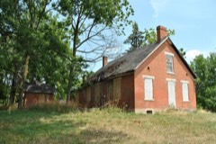
Drake, Elam, House1.8 miles1978
Old Port Columbus Airport Control Tower1.8 miles1979
Jeffrey, Malcolm, House1.9 miles1983
Duncan, Robert P., House2.0 miles1984
Huntington, Franz, House2.1 miles1980
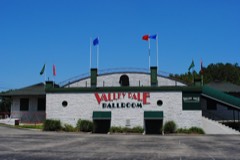
Valley Dale Ballroom2.2 miles1982

Sources for this property

National Archives recordThe nomination case file for reference 97001461 in Record Group 79.
Wikipedia articleCommunity-written account of this property, licensed CC BY-SA.
Franklin CountyAll 295 listed properties in this county.

Provenance

  • Listing record. National Park Service National Register of Historic Places, listed-properties dataset, current to 2026-05-22.
  • Map join. Address geocoded through the United States Census geocoder, then tested against the published boundary of every sheet in the USGS Historical Topographic Map Collection.
  • How this page is made. Listing fields come from federal records; map-sheet coverage is a labelled coordinate-to-boundary calculation, not a source-field claim.
  • Wildfire. Short, Karen C. 2022. Spatial wildfire occurrence data for the United States, 1992-2020 [FPA_FOD_20221014]. 6th Edition. Fort Collins, CO: Forest Service Research Data Archive. https://doi.org/10.2737/RDS-2013-0009.6 Collected with United States Government funding and usable without additional permissions or fees.
  • Specimens. Global Biodiversity Information Facility (GBIF), https://www.gbif.org/. Only records licensed CC0 or CC BY are used. Records licensed CC BY-NC are excluded because this site carries advertising. Images are checked individually and any whose licence is non-commercial, no-derivatives or unreadable is refused.
  • Mines and quarries. USGS Mineral Resources Data System (MRDS) https://mrdata.usgs.gov/mrds/ A work of the United States government, no copyright under 17 U.S.C. 105.
  • Storms. NOAA National Centers for Environmental Information, Storm Events Database https://www.ncei.noaa.gov/stormevents/ A work of the United States government, no copyright under 17 U.S.C. 105. Narratives are quoted verbatim from the National Weather Service report and are not edited or summarised.