Listed on the National Register of Historic Places in
1979. A historic map-sheet match is not published yet. The record needs a coordinate-quality review before it can be joined to a sheet boundary.
From the record
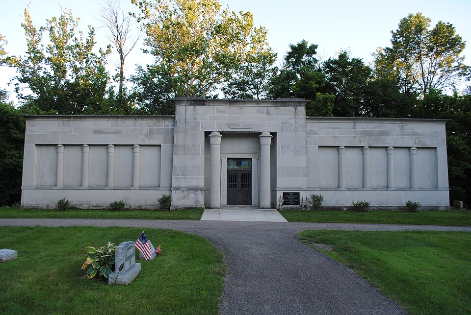
“Otterbein Mausoleum is a historic mausoleum located in Westerville, Ohio, United States, on the bank of Otterbein Cemetery. It was added to the National Register of Historic Places on November 29, 1979.”
Wikipedia article Otterbein Mausoleum, CC BY-SA 4.0.
one of 295 National Register listings in Franklin County · listed in 1979 · category: Building · one of 3 National Historic Landmarks in Franklin County.
National Register reference number.79001845- the number the National Park Service assigned this property when it was listed, and the key its nomination file is catalogued under at the National Archives.
Specimens collected near this property
12 of 3,758 shown
Regional context, not property-specific
evidence. Museums hold 3,758 specimens
collected within 10 miles of Otterbein Mausoleum between 1804 and
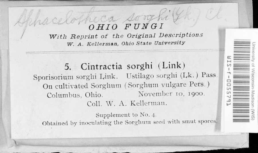
1975: 3,479 Animalia, 197 Plantae, 62 Fungi, 17 Chromista, 3 Unrecorded. 12 distinct Species records are shown.
Collected by A C Whitney, A. J. Basinger, A. J. P. and others. Each is a
physical object with a catalogue
number, and each entry opens the museum's record. This is what was
collected and kept, not a survey of what lives here - nothing can be
concluded from a species being absent.
Regional context, not property-specific
evidence. The National Weather Service names
Westerville, the town this property stands in, in 36 storm reports between 1994 and 2026: 19 thunderstorm wind, 12 hail, 2 flash flood, 2 flood.
No death or injury is recorded in these reports. Each account below is quoted exactly as the forecast office
filed it, from the NOAA Storm Events Database, and each date
opens the federal record of that event.
Hail up to the size of golf balls affected the north side of the Columbus metro area and southern Delaware county. Hail was extensive from Dublin, through Worthington and Powell, to Westerville. Trees and shrubs were stripped of their foliage and cars and homes sustained significant hail damage. The hail covered the ground in some locations up to six inches deep in Worthington in northern Franklin county and near the Polaris Mall in southern Delaware county.
No historic map-sheet match is published
for this property yet. That does not mean no map exists. This record needs
a coordinate-quality review before it can be joined to a sheet boundary.
Browse the county's mapped places while that work is
pending.
From the nomination file
1,477 words on record
When this property was proposed for the
National Register, someone wrote the case for it: what the building is,
and why it matters. That document is a federal record in the public domain.
It is quoted below word for word, never summarised. The text was read off the scanned case file by machine, so the
occasional stray character is the recogniser's and the 1970s
typewriter's.
Description of the property
is set back off Walnut Street a distance of approximately 500 feet, and is barely The front of the building is divided into three bays, with the middle bay being the except for the middle entrance bay of the front, consists of high-relief Egyptian The interior walls are faced in Vermont marble, and the space is lighted by cathedral The entrance bay projects slightly outward and upward from the remainder of the facade. Condition unexposed fair the doorway there is the vulture and sun disk symbol, which is typical of most Revival style pillars set in rectangular recesses, and backed by plain Bedford stone. set glass windows. Egyptian Revival buildings. The Otterbein Mausoleum is a one story structure with a simple T-shaped layout.It Check one visible from the road.
entrance.The sides of the Mausoleum also consist of three bays. A gorged and rolled cornice forms the upper limit of the building. ruins A concrete pad forms the foundation of the structure.At a height of approximately Areas of Significance-Check and justify below - prehistoric _archeology-prehistoric - archeology-historic _ conservation _ science - agriculture - sculpture X architecture . military - engineering . music _ commerce - philosophy .theater X 1900- - industry - politics/government _ transportation other (specify) Builder/Architect Columbus Mausoleum Company Statement of
Statement of significance
(in one paragraph) The Otterbein Mausoleum represents a unique and rare style of architecture known as number, but represents a style of architecture which attained a certain level of interest in the 1830s and later during the 1920s. The heavy massive walls, the gorged and rolled cornice, the capitals of columns which resemble palm tree leaves, and the style. There are few examples of this style in the greater Columbus area and this The building was planned for the community of Westerville by E. E. Redman, who was was built at a cost of $125,000 and was dedicated on November 30, 1924.
1600-1699 1800-1899 communications 1400-1499 economics 1700-1799 education invention art humanitarian literature Period exploration/settlement social/ law Specific dates 1924 familar vulture-and-sun-disk symbol all clearly reflect the Neo-Egyptian Revival is perhaps the best remaining. 8. Significance 1500-1599 - communityplanning landscape architecture _ religion Neo-Egyptian Revival. Egyptian and later Neo-Egyptian style buildings are small in a construction agent of the Columbus Mausoleum Company.The 3o0 crypt structure Harold Hancock. History of Westerville, Ohio, Westerville, 0., 1974.
Quoted from the National Register nomination
for reference 79001845, 12 pages, held by the National Archives in Record
Group 79. See the
catalogue record.
Listed places nearby
6 within 8 miles
Other National Register properties close
enough to walk or drive between, ordered by distance from this one. Both
positions come from the same geocoding pass that matched these properties
to their map sheets.
Listing record. National Park Service National Register of Historic Places, listed-properties dataset, current to 2026-05-22.
Map join. Address geocoded through the United States Census geocoder, then tested against the published boundary of every sheet in the USGS Historical Topographic Map Collection.
How this page is made. Listing fields come from federal records; map-sheet coverage is a labelled coordinate-to-boundary calculation, not a source-field claim.
Specimens. Global Biodiversity Information Facility (GBIF), https://www.gbif.org/. Only records licensed CC0 or CC BY are used. Records licensed CC BY-NC are excluded because this site carries advertising. Images are checked individually and any whose licence is non-commercial, no-derivatives or unreadable is refused.
Storms. NOAA National Centers for Environmental Information, Storm Events Database https://www.ncei.noaa.gov/stormevents/ A work of the United States government, no copyright under 17 U.S.C. 105. Narratives are quoted verbatim from the National Weather Service report and are not edited or summarised.
 Block
Block