 Block
BlockFrom the record
one of 295 National Register listings in Franklin County · listed in 2021 · category: Building · one of 3 National Historic Landmarks in Franklin County.
Sources: the National Register database, National Park Service

Listed on the National Register of Historic Places in 2021. A historic map-sheet match is not published yet. The record needs a coordinate-quality review before it can be joined to a sheet boundary.
one of 295 National Register listings in Franklin County · listed in 2021 · category: Building · one of 3 National Historic Landmarks in Franklin County.
Sources: the National Register database, National Park Service
Regional context, not property-specific evidence. Museums hold 3,447 specimens collected within 10 miles of Carnegie Library Otterbein University between 1804 and 1975: 3,362 Animalia, 52 Plantae, 28 Fungi, 3 Unrecorded, 2 Chromista. 12 distinct Species records are shown. Collected by A C Whitney, A. J. Penniman, A. P. Morgan and others. Each is a physical object with a catalogue number, and each entry opens the museum's record. This is what was collected and kept, not a survey of what lives here - nothing can be concluded from a species being absent.
| Image | Species | Year | Collected by | Where, as recorded |
|---|---|---|---|---|
 | Juniperus virginiana var. virginiana | 1804 | Dr. Paddock | Worthington |
 | Platanthera psycodes (L.) Lindl. | 1805 | J. R. Paddock | Worthington |
 | Carex comosa Boott | 1809 | Collector unknown | Worthington, O. [Inferred county from precise loc.] |
 | Serpoleskea confervoides (Brid.) Loeske | 1842 | W. S. Sullivant | 6 miles above Columbus |
 | Vireo olivaceus (Linnaeus, 1766) | 1870 | not recorded | Franklin, Ohio, USA |
 | Chaetura pelagica (Linnaeus, 1758) | 1873 | J M Wheaton | |
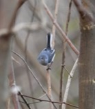 | Polioptila caerulea caerulea (Linnaeus, 1766) | 1875 | Muriealin, J | Flint? |
 | Aquila chrysaetos canadensis (Linnaeus, 1758) | 1878 | not recorded | Franklin, Ohio, USA |
 | Ameiurus natalis (Lesueur, 1819) | 1897 | R. Osburn & E. Williamson | Alum Creek, Franklin County, Ohio |
 | Ameiurus nebulosus (Lesueur, 1819) | 1897 | R. Osburn & E. Williamson | Olentangy River, Franklin County, Ohio |
 | Ericymba buccata Cope, 1865 | 1897 | R. Osburn & E. Williamson | Alum Creek, Franklin County, Ohio |
 | Etheostoma blennioides Rafinesque, 1819 | 1897 | R. Osburn & E. Williamson | Alum Creek, Franklin County, Ohio |
All 3,447 specimens within 10 miles, at the Global Biodiversity Information Facility.
Regional context, not property-specific evidence. The National Weather Service names Westerville, the town this property stands in, in 36 storm reports between 1994 and 2026: 19 thunderstorm wind, 12 hail, 2 flash flood, 2 flood. No death or injury is recorded in these reports. Each account below is quoted exactly as the forecast office filed it, from the NOAA Storm Events Database, and each date opens the federal record of that event.
| When | Event | Place named | Harm | What the report says |
|---|---|---|---|---|
| April 2003 | Hail | Westerville | $80,000,000 | Hail up to the size of golf balls affected the north side of the Columbus metro area and southern Delaware county. Hail was extensive from Dublin, through Worthington and Powell, to Westerville. Trees and shrubs were stripped of their foliage and cars and homes sustained significant hail damage. The hail covered the ground in some locations up to six inches deep in Worthington in northern Franklin county and near the Polaris Mall in southern Delaware county. |
| October 1999 | Lightning | Westerville | $20,000 | A lightning strike created a house fire, causing extensive damage to one residence. |
| August 2021 | Thunderstorm Wind | Westerville | $10,000 | Numerous trees were downed, including two that fell on houses. |
| July 2011 | Flash Flood | Westerville | $10,000 | County line road was closed between Spring Road and Hempstead Road due to high water caused by heavy rain. One car was stranded in the high water. |
| June 1998 | Thunderstorm Wind | Westerville | $5,000 | Numerous trees downed. |
| August 2020 | Thunderstorm Wind | Westerville | $3,000 | Three mature trees were knocked down near the intersection of County Line and Hempstead Roads. |
| August 2020 | Thunderstorm Wind | Westerville | $3,000 | Several trees were knocked down near the intersection of Walnut Street and Orchard Lane. |
| September 2018 | Flash Flood | Westerville | $3,000 | High water was reported on numerous roads through the city of Westerville. Several cars became stranded in the high water. |
| June 2006 | Thunderstorm Wind | Westerville | $3,000 | Trees were knocked down a mile or two south of the Polaris area. |
| July 2003 | Thunderstorm Wind | Westerville | $3,000 | Several trees were knocked down. |
| May 1995 | Thunderstorm Wind | Westerville | $3,000 | Trees downed. |
| August 2020 | Thunderstorm Wind | Westerville | $1,000 | A large section of a 50 foot tall tree was knocked down. |
| June 2014 | Thunderstorm Wind | Westerville | $1,000 | Two large trees were downed due to thunderstorm winds. |
| September 2012 | Thunderstorm Wind | Westerville | $1,000 | Tree limbs were downed in the area of Westerville due to thunderstorm winds. |
| June 2011 | Thunderstorm Wind | Westerville | $1,000 | A large tree limb was broken due to damaging thunderstorm winds. |
| September 2010 | Thunderstorm Wind | Westerville | $1,000 | Trees were reported down due to damaging thunderstorm winds. |
| August 2010 | Thunderstorm Wind | Westerville | $1,000 | Trees were reported down due to damaging thunderstorm winds. |
| August 2010 | Thunderstorm Wind | Westerville | $1,000 | Trees were reported down due to damaging thunderstorm winds. |
| April 2024 | Thunderstorm Wind | Westerville | $500 | Several large tree limbs were downed. |
| July 2023 | Hail | Westerville | - | Pea to dime sized hail was covering the ground. |
| August 2022 | Flood | Westerville | - | High water was encroaching on a building at Columbus State Community College. |
| June 2014 | Flood | Westerville | - | Park Meadow Road near Schrock Road was closed due to high water caused by heavy rainfall. |
| June 2012 | Thunderstorm Wind | Westerville | - | The spotter estimated the magnitude of the thunderstorm wind gust. |
| June 2010 | Thunderstorm Wind | Westerville | - | A trained spotter estimated the wind gust. |
| March 2026 | Hail | Westerville | - | no account filed |
| March 2026 | Hail | Westerville | - | no account filed |
| March 2024 | Hail | Westerville | - | no account filed |
| April 2024 | Hail | Westerville | - | no account filed |
| July 2023 | Hail | Westerville | - | no account filed |
| March 2022 | Hail | Westerville | - | no account filed |
| August 2012 | Hail | Westerville | - | no account filed |
| March 2012 | Hail | Westerville | - | no account filed |
| June 2011 | Thunderstorm Wind | Westerville | - | no account filed |
| August 2006 | Thunderstorm Wind | Westerville | - | no account filed |
| August 2003 | Hail | Westerville | - | no account filed |
| June 1994 | Hail | Westerville | - | no account filed |
No historic map-sheet match is published for this property yet. That does not mean no map exists. This record needs a coordinate-quality review before it can be joined to a sheet boundary. Browse the county's mapped places while that work is pending.
Other National Register properties close enough to walk or drive between, ordered by distance from this one. Both positions come from the same geocoding pass that matched these properties to their map sheets.
| Photograph | Property | Distance | Listed |
|---|---|---|---|
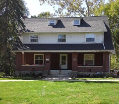 | Temperance Row Historic District | 0.1 miles | 2008 |
 | Hanby, Benjamin, House | 0.2 miles | 1970 |
 | Westerville High School-Vine Street School | 0.4 miles | 1975 |
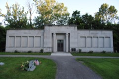 | Otterbein Mausoleum | 0.4 miles | 1979 |
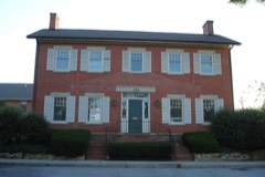 | Alkire House | 0.5 miles | 1978 |
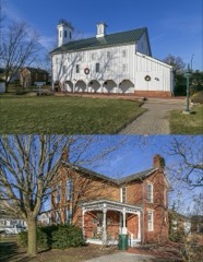 | Everal, John W., Farm Buildings | 0.7 miles | 1975 |
| National Archives record | The nomination case file for reference 100006110 in Record Group 79. |
| Franklin County | All 295 listed properties in this county. |