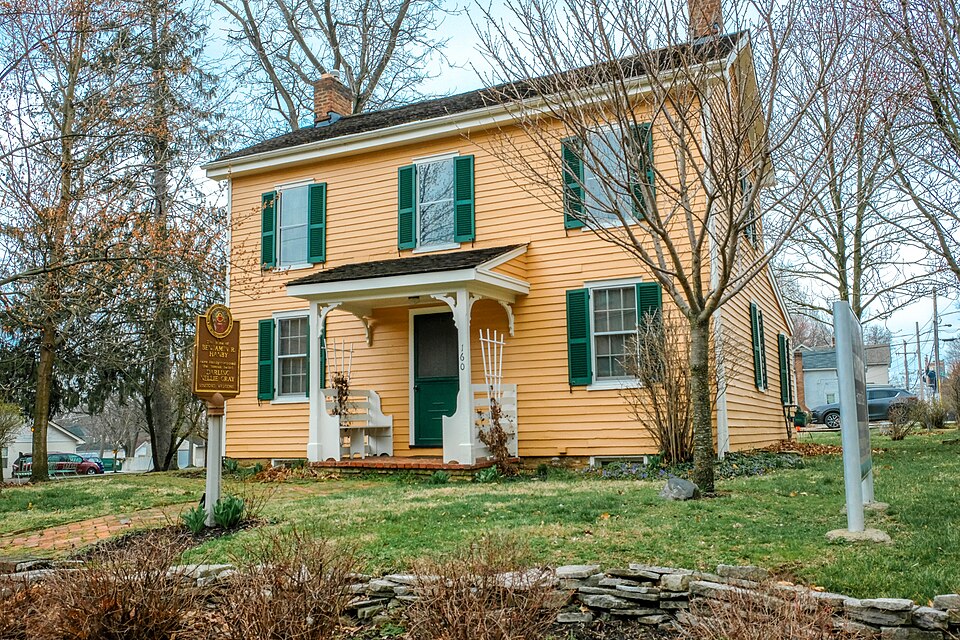
Listed on the National Register of Historic Places in
1970. A historic map-sheet match is not published yet. The record needs a coordinate-quality review before it can be joined to a sheet boundary.
From the record
one of 295 National Register listings in Franklin County · listed in 1970 · category: Building · one of 3 National Historic Landmarks in Franklin County.
National Register reference number.70000493- the number the National Park Service assigned this property when it was listed, and the key its nomination file is catalogued under at the National Archives.
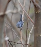
Specimens collected near this property
12 of 3,458 shown
Regional context, not property-specific
evidence. Museums hold 3,458 specimens
collected within 10 miles of Hanby, Benjamin, House between 1804 and
1975: 3,373 Animalia, 53 Plantae, 27 Fungi, 3 Unrecorded, 2 Chromista. 12 distinct Species records are shown.
Collected by A C Whitney, A. J. Penniman, A. P. Morgan and others. Each is a
physical object with a catalogue
number, and each entry opens the museum's record. This is what was
collected and kept, not a survey of what lives here - nothing can be
concluded from a species being absent.
Regional context, not property-specific
evidence. The National Weather Service names
Westerville, the town this property stands in, in 36 storm reports between 1994 and 2026: 19 thunderstorm wind, 12 hail, 2 flash flood, 2 flood.
No death or injury is recorded in these reports. Each account below is quoted exactly as the forecast office
filed it, from the NOAA Storm Events Database, and each date
opens the federal record of that event.
Hail up to the size of golf balls affected the north side of the Columbus metro area and southern Delaware county. Hail was extensive from Dublin, through Worthington and Powell, to Westerville. Trees and shrubs were stripped of their foliage and cars and homes sustained significant hail damage. The hail covered the ground in some locations up to six inches deep in Worthington in northern Franklin county and near the Polaris Mall in southern Delaware county.
No historic map-sheet match is published
for this property yet. That does not mean no map exists. This record needs
a coordinate-quality review before it can be joined to a sheet boundary.
Browse the county's mapped places while that work is
pending.
From the nomination file
1,699 words on record
When this property was proposed for the
National Register, someone wrote the case for it: what the building is,
and why it matters. That document is a federal record in the public domain.
It is quoted below word for word, never summarised. The text was read off the scanned case file by machine, so the
occasional stray character is the recogniser's and the 1970s
typewriter's.
Description of the property
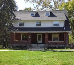
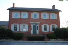
The house, which was constructed about 1850, is a small, 2-story frame The first floor contains a parlor, a bedroom and the kitchen and the the building restored, using many pieces of furniture and personal interest are a walnut desk made by Benjamin, his piano, the original plates for the first edition of "Darling Nelly Gray" and a large APR 13 1971 CONDITION DESCRIPTION Excellent Good REGISTER NATIONAL Fair collection of sheet music and books which contain Hanby songs. items belonging to or associated with the Hanby family.Of special including kitchen, are 28'across the front and 30' deep.
center of the 3-part front.Overall dimensions of the first floor, (Check One) A Moved - Original Site building with a low kitchen wing at the rear and a small porch at the RECEIVED PERIOD (Check One or More as Appropriate) - Pre-Columbian | - 20th Century SPECIFIC DATE(S) (lf Applicable and Known) - Landscape APR 13 1971 - Literature his family moved to Circleville and, in 1853, to Westerville, where Benjamin's father, the Rev. William Hanby, was active in the United the music, at a musical gathering for friends in the Hanby parlor. His 1853 Architecture Commerce Aboriginal Military Transportation Education the words.
Communications Science Conservation Theater Political Engineering Agriculture itarian "Darling Nelly Gray" was popular in the pre-Civil War days, promoting so Sculpture Prehistoric much antislavery sentiment that it was referred to as the Uncle Tom's Industry Social/Human In 1858 Hanby graduated from Otterbein and soon after married Mary Urban Planning Hanby first presented the song, for which he wrote both the words and and then in Chicago. graduation Benjamin served as college agent in neighboring states, then inspiration for Hanby's best-known song, "Darling Nelly Gray." Brethren Church and was one of the founders of Otterbein College.
Religion/Phi- suggested that he send the manuscript to a publisher.He submitted it music teacher, Miss Cornelia Walker, to whom the song was dedicated, Hanby died in 1867 in Chicago at the age of 34,and his body was buried Other (Specify) at Rushville in 1842while attempting to reach Canada where he hoped to SIGNIFICANCE AREAs OF SIGNIFICANCE (Check One or More as Appropriate) REGISTER Katherine Winter, a member of Otterbein's first class (1857). After as principal of an academy, before entering the ministry. A few years X Music rejected until his sister heard it sung at a recital. It was soon later he resigned because of the church members' opposition to his losophy Art In all, Hanby wrote sixty-eight songs. Among them are two Christmas name but secured the copyright for themselves.
Hanby sued the firm, church. He then worked for musical publishers, first in Cincinnati in Otterbein Cemetery at Westerville.The home where he and his family Hanby was born at Rushville, in Fairfield County in 1833. From there The Ohio Historical Society in 1936 by the Benjamin R.Hanby National
Quoted from the National Register nomination
for reference 70000493, 14 pages, held by the National Archives in Record
Group 79. See the
catalogue record.
Listed places nearby
6 within 8 miles
Other National Register properties close
enough to walk or drive between, ordered by distance from this one. Both
positions come from the same geocoding pass that matched these properties
to their map sheets.
Listing record. National Park Service National Register of Historic Places, listed-properties dataset, current to 2026-05-22.
Map join. Address geocoded through the United States Census geocoder, then tested against the published boundary of every sheet in the USGS Historical Topographic Map Collection.
How this page is made. Listing fields come from federal records; map-sheet coverage is a labelled coordinate-to-boundary calculation, not a source-field claim.
Specimens. Global Biodiversity Information Facility (GBIF), https://www.gbif.org/. Only records licensed CC0 or CC BY are used. Records licensed CC BY-NC are excluded because this site carries advertising. Images are checked individually and any whose licence is non-commercial, no-derivatives or unreadable is refused.
Storms. NOAA National Centers for Environmental Information, Storm Events Database https://www.ncei.noaa.gov/stormevents/ A work of the United States government, no copyright under 17 U.S.C. 105. Narratives are quoted verbatim from the National Weather Service report and are not edited or summarised.
 Block
Block