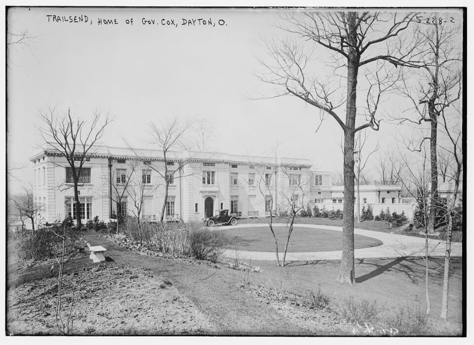
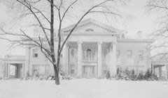
Photograph by Bain News Service, Public domain. Via
Wikimedia Commons.
Trailsend
Listed on the National Register of Historic Places in
1979. A historic map-sheet match is not published yet. The record needs a coordinate-quality review before it can be joined to a sheet boundary.
From the record
one of 117 National Register listings in Montgomery County · listed in 1979 · category: Building · one of 4 National Historic Landmarks in Montgomery County.
National Register reference number.79001905- the number the National Park Service assigned this property when it was listed, and the key its nomination file is catalogued under at the National Archives.
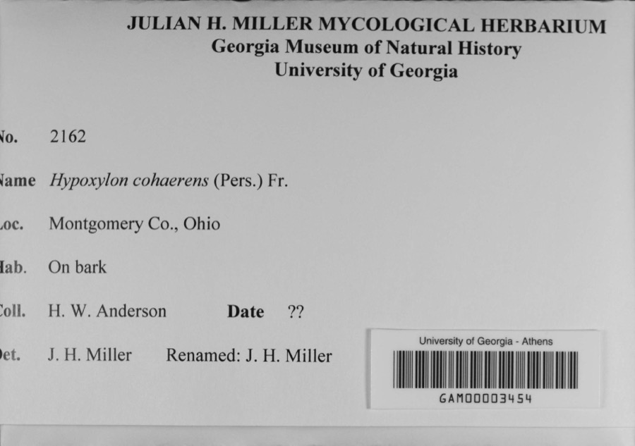
Specimens collected near this property
12 of 577 shown
Regional context, not property-specific
evidence. Museums hold 577 specimens
collected within 10 miles of Trailsend between 1836 and
1975: 424 Animalia, 88 Plantae, 56 Fungi, 4 Protozoa, 4 Chromista, 1 Unrecorded. 12 distinct Species records are shown.
Collected by A JOHN, A JOHN AND W E DUELLMAN, A. E. Foeerste and others. Each is a
physical object with a catalogue
number, and each entry opens the museum's record. This is what was
collected and kept, not a survey of what lives here - nothing can be
concluded from a species being absent.
Regional context, not property-specific
evidence. The federal mineral resources record lists
16 workings within 5 miles of Trailsend: 8 past producers, 8 producers.
8 still produce. What was taken out: Sand and Gravel, Construction. Distance is straight-line from the
map coordinates, so a quarry counted here may appear on a neighbouring
settlement's page as well.
Regional context, not property-specific
evidence. The National Weather Service names
Kettering, the town this property stands in, in 27 storm reports between 1995 and 2023: 15 thunderstorm wind, 9 hail, 1 lightning, 1 flood.
The reports record 9 injuries. Each account below is quoted exactly as the forecast office
filed it, from the NOAA Storm Events Database, and each date
opens the federal record of that event.
Lightning struck a tree near a home where an outdoor party was occurring. Nine people standing near the tree suffered minor injuries including burned feet. One person was held overnight at the local hospital for observation, but everyone else affected was treated and released the same evening.
Many large limbs were reported down. Two roofs were blown off two apartment buildings and into a neighboring yard. Numerous trees and power lines were down throughout eastern Kettering. Kantner Park had a shelter damaged and picnic tables were tossed around. These occurrences were due to damaging thunderstorm winds.
No historic map-sheet match is published
for this property yet. That does not mean no map exists. This record needs
a coordinate-quality review before it can be joined to a sheet boundary.
Browse the county's mapped places while that work is
pending.
From the nomination file
2,042 words on record
When this property was proposed for the
National Register, someone wrote the case for it: what the building is,
and why it matters. That document is a federal record in the public domain.
It is quoted below word for word, never summarised. The text was read off the scanned case file by machine, so the
occasional stray character is the recogniser's and the 1970s
typewriter's.
Description of the property
The fenistration on the first range is recessed rectangular French door with transom. The building has gone through very few changes since its construction. The original butternut paneling still remains in the library and in the dining room. Some of wraparound terrace in 1959. The gymnasium and swimming pool located in the basement DATE XALTERED serves as an entrance way.The semicircular recessed doorway has an embrasure with classical paneled surround.The embrasure is smooth stone with a twelve- with entablature and keystone.Recessedpanels divide the ranges.Bays three and _RUINS AREAS OF
Statement of significance
one-time Governor of Ohio, James M. Cox. is considered to have been Ohio's most progressive governor and his first term is Cox was raised on his father's farm near Dayton during the 1870s and 80s, and worked successively as a school teacher, printer's devil, newspaper reporter, and secretary with the progressive reformers. Cox campaigned for and won election in 1912 on a platform that would propel Ohio into were the adoption of a direct primary law, reorganization of the courts, state workmen's compensation and penal reform. Cox was the Democratic nominee for President in 1920 but was defeated by Warren G. Harding in a popular backlash against Wilson.
After his defeat Cox retired to serve Trailsend was constructed while Cox was in the midst of his political career and re- Trailsend was designed by Oswald Hering of New York. Hering's speciality was country houses where he utilized an uncluttered symmetry of the classical revival that was unique for his time. He was also a noted author of architectural works, publishing Concrete and Stucco Houses in 1913, of which Trailsend is an excellent in fact, lists the Trailsend as one of the best examples of his work.
The quoins The Trailsend thus remains as an important historic and architectural landmark for 1700-1799 1400-1499 ENGINEERING 1800-1899 1500-1599 ART LAW RELIGION PERIOD CONSERVATION SCIENCE TRANSPORTATION SIGNIFICANCE AGRICULTURE INDUSTRY LITERATURE X1900- MILITARY SPECIFIC DATES 1915 XARCHITECTURE XPOLITICS/GOVERNMENT _EXPLORATION/SETTLEMENT _OTHER (SPECIFY) _PHILOSOPHY ARCHEOLOGY-HISTORIC -SCULPTURE INVENTION -1600-1699 _COMMERCE as an elder statesman and to manage his various newspaper holdings across the nation.
Quoted from the National Register nomination
for reference 79001905, 19 pages, held by the National Archives in Record
Group 79. See the
catalogue record.
Listed places nearby
6 within 8 miles
Other National Register properties close
enough to walk or drive between, ordered by distance from this one. Both
positions come from the same geocoding pass that matched these properties
to their map sheets.
Listing record. National Park Service National Register of Historic Places, listed-properties dataset, current to 2026-05-22.
Map join. Address geocoded through the United States Census geocoder, then tested against the published boundary of every sheet in the USGS Historical Topographic Map Collection.
How this page is made. Listing fields come from federal records; map-sheet coverage is a labelled coordinate-to-boundary calculation, not a source-field claim.
Specimens. Global Biodiversity Information Facility (GBIF), https://www.gbif.org/. Only records licensed CC0 or CC BY are used. Records licensed CC BY-NC are excluded because this site carries advertising. Images are checked individually and any whose licence is non-commercial, no-derivatives or unreadable is refused.
Mines and quarries. USGS Mineral Resources Data System (MRDS) https://mrdata.usgs.gov/mrds/ A work of the United States government, no copyright under 17 U.S.C. 105.
Storms. NOAA National Centers for Environmental Information, Storm Events Database https://www.ncei.noaa.gov/stormevents/ A work of the United States government, no copyright under 17 U.S.C. 105. Narratives are quoted verbatim from the National Weather Service report and are not edited or summarised.
 Block
Block