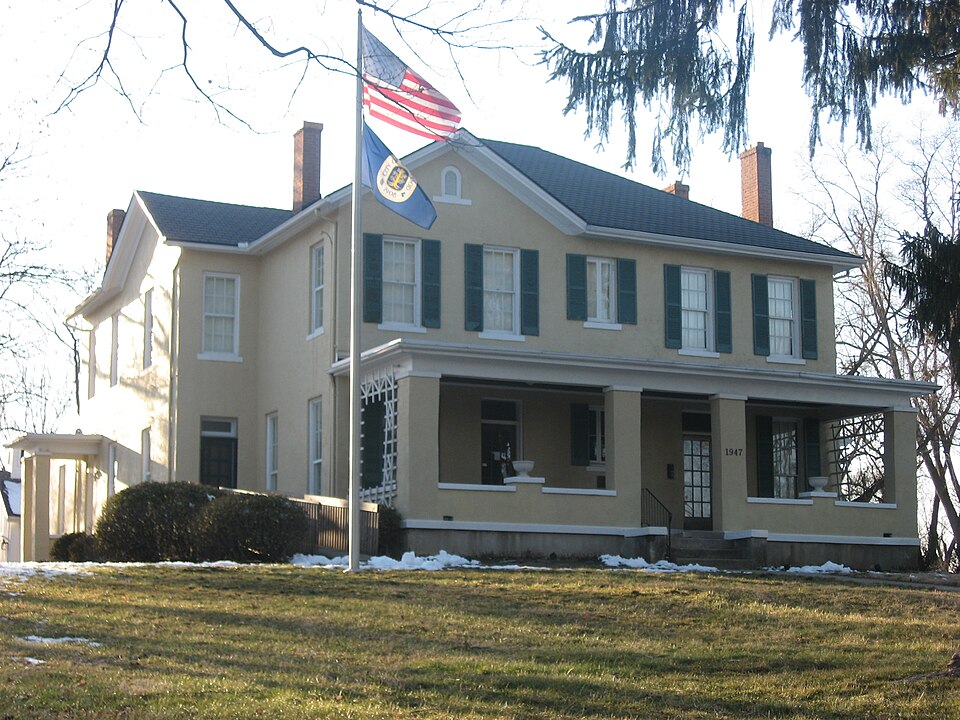
Listed on the National Register of Historic Places in
1987. A historic map-sheet match is not published yet. The record needs a coordinate-quality review before it can be joined to a sheet boundary.
From the record
one of 117 National Register listings in Montgomery County · listed in 1987 · category: Building · one of 4 National Historic Landmarks in Montgomery County.
National Register reference number.87001522- the number the National Park Service assigned this property when it was listed, and the key its nomination file is catalogued under at the National Archives.
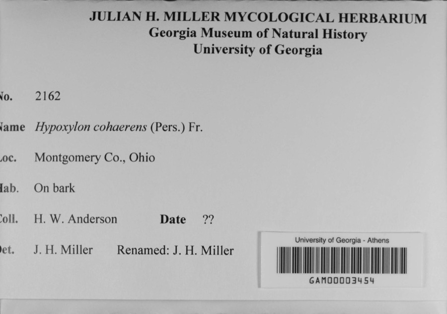
Specimens collected near this property
12 of 587 shown
Regional context, not property-specific
evidence. Museums hold 587 specimens
collected within 10 miles of Long--Romspert House between 1836 and
1975: 435 Animalia, 87 Plantae, 56 Fungi, 4 Protozoa, 4 Chromista, 1 Unrecorded. 12 distinct Species records are shown.
Collected by A JOHN, A JOHN AND W E DUELLMAN, A. E. Foeerste and others. Each is a
physical object with a catalogue
number, and each entry opens the museum's record. This is what was
collected and kept, not a survey of what lives here - nothing can be
concluded from a species being absent.
Regional context, not property-specific
evidence. The federal mineral resources record lists
15 workings within 5 miles of Long--Romspert House: 9 past producers, 6 producers.
6 still produce. What was taken out: Sand and Gravel, Construction. Distance is straight-line from the
map coordinates, so a quarry counted here may appear on a neighbouring
settlement's page as well.
Regional context, not property-specific
evidence. The National Weather Service names
Oakwood, the town this property stands in, in 10 storm reports between 2002 and 2025: 6 thunderstorm wind, 3 flood, 1 hail.
No death or injury is recorded in these reports. Each account below is quoted exactly as the forecast office
filed it, from the NOAA Storm Events Database, and each date
opens the federal record of that event.
An approximately 4.5 mile swath of intermittent wind damage, mainly to trees, was surveyed. In the Oakwood area, damage was broad and sporadic in nature, centered on Forrer Boulevard but extending several blocks north and south of the boulevard, over a half mile wide at times. Tree damage in this area was mostly comprised of small and large limb breaks, but a few uprooted trees were noted. Tree damage was not determined to be convergent or to have a particularly strong cross-path component when taken in sum, and pointed more to being non-tornadic in nature.||Gaps of more consistent wind damage were evident before another area of more concentrated wind damage in Kettering along Aragon Avenue and Vale Drive, including an apartment complex which had several trees heavily damaged. Like with the Oakwood area damage, little evidence of a concentrated tornadic circulation existed in the tree damage, which again consisted of large broken limbs and a couple uprooted trees.
A tree was downed on Shroyer Road and Wonderly Avenue and another was downed on a car near the intersection of Oakdale Avenue and White Oak Drive due to thunderstorm winds.
No historic map-sheet match is published
for this property yet. That does not mean no map exists. This record needs
a coordinate-quality review before it can be joined to a sheet boundary.
Browse the county's mapped places while that work is
pending.
From the nomination file
2,771 words on record
When this property was proposed for the
National Register, someone wrote the case for it: what the building is,
and why it matters. That document is a federal record in the public domain.
It is quoted below word for word, never summarised. The text was read off the scanned case file by machine, so the
occasional stray character is the recogniser's and the 1970s
typewriter's.
Description of the property
summary paragraph ruins Ownership completeness Accessible REJECT clarity unexposed dates resubmission Condition Status Discipline fair yes RETURN Action: good Montgomery County alterations/integrity Long-Romspert House Category boundary selection Substantive Review: deteriorated Present Use Working No. Federal Agency: AUG 13 1987 87001522 9/25/87 Nomination returned for: .technical corrections cited below substantive reasons discussed below Recom./Criteria_ 8.
Statement of significance
Applicable National Register Criteria Areas of Significance (enter categories from instructions) Period of Significance Significant Dates other: community growth and development State significance of property, and justify criteria, criteria considerations, and areas and periods of significance noted above. development, the early agricultural period of the mid to late nineteenth representation of the agricultural period. The Romspert renovation of rural farming area to a fashionable Dayton residential suburb. Henry Long's Italianate farmhouse represents the early agricultural period. This is especially true of the interior which remains relatively unchanged. He bought this apparently underdeveloped quarter 'section in 1857 for $280.00. 1and.
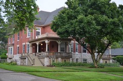
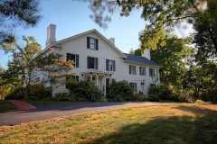
The area was primarily rural consisting of orchards and cornfields. off parcels of the original farmland as the 20th century suburban development successful lawyer and music publisher married Ethel Gilbert of a noted [X See continuation sheet 1917-1923 1866 Architect/Builder Significant Person Cultural Affiliation Italianate T-Plan farmhouse and outbuildings are the best surviving century and the explosive suburban growth in the early twentieth century.The The history and architecture of the Long-Romspert House reflects the history map shows a toll gate on the Pike located at the southeast corner of Henry of its time.
Henry Long was typical of the early settlers who cleared and farmed their Long also owned a sand and gravel quarry pit just west of what is today T-plan farmhouse was built in 1866 on Lebanon Far Hills Avenue). Jnationally Lstatewide *locally and developnent of Oakwood from the mid-19th century to the early 20th century. Three generations of the Long-Romspert family who lived in the house two children, Harry and Maude.
Quoted from the National Register nomination
for reference 87001522, 26 pages, held by the National Archives in Record
Group 79. See the
catalogue record.
Listed places nearby
6 within 8 miles
Other National Register properties close
enough to walk or drive between, ordered by distance from this one. Both
positions come from the same geocoding pass that matched these properties
to their map sheets.
Listing record. National Park Service National Register of Historic Places, listed-properties dataset, current to 2026-05-22.
Map join. Address geocoded through the United States Census geocoder, then tested against the published boundary of every sheet in the USGS Historical Topographic Map Collection.
How this page is made. Listing fields come from federal records; map-sheet coverage is a labelled coordinate-to-boundary calculation, not a source-field claim.
Specimens. Global Biodiversity Information Facility (GBIF), https://www.gbif.org/. Only records licensed CC0 or CC BY are used. Records licensed CC BY-NC are excluded because this site carries advertising. Images are checked individually and any whose licence is non-commercial, no-derivatives or unreadable is refused.
Mines and quarries. USGS Mineral Resources Data System (MRDS) https://mrdata.usgs.gov/mrds/ A work of the United States government, no copyright under 17 U.S.C. 105.
Storms. NOAA National Centers for Environmental Information, Storm Events Database https://www.ncei.noaa.gov/stormevents/ A work of the United States government, no copyright under 17 U.S.C. 105. Narratives are quoted verbatim from the National Weather Service report and are not edited or summarised.
 Block
Block