Listed on the National Register of Historic Places in
1979. A historic map-sheet match is not published yet. The record needs a coordinate-quality review before it can be joined to a sheet boundary.
From the record
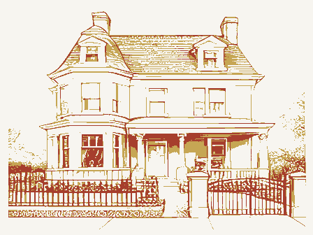
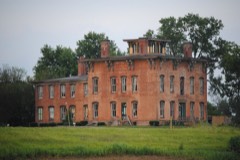
“Adams House was a registered historic building near Trinway, Ohio, United States, listed in the National Register on November 29, 1979. A housing development now sits in its place.”
Wikipedia article George W. Adams House, CC BY-SA 4.0.
one of 70 National Register listings in Muskingum County · listed in 1979 · category: Building.
National Register reference number.79001912- the number the National Park Service assigned this property when it was listed, and the key its nomination file is catalogued under at the National Archives.
Fires near this property
26 since 2012
Regional context, not property-specific
evidence. The
federal wildfire occurrence database
lists 26 fires within 5 miles of Adams, George W., House between
2012 and 2020, burning about 88 acres in total. None started naturally. None was recorded as arson.
Distance is straight-line from the map coordinates, so a fire counted
here may appear on a neighbouring settlement's page as well.
Reported cause
Fires
Debris and open burning
14
Missing data/not specified/undetermined
9
Power generation/transmission/distribution
2
Smoking
1
The most recent of
them, most recent first, with the day each was reported and the service
that recorded it.
Regional context, not property-specific
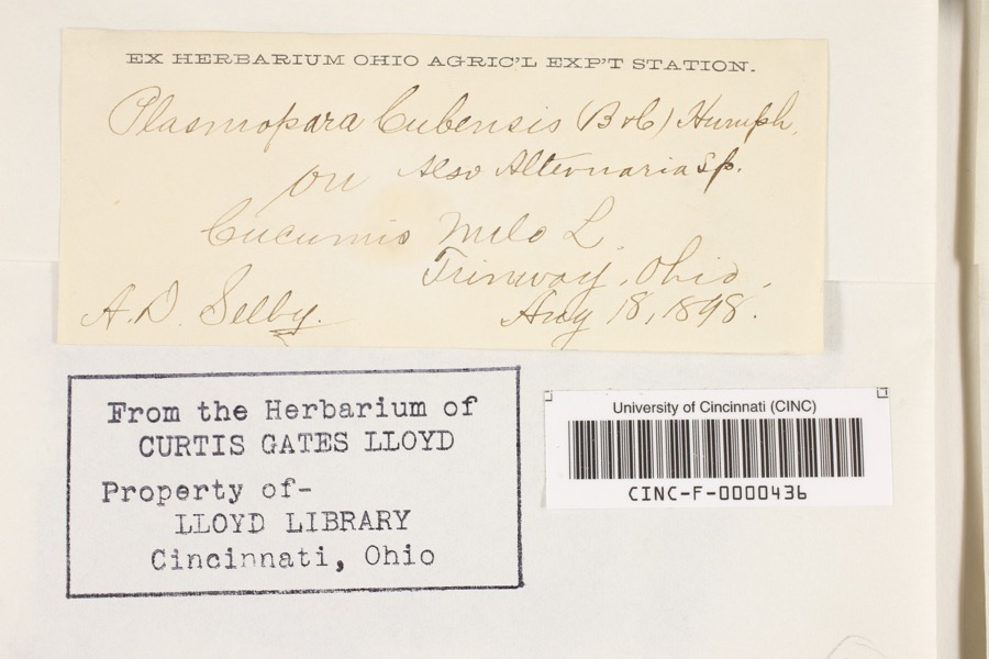
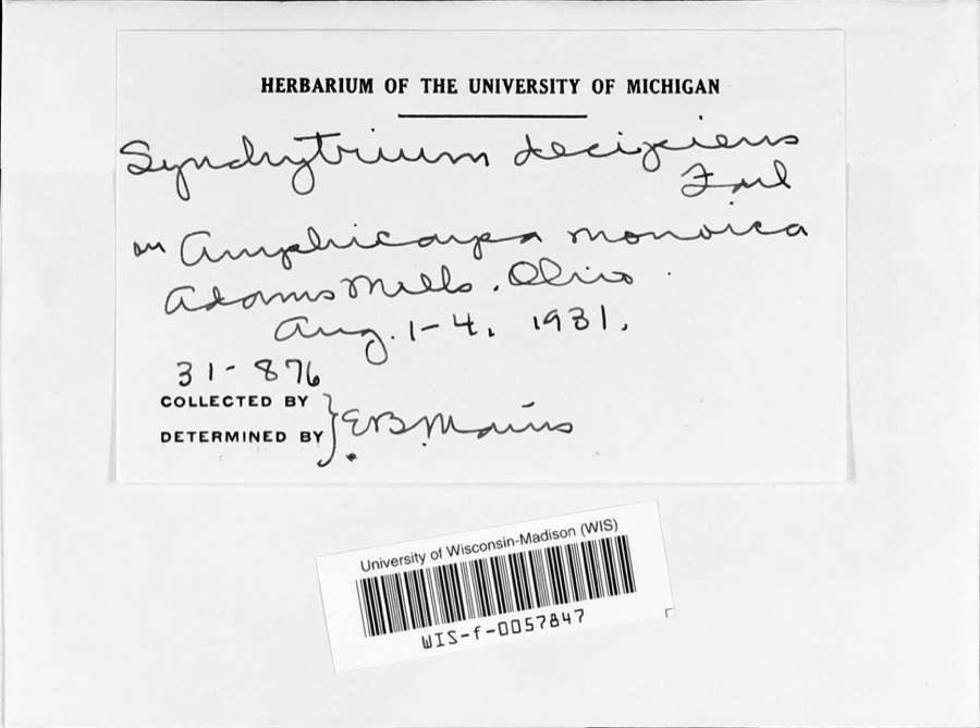
evidence. Museums hold 326 specimens
collected within 10 miles of Adams, George W., House between 1866 and
1974: 237 Animalia, 72 Plantae, 16 Fungi, 1 Chromista. 12 distinct Species records are shown.
Collected by A. Spreitzer, Andreas, Barbara; Cusick, Allison, Buker, W.C. and others. Each is a
physical object with a catalogue
number, and each entry opens the museum's record. This is what was
collected and kept, not a survey of what lives here - nothing can be
concluded from a species being absent.
Regional context, not property-specific
evidence. The federal mineral resources record lists
4 workings within 5 miles of Adams, George W., House: 2 past producers, 2 producers.
2 still produce. What was taken out: Sand and Gravel, Construction. Distance is straight-line from the
map coordinates, so a quarry counted here may appear on a neighbouring
settlement's page as well.
Regional context, not property-specific
evidence. The National Weather Service names
Trinway, the town this property stands in, in 8 storm reports between 2011 and 2025: 5 thunderstorm wind, 2 flash flood, 1 tornado.
No death or injury is recorded in these reports. Each account below is quoted exactly as the forecast office
filed it, from the NOAA Storm Events Database, and each date
opens the federal record of that event.
A local emergency manager reported that a high-water rescue took place along School House Road. Additional flooding was experienced along Moore Road and Hedges Lane. School House Road and Moore Road remained closed the following day.
A EF-0 tornado briefly touched down near the town of Twinway. Maximum winds were estimated at 70 MPH, with a path width of 25 yards. Video and pictures showed the tornado skipped as it touched down for less than one quarter mile. A large tree branch was on top of a home with no apparent damage, and areas of corn were knocked down in a field.
No historic map-sheet match is published
for this property yet. That does not mean no map exists. This record needs
a coordinate-quality review before it can be joined to a sheet boundary.
Browse the county's mapped places while that work is
pending.
From the nomination file
1,595 words on record
When this property was proposed for the
National Register, someone wrote the case for it: what the building is,
and why it matters. That document is a federal record in the public domain.
It is quoted below word for word, never summarised. The text was read off the scanned case file by machine, so the
occasional stray character is the recogniser's and the 1970s
typewriter's.
Description of the property
sheathed in clapboards, probably poplar, a characteristic wall treatment for houses of this period. It is basically a temple-form house, without the collonaded portico found on more pretentious temple-form residences. Its gable-end orientation is toward the south, featuring a three-bay facade with the main entrance offset to the right. This lower third is of panel wood. The original door itself has been replaced. The corners of the house, on the front and rear, are trimmed with plain cornerboards which termiante porated into the roof treatment is a molded fascia which extends. on all sides. The facade the original character of the interior is intact, including a handsome open-string stair in removed.
Secondly, a recessed one-story porch area near the north corner of the east wall The house stands on a 1.5 acre tract north of the village of Dresden and south of the statement which follows, Adams was a prominent miller and had a mill nearly; no remnent of the mill exists today.
CONDITION UNEXPOSED DATE MOVED DETERIORATED UNALTERED FAIR EXCELLENT First, an early one-story rear section with an asymmetrically-placed gable roof has been XGOOD into molded entablatures.Fenestration features exclusive use of six-over-six sash which entrance consists of the characteristic trabeated doorway with fixed transom and side- The George W.Adams House is a rectangular residential structure of wood frame con- features a pediment with a full cornice return and a tympanum of flush-set boards.The fireplace chimney and a kitchen stove chimney at the rear of the house. the hallway, and the original woodwork.Two alterations have taken place to the house. integrity of the structure.
rear has a partially.returned cornice.Two chimneys break the plan of.the roof:a central are set in plain casings.The house has a slate gable roof of mp derate pitch.Incor- -RUINS struction, set on a tooled sandstone foundation.
village itself does remain from the early 1830's. However, these structures are executed in the vernacular, and this house clearly stands out as the last remnant of the Classical Revival hereabouts. It embodies various elements of the Greek Revival, including its compact, block-like massing, its gable-end orientation and pedimental embellishment, and interior and exterior trim. (perhaps a 1og house) until his income and security permitted him to build this Adams became the largest landholder in the area, owning more than 14,000 acres. As his wealth increased, Adams apparently decided that his Greek Revival although he retained title to the older house.
1400-1499 ART EDUCATION X1800-1899 BUILDER/ARCHITECT AGRICULTURE SIGNIFICANCE PERIOD RELIGION MILITARY SCULPTURE ARCHEOLOGY-HISTORIC LITERATURE TRANSPORTATION XINDUSTRY _EXPLORATION/SETTLEMENT _CONSERVATION XARCHITECTURE X_POLITICS/GOVERNMENT SOCIAL/HUMANITARIAN _COMMUNICATIONS _PREHISTORIC est known surviving example of pure Greek Revival architecture in northern Muskingum _COMMERCE _ENGINEERING _1700-1799 -1500-1599 Adams' Miils),with his brother Edward.Later they built their mill at Dresden, It was built for G.W.Adams became the foremost industrialist _1900- -THEATER -1600-1699 - MUSIC -LAW COMMUNITY PLANNING. SPECIFIC DATES and entrepreneur of this area. He first opened a flour mill at Preston (now not far from his house.
It seems likely that Adams lived in a smaller dwelling at Dresden, the first of its kind built west of the Ohio River. He operated it home no longer met his needs or adequately reflected his position. In 1856 he mile to the northeast.
Quoted from the National Register nomination
for reference 79001912, 11 pages, held by the National Archives in Record
Group 79. See the
catalogue record.
Listed places nearby
2 within 8 miles
Other National Register properties close
enough to walk or drive between, ordered by distance from this one. Both
positions come from the same geocoding pass that matched these properties
to their map sheets.
Listing record. National Park Service National Register of Historic Places, listed-properties dataset, current to 2026-05-22.
Map join. Address geocoded through the United States Census geocoder, then tested against the published boundary of every sheet in the USGS Historical Topographic Map Collection.
How this page is made. Listing fields come from federal records; map-sheet coverage is a labelled coordinate-to-boundary calculation, not a source-field claim.
Wildfire. Short, Karen C. 2022. Spatial wildfire occurrence data for the United States, 1992-2020 [FPA_FOD_20221014]. 6th Edition. Fort Collins, CO: Forest Service Research Data Archive. https://doi.org/10.2737/RDS-2013-0009.6 Collected with United States Government funding and usable without additional permissions or fees.
Specimens. Global Biodiversity Information Facility (GBIF), https://www.gbif.org/. Only records licensed CC0 or CC BY are used. Records licensed CC BY-NC are excluded because this site carries advertising. Images are checked individually and any whose licence is non-commercial, no-derivatives or unreadable is refused.
Mines and quarries. USGS Mineral Resources Data System (MRDS) https://mrdata.usgs.gov/mrds/ A work of the United States government, no copyright under 17 U.S.C. 105.
Storms. NOAA National Centers for Environmental Information, Storm Events Database https://www.ncei.noaa.gov/stormevents/ A work of the United States government, no copyright under 17 U.S.C. 105. Narratives are quoted verbatim from the National Weather Service report and are not edited or summarised.
 Block
Block