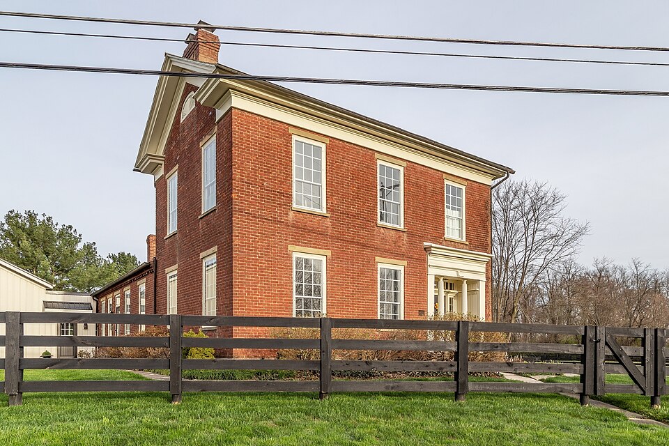
Listed on the National Register of Historic Places in
1979. A historic map-sheet match is not published yet. The record needs a coordinate-quality review before it can be joined to a sheet boundary.
From the record
“C., born 1835, post ofice, Somerset, O., occupation jeweler and watchn'aker. With his ownrude tools, while yet a boy on the farm, he began mending and cleaning watches, and achieving such wonders in the art that in 1863 he began business in Somerset, and since then has not only sustained it against severe and educated competition, until now, when local effort, though often attempted, has entirely withdrawn from the contest.”
1883 History Perry County, Ohio (1883). Machine-read text.
one of 11 National Register listings in Perry County · listed in 1979 · category: Building.
National Register reference number.79001924- the number the National Park Service assigned this property when it was listed, and the key its nomination file is catalogued under at the National Archives.
The ground it stands on
165,003 words
The chapter on Thorn Township in 1883 History Perry County, Ohio, published 1883 names Thornville. This is what it says, exactly as the scans read.
The internal improvements of Thorn township, until 1871, consisted of the common road only, but Millersport, in Fairfield county, is only a short distance from the northwest corner of the township, and is situated on the canal, and it became the place where most of the wheat was sold. Brooke & Lewis, Thorn township merchants (one from Thornville and the other from New Salem), built a warehouse on the canal a little east of Millersport, and, for several years, purchased nearly all the surplus wheat of the township, which, in the '30s, and up into the *40s, was very large, and the principal export, as the surplus corn was nearly all sold to drovers, and fed on the ground; for, until cattle were shipped East by the cars, there were large numbers from Southern Ohio, Kentucky, and Northern Indiana, driven through this township on the wav to the Eastern market. ;
In 1832, the Asiatic cholera raged fearfully in the central-southern part of the township, and a large number of deaths occurred. George Clum and William Friend, who lived in the cholera region, were about . the only grown male persons who did not take it; and yet, as long as the dreadful scourge raged there, these two men visited the sick, the dying, and prepared the dead for burial, neither of them sleeping in a bed for several weeks, so constant and untiring were they engaged in their sel@sacrificing ministrations. Dr. William Trevitt then resided in Thornville, distant five or six miles from the infected district. He was a skillful physician, and saved every case he reached before the patient got into a certain condition.. He kept three horses constantly bridled and saddled, and rode both day and night. Two of his horses dropped dead under the spur. He saved one of his patients after his horse fell dead, though he ran a considerable distance with his saddle-bags on his arm. If he had arrived five minutes later, it is believed, his patient would have died. After Henderson (tor that was the patient's name) got well, he went to Trevitt's office and inquired for his bill. Trevitt turned to his book, and told him the ordinary charge of only two or three dollars. Henderson asked'him what his horse was worth. Trev- : itt told him that he had paid eighty dollars for him, only a few days before. Thereupon Henderson took out his pocket-book and counted out eighty-five dollars, and offered the money to Trevitt, who declined to take any thing but his regular fee, which he took and put in his pocket. Henderson then took out change so as to leave just eighty dollars remaining, the price of the horse, which he left upon the counter, with an emphatic remark, that that money belonged to Trevitt; and not to him. The cholera raged fearfully for several weéks, and then disappeared as suddenly as it came. It was very bad in Newark, Licking county, at the same time.
Regional context, not property-specific
evidence. The
federal wildfire occurrence database
lists 5 fires within 5 miles of Whitmer, Soloman, House between
2007 and 2020, burning about 52 acres in total. None started naturally. None was recorded as arson.
Distance is straight-line from the map coordinates, so a fire counted
here may appear on a neighbouring settlement's page as well.
Reported cause
Fires
Debris and open burning
4
Missing data/not specified/undetermined
1
The most recent of
them, most recent first, with the day each was reported and the service
that recorded it.
Regional context, not property-specific
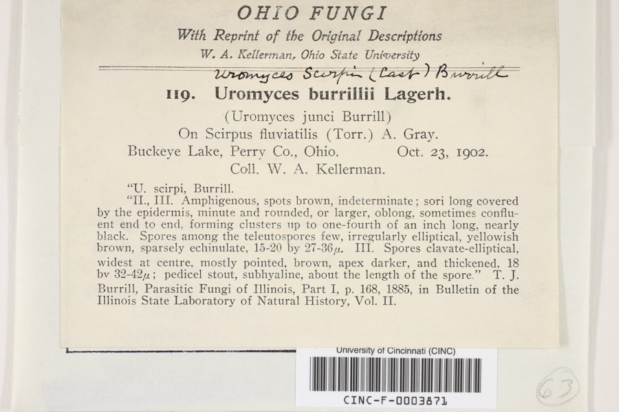
evidence. Museums hold 130 specimens
collected within 10 miles of Whitmer, Soloman, House between 1900 and
1965: 116 Animalia, 8 Plantae, 6 Fungi. 12 distinct Species records are shown.
Collected by Auten, Breakey, David H. Stansbery and others. Each is a
physical object with a catalogue
number, and each entry opens the museum's record. This is what was
collected and kept, not a survey of what lives here - nothing can be
concluded from a species being absent.
Regional context, not property-specific
evidence. The federal mineral resources record lists
1 working within 5 miles of Whitmer, Soloman, House: 1 plant.
All of them still produce. What was taken out: Stone, Crushed/Broken. Distance is straight-line from the
map coordinates, so a quarry counted here may appear on a neighbouring
settlement's page as well.
Regional context, not property-specific
evidence. The National Weather Service names
Thornville, the town this property stands in, in 33 storm reports between 1998 and 2025: 16 thunderstorm wind, 11 hail, 3 flood, 3 flash flood.
No death or injury is recorded in these reports. Each account below is quoted exactly as the forecast office
filed it, from the NOAA Storm Events Database, and each date
opens the federal record of that event.
Numerous large branches and trees fell across Perry County. Over 10,000 customers lost electricity. One shelter was set up in Crooksville High School in which 28 people stayed overnight. Fire houses were used as cooling stations and also to feed citizens. Some private stores gave away their foods before it would spoil. ||Public damage which includes damages to roads and clearing debris was on the order of $600,000. There was one indirect death to a 69 year old male that occurred in the Thornville vicinity. He had health issues, but the lack of electricity in the aftermath of the storm contributed to his death.
A bow echo type event with winds estimated at around 75 mph damaged outbuildings and caused an old barn to collapse. Several old and large trees were snapped.
Multiple creeks across northern Perry County flooded following heavy rain. The majority of the flooding was along Jonathan Creek, Honey Creek, Bowling Green Creek and their smaller tributaries. Many roads were closed due to high water, including Route 204 and 668 between Thornville and Mount Perry. Zartman Road was closed west of Thornville, and Blackbird Lane was closed north east of Thornville. Honey Creek Road was also closed just west of Thornport. Township Roads 21 and 390B both had sections washed out. A vehicle drove into high water along Boundries Road and the driver had to be rescued by the fire department.
One local downpour drifted south through extreme northern Perry County. This was in the vicinity of eastern reaches of Buckeye Lake. Roads were flooded from the county line on south toward Thornville. This included Boundary Road. Water was 1 foot deep on Honey Creek Road and Route 13. No dwellings were affected. ||Rain estimates were over 3 inches in less than 2 hours.
No historic map-sheet match is published
for this property yet. That does not mean no map exists. This record needs
a coordinate-quality review before it can be joined to a sheet boundary.
Browse the county's mapped places while that work is
pending.
From the nomination file
1,854 words on record
When this property was proposed for the
National Register, someone wrote the case for it: what the building is,
and why it matters. That document is a federal record in the public domain.
It is quoted below word for word, never summarised. The text was read off the scanned case file by machine, so the
occasional stray character is the recogniser's and the 1970s
typewriter's.
Description of the property
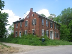
is rather severely inset, with the plane of the masonry wall being trimmed with engaged may have been built first, with the front, more elaborate section added shortly there- where a porch, once open, has been enclosed. open stair rises from the hallway to the attic, with the balustrade intact in its are deep, corresponding to the thickness of the masonry walls; and are highlighted CONDITION DESCRIPTION XEXCELLENT XALTERED ted with various agricultural outbuildings, the most outstanding of which is an immense door being highlighted by horizontal molding and flanked by a transom and sidelights. Some minor bond irregularities and a large basement fireplace indicate that this section extant;nor do photos survive to document their existence.
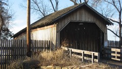
of the 2-story front section features a molded fascia which terminates in a partial are decorated with molded trim.All voids on the house are trabeated and no windows less than one mile north of the village of Thornville.The cultural landscape was dot- CHECK ONE Extending westward from the south corner of the west wall is a l-story brick ell. frame construction, with most of the frame comprised of hugh hand-hewn beech timbers. with molded wood trim.
Greek Revival, and is indicative öf the stylistic transition which took place in the"? 1802 with his brother-in-law, Peter Overmeyer. Whitmer had married Overmeyer's sister, Mary Magdaline, who bore him eleven children, the eighth of which was Soloman. By 1829 Through the years, the property passed to Soloman's son, John, and later to John's of Soloman Whitmer. Thus, the house and property remained in the Whitmer family for tion between these two styles which occurred in Ohio between 1830 and 1850.
The sun- Revival in form, the attenuation of its details, most notably the detached columns, are Whitmer House, located as it is in a rural area, is atypical of period residences in the 1400-1499 1600-1699 1700-1799 ECONOMICS INVENTION COMMUNICATIONS 1900- LAW ARCHEOLOGY-HISTORIC SCULPTURE ARCHEOLOGY-PREHISTORIC SIGNIFICANCE BUILDER/ARCHITECT THEATER PERIOD RELIGION X1800-1899 MILITARY TRANSPORTATION ENGINEERING AGRICULTURE INDUSTRY XEXPLORATION/SETTLEMENT 1500-1599 Architecturally, the Whitmer House displays interesting features of both the County is generally an area of folk and vernacular dwellings.Structures such as the first white child born in the newly-settled Perry County.He was the son of Peter (along the Ohio-Erie Canal) developed with specific mercantile interests and contain various The Soloman Whitmer House is nominated for its siginficance as an intact vestige _PREHISTORIC Soloman Whitmer had acquired 158 acres in Section 9 of Thorn Township, and by the are commonly aspects of the Greek Revival style.The major distinguishing Federal and Greek Revival styles, and should be considered as an example of the transi- early history of this rural area of southeastern ohio.
Quoted from the National Register nomination
for reference 79001924, 12 pages, held by the National Archives in Record
Group 79. See the
catalogue record.
Listed places nearby
3 within 8 miles
Other National Register properties close
enough to walk or drive between, ordered by distance from this one. Both
positions come from the same geocoding pass that matched these properties
to their map sheets.
Listing record. National Park Service National Register of Historic Places, listed-properties dataset, current to 2026-05-22.
Map join. Address geocoded through the United States Census geocoder, then tested against the published boundary of every sheet in the USGS Historical Topographic Map Collection.
How this page is made. Listing fields come from federal records; map-sheet coverage is a labelled coordinate-to-boundary calculation, not a source-field claim.
Wildfire. Short, Karen C. 2022. Spatial wildfire occurrence data for the United States, 1992-2020 [FPA_FOD_20221014]. 6th Edition. Fort Collins, CO: Forest Service Research Data Archive. https://doi.org/10.2737/RDS-2013-0009.6 Collected with United States Government funding and usable without additional permissions or fees.
Specimens. Global Biodiversity Information Facility (GBIF), https://www.gbif.org/. Only records licensed CC0 or CC BY are used. Records licensed CC BY-NC are excluded because this site carries advertising. Images are checked individually and any whose licence is non-commercial, no-derivatives or unreadable is refused.
Mines and quarries. USGS Mineral Resources Data System (MRDS) https://mrdata.usgs.gov/mrds/ A work of the United States government, no copyright under 17 U.S.C. 105.
Storms. NOAA National Centers for Environmental Information, Storm Events Database https://www.ncei.noaa.gov/stormevents/ A work of the United States government, no copyright under 17 U.S.C. 105. Narratives are quoted verbatim from the National Weather Service report and are not edited or summarised.
 Block
Block