BlockBefore
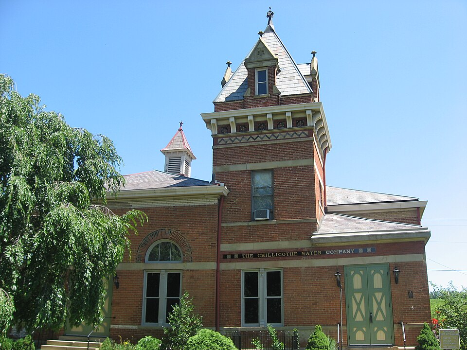
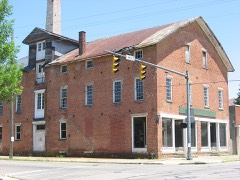
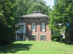
Photograph of Chillicothe Water and Power Company Pumping Station
Photograph by Nyttend, Public domain. Via Wikimedia Commons.

Chillicothe Water And Power Company Pumping Station

Listed on the National Register of Historic Places in 1979. A historic map-sheet match is not published yet. The record needs a coordinate-quality review before it can be joined to a sheet boundary.

From the record

“The Chillicothe Water and Power Company Pumping Station is a historic building on the northern side of Chillicothe, Ohio, United States. A Gothic Revival structure built in 1881, it was constructed to house the city's waterworks and power plant.”

Wikipedia article Chillicothe Water and Power Company Pumping Station, CC BY-SA 4.0.

one of 22 National Register listings in Ross County · listed in 1979 · category: Building.

Sources: the Wikipedia article · the case file at the National Archives · the National Register database, National Park Service

The listing

  • What is counted as historic. The nomination lists 1 building, 1 structure as contributing to the listing.
  • Address. Enderlin Circle, Chillicothe, 45601
  • When was it listed? 1979-11-15
  • Category. building
  • Township. Scioto township
  • Architectural style. Gothic Revival
  • National Register reference number. 79001932 - the number the National Park Service assigned this property when it was listed, and the key its nomination file is catalogued under at the National Archives.

Fires near this property

25 since 2002

Regional context, not property-specific evidence. The federal wildfire occurrence database lists 25 fires within 5 miles of Chillicothe Water And Power Company Pumping Station between 2002 and 2020, burning about 49 acres in total. None started naturally. 1 was recorded as arson. Distance is straight-line from the map coordinates, so a fire counted here may appear on a neighbouring settlement's page as well.

Reported cause Fires
Debris and open burning13
Missing data/not specified/undetermined5
Recreation and ceremony3
Power generation/transmission/distribution2
Arson/incendiarism1
Smoking1

The most recent of them, most recent first, with the day each was reported and the service that recorded it.

DateCause SizeReported by Name on the report
6 August 2018Power generation/transmission/distribution1.5 acresOhio Department of Natural Resources14305
28 August 2018Power generation/transmission/distribution1.0 acresOhio Department of Natural Resources13945
17 August 2019Smokingunder an acreOhio Department of Natural Resources15231
3 June 2017Debris and open burningunder an acreOhio Department of Natural Resources8367
21 May 2019Debris and open burning1.0 acresOhio Department of Natural Resources15214
29 April 2018Missing data/not specified/undetermined2.0 acresOhio Department of Natural Resources11235
27 April 2009Debris and open burning7.0 acresOhio Department of Natural Resourcesnot named
24 April 2019Arson/incendiarism1.0 acresOhio Department of Natural Resources15196

Every fire recorded in Ross County

Specimens collected near this property

12 of 1,786 shown

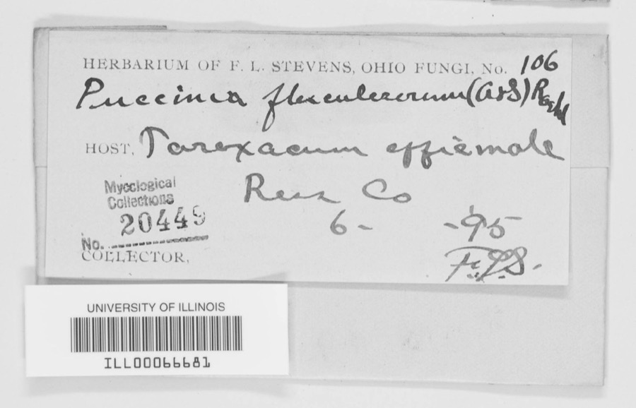
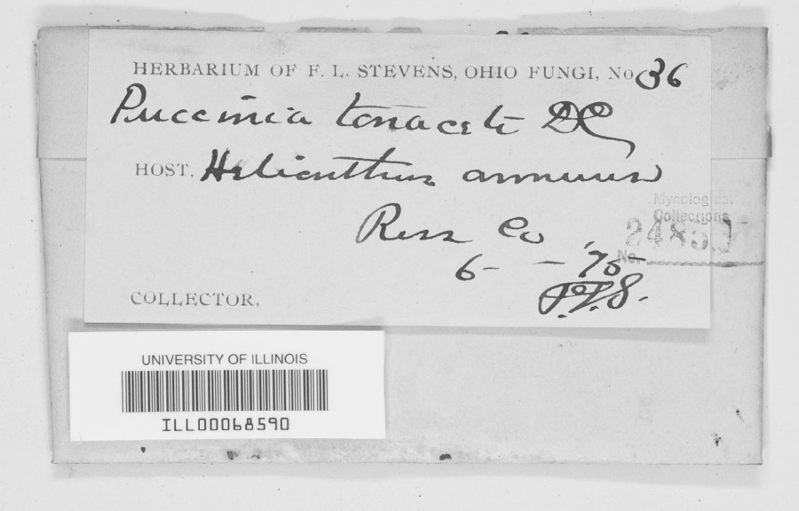
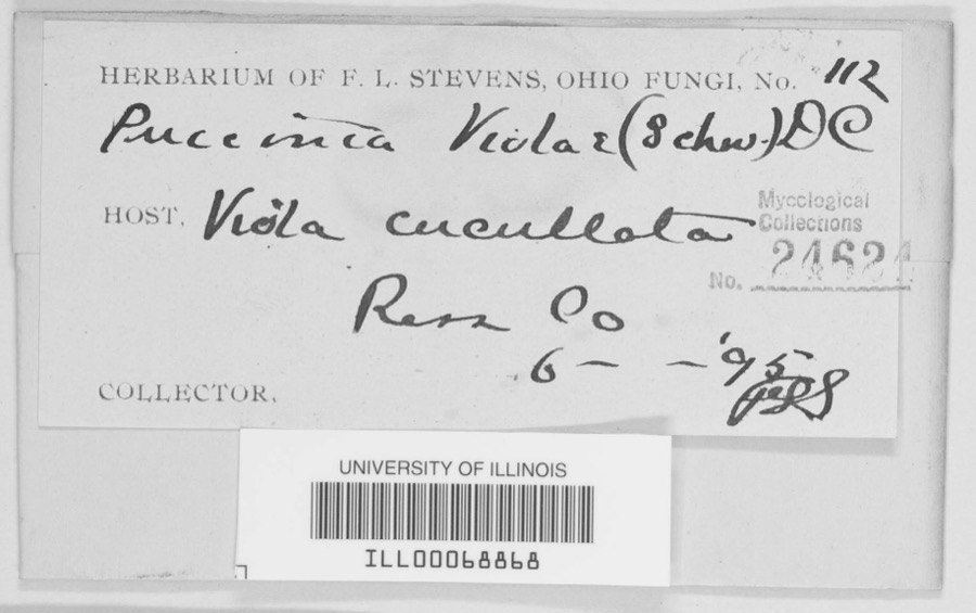
Regional context, not property-specific evidence. Museums hold 1,786 specimens collected within 10 miles of Chillicothe Water And Power Company Pumping Station between 1874 and 1975: 1,291 Animalia, 397 Fungi, 86 Plantae, 8 Protozoa, 3 Unrecorded, 1 Chromista. 12 distinct Species records are shown. Collected by A. C. Kinsey, A. C. Lincoln, A. Cronquist and others. Each is a physical object with a catalogue number, and each entry opens the museum's record. This is what was collected and kept, not a survey of what lives here - nothing can be concluded from a species being absent.

Image SpeciesYear Collected by Where, as recorded
Specimen of Puccinia flosculosorum Röhl., 1813Puccinia flosculosorum Röhl., 18131895F. L. S.Ross County
Specimen of Puccinia tanaceti DC.Puccinia tanaceti DC.1895F. L. StevensRoss County
Specimen of Puccinia violae (Schumach.) DC.Puccinia violae (Schumach.) DC.1895F. L. StevensRoss County
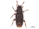
A photograph of the species Euaesthetus iripennis, not of this specimenEuaesthetus iripennis Casey, 18841874[Not Stated][Not Stated]
A photograph of the species Myrmedonia loricata, not of this specimenMyrmedonia loricata Casey, 18931874[Not Stated][Not Stated]
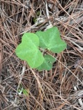
A photograph of the species Passiflora lutea, not of this specimenPassiflora lutea L.1885Safford, William EdwinChillicothe
A photograph of the species Albugo ipomoeae-panduratae, not of this specimenAlbugo ipomoeae-panduratae (Schwein.) Swingle1896Selby, A. D.Chillicothe
Phyllosticta pyrina Sacc.1896Selby A. D.Chillicothe
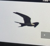
A photograph of the species Elanoides forficatus, not of this specimenElanoides forficatus forficatus (Linnaeus, 1758)1898Seip, J. (John)Near Chillicothe, Ross, Ohio, USA
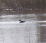
A photograph of the species Lophodytes cucullatus, not of this specimenLophodytes cucullatus (Linnaeus, 1758)1901not recordedRoss, Ohio, USA
A photograph of the species Lophophanes Kaup, not of this specimenLophophanes Kaup, 18291901Henninger, W. F. (Walther Frederick)Ross, Ohio, USA
A photograph of the species Armillaria mellea, not of this specimenArmillaria mellea (Vahl) P.Kumm.1902Hard, MironChillicothe

All 1,786 specimens within 10 miles, at the Global Biodiversity Information Facility.

Mines and quarries near this property

4 within 5 miles

Regional context, not property-specific evidence. The federal mineral resources record lists 4 workings within 5 miles of Chillicothe Water And Power Company Pumping Station: 3 past producers, 1 producer. 1 still produces. What was taken out: Sand and Gravel, Construction. Distance is straight-line from the map coordinates, so a quarry counted here may appear on a neighbouring settlement's page as well.

Where SiteCommodity StatusRecorded
N3 Sand and Gravel PitSand and Gravel, ConstructionPast ProducerSedimentary
N3 Sand and Gravel PitSand and Gravel, ConstructionProducer
Plant Number 6 PitSand and Gravel, ConstructionPast ProducerSedimentary
Plant Number 6 PitSand and Gravel, ConstructionPast Producer

Every working recorded in Ross County

Storms near this property

60 of 92 shown

Regional context, not property-specific evidence. The National Weather Service names Chillicothe, the town this property stands in, in 92 storm reports between 1995 and 2025: 56 thunderstorm wind, 24 hail, 6 flood, 3 lightning. The reports record 1 death and 6 injuries. Each account below is quoted exactly as the forecast office filed it, from the NOAA Storm Events Database, and each date opens the federal record of that event.

WhenEvent Place namedHarm What the report says
June 2005LightningChillicothe1 killed, 5 hurtAn inmate in the yard at the Chillicothe Correctional Institute was struck and killed by lightning. Five others were injured by the lightning strike.
September 1999LightningChillicothe1 hurtA man was struck by lightning and suffered injury.
May 2000LightningChillicothe$30,000A lightning strike caused a fire in the attic of a house leading to extensive damage.
February 2000Flash FloodChillicothe$25,000North Fork Creek flooded west of Chillicothe causing evacuation of a camp ground.
June 2022Thunderstorm WindChillicothe$20,000Numerous trees were downed and trees were snapped in the Chillicothe area.
June 2012Thunderstorm WindChillicothe$15,000A metal roof was removed from a building on Race Street due to thunderstorm winds.
April 2005HailChillicothe$15,000no account filed
June 2011Thunderstorm WindChillicothe$12,000Trees and utility poles were reported down due to damaging thunderstorm winds.
July 2012Thunderstorm WindChillicothe$10,000Numerous trees were reported down along several roadways in the county.
April 2011Thunderstorm WindChillicothe$10,000Damage occurred to a building due to thunderstorm winds.
July 2003Flash FloodChillicothe$10,000Several homes were flooded and one road was washed out.
July 2002Flash FloodChillicothe$10,000Problems with high water occurred across the county. A roof of a gas station on the west side of Chillicothe collapsed under the weight of the heavy rain.
September 2000Thunderstorm WindChillicothe$10,000Numerous trees downed.
August 2000Thunderstorm WindChillicothe$10,000Strong winds blew trailers over at the county fair.
July 1998Thunderstorm WindChillicothe$10,000Numerous trees downed.
July 1997Thunderstorm WindChillicothe$10,000Several trees knocked down across the county.
April 2002HailChillicothe$10,000no account filed
February 2011Thunderstorm WindChillicothe$7,000A small metal shed was destroyed, trees were down, and power lines were down due to damaging thunderstorm winds.
June 1995HailChillicothe$6,000Crop damage was reported due to wind blown hail.
July 2022Thunderstorm WindChillicothe$5,000A large tree fell onto a house and knocked down some power lines.
June 2019Thunderstorm WindChillicothe$5,000Numerous trees were knocked down throughout the county, including in and around Chillicothe.
June 2011Thunderstorm WindChillicothe$5,000Trees and power lines were reported down due to damaging thunderstorm winds.
June 2007Thunderstorm WindChillicothe$5,000Several trees and power poles were knocked down in the Great Seal State Forest and along Marietta Road.
June 2001Thunderstorm WindChillicothe$5,000Thunderstorms produced strong winds which moved 500 pound bleachers and tore off dugout roofs at a ball field.
April 2000Thunderstorm WindChillicothe$5,000Numerous trees downed.
August 1999Thunderstorm WindChillicothe$5,000Several large trees downed.
July 1997Thunderstorm WindChillicothe$5,000Trees and power lines downed.
August 2007HailChillicothe$5,000no account filed
April 2002HailChillicothe$5,000no account filed
May 1996Thunderstorm WindChillicothe$5,000no account filed
May 2024Thunderstorm WindChillicothe$4,000A few trees were downed on the southeast side of Chillicothe.
July 2023Thunderstorm WindChillicothe$4,000A few trees were downed in Chillicothe.
June 2008Thunderstorm WindChillicothe$4,000Large tree limbs were downed across several roads.
April 2006Thunderstorm WindChillicothe$4,000Several tree limbs were downed.
May 2024Thunderstorm WindChillicothe$3,000A few trees were downed on Church Street and Carlisle Place.
May 2022Thunderstorm WindChillicothe$3,000Several trees were downed along Eastern Avenue near U.S. 23.
August 2020Thunderstorm WindChillicothe$3,000Trees were reported knocked down near the intersection of Liberty Hill Road and OH-772.
August 2020Thunderstorm WindChillicothe$3,000Trees were reported knocked down.
May 2009Thunderstorm WindChillicothe$3,000Trees were downed in town.
June 2005Thunderstorm WindChillicothe$3,000Trees were knocked down.
May 2004Thunderstorm WindChillicothe$3,000A few trees were downed.
August 2003Thunderstorm WindChillicothe$3,000Trees and powerlines were downed.
August 2002Thunderstorm WindChillicothe$3,000Trees were downed on the north and east sides of town.
April 2001Thunderstorm WindChillicothe$3,000A thunderstorm produced strong winds which knocked down a few trees.
June 2001Thunderstorm WindChillicothe$3,000A few trees downed
May 2001Thunderstorm WindChillicothe$3,000Trees were knocked down by thunderstorm winds.
July 1999Thunderstorm WindChillicothe$3,000Numerous trees knocked down.
September 1999Thunderstorm WindChillicothe$3,000Trees were knocked down across Rocky Road.
July 1998Thunderstorm WindChillicothe$3,000Trees downed.
June 1998Thunderstorm WindChillicothe$3,000Several trees downed.
July 1997Thunderstorm WindChillicothe$3,000Several trees downed.
April 2002HailChillicothe$3,000no account filed
November 2020Thunderstorm WindChillicothe$2,000A few trees were downed.
August 2020Thunderstorm WindChillicothe$2,000Trees were reported knocked down.
December 2013Thunderstorm WindChillicothe$2,000A few trees were down across the county due to thunderstorm winds.
June 2011Thunderstorm WindChillicothe$2,000A few trees were reported down due to damaging thunderstorm winds.
October 2010Thunderstorm WindChillicothe$2,000Trees and large tree limbs were reported down due to damaging thunderstorm winds.
June 2003Thunderstorm WindChillicothe$2,000Large limbs and branches were knocked down.
October 2006HailChillicothe$2,000no account filed
May 2022Thunderstorm WindChillicothe$1,000A large tree was downed along East Main Street. Several large branches were also downed in the area.

Every storm recorded in Ross County

Map coverage status

No historic map-sheet match is published for this property yet. That does not mean no map exists. This record needs a coordinate-quality review before it can be joined to a sheet boundary. Browse the county's mapped places while that work is pending.

From the nomination file

1,957 words on record

When this property was proposed for the National Register, someone wrote the case for it: what the building is, and why it matters. That document is a federal record in the public domain. It is quoted below word for word, never summarised. The text was read off the scanned case file by machine, so the occasional stray character is the recogniser's and the 1970s typewriter's.

Description of the property

The Chillicothe Water and Power Company Pumping Station is an utilitarian building lies at the edge of Yoctangee Park near the railroad tracks and the Scioto River levee. Chillicothe Business District, a National Register Historic District. The Pumping Station itself is a slightly irregular rectangular one-story building The tower is the building's most notable feature. Its pyramidal slate roof is which run around the tower. The tower's first floor window has been partially bricked is to the right of the afore-mentioned window, and consists of a single, four-paneled the bricked-in window of the tower. The facade and the NW side of the Pumping Station at one time each had three large have been bricked in; the side windows have been partially covered by the cinder-block addition (see below).

The brick round-arches remain, however. It is evident that the original windows were divided into two parts by the still-existing stone belt course. The sills of the windows were formed by a narrower belt course; both belt courses run Both of them, however, have a Tudor arch over four openings, divided by brick course and they are divided at mid-section by the other wider belt course. (like the tower), and louvred sides. On the interior, the features which contribute to the

Statement of significance

(in one paragraph) The Chillicothe Water and Power Company Pumping Station is being nominated on the ficant also for the fact that the Water Company made a deliberate effort to construct a Power House, the well, a large reservoir (located on Belleview Hill several blocks away) Department personnel and equipment out of the building, and current plans are to lease the building to the Jaycees for rehabilitation and eventual use as a community center. Igcioto Gazette, Aug. 10, 1881 commerce 1400-1499 1500-1599 communications humanitarian education 1700-1799 1600-1699 industry politics/government engineering theater Period agriculture literature be rather fanciful in architecture, so as to be an ornament to the park."l Although some- Specific dates 8.

Significance Gothic architecture was used for utilitarian structures such as this one.It is signi- 1900- new waterworks project (begun in 1881 and completed in 1882)including construction of the the project and then goes on to state,"It is intended to erect a power house which shall _ archeology-prehistoric _ community planning _ landscape architecture _ religion what compromised by the alterations made to it, the Power House is still recognized local- 1y as an asset to Yoctangee Park. The City of Chillicothe recently moved its Service 1882 economics art 9.

The whole case file for this property - 1,957 words, 14 pages, reproduced complete.

Quoted from the National Register nomination for reference 79001932, 14 pages, held by the National Archives in Record Group 79. See the catalogue record.

Listed places nearby

6 within 8 miles

Other National Register properties close enough to walk or drive between, ordered by distance from this one. Both positions come from the same geocoding pass that matched these properties to their map sheets.

Photograph PropertyDistance Listed
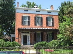
Majestic Theatre0.3 miles1979
Canal Warehouse0.4 miles1973
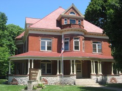
Vanmeter Church Street House0.6 miles1979
Seip House0.6 miles1981
Mountain House0.7 miles1978
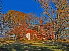
Tanglewood0.9 miles1979

Sources for this property

National Archives recordThe nomination case file for reference 79001932 in Record Group 79.
Wikipedia articleCommunity-written account of this property, licensed CC BY-SA.
Ross CountyAll 22 listed properties in this county.

Provenance

  • Listing record. National Park Service National Register of Historic Places, listed-properties dataset, current to 2026-05-22.
  • Map join. Address geocoded through the United States Census geocoder, then tested against the published boundary of every sheet in the USGS Historical Topographic Map Collection.
  • How this page is made. Listing fields come from federal records; map-sheet coverage is a labelled coordinate-to-boundary calculation, not a source-field claim.
  • Wildfire. Short, Karen C. 2022. Spatial wildfire occurrence data for the United States, 1992-2020 [FPA_FOD_20221014]. 6th Edition. Fort Collins, CO: Forest Service Research Data Archive. https://doi.org/10.2737/RDS-2013-0009.6 Collected with United States Government funding and usable without additional permissions or fees.
  • Specimens. Global Biodiversity Information Facility (GBIF), https://www.gbif.org/. Only records licensed CC0 or CC BY are used. Records licensed CC BY-NC are excluded because this site carries advertising. Images are checked individually and any whose licence is non-commercial, no-derivatives or unreadable is refused.
  • Mines and quarries. USGS Mineral Resources Data System (MRDS) https://mrdata.usgs.gov/mrds/ A work of the United States government, no copyright under 17 U.S.C. 105.
  • Storms. NOAA National Centers for Environmental Information, Storm Events Database https://www.ncei.noaa.gov/stormevents/ A work of the United States government, no copyright under 17 U.S.C. 105. Narratives are quoted verbatim from the National Weather Service report and are not edited or summarised.