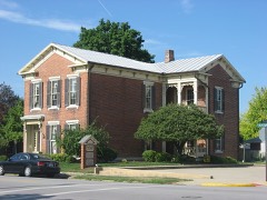
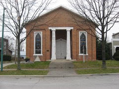
Listed on the National Register of Historic Places in
1979. A historic map-sheet match is not published yet. The record needs a coordinate-quality review before it can be joined to a sheet boundary.
From the record
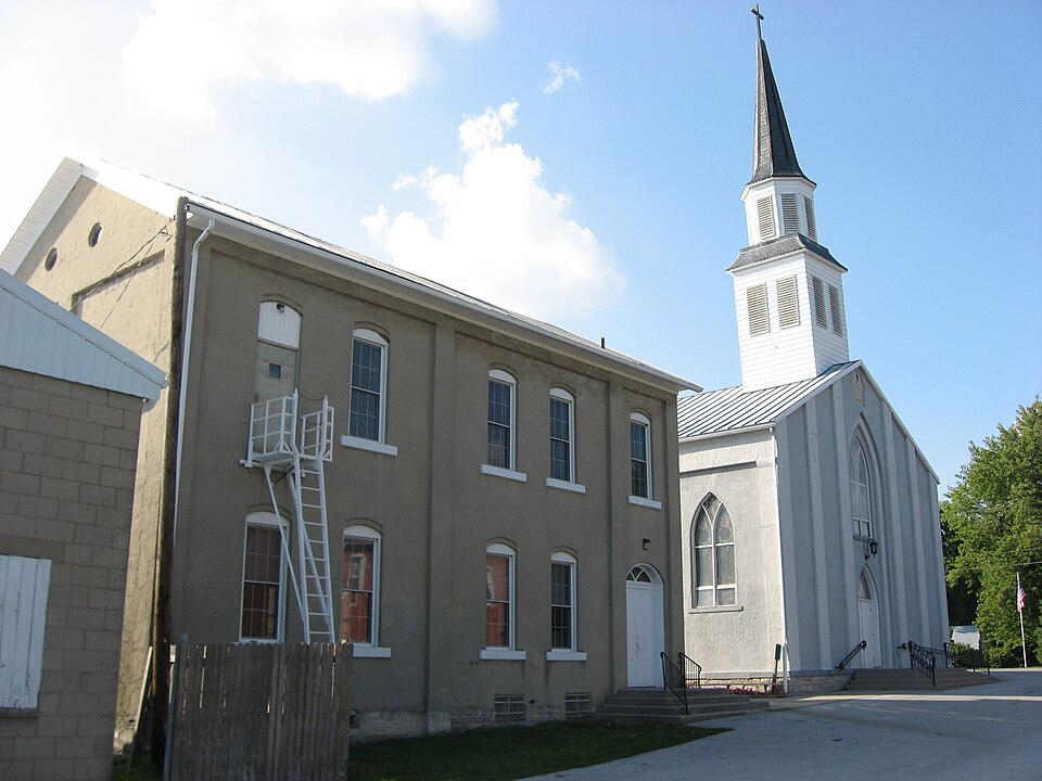
“John Catholic Church is a Roman Catholic church in the unincorporated community of Fryburg in Pusheta Township, Auglaize County, Ohio, United States. The parish was established in 1848, the same year in which the community was platted, and construction was completed in 1850.”
Wikipedia article St. John's Catholic Church (Fryburg, Ohio), CC BY-SA 4.0.
one of 24 National Register listings in Auglaize County · listed in 1979 · category: Building.
National Register reference number.79003451- the number the National Park Service assigned this property when it was listed, and the key its nomination file is catalogued under at the National Archives.
Regional context, not property-specific
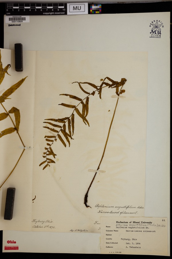
evidence. Museums hold 832 specimens
collected within 10 miles of St. John Catholic Church and Parish Hall between 1882 and
1970: 821 Animalia, 6 Plantae, 5 Fungi. 12 distinct Species records are shown.
Collected by A. Wetzstein, Adler, K. K., C L CLARK and others. Each is a
physical object with a catalogue
number, and each entry opens the museum's record. This is what was
collected and kept, not a survey of what lives here - nothing can be
concluded from a species being absent.
Regional context, not property-specific
evidence. The federal mineral resources record lists
6 workings within 5 miles of St. John Catholic Church and Parish Hall: 5 past producers, 1 plant.
1 still produces. What was taken out: Sand and Gravel, Construction. Distance is straight-line from the
map coordinates, so a quarry counted here may appear on a neighbouring
settlement's page as well.
Regional context, not property-specific
evidence. The National Weather Service names
Fryburg, the town this property stands in, in 8 storm reports between 2010 and 2024: 4 thunderstorm wind, 1 heavy rain, 1 hail, 1 flash flood.
The reports record 2 injuries. Each account below is quoted exactly as the forecast office
filed it, from the NOAA Storm Events Database, and each date
opens the federal record of that event.
The tornado began immediately east of Interstate 75, south of Wapakoneta, where it damaged a farm on the west side of Cemetery Road. Video shared on social media showed the tornado rapidly strengthened west of Glacier Hill Lakes RV Resort, causing significant damage to a grove of trees west of the resort. After crossing a field, the tornado moved through the center of the resort, lofting campers and snapping trees. Two individuals at the resort suffered injuries that required hospitalization. The tornado continued eastward toward Wapak-Freyburg Road and caused significant damage to the Resort clubhouse and residential homes on the west side of the road. The collective damage done to the trees and buildings within this corridor of damage justified wind estimates of 140 mph, EF-3. The tornado moved into an open field east of Wapak-Freyburg Road at an unknown intensity. ||Three-tenths of a mile south of Pusheta Road, the tornado caused significant tree damage to three separate groves of trees as it neared Town Line Road. Aerial images provided by the Auglaize County EMA/CERT confirmed the tornado was still strong, at least EF-2 strength, south of Pusheta Road. The tornado likely remained fairly strong as it impacted homes and outbuildings along Town Line Road, Ashburn Road, and Geyer Road. A brief weakening period, or narrowing of the tornado was observed near Geyer, where the tornado remained mainly over open fields. ||The next period of intensification occurred between State Route 65 and Valley Road. Damage to a few homes and outbuildings, along with significant damage to a few groves of trees confirmed this period of intensification. The tornado began to make a more significant southeast turn between Wrestle Creek Road and Valley Road. The strong, likely EF2 tornado continued to move southeastward and entered Logan County at 1843EST, just north of Santa Fe. ||The tornado continued east-southeast across much of Logan County before ending at 1916EST, 3 miles west-southwest of West Mansfield.
One barn was destroyed and another damaged due to damaging thunderstorm winds. A wheat field was damaged due to debris that blew into the field. Nearby, the house had damage to the siding.
No historic map-sheet match is published
for this property yet. That does not mean no map exists. This record needs
a coordinate-quality review before it can be joined to a sheet boundary.
Browse the county's mapped places while that work is
pending.
From the nomination file
980 words on record
When this property was proposed for the
National Register, someone wrote the case for it: what the building is,
and why it matters. That document is a federal record in the public domain.
It is reproduced in full on its own page, word for word and never summarised. The text was read off the scanned case file by machine, so the
occasional stray character is the recogniser's and the 1970s
typewriter's.
Quoted from the National Register nomination
for reference 79003451, 10 pages, held by the National Archives in Record
Group 79. See the
catalogue record.
Listed places nearby
6 within 8 miles
Other National Register properties close
enough to walk or drive between, ordered by distance from this one. Both
positions come from the same geocoding pass that matched these properties
to their map sheets.
Listing record. National Park Service National Register of Historic Places, listed-properties dataset, current to 2026-05-22.
Map join. Address geocoded through the United States Census geocoder, then tested against the published boundary of every sheet in the USGS Historical Topographic Map Collection.
How this page is made. Listing fields come from federal records; map-sheet coverage is a labelled coordinate-to-boundary calculation, not a source-field claim.
Specimens. Global Biodiversity Information Facility (GBIF), https://www.gbif.org/. Only records licensed CC0 or CC BY are used. Records licensed CC BY-NC are excluded because this site carries advertising. Images are checked individually and any whose licence is non-commercial, no-derivatives or unreadable is refused.
Mines and quarries. USGS Mineral Resources Data System (MRDS) https://mrdata.usgs.gov/mrds/ A work of the United States government, no copyright under 17 U.S.C. 105.
Storms. NOAA National Centers for Environmental Information, Storm Events Database https://www.ncei.noaa.gov/stormevents/ A work of the United States government, no copyright under 17 U.S.C. 105. Narratives are quoted verbatim from the National Weather Service report and are not edited or summarised.
 Block
Block