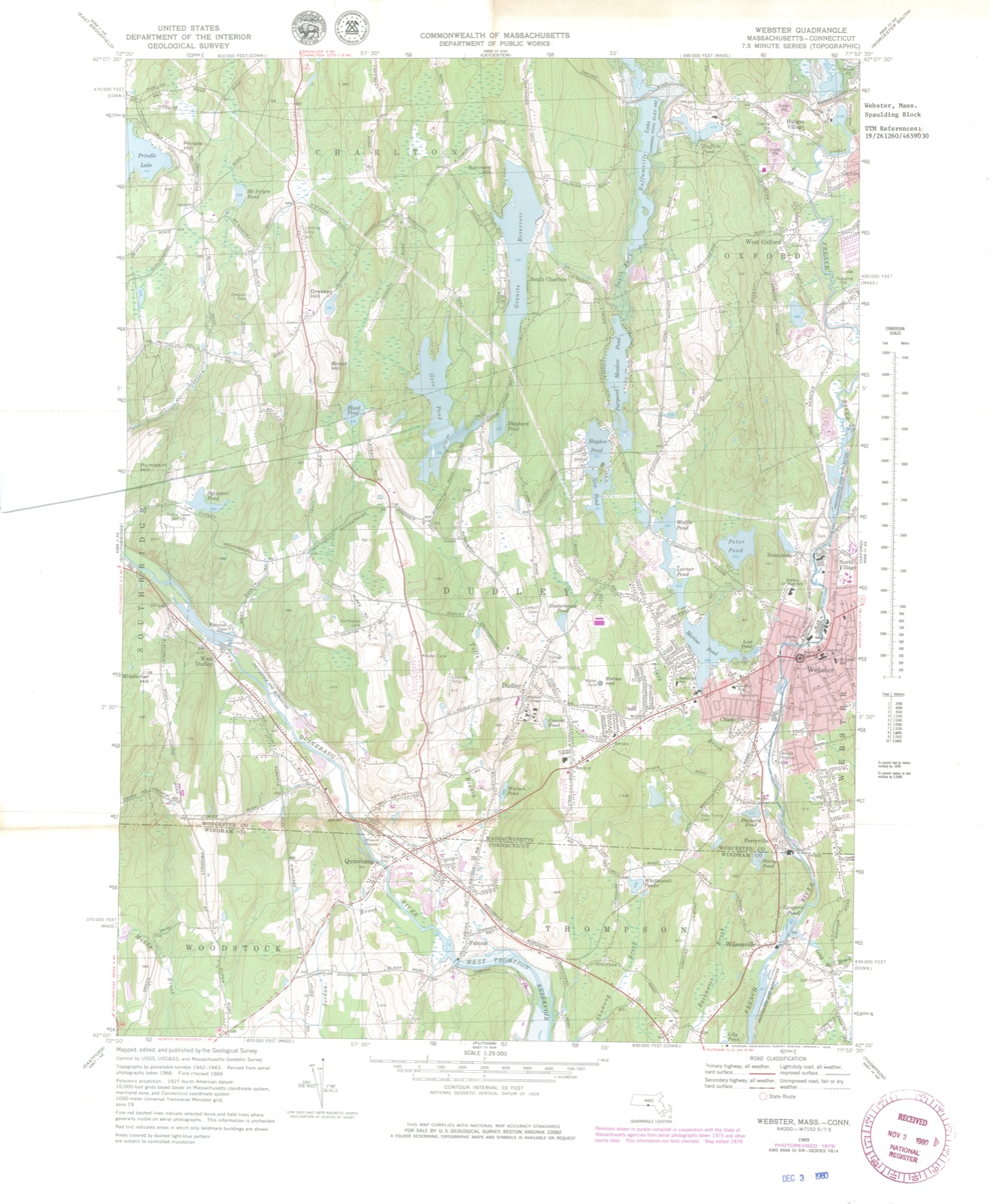
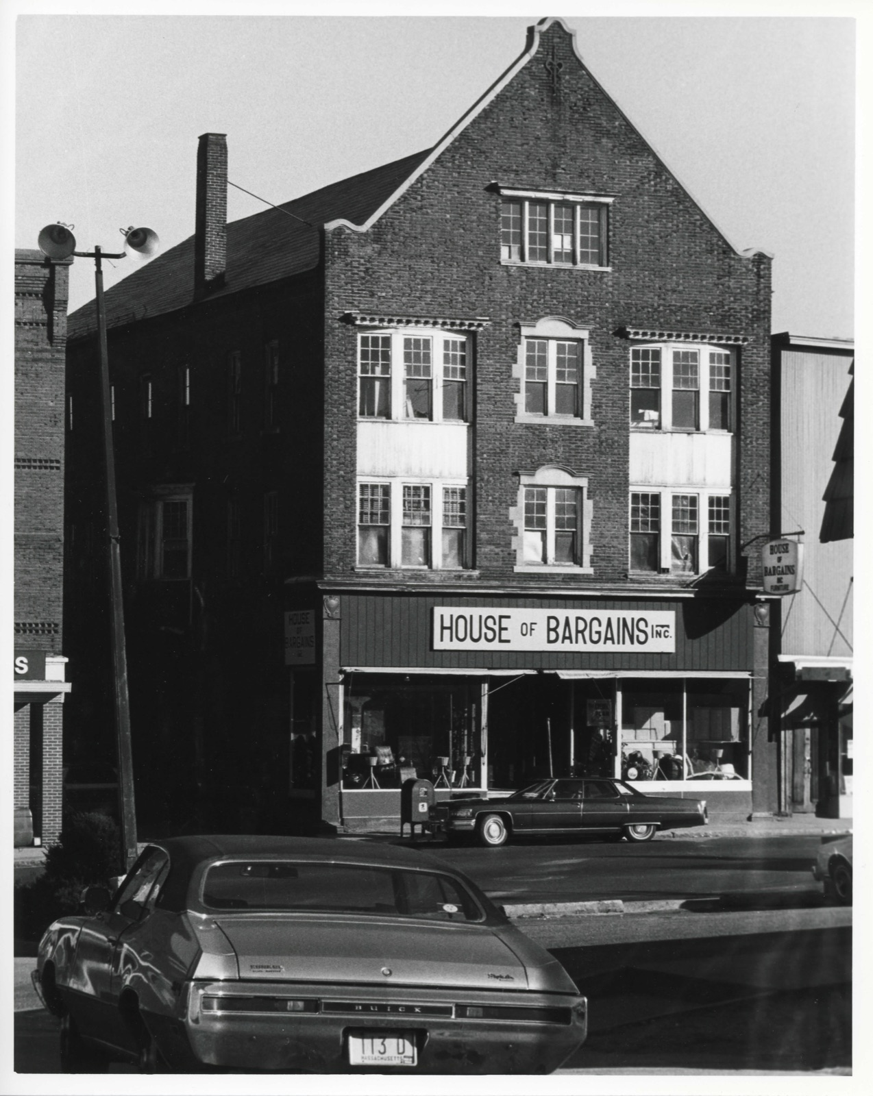
Photographs from the nomination case file, National Park Service records.
Spaulding Block
Listed on the National Register of Historic Places in
1980. A historic map-sheet match is not published yet. The record needs a coordinate-quality review before it can be joined to a sheet boundary.
From the record
“Just as the last sheets of the Appendix were going through the press, the Reporter learning, for the first time, that Professor Webster had made a formal apology to Messrs. Sohier, an extract from such a letter; the same letter containing allusions to other matters which Mr.”
Report of the Case of John W. Webster, Indicted for the Murder of George Parkman, Before the Supreme Judicial Court of Massachusetts : Including the Hearing on the Petition for a Writ of Error, the Prisoner's Confessional Statements and Application for a Commutation of Sentence, and an Appendix Containing Several Interesting Matters Never Before Published (1850). Machine-read text.
one of 500 National Register listings in Worcester County · listed in 1980 · category: Building · one of 1 National Historic Landmarks in Worcester County.
National Register reference number.80000466- the number the National Park Service assigned this property when it was listed, and the key its nomination file is catalogued under at the National Archives.
We compile from two of the newspapers of the day, the Boston Daily Evening Transcript and the Boston Daily Evening Traveller, some particulars of the last hours and execution of Prof. Webster, which we deem not inappropriate, in this connection, to the present volume. We have taken pains to verify the statements by a reference to eye-witnesses present at the scenes or interviews, and have made an occasional alteration for the sake of greater exactness. - Rep.
Professor Webster was visited as usual by his family yesterday afternoon, and they remained with him nearly four hours. There is every reason to believe that they left entirely ignorant as to the day of the execution. The prisoner had felt great anxiety in regard to this closing interview, lest he should betray himself. When it was over, he felt greatly relieved, and spoke cheerfully. He had detected no sign of a recognition of the fact that this was their last interview in the demeanor of his family : neither had the jailer. To the latter, as they left the cell, they addressed some remarks plainly indicating their expectation of re-visiting the prisoner. An immense crowd had assembled in Leverett street, and about the jail, to see the unhappy family as they went out ; but Mr. Andrews took Mrs. Webster and her family through his own house to a door opening on Lowell street, where a carriage was waiting, and they thus escaped the scrutiny and remarks of the multitude.
Regional context, not property-specific
evidence. The
federal wildfire occurrence database
lists 47 fires within 5 miles of Spaulding Block between
2007 and 2020, burning about 18 acres in total. None started naturally. 2 were recorded as arson.
Distance is straight-line from the map coordinates, so a fire counted
here may appear on a neighbouring settlement's page as well.
Reported cause
Fires
Debris and open burning
23
Missing data/not specified/undetermined
10
Recreation and ceremony
7
Arson/incendiarism
2
Smoking
2
Equipment and vehicle use
1
Power generation/transmission/distribution
1
Railroad operations and maintenance
1
The most recent of
them, most recent first, with the day each was reported and the service
that recorded it.
Regional context, not property-specific
evidence. Museums hold 407 specimens
collected within 10 miles of Spaulding Block between 1857 and
1975: 208 Animalia, 157 Plantae, 29 Fungi, 10 Protozoa, 2 Chromista, 1 Unrecorded. 12 distinct Species records are shown.
Collected by A. S. Pease, Agassiz, Agassiz, Alexander Emanuel Rodolphe and others. Each is a
physical object with a catalogue
number, and each entry opens the museum's record. This is what was
collected and kept, not a survey of what lives here - nothing can be
concluded from a species being absent.
Regional context, not property-specific
evidence. The federal mineral resources record lists
15 workings within 5 miles of Spaulding Block: 13 past producers, 2 producers.
2 still produce. What was taken out: Sand and Gravel, Construction, Stone, Crushed/Broken. Distance is straight-line from the
map coordinates, so a quarry counted here may appear on a neighbouring
settlement's page as well.
Regional context, not property-specific
evidence. The National Weather Service names
Webster, the town this property stands in, in 21 storm reports between 1998 and 2025: 13 thunderstorm wind, 2 hail, 2 flood, 2 tornado.
The reports record 1 injury. Each account below is quoted exactly as the forecast office
filed it, from the NOAA Storm Events Database, and each date
opens the federal record of that event.
In just about one minute, an EF-1 tornado, with maximum winds estimated at 110 mph, wreaked havoc in the easternmost portion of Dudley, MA and in the downtown portion of Webster, MA. It touched down along Route 12 (Schofield Avenue) to the west of Laprise Court in Dudley and traveled northeastward onto Main Street in Webster, then lifted near the French River by Oxford Avenue. ||Many trees were snapped and debarked. In Webster, a gas station overhang was twisted. An old brick rooftop was damaged, with bricks having fallen onto Main Street. The rubber roof covering of another building was peeled completely off. Windows were blown out at a business on Main Street and the street was littered with broken glass. The side walls of an apartment complex were bent slightly outward toward the tornado. Window screens were sucked outward. A car windshield and side mirror was damaged. There were other reports of trees fallen onto cars. Utility poles were snapped and numerous wires were downed. According to MEMA, at least 3 buildings were condemned and at least 5 were uninhabitable.||Nearly everyone that our survey team spoke with had heard the warning via the Wireless Emergency Alert on their cell phones as much as 20+ minutes in advance of the touchdown! This undoubtedly played a big role in the fact that there were no fatalities. According to media reports, there was one minor injury when part of a roof fell on top of a woman's car.
In Webster at 411 PM EDT (311 PM EST), lightning caused a house fire on Colonial Road. Subsequent follow-up with the fire department revealed that there was $100,000 in water damage to the home from extinguishing the fire.
A weak tornado touched town in the town of |Thompson in northern Windham County, Connecticut. A NWS |meteorologist conducted a storm survey following tips from amateur |radio operators and local broadcast meteorologists. The following |information summarizes all of the reports. ||The tornado touched down near a red barn near the intersection of |Quinebaug Road (Route 131) and Riverside Drive (Route 12). It was |reported to be about 50 yards wide and tracked northeastward in a |discontinuous path, impacting areas just south of Ryler Court at |Riverside Drive, Wilsonville Road, Wagher Road, and Denis Drive at |Labby Road. It then crossed the Massachusetts/Connecticut state |line and ended as a waterspout in Lake Chaubunagungamaug. Although |discontinuous, the total path length was 4.7 miles. The approximate |path width was 50 yards. Damage photos led to estimates of maximum |wind speeds of 80 to 85 mph, which puts this on the upper end of |the EF0 category of the Enhanced Fujita Scale. The time, based on |radar and eyewitness accounts, was from 1015 AM to 1024 AM EDT. ||More specifically, when the tornado touched down near Backwater |Brook, it snapped several trees in half in a convergent fashion. |It caused minor backyard damage at a nearby property before felling |numerous trees and power lines near the intersection of Riverside |Drive and Ryler Court. Tree damage was also reported at Wilsonville |Road and several trees were snapped in the backyard of a house near |Wagher Road and Forest Hill Drive. A tree was partially snapped near |Denis Drive at Labby Road before causing minor damage near Woods |Grove. Finally, multiple residents witnessed a waterspout over Lake |Chaubunagungamaug before dissipating near Killdeer Island.
In Webster, multiple trees and wires were down on Highland Street. One tree fell onto the side of a house. One utility pole was snapped. Also, multiple wires were down on School Street.
No historic map-sheet match is published
for this property yet. That does not mean no map exists. This record needs
a coordinate-quality review before it can be joined to a sheet boundary.
Browse the county's mapped places while that work is
pending.
Named in the fire insurance atlases
Sanborn surveyors printed an index of the
town's establishments at the front of each atlas. This property is named in
one, read straight off the scanned sheet.
When this property was proposed for the
National Register, someone wrote the case for it: what the building is,
and why it matters. That document is a federal record in the public domain.
It is quoted below word for word, never summarised. The text was read off the scanned case file by machine, so the
occasional stray character is the recogniser's and the 1970s
typewriter's.
Description of the property
Located on the north side of Main Street, one lot east of Davis Street, in Webster's central business district, the Spaulding Block is a rectangular plan commercial block which covers most of its narrow lot. The block's facade (south elevation) is built out to the sidewalk, the west elevation faces a narrow alley, the north ele- vation has an attached one-and-one half story wooden shed facing a rear court, and the east elevation is concealed by a closely built (but not connected) wood-frame structure. The Spaulding Block is a three-story brick building, the rear portion of which (90% of the structure) was built in 1866, while the facade was added in 1897.
The facade is symmetrical, having two store fronts with paired center entries at the first story; although now covered with modern materials these store fronts are framed at the facade's corners by two iron piers which rise to a metal cornice. The facade's upper stories are faced with a Flemish bond of red brick stretchers and blackened headers; trimmings are of dressed limestone. Fenestration of the second and third stories is identical, each containing a central window of paired 6/1 sash set in a quoined surround with an arched head; each central window is flanked by two sereghnad hads eaca recessed bay windows, each of which is made up of three sets of 9/1 sash.
A steep gable with a limestone coping rises above the third story; centered on the gable is a window made up of four eight-pane casements. The west elevation rises from a base of rock-faced granite above which the wall is. faced with common red brick, except for the elevation's southernmost bay where the brickwork matches that of the facade.
(in one paragraph) Builder/Architect Unknown The Spaulding Block possesses integrity of design, location and materials as wel! as historical associations with several local businesses and fraternal organizations. Now the oldest brick commercial building extant in Webster, the Spaulding Block is building was constructed, a three-and-one halt story biock of simple italianate/ utilitarian design with low-arched window heads, rock-taced granite trim and, pernaps, a facade of pressed red brick. In 1897, the original facade was removed, an addi- tion of approximately 10' depth was made, and the current late Queen Anne/Tudor facade was constructed.
Faced with a Flemish bond of red and blackened bricks, this facade retains recessed bay windows, quoined window surrounds and a high central gable with a stone coping; the only significant alterations to the building's 1897 design are the covering of original store fronts with modern materials. Built for Cyrus Spaulding, the Spaulding Block originally housed Spaulding's hardware store, a business which had been founded by Spaulding's father, Erastus, in 1834. Ihe block also housed the jeweler's shop of John Hinds until 1894 (ground floor), the printing office of the Webster Times after 1867 (second story), the Webster Masonic Lodge (third story) and the Webster Sigel Lodge, a late nineteenth century German-American fraternal organization.
In 1902, the Spaulding Block was sold to Rosebrooks & Cummings who maintained Spaulding's hardware business until 1928, after which it was operated by Waite's Hardware Company until 1978, when the business closed permanently. The Spaulding Block is one of the few remaining structures which reflect the late nineteenth century commercial character of Railroad Square.
Quoted from the National Register nomination
for reference 80000466, 9 pages, held by the National Archives in Record
Group 79. See the
catalogue record.
Listed places nearby
6 within 8 miles
Other National Register properties close
enough to walk or drive between, ordered by distance from this one. Both
positions come from the same geocoding pass that matched these properties
to their map sheets.
Listing record. National Park Service National Register of Historic Places, listed-properties dataset, current to 2026-05-22.
Map join. Address geocoded through the United States Census geocoder, then tested against the published boundary of every sheet in the USGS Historical Topographic Map Collection.
How this page is made. Listing fields come from federal records; map-sheet coverage is a labelled coordinate-to-boundary calculation, not a source-field claim.
Wildfire. Short, Karen C. 2022. Spatial wildfire occurrence data for the United States, 1992-2020 [FPA_FOD_20221014]. 6th Edition. Fort Collins, CO: Forest Service Research Data Archive. https://doi.org/10.2737/RDS-2013-0009.6 Collected with United States Government funding and usable without additional permissions or fees.
Specimens. Global Biodiversity Information Facility (GBIF), https://www.gbif.org/. Only records licensed CC0 or CC BY are used. Records licensed CC BY-NC are excluded because this site carries advertising. Images are checked individually and any whose licence is non-commercial, no-derivatives or unreadable is refused.
Mines and quarries. USGS Mineral Resources Data System (MRDS) https://mrdata.usgs.gov/mrds/ A work of the United States government, no copyright under 17 U.S.C. 105.
Storms. NOAA National Centers for Environmental Information, Storm Events Database https://www.ncei.noaa.gov/stormevents/ A work of the United States government, no copyright under 17 U.S.C. 105. Narratives are quoted verbatim from the National Weather Service report and are not edited or summarised.
 Block
Block