National Register reference number.89000436- the number the National Park Service assigned this property when it was listed, and the key its nomination file is catalogued under at the National Archives.
In the town of Helper, Derbyshire, England, on the 9th of June, 1768, Samuel Slater, the founder of the town of Webster, was born. On the 28th of June, 1782, at the age of fourteen, he was apprenticed for seven years to Jedediah Strutt, a partner of Arkwright, to learn the business of manufacturing cotton. At about the time of the close of his apprenticeship he saw an advertisement of a premium for the introduction of Arkwright machinery into the United States, and being familiar with the methods used by his employer, he determined to seek his fortunes in the New World. On the 1st of September, 1789, he left Derbyshire for London, and on the 13th of the same month sailed for New York, where he arrived after a sixty-six days' passage. He at first engaged his services to the New York Manufacturing Company, but, after a few weeks, hearing of Moses Brown, of Providence, he wrote to that gentleman on the 2d of December, offering his services in the line of his trade. On the 10th of December Mr. Brown replied, inviting him to Providence, to which place he removed in January, 1790. On the 5th of April in that year he signed a contract to construct machinery after the plan of that with which he had become familiar during his apprenticeship. He soon became engaged in Pawtucket, R. I., in the successful manufacture of cotton-yarn, which was sold to be woven on hand-looms into cloth by domestic labor.
While engaged in this business, Mr. James Tiffany, of the town of Wales, in Massachusetts, then known as South Brimfield, became acquainted with Mr. Slater in his trading expeditions to Pawtucket, and at his request Mr. Slater took his two sons, Lyman and Bela TiffaJiy, into his employ. Through Mr. Tiffany, Mr. Slater was informed of the existence of water-power in what is now Webster, and in 1811 Bela Tiffany was sent to examine it. In a letter, dated May 27, 1811, Bela Tiffany wrote to Mr. Slater that he had found on the examined premises a two-story house unfinished, a grist-mill with two sione.s, a good saw-mill, a trip-hammer shop, thirteen or fourteen acres of land, one-half of which was swamp, and water-fall sufficient for all practicable purposes. He added that the region was a most benighted one, four miles from Oxford, three miles from Dudley and six and one-half miles from Thompson, in Connecticut. The price asked was $4000, and he wrote that he had secured a refusal of the property until the 20th of June. The result of the examination was the purchase of the property in the name of Bela Tiffany, and this purchase was followed by others, including a farm of two hundred and twenty acres, with a house and barn, nine and one-half acres bought of Elijah Pratt, and before the close of the year 1812 about two hundred and sixty acres more from various persons. In December, 1812, Mr. Tiflany transferred to Mr. Slater five-sixths of the property, retaining one-sixth as his own interest in the enterprise.
Regional context, not property-specific
evidence. The
federal wildfire occurrence database
lists 77 fires within 5 miles of Thompson School
between 2007 and 2020, burning about 122 acres in total. 1 started naturally. 3 were recorded as arson.
Distance is straight-line from the map coordinates, so a fire counted
here may appear on a neighbouring settlement's page as well.
Reported cause
Fires
Missing data/not specified/undetermined
31
Debris and open burning
25
Recreation and ceremony
11
Smoking
3
Arson/incendiarism
3
Natural
1
Equipment and vehicle use
1
Power generation/transmission/distribution
1
Railroad operations and maintenance
1
The most recent of
them, most recent first, with the day each was reported and the service
that recorded it.
Regional context, not property-specific
evidence. Museums hold 409 specimens
collected within 10 miles of Thompson School between 1857 and 1975: 209 Animalia, 157 Plantae, 30 Fungi, 10 Protozoa, 2 Chromista, 1 Unrecorded.
12 distinct Species records are shown.
Collected by A. S. Pease, Agassiz, Agassiz, Alexander Emanuel Rodolphe and others. Each is a
physical object with a catalogue
number, and each entry opens the museum's record. This is what was
collected and kept, not a survey of what lives here - nothing can be
concluded from a species being absent.
Regional context, not property-specific
evidence. The federal mineral resources record lists
19 workings within 5 miles of Thompson School: 17 past producers, 2 producers.
2 still produce. What was taken out: Sand and Gravel, Construction, Stone, Crushed/Broken. Distance is straight-line from the
map coordinates, so a quarry counted here may appear on a neighbouring
settlement's page as well.
Regional context, not property-specific
evidence. The National Weather Service names
Webster, the town this property stands in, in 21 storm reports between 1998 and 2025: 13 thunderstorm wind, 2 hail, 2 flood, 2 tornado.
The reports record 1 injury. Each account below is quoted exactly as the forecast office
filed it, from the NOAA Storm Events Database, and each date
opens the federal record of that event.
In just about one minute, an EF-1 tornado, with maximum winds estimated at 110 mph, wreaked havoc in the easternmost portion of Dudley, MA and in the downtown portion of Webster, MA. It touched down along Route 12 (Schofield Avenue) to the west of Laprise Court in Dudley and traveled northeastward onto Main Street in Webster, then lifted near the French River by Oxford Avenue. ||Many trees were snapped and debarked. In Webster, a gas station overhang was twisted. An old brick rooftop was damaged, with bricks having fallen onto Main Street. The rubber roof covering of another building was peeled completely off. Windows were blown out at a business on Main Street and the street was littered with broken glass. The side walls of an apartment complex were bent slightly outward toward the tornado. Window screens were sucked outward. A car windshield and side mirror was damaged. There were other reports of trees fallen onto cars. Utility poles were snapped and numerous wires were downed. According to MEMA, at least 3 buildings were condemned and at least 5 were uninhabitable.||Nearly everyone that our survey team spoke with had heard the warning via the Wireless Emergency Alert on their cell phones as much as 20+ minutes in advance of the touchdown! This undoubtedly played a big role in the fact that there were no fatalities. According to media reports, there was one minor injury when part of a roof fell on top of a woman's car.
In Webster at 411 PM EDT (311 PM EST), lightning caused a house fire on Colonial Road. Subsequent follow-up with the fire department revealed that there was $100,000 in water damage to the home from extinguishing the fire.
A weak tornado touched town in the town of |Thompson in northern Windham County, Connecticut. A NWS |meteorologist conducted a storm survey following tips from amateur |radio operators and local broadcast meteorologists. The following |information summarizes all of the reports. ||The tornado touched down near a red barn near the intersection of |Quinebaug Road (Route 131) and Riverside Drive (Route 12). It was |reported to be about 50 yards wide and tracked northeastward in a |discontinuous path, impacting areas just south of Ryler Court at |Riverside Drive, Wilsonville Road, Wagher Road, and Denis Drive at |Labby Road. It then crossed the Massachusetts/Connecticut state |line and ended as a waterspout in Lake Chaubunagungamaug. Although |discontinuous, the total path length was 4.7 miles. The approximate |path width was 50 yards. Damage photos led to estimates of maximum |wind speeds of 80 to 85 mph, which puts this on the upper end of |the EF0 category of the Enhanced Fujita Scale. The time, based on |radar and eyewitness accounts, was from 1015 AM to 1024 AM EDT. ||More specifically, when the tornado touched down near Backwater |Brook, it snapped several trees in half in a convergent fashion. |It caused minor backyard damage at a nearby property before felling |numerous trees and power lines near the intersection of Riverside |Drive and Ryler Court. Tree damage was also reported at Wilsonville |Road and several trees were snapped in the backyard of a house near |Wagher Road and Forest Hill Drive. A tree was partially snapped near |Denis Drive at Labby Road before causing minor damage near Woods |Grove. Finally, multiple residents witnessed a waterspout over Lake |Chaubunagungamaug before dissipating near Killdeer Island.
In Webster, multiple trees and wires were down on Highland Street. One tree fell onto the side of a house. One utility pole was snapped. Also, multiple wires were down on School Street.
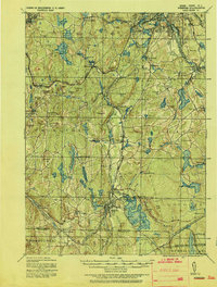
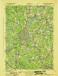
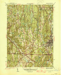
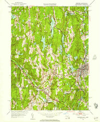
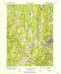
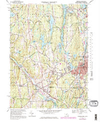
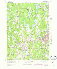
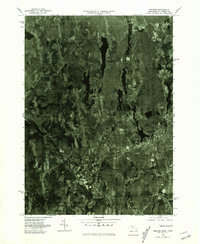
United States Geological Survey topographic
sheets whose coverage includes this point. Matched by taking the coordinate the National Park Service records for this property, then
testing that coordinate against the published boundary of every sheet.
When this property was proposed for the
National Register, someone wrote the case for it: what the building is,
and why it matters. That document is a federal record in the public domain.
It is quoted below word for word, never summarised. The text was read off the scanned case file by machine, so the
occasional stray character is the recogniser's and the 1970s
typewriter's.
Statement of significance
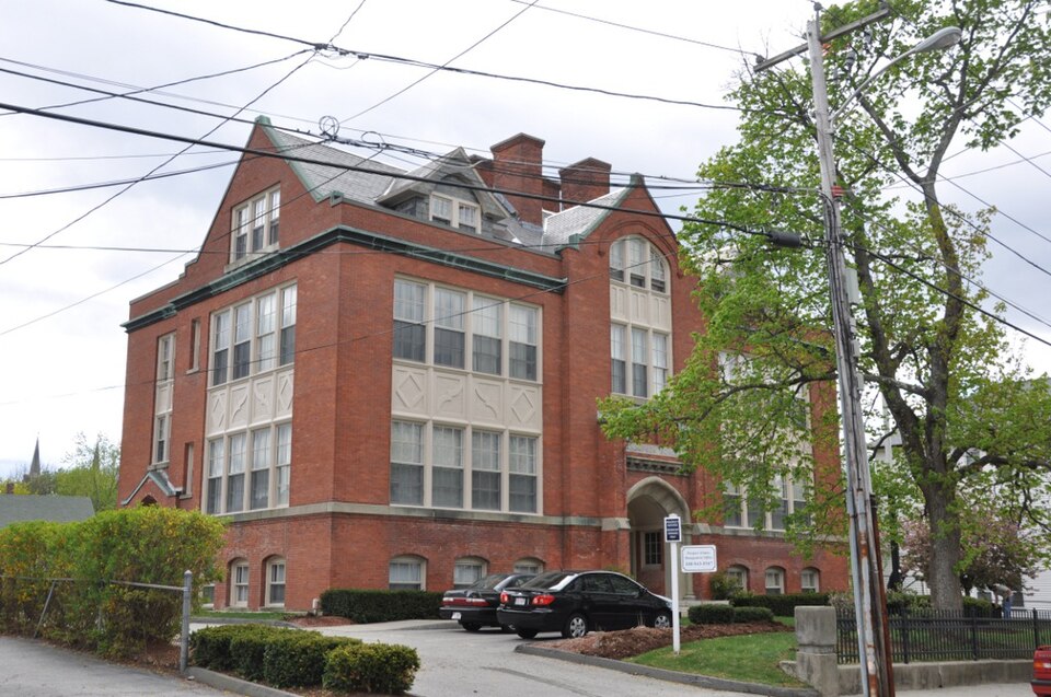
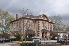
Thompson School, Wehster, Massachusetts Certifying official has considered the significance of this property in relation to other properties: nationally statewide Mlocally Applicable National Register Criteria _B Criteria Considerations (Exceptions) LA Areas of Significance (enter categories from instructions) Architectural Community Planning and Development LE F -G Period of Significance Significant Dates 1912 1912-1938 Cultural Affiliation NA Significant Person NA Architect/Builder Walter F, Fontaine State significance of property, and justify criteria, criteria considerations, and areas and periods of significance noted above.
The Thompson School, Webster, possesses integrity of design, materials, workmanship, setting, and historical association with the development of Webster as an industrial center in the nineteenth and early twentieth centuries. A wel1-preserved example of late Gothic/Jacobean Revival architecture, the building is representative of the substantial public buildings that were constructed in Webster as an expression of civic pride during the town's period of industrial prosperity. The Thompson School thus meets criteria A and C of the National Register of Historic Places, with significance at the local level. The town of Webster was incorporated in 1832, joining land that was formerly part of Oxford and Dudley.
In 1812, manufacturer Samuel Slater began purchasing land in Oxford and Dudley for the purpose of setting up a cotton factory; he began production in the area in 1913. Slater's acquisition of property around his new factory continued into the 1820s as his manufacturing interests grew. In 1832, a petition was filed that provided for the incorporation of the town of Webster, which would be occupied by the 1,168 inhabitants. One of the first orders of business was the establishment of an appropriate public school system. At the first town meeting, a committee was appointed to divide the town into school districts; five districts were formed.
Quoted from the National Register nomination
for reference 89000436, 14 pages, held by the National Archives in Record
Group 79. See the
catalogue record.
Listed places nearby
6 within 8 miles
Other National Register properties close
enough to walk or drive between, ordered by distance from this one. Both
positions come from the same geocoding pass that matched these properties
to their map sheets.
Listing record. National Park Service National Register of Historic Places, listed-properties dataset, current to 2026-05-22.
Map join. Address geocoded through the United States Census geocoder, then tested against the published boundary of every sheet in the USGS Historical Topographic Map Collection.
How this page is made. Listing fields come from federal records; map-sheet coverage is a labelled coordinate-to-boundary calculation, not a source-field claim.
Wildfire. Short, Karen C. 2022. Spatial wildfire occurrence data for the United States, 1992-2020 [FPA_FOD_20221014]. 6th Edition. Fort Collins, CO: Forest Service Research Data Archive. https://doi.org/10.2737/RDS-2013-0009.6 Collected with United States Government funding and usable without additional permissions or fees.
Specimens. Global Biodiversity Information Facility (GBIF), https://www.gbif.org/. Only records licensed CC0 or CC BY are used. Records licensed CC BY-NC are excluded because this site carries advertising. Images are checked individually and any whose licence is non-commercial, no-derivatives or unreadable is refused.
Mines and quarries. USGS Mineral Resources Data System (MRDS) https://mrdata.usgs.gov/mrds/ A work of the United States government, no copyright under 17 U.S.C. 105.
Storms. NOAA National Centers for Environmental Information, Storm Events Database https://www.ncei.noaa.gov/stormevents/ A work of the United States government, no copyright under 17 U.S.C. 105. Narratives are quoted verbatim from the National Weather Service report and are not edited or summarised.
 Block