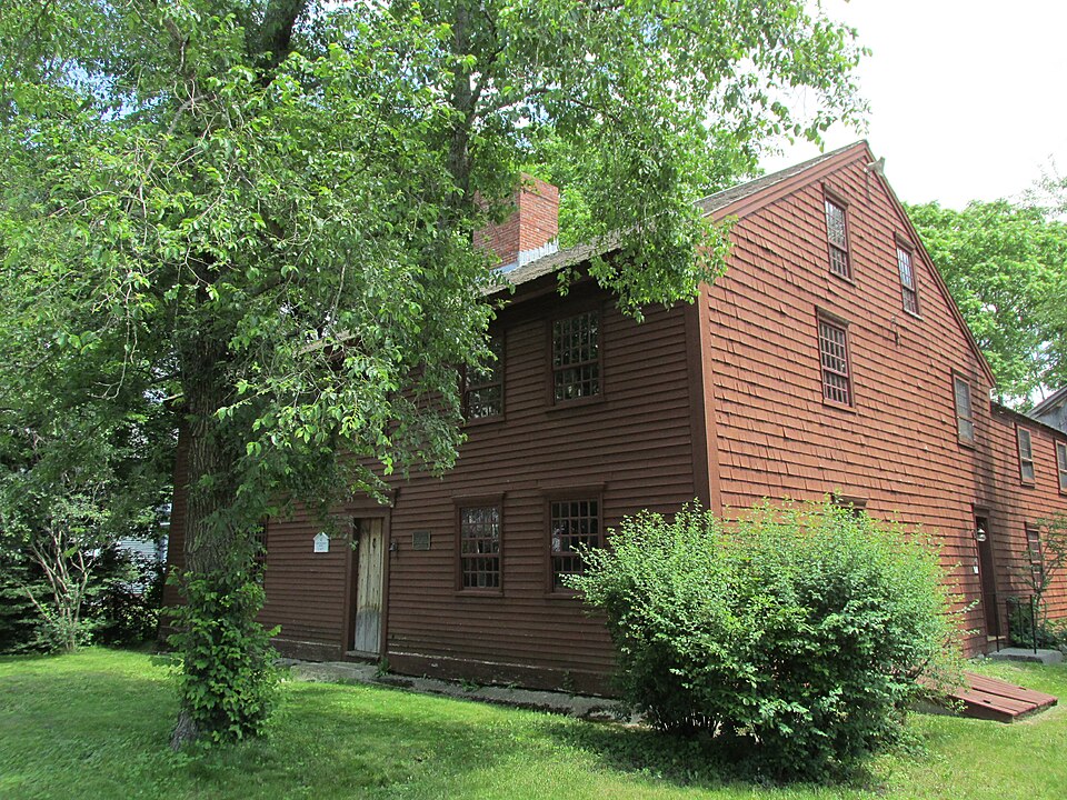
Built in 1677. Listed on the National Register of Historic Places in
1980. A historic map-sheet match is not published yet. The record needs a coordinate-quality review before it can be joined to a sheet boundary.
From the record
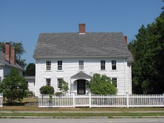
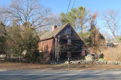
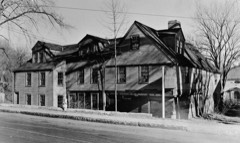
“The Platts-Bradstreet House, is a historic house museum at 233 Main Street in Rowley, Massachusetts. Its oldest portion dating to about 1677, it is a well-preserved example of First Period architecture, modified by repeated addition during the 18th century.”
Wikipedia article Platts-Bradstreet House, CC BY-SA 4.0.
one of 350 National Register listings in Essex County · listed in 1980 · category: Building · built in 1677 · one of 2 National Historic Landmarks in Essex County.
National Register reference number.80000645- the number the National Park Service assigned this property when it was listed, and the key its nomination file is catalogued under at the National Archives.
Fires near this property
52 since 2015
Regional context, not property-specific
evidence. The
federal wildfire occurrence database
lists 52 fires within 5 miles of Platts-Bradstreet House between
2015 and 2020, burning about 43 acres in total. None started naturally. 8 were recorded as arson.
Distance is straight-line from the map coordinates, so a fire counted
here may appear on a neighbouring settlement's page as well.
Reported cause
Fires
Debris and open burning
18
Arson/incendiarism
8
Equipment and vehicle use
8
Missing data/not specified/undetermined
4
Power generation/transmission/distribution
4
Railroad operations and maintenance
3
Smoking
3
Recreation and ceremony
2
Misuse of fire by a minor
2
The most recent of
them, most recent first, with the day each was reported and the service
that recorded it.
Regional context, not property-specific
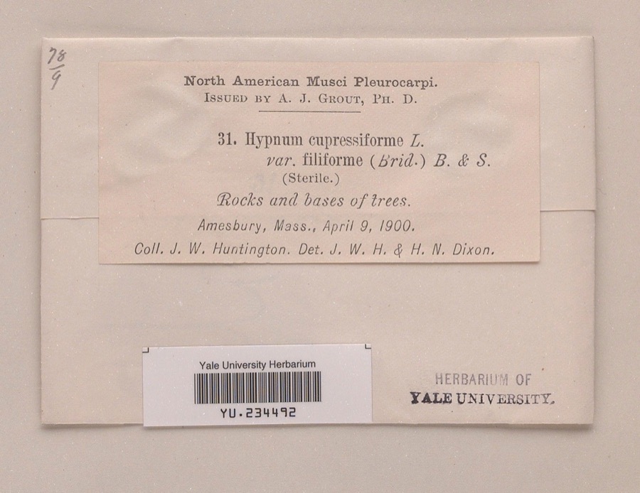
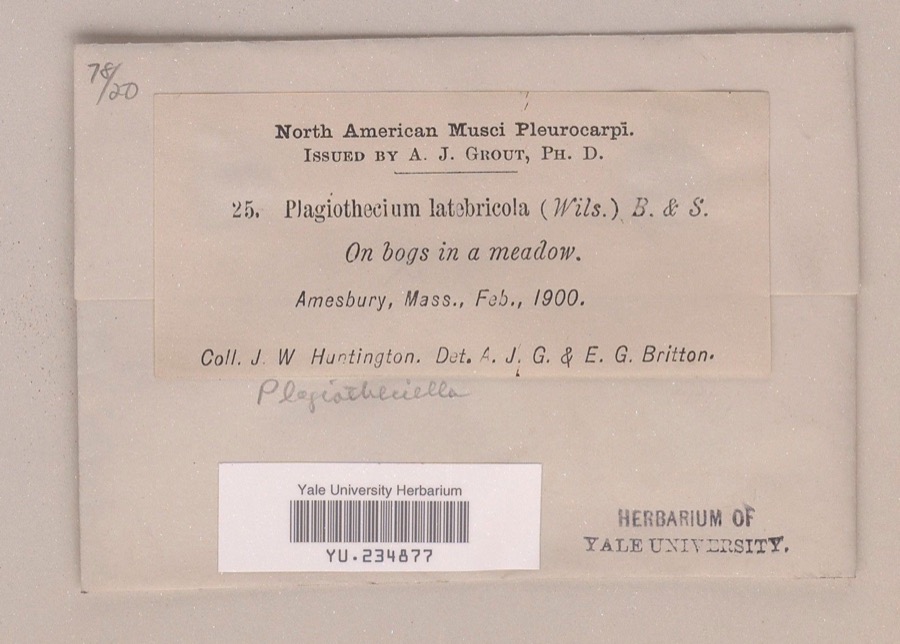
evidence. Museums hold 2,855 specimens
collected within 10 miles of Platts-Bradstreet House between 1821 and
1975: 1,279 Plantae, 926 Animalia, 543 Fungi, 72 Chromista, 17 Unrecorded, 10 Protozoa, 8 Bacteria. 12 distinct Species records are shown.
Collected by A Brown, A. A. Eaton, A. A. Eaton; R. G. Leavitt and others. Each is a
physical object with a catalogue
number, and each entry opens the museum's record. This is what was
collected and kept, not a survey of what lives here - nothing can be
concluded from a species being absent.
Regional context, not property-specific
evidence. The federal mineral resources record lists
9 workings within 5 miles of Platts-Bradstreet House: 7 past producers, 2 producers.
2 still produce. What was taken out: Sand and Gravel, Construction, Lead, Silver, Zinc, Copper, Gold, Silver. Distance is straight-line from the
map coordinates, so a quarry counted here may appear on a neighbouring
settlement's page as well.
Regional context, not property-specific
evidence. The National Weather Service names
Rowley, the town this property stands in, in 7 storm reports between 1999 and 2023: 5 thunderstorm wind, 2 hail.
No death or injury is recorded in these reports. Each account below is quoted exactly as the forecast office
filed it, from the NOAA Storm Events Database, and each date
opens the federal record of that event.
No historic map-sheet match is published
for this property yet. That does not mean no map exists. This record needs
a coordinate-quality review before it can be joined to a sheet boundary.
Browse the county's mapped places while that work is
pending.
From the nomination file
1,829 words on record
When this property was proposed for the
National Register, someone wrote the case for it: what the building is,
and why it matters. That document is a federal record in the public domain.
It is quoted below word for word, never summarised. The text was read off the scanned case file by machine, so the
occasional stray character is the recogniser's and the 1970s
typewriter's.
Description of the property
The Platts -Bradstreet House is located on Main Street (Route 1A) in Rowley just beyond the town green area. It stands on a small lot along with a barn, a shoe shop Dra gerent toae a docadd on edl, and a long raised structure. The house consists of a 2½ story main section with two story rear ell, both of timber frame construction and covered with clapboards on the facade and shingles on the other elevations. The main house is rectangular in plan with a central chimney rising in front of the roof ridge. The facade (west) is asym- metrical consisting of a center entry flanked by two windows on each side at the first story and five windows across the second story. The entry contains a paneled door set within a simple architrave frame.
The windows contain 12/8 double hung sash set in projecting frames; first story windows have molded caps while the heads of second story windows are set in the base of the cornice. 22222 The south elevation is symmetrical, containing two windows at each of the three stories. These windows are identical to the facade windows. The two story ell which extends from this elevation contains an entry and a window at the first story and two windows at the second story. The north elevation is identical to the south with the exception of the The shoe shop is a small one story rectangular plan building which is covered by clap- boards and enclosed by a pitched roof. It contains an entry and window on its north elevation and windows on its other elevations.
The barn is a two story rectangular plan building which is covered with a combination of shingles and weatherboarding and is enlcosed by a pitched roof.
(in one paragraph) The Platts-Bradstreet House possesses integrity of location, design, setting, materials, and workmanship and significant associations with the early development of Rowley. It is a good example of a first period house expanded during the eighteenth century to meet changing needs. Important features include the framing which reflects its earlier lean-to form, interior paneling and existing asymmetrical plan and elevations. It is believed that the house was built in 1677 by Samuel Platts, who had purchased the land in 1660. In that year he was taxed as follows: "To Samuel Platts Senior, to his house and Gate 2 Freeholds and one to Samuel Platts Junior New House". Framing reveals that its original form was a two story, one room deep house.
During the first quarter of the eighteenth century a rear lean-to was added. Between 1766 and 1770 the property passed to Moses Bradstreet and the house was further enlarged by raising the lean-to to create a full 2½ story, two room deep structure. Most of the present interior finish also appear to date from this period. Few other alterations have occured to the building which has been owned by the Rowley Historical Society since the 1920's. Several occupants of the house achieved military distinction. Abel Platts served as an ensign in the Canada Expedition of 1690. Lieutenant Moses Bradstreet and his son, Moses Sr., both served in the Revolution. Along with its outbuidings, the Platts- Bradstreet House is an excellent reflection of early American life.
The Platts-Bradstreet property also contains an archaeological component which may be likely to yield information important in the social history of early American life.
Quoted from the National Register nomination
for reference 80000645, 15 pages, held by the National Archives in Record
Group 79. See the
catalogue record.
Listed places nearby
6 within 8 miles
Other National Register properties close
enough to walk or drive between, ordered by distance from this one. Both
positions come from the same geocoding pass that matched these properties
to their map sheets.
Listing record. National Park Service National Register of Historic Places, listed-properties dataset, current to 2026-05-22.
Map join. Address geocoded through the United States Census geocoder, then tested against the published boundary of every sheet in the USGS Historical Topographic Map Collection.
How this page is made. Listing fields come from federal records; map-sheet coverage is a labelled coordinate-to-boundary calculation, not a source-field claim.
Wildfire. Short, Karen C. 2022. Spatial wildfire occurrence data for the United States, 1992-2020 [FPA_FOD_20221014]. 6th Edition. Fort Collins, CO: Forest Service Research Data Archive. https://doi.org/10.2737/RDS-2013-0009.6 Collected with United States Government funding and usable without additional permissions or fees.
Specimens. Global Biodiversity Information Facility (GBIF), https://www.gbif.org/. Only records licensed CC0 or CC BY are used. Records licensed CC BY-NC are excluded because this site carries advertising. Images are checked individually and any whose licence is non-commercial, no-derivatives or unreadable is refused.
Mines and quarries. USGS Mineral Resources Data System (MRDS) https://mrdata.usgs.gov/mrds/ A work of the United States government, no copyright under 17 U.S.C. 105.
Storms. NOAA National Centers for Environmental Information, Storm Events Database https://www.ncei.noaa.gov/stormevents/ A work of the United States government, no copyright under 17 U.S.C. 105. Narratives are quoted verbatim from the National Weather Service report and are not edited or summarised.
 Block
Block