Listed on the National Register of Historic Places in
1983. A historic map-sheet match is not published yet. The record needs a coordinate-quality review before it can be joined to a sheet boundary.
From the record
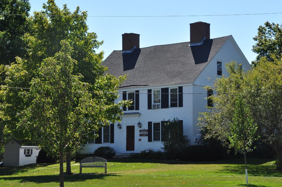
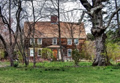
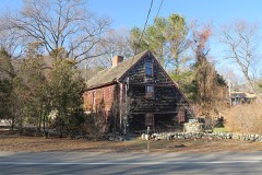
“The Hale-Boynton House is a historic house on Middle Street in Newbury, Massachusetts. The house is now part of the campus of The Governor's Academy, where it is referred to as "Boynton House".”
Wikipedia article Hale-Boynton House, CC BY-SA 4.0.
one of 350 National Register listings in Essex County · listed in 1983 · category: Building · one of 2 National Historic Landmarks in Essex County.
National Register reference number.83000578- the number the National Park Service assigned this property when it was listed, and the key its nomination file is catalogued under at the National Archives.
Fires near this property
63 since 2015
Regional context, not property-specific
evidence. The
federal wildfire occurrence database
lists 63 fires within 5 miles of Hale-Boynton House between
2015 and 2020, burning about 31 acres in total. None started naturally. 9 were recorded as arson.
Distance is straight-line from the map coordinates, so a fire counted
here may appear on a neighbouring settlement's page as well.
Reported cause
Fires
Debris and open burning
18
Equipment and vehicle use
14
Arson/incendiarism
9
Missing data/not specified/undetermined
8
Misuse of fire by a minor
4
Recreation and ceremony
4
Power generation/transmission/distribution
3
Smoking
2
Railroad operations and maintenance
1
The most recent of
them, most recent first, with the day each was reported and the service
that recorded it.
Regional context, not property-specific
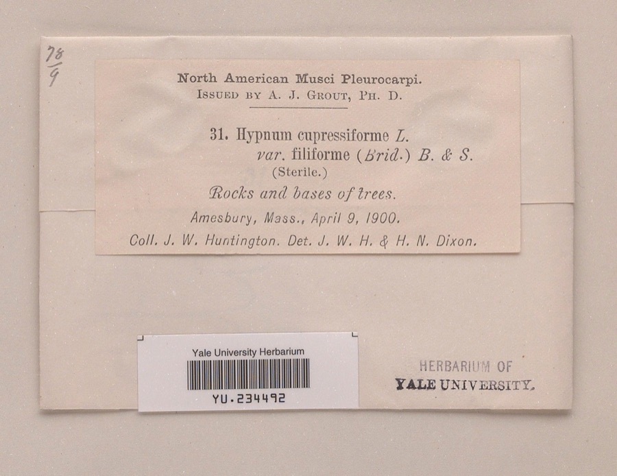
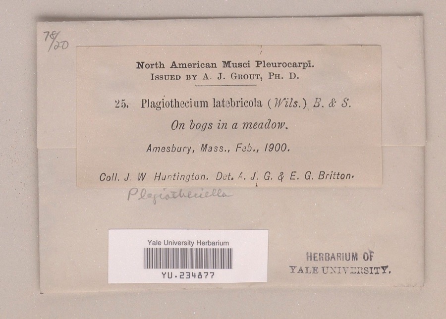
evidence. Museums hold 3,208 specimens
collected within 10 miles of Hale-Boynton House between 1800 and
1975: 1,653 Plantae, 935 Animalia, 506 Fungi, 92 Chromista, 11 Protozoa, 9 Unrecorded, 2 Bacteria. 12 distinct Species records are shown.
Collected by A A Eaton, A Brown, A. A. Eaton and others. Each is a
physical object with a catalogue
number, and each entry opens the museum's record. This is what was
collected and kept, not a survey of what lives here - nothing can be
concluded from a species being absent.
Regional context, not property-specific
evidence. The federal mineral resources record lists
5 workings within 5 miles of Hale-Boynton House: 3 past producers, 2 producers.
2 still produce. What was taken out: Sand and Gravel, Construction, Lead, Silver, Zinc, Copper, Gold, Silver. Distance is straight-line from the
map coordinates, so a quarry counted here may appear on a neighbouring
settlement's page as well.
No historic map-sheet match is published
for this property yet. That does not mean no map exists. This record needs
a coordinate-quality review before it can be joined to a sheet boundary.
Browse the county's mapped places while that work is
pending.
From the nomination file
3,512 words on record
When this property was proposed for the
National Register, someone wrote the case for it: what the building is,
and why it matters. That document is a federal record in the public domain.
It is quoted below word for word, never summarised. The text was read off the scanned case file by machine, so the
occasional stray character is the recogniser's and the 1970s
typewriter's.
Description of the property
The Hale-Boynton House (1764) is a Georgian period dwelling located on the campus of Governor Dummer School in Byfield, a subsection of the town of Newbury, Massachusetts. It is situated on a small rise, rolling east across Middle Road, formerly the Old Bay Colony Road. The Governor Dummer campus, an informally arranged group of domestic and moderate scaled institutional buildings, occupies a rural setting on the south bank of the Parker River. The house rises two-and-one-half stories high from a low rubble stone foundation. Above the symmetrical five bay main facade, two twin interior chimneys punctuate an expansive, steeply pitched gable roof. A one story addition, fifteen feet deep, extends across the rear of the house.
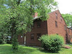
post and beam construction, the house is clapboarded on the main (east) and rear (west) elevations, and shingled on the side elevations.Decor- ative shingles in the gables date this alteration to c. 1890-1900, when the house changed ownership for the first time. Other extensive woodwork details such as the cornice and window casings are simple and restrained in design. The original six light transom above the wide central doorway is characteristic of late 18th century rural designs. Other elements of the entrance have been modified, although a c. 1951 view indicates that a simple surround existed even before 1960 rehabilitation, which also enlarged the earlier 6/6 sash to the existing 12/12 double hung sash.
While the exterior is Istrikingly handsome for its generous proportions and dignified simplicity, it is the interior which has drawn the most comment from architectural historians. From the traditional four room plan with back to back fireplaces, the plan departs significantly, arranging five rooms around a double and a triple fireplace chimney. The southern stack is rectangular with a shallow west room.
(in one paragraph) Builder/Architect Unknown The Hale-Boynton House possesses integrity of location, design, setting, materials, workmanship, feeling and association. Completed in 1764, it is significant for both its historic associations and the excellent preservation of its fine period architectural detailing. The house was built and owned for 133 years by the Hale family who were closely associated with Governor Dummer Academy, the oldest boys' boarding school in the U.S. Subsequently, it was owned by E. Moody Boynton, inventor of the M-toothed speed saw and the first working monorail system in the country. Architecturally, as noted by Abbott Lowell Cummings in 1956, "(the house) contains in an unusually unaltered condition, considerable typical woodwork and hardware of its period.
In addition, it exhibits out of the ordinary arrangement of the fireplaces."! Thus, the property meets criteria B and C of the National Register of Historic Places. The history of the property began for the English in 1634 when Richard Dummer, Richard Saltonstall, and Henry Sewall contracted for the importation of cattle and selected this territory along the Parker River for settlement. By 1658, they had built a bridge across the river and a road, which was an important segment of the highway from Boston to Ports- The Hales were among the first settlers in the area.
By 1733 Joseph Hale had built and was operating a tavern on this Bay Colony Road; he was also a cordwainer and "gentleman." His son, Captain Joseph Hale began keeping family ledgers in 173°, which were maintained for over a century and are a source of information on the Hale-Boynton House. An entry of 1764 states that the tavern was taken down in that year and the new Hale house begun on the same site.
Quoted from the National Register nomination
for reference 83000578, 23 pages, held by the National Archives in Record
Group 79. See the
catalogue record.
Listed places nearby
6 within 8 miles
Other National Register properties close
enough to walk or drive between, ordered by distance from this one. Both
positions come from the same geocoding pass that matched these properties
to their map sheets.
Listing record. National Park Service National Register of Historic Places, listed-properties dataset, current to 2026-05-22.
Map join. Address geocoded through the United States Census geocoder, then tested against the published boundary of every sheet in the USGS Historical Topographic Map Collection.
How this page is made. Listing fields come from federal records; map-sheet coverage is a labelled coordinate-to-boundary calculation, not a source-field claim.
Wildfire. Short, Karen C. 2022. Spatial wildfire occurrence data for the United States, 1992-2020 [FPA_FOD_20221014]. 6th Edition. Fort Collins, CO: Forest Service Research Data Archive. https://doi.org/10.2737/RDS-2013-0009.6 Collected with United States Government funding and usable without additional permissions or fees.
Specimens. Global Biodiversity Information Facility (GBIF), https://www.gbif.org/. Only records licensed CC0 or CC BY are used. Records licensed CC BY-NC are excluded because this site carries advertising. Images are checked individually and any whose licence is non-commercial, no-derivatives or unreadable is refused.
Mines and quarries. USGS Mineral Resources Data System (MRDS) https://mrdata.usgs.gov/mrds/ A work of the United States government, no copyright under 17 U.S.C. 105.
 Block
Block