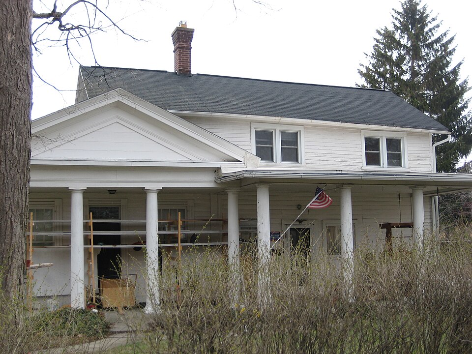
Listed on the National Register of Historic Places in
1980. A historic map-sheet match is not published yet. The record needs a coordinate-quality review before it can be joined to a sheet boundary.
From the record
“Michael Thomas and wife, and sons, Liverton, Michael, Hugh and Jonathan, came here fi-om Wayne County, Ohio, in the spring of 1832. The parents settled on the northwest quarter of Section 3, and Liverton, who was then married, on the southwest quarter of Section 2.”
History of Hancock County, Ohio : Containing a History of the County, Its Townships, Towns ... Portraits of Early Settlers and Prominent Men, Biographies, History of the Northwest Territory, History of Ohio, Statistical and Miscellaneous Matter, Etc (1886). Machine-read text.
one of 12 National Register listings in Hancock County · listed in 1980 · category: Building.
National Register reference number.80003095- the number the National Park Service assigned this property when it was listed, and the key its nomination file is catalogued under at the National Archives.
This township is watered by the east and middle branches of the Portage River. These branches are now known by the names of x\rcadia and Fostoria Creeks, one passing through the town of Arcadia, and the other one through Fostoria. The east branch has its source in section twelve, in Big Lick Tow nship, running in a north-easterly direction, entering this township in section thirty-five, running across the township in a north-easterly course, leaving it near the north-east corner of the county. The middle branch rises at the south line of the township, about four miles southeast of the village of Arcadia, crossing the township, leaving it near the north-west corner.
The first church in this township was built in i^'.Vl. at the center of section five, by the Methodists. xVlthough the building was erected at this time, yet for some reason it was not occupied for church purposes until some years later.. The first church in which worship was conducted, was on section one, near the north-east corner of the county, now West Fostoria, and was built by the Methodists. It was a hewed log building, about tw^euty-six by thirty-two feet, and probably seven feet between the floor and ceiling, and was* covered with lap shingles.
Regional context, not property-specific
evidence. The
federal wildfire occurrence database
lists 2 fires within 5 miles of Dana, Marcus, House between
2002 and 2002, burning about 0 acres in total. None started naturally. None was recorded as arson.
Distance is straight-line from the map coordinates, so a fire counted
here may appear on a neighbouring settlement's page as well.
Reported cause
Fires
Missing data/not specified/undetermined
2
The most recent of
them, most recent first, with the day each was reported and the service
that recorded it.
Regional context, not property-specific
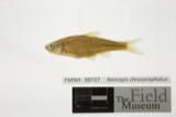
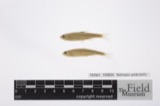
evidence. Museums hold 7 specimens
collected within 10 miles of Dana, Marcus, House between 1975 and
1975: 7 Animalia. 6 distinct Species records are shown.
Collected by Hoke, B. & Norrocky, M. J. (Michael J.), Norrocky, M. J. (Michael J.). Each is a
physical object with a catalogue
number, and each entry opens the museum's record. This is what was
collected and kept, not a survey of what lives here - nothing can be
concluded from a species being absent.
No historic map-sheet match is published
for this property yet. That does not mean no map exists. This record needs
a coordinate-quality review before it can be joined to a sheet boundary.
Browse the county's mapped places while that work is
pending.
From the nomination file
1,606 words on record
When this property was proposed for the
National Register, someone wrote the case for it: what the building is,
and why it matters. That document is a federal record in the public domain.
It is quoted below word for word, never summarised. The text was read off the scanned case file by machine, so the
occasional stray character is the recogniser's and the 1970s
typewriter's.
Description of the property
house are double-hung with wood surrounds, with some 2/2, some 4/1, etc. The windows chimney in the house. This room features an ornate oil chandelier that has been electrified; three oil Lamps on it. Iwo bedrooms, each 9½ x 15 feet, were back of the main room. Walls x 20 feet) that was a stationhouse for stagecoaches visiting Risdon. The brick foundations have been located on the property, and, like the brick for the main house foundation, this DATE The original horizontal wood siding with endboards can be seen on probably was made from clay found along the nearby Portage Creek. The southern section of the house was built in 1836 and is AREAS OF
Statement of significance
The Marcus Dana Residence is significant as an excellent local example of Greek Revival architecture, as the oldest home in Fostoria, and as the residence of one of the Greek Revival full portico with pediment, the house was enlarged four years later. The Risdon, the Dana residence has a beautiful setting facing the Risdon Square, now maintained house stayed in the Dana family for 58 years and, after other owners, was purchased by practicing medicine "in Rison in-June 1834. As one of the first two doctors in Risdon, he continued his medical practice until his death in June 1853. Dana was also active in the first church in Risdon, which was located near his home.
Although the ownership record of the house is not clear after Dana's death, it appears that the house stayed in the family for 58 years (Dana bought the land in 1835) and was then owned by the Lloyd and Hathaway families before being purchased by Howard Kimes in 1908. The Kimes family lived here for 7 years before purchasing the property. Elwood Kimes, one of the five children of Howard, is the present owner of the property.
the City of Fostoria, but it is easy to miss the importance of the area as you drive 1700-1799 1600-1699 LAW 1400-1499 1900- ART ARCHEOLOGY-HISTORIC ECONOMICS EDUCATION SIGNIFICANCE AGRICULTURE PERIOD THEATER BUILDER/ARCHITECT INDUSTRY LITERATURE X1800-1899 XARCHITECTURE _CONSERVATION facing on to Risdon Square, is an excellent reminder of Risdon's brief history as an through Fostoria today. _TRANSPORTATION _SOCIAL/HUMANITARIAN College (another source says Jefferson Medical College in Philadelphia),Dana started articles and local histories as an important local structure.
Quoted from the National Register nomination
for reference 80003095, 11 pages, held by the National Archives in Record
Group 79. See the
catalogue record.
Listed places nearby
1 within 8 miles
Other National Register properties close
enough to walk or drive between, ordered by distance from this one. Both
positions come from the same geocoding pass that matched these properties
to their map sheets.
Listing record. National Park Service National Register of Historic Places, listed-properties dataset, current to 2026-05-22.
Map join. Address geocoded through the United States Census geocoder, then tested against the published boundary of every sheet in the USGS Historical Topographic Map Collection.
How this page is made. Listing fields come from federal records; map-sheet coverage is a labelled coordinate-to-boundary calculation, not a source-field claim.
Wildfire. Short, Karen C. 2022. Spatial wildfire occurrence data for the United States, 1992-2020 [FPA_FOD_20221014]. 6th Edition. Fort Collins, CO: Forest Service Research Data Archive. https://doi.org/10.2737/RDS-2013-0009.6 Collected with United States Government funding and usable without additional permissions or fees.
Specimens. Global Biodiversity Information Facility (GBIF), https://www.gbif.org/. Only records licensed CC0 or CC BY are used. Records licensed CC BY-NC are excluded because this site carries advertising. Images are checked individually and any whose licence is non-commercial, no-derivatives or unreadable is refused.
 Block
Block