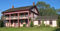
Listed on the National Register of Historic Places in
1980. A historic map-sheet match is not published yet. The record needs a coordinate-quality review before it can be joined to a sheet boundary.
From the record
one of 81 National Register listings in Stark County · listed in 1980 · category: Building.
National Register reference number.80003235- the number the National Park Service assigned this property when it was listed, and the key its nomination file is catalogued under at the National Archives.
Fires near this property
2 since 2002
Regional context, not property-specific
evidence. The
federal wildfire occurrence database
lists 2 fires within 5 miles of Hartville Hotel between
2002 and 2002, burning about 0 acres in total. None started naturally. None was recorded as arson.
Distance is straight-line from the map coordinates, so a fire counted
here may appear on a neighbouring settlement's page as well.
Reported cause
Fires
Recreation and ceremony
1
Debris and open burning
1
The most recent of
them, most recent first, with the day each was reported and the service
that recorded it.
Regional context, not property-specific
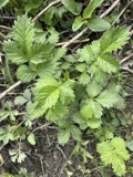
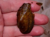
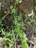
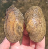
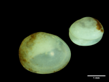
evidence. Museums hold 130 specimens
collected within 10 miles of Hartville Hotel between 1887 and
1975: 118 Animalia, 11 Plantae, 1 Fungi. 12 distinct Species records are shown.
Collected by A. W. Cusick, Allen, John, Armbruster, D. C. (Daniel C.) and others. Each is a
physical object with a catalogue
number, and each entry opens the museum's record. This is what was
collected and kept, not a survey of what lives here - nothing can be
concluded from a species being absent.
Regional context, not property-specific
evidence. The federal mineral resources record lists
6 workings within 5 miles of Hartville Hotel: 3 past producers, 2 producers, 1 plant.
3 still produce. What was taken out: Sand and Gravel, Construction, Limestone, General, Stone, Crushed/Broken. Distance is straight-line from the
map coordinates, so a quarry counted here may appear on a neighbouring
settlement's page as well.
Regional context, not property-specific
evidence. The National Weather Service names
Hartville, the town this property stands in, in 22 storm reports between 1996 and 2010: 11 thunderstorm wind, 9 hail, 1 funnel cloud, 1 flash flood.
No death or injury is recorded in these reports. Each account below is quoted exactly as the forecast office
filed it, from the NOAA Storm Events Database, and each date
opens the federal record of that event.
A line of severe thunderstorms moved across Stark County just before daybreak and caused widespread damage and scattered power outages. A 63 mph thunderstorm wind gust was measured near Hartville at 531 a.m. Dozens of trees were downed across the county and homes were damaged in Alliance and near East Canton. Several vehicles were also damaged or destroyed in the county.
Heavy rain fell across the area during the morning hours of the 20th. Flash flooding conditions quickly developed during the mid morning hours as many roads between Hartville and Alliance were closed. A spotter in Hartville reported 3.05 inches of rain between 9:30 am and 11:00 am, with 2.0 inches falling just between 9:30 am and 10:30 am.
No historic map-sheet match is published
for this property yet. That does not mean no map exists. This record needs
a coordinate-quality review before it can be joined to a sheet boundary.
Browse the county's mapped places while that work is
pending.
From the nomination file
1,515 words on record
When this property was proposed for the
National Register, someone wrote the case for it: what the building is,
and why it matters. That document is a federal record in the public domain.
It is quoted below word for word, never summarised. The text was read off the scanned case file by machine, so the
occasional stray character is the recogniser's and the 1970s
typewriter's.
Description of the property
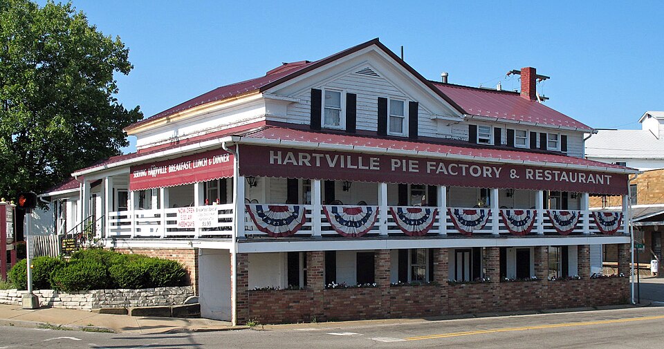
The original structure consisted of a two-story log cabin, rectangular was an outside end chimney. It had a board & batten door, characteristic of pioneer days. Over the years from 1829 to 1895, the Hartville Hotel changed in size and looks. By the latter date it had become a two and a half story structure, dation and weather-boarding walls. There was a two story porch, a gambrel roof, and a shed roof over the second story porch. The windows were double- From 1895 to the present, still more changes were made to the building. Today the structure is a two and a half story, L-shaped, four bay construction. The low stone foundation, weather-boarding walls, second story porch, gambrel roof, and shed roof are still existant, although improvements have been added.
box cornice eaves still are in place, while the windows have changed slightly CONDITION UNEXPOSED DETERIORATED DESCRIPTION FAIR XALTERED UNALTERED corbeled caps.The eaves of the structure were of the box cornice type. place for community civic groups to meet.On the third floor exists the residence in shape.It had a low stone foundation.The roof was gable-shaped and there CHECK ONE There is now one outside end chimney on the north side of the building.The hung sash (l/l) with plain trim.There existed several interior chimneys with a spacious restaurant and kitchen. The second floor has been made over to a due to breakage and other factors.
The present use of the building is three-fold.On the first floor houses rectangular in shape.It was now a four bay building with a low stone foun- of the present owners of the Pantry Restaurant. from double-hung sash(1/l) to double-hung sash(mixture of 1/1,2/2,4/4) -GOOD AREAS OF
Statement of significance
the early 1810's, a man by the name of John Morehart built a tavern and rounding forests, the "Hartville Hotel" served as the focal gathering ions. Besides being a long-time tavern and lodging house, the Hartville Hotel has been a stagecoach stop, a livery stable, an Underground Rail- road station (reputedly), and presently a restaurant, private residence, The Hartville Hotel, now the Pantry, has been a local landmark for whatever it has been known for, the Hartville Hotel has been in the ante-bellum heritage of the village. 1400-1499 nail.
LAW RELIGION INVENTION AGRICULTURE ARCHEOLOGY-HISTORIC ARCHITECTURE POLITICS/GOVERNMENT ENGINEERING MILITARY COMMUNICATIONS ART SCIENCE EDUCATION THEATER SIGNIFICANCE TRANSPORTATION PERIOD ECONOMICS LITERATURE XCOMMERCE ARCHEOLOGY-PREHISTORIC SCULPTURE _EXPLORATION/SETTLEMENT and place where local civic organizations hold their meetings.
ities and alcoholic beverages;today it is known for its fine food.But of the village square.Constructed primarily of logs hewn from the sur- day remains virtually intact, but has been covered over and remodeled spot for local townsfolk and travelers for many years.The structure to- _CONSERVATION The Hartville Hotel is the oldest building in the community and is crossroads and its age help to define its significance and role in the so that the log construction no longer shows.
_OTHER(SPECIFY) lodging quarters at the crossroads in Hartville on the northwest corner Over the past 149 years the Hartville Hotel (known today as the Pan- _PHILOSOPHY -1500-1599 _SOCIAL/HUMANITARIAN -1600-1699 In 1829,after having settled in the Hartville/Congress Lake area in -1700-1799 -1900- -MUSIC BUILDER/ARCHITECT John Morehart INDUSTRY try Restaruant has served the local community in several different fash- the only pre-Civil War structure remaining. Its location at the main
Quoted from the National Register nomination
for reference 80003235, 14 pages, held by the National Archives in Record
Group 79. See the
catalogue record.
Listed places nearby
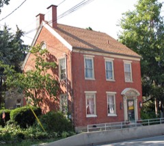
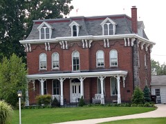
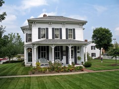
6 within 8 miles
Other National Register properties close
enough to walk or drive between, ordered by distance from this one. Both
positions come from the same geocoding pass that matched these properties
to their map sheets.
Listing record. National Park Service National Register of Historic Places, listed-properties dataset, current to 2026-05-22.
Map join. Address geocoded through the United States Census geocoder, then tested against the published boundary of every sheet in the USGS Historical Topographic Map Collection.
How this page is made. Listing fields come from federal records; map-sheet coverage is a labelled coordinate-to-boundary calculation, not a source-field claim.
Wildfire. Short, Karen C. 2022. Spatial wildfire occurrence data for the United States, 1992-2020 [FPA_FOD_20221014]. 6th Edition. Fort Collins, CO: Forest Service Research Data Archive. https://doi.org/10.2737/RDS-2013-0009.6 Collected with United States Government funding and usable without additional permissions or fees.
Specimens. Global Biodiversity Information Facility (GBIF), https://www.gbif.org/. Only records licensed CC0 or CC BY are used. Records licensed CC BY-NC are excluded because this site carries advertising. Images are checked individually and any whose licence is non-commercial, no-derivatives or unreadable is refused.
Mines and quarries. USGS Mineral Resources Data System (MRDS) https://mrdata.usgs.gov/mrds/ A work of the United States government, no copyright under 17 U.S.C. 105.
Storms. NOAA National Centers for Environmental Information, Storm Events Database https://www.ncei.noaa.gov/stormevents/ A work of the United States government, no copyright under 17 U.S.C. 105. Narratives are quoted verbatim from the National Weather Service report and are not edited or summarised.
 Block
Block