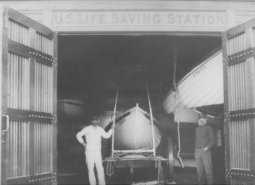
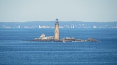
Photograph by Unknown author Unknown author, Public domain. Via
Wikimedia Commons.
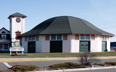
Point Allerton Lifesaving Station
Listed on the National Register of Historic Places in
1981. A historic map-sheet match is not published yet. The record needs a coordinate-quality review before it can be joined to a sheet boundary.
From the record
“Point Allerton Lifesaving Station is a historic building of the United States Life-Saving Service at 1117 Nantasket Avenue in Hull, Massachusetts. The service was eventually merged with the Revenue Cutter Service to form the United States Coast Guard.”
Wikipedia article Point Allerton Lifesaving Station, CC BY-SA 4.0.
one of 93 National Register listings in Plymouth County · listed in 1981 · category: Building · one of 1 National Historic Landmarks in Plymouth County.
Architectural style. Queen Anne style architecture in the United States
National Register reference number.81000110- the number the National Park Service assigned this property when it was listed, and the key its nomination file is catalogued under at the National Archives.
Fires near this property
86 since 2015
Regional context, not property-specific
evidence. The
federal wildfire occurrence database
lists 86 fires within 5 miles of Point Allerton Lifesaving Station between
2015 and 2020, burning about 26 acres in total. None started naturally. 1 was recorded as arson.
Distance is straight-line from the map coordinates, so a fire counted
here may appear on a neighbouring settlement's page as well.
Reported cause
Fires
Debris and open burning
52
Recreation and ceremony
11
Missing data/not specified/undetermined
10
Misuse of fire by a minor
6
Smoking
4
Fireworks
2
Arson/incendiarism
1
The most recent of
them, most recent first, with the day each was reported and the service
that recorded it.
Regional context, not property-specific
evidence. Museums hold 5,538 specimens
collected within 10 miles of Point Allerton Lifesaving Station between 1810 and
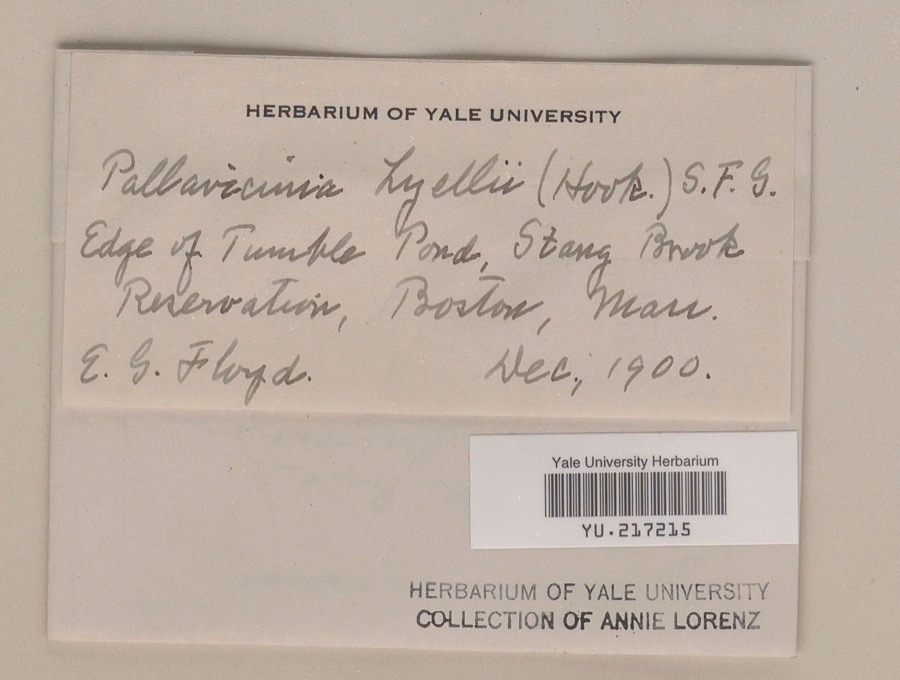
1975: 3,432 Plantae, 1,089 Animalia, 572 Fungi, 369 Chromista, 53 Unrecorded, 16 Protozoa, 7 Bacteria. 12 distinct Species records are shown.
Collected by (MARSDEN, H W), A Loveridge, A Phelps Wyman and others. Each is a
physical object with a catalogue
number, and each entry opens the museum's record. This is what was
collected and kept, not a survey of what lives here - nothing can be
concluded from a species being absent.
Regional context, not property-specific
evidence. The federal mineral resources record lists
1 working within 5 miles of Point Allerton Lifesaving Station: 1 past producer.
None of them still produces. What was taken out: Stone, Crushed/Broken. Distance is straight-line from the
map coordinates, so a quarry counted here may appear on a neighbouring
settlement's page as well.
Regional context, not property-specific
evidence. The National Weather Service names
Hull, the town this property stands in, in 6 storm reports between 1997 and 2006: 3 thunderstorm wind, 1 hail, 1 lightning, 1 flood.
The reports record 1 death. Each account below is quoted exactly as the forecast office
filed it, from the NOAA Storm Events Database, and each date
opens the federal record of that event.
No historic map-sheet match is published
for this property yet. That does not mean no map exists. This record needs
a coordinate-quality review before it can be joined to a sheet boundary.
Browse the county's mapped places while that work is
pending.
Named in the fire insurance atlases
Sanborn surveyors printed an index of the
town's establishments at the front of each atlas. This property is named in
one, read straight off the scanned sheet.
When this property was proposed for the
National Register, someone wrote the case for it: what the building is,
and why it matters. That document is a federal record in the public domain.
It is quoted below word for word, never summarised. The text was read off the scanned case file by machine, so the
occasional stray character is the recogniser's and the 1970s
typewriter's.
Description of the property
The Point Allerton Life Saving Station is situated in its original location on Stony Beach at the entrance to Boston Harbor and at the foot of Telegraph Hill in Hull. It occupies a 7500 square foot lot on the south side of Nantasket Avenue; the property also includes another 3040 square feet of waterfront acreage across the Avenue. Neigh- boring properties include homes that have been or still are occupied by surfmen who served at the Station. At the top of Telegraph Hill is the Fort Revere National Register district which includes a Revolutionary War fort, telegraph signal stations, and the World War I era Fort Revere. The Station and Fort Revere 1ook out toward Boston Light (NR), the oldest lighthouse in the country..
The Station is a 1½ story Queen Anne style structure with a latter two story rear ell attached to its southeast corner. The walls are sheathed with clapboards while the roof is covered with cedar shingles. It rests on a modern poured concrete foundation and all windows are currently boarded up. size and placement. A small one story outbuilding with a gable roof stands directly behind the ell. The original portion of the station, constructed in 1889, is rectangular in plan and consists of two sections. The eastern section which contains kitchen, living and dining quarters, is enclosed by a pitched roof and faces gable end to the street. A center chimney rises through its ridge and two hip roof dormer pierce the eastern slope of its roof. The main entry is located west of center.
The western section, which orignally functioned as a boat room, is enclosed by a hip roof whose front slope is pierced by a latter oversized dormer.
(in one paragraph) Builder/Architect U.S. Corps of Engineers The Point Allerton Lite Saving Station possesses integrity of location, design, setting, materials, and workmanship. It is significant both for the central role it has played in Massachusetts maritime history and for its associations with Captain Joshua James, its first keeper and the most decorated life saver in United States history. The Station therefore meets criteria A and B of the National Register of Historic Places. The United States decided toestablish a Life Saving Service station at Point Allerton after Joshua James and his crew rescued 29 persons from four vessels wrecked in the shipping entrance to Boston Harbor during the great storm of November, 1888. the holder of the gold life saving medal of the U.S.
Treasury Deparmtent and the gold, silver, and bronze medals of the Massachusetts Humane Society. Appointed Keeper at the age of 62, Capt. James received the only waiver of the Keeper's age requirements given by the U.S. Congress. Between 1890 and his death in 1902, Capt. James and his crews rescued people from eighty-six shipwrecks which occurred within the jurisdiction of the Point Allerton Station. There were 556 persons on board these vessels. Only 16 of these lost their lives, and they were all lost in the terrible storm of November, 1898, under circumstances which placed them beyond human aid and which precluded even an attempt to assist them. The Station is also significant as a link between the earliest days of U.S. Lifesaving and current U.S. Lifesaving activity.
At the time it was built, the Point Allerton Life Saving Station replaced the exisitng small station that had been established by the Massachusetts Humane Society prior to 1874.
Quoted from the National Register nomination
for reference 81000110, 12 pages, held by the National Archives in Record
Group 79. See the
catalogue record.
Listed places nearby
3 within 8 miles
Other National Register properties close
enough to walk or drive between, ordered by distance from this one. Both
positions come from the same geocoding pass that matched these properties
to their map sheets.
Listing record. National Park Service National Register of Historic Places, listed-properties dataset, current to 2026-05-22.
Map join. Address geocoded through the United States Census geocoder, then tested against the published boundary of every sheet in the USGS Historical Topographic Map Collection.
How this page is made. Listing fields come from federal records; map-sheet coverage is a labelled coordinate-to-boundary calculation, not a source-field claim.
Wildfire. Short, Karen C. 2022. Spatial wildfire occurrence data for the United States, 1992-2020 [FPA_FOD_20221014]. 6th Edition. Fort Collins, CO: Forest Service Research Data Archive. https://doi.org/10.2737/RDS-2013-0009.6 Collected with United States Government funding and usable without additional permissions or fees.
Specimens. Global Biodiversity Information Facility (GBIF), https://www.gbif.org/. Only records licensed CC0 or CC BY are used. Records licensed CC BY-NC are excluded because this site carries advertising. Images are checked individually and any whose licence is non-commercial, no-derivatives or unreadable is refused.
Mines and quarries. USGS Mineral Resources Data System (MRDS) https://mrdata.usgs.gov/mrds/ A work of the United States government, no copyright under 17 U.S.C. 105.
Storms. NOAA National Centers for Environmental Information, Storm Events Database https://www.ncei.noaa.gov/stormevents/ A work of the United States government, no copyright under 17 U.S.C. 105. Narratives are quoted verbatim from the National Weather Service report and are not edited or summarised.
 Block
Block