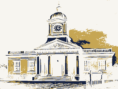
Listed on the National Register of Historic Places in
1981. A historic map-sheet match is not published yet. The record needs a coordinate-quality review before it can be joined to a sheet boundary.
From the record
“On March 9, 1792, Judge Dana and sundry associates were incorporated as the "Proprietors of West Boston Bridge," with authority to build a toll bridge from the westerly part of Boston to Pelham's Island in the town of Cambridge. The toll franchise was to run for forty years, and from the tolls the proprietors were required to pay three hundred pounds a year to Harvard College.”
A History of Cambridge, Massachusetts, 1630-1913 (1913). Machine-read text.
one of 1100 National Register listings in Middlesex County · listed in 1981 · category: Site · one of 3 National Historic Landmarks in Middlesex County.
National Register reference number.81000115- the number the National Park Service assigned this property when it was listed, and the key its nomination file is catalogued under at the National Archives.
Dr. Appleton and the people of the Cambridge Church shared the feelings of their neighbors. In the Boston Evening Post, of January 7, 1745, we read the following record of a gathering held at "Cambridge, Jan. 1, 1744-5. At a meeting of the Association of this and the neighboring towns, present, the Reverend Messieurs John Hancock of Lexington, WilHam Williams of Weston, John Cotton of Newton, Nath. Appleton of Cambridge, Warham Williams of Waltham, Seth Storer of Watertown, Eben. Turell of Medford, Nicholas Bowes of Bedford, Samuel Cook of Cambridge. The Rev. Mr. Appleton having applied to his brethren of said association for our advice, relating to a request which hath been made to him by a number of his church and congregation, that he would invite the Rev. Mr. George White field to preach in Cambridge; after supplications to God and mature consideration of the case proposed, and the several pleas made in favor of said request, and the state of the town, as also the many weighty objections which lie against the said Mr. Whitefield, with respect to his principles, expressions, and conduct, which are not yet answered, nor has any Christian satisfaction been given by him for them; considering also how much the order, peace and edification of the churches of this land are endangered, together with the unhappy, divided state of many of them; It was unanimously voted, that it was not advisable, under the present situation of things, that the Rev. Mr. Appleton should invite the Rev. Mr. Whitefield to preach in Cambridge. And they accordingly declared, each of them for themselves respectively, that they would not invite the said gentleman into their pulpits. The above advice was signed by each member of the association."
From Medford also came Colonel Isaac Royall, whose daughter had married Henry Vassall. Many of these families, as has been seen, were connected by relationship and marriage. Mrs. Lee, Mrs. Lechmere and Mrs. John Vassall the elder, were sisters of Colonel David Phips, and daughters of Lieutenant-Governor Spencer Phips. The "pretty, little, dapper man. Colonel Oliver," as Reverend Mr. Serjeant used to call in sport the sometime lieutenantgovernor, married a sister of Colonel John Vassall the younger, and Colonel Vassall married the sister of Colonel Oliver. Mrs. Ruggles and Mrs. Borland were the sisters of Henry and John Vassall. These families were on very intimate terms with one another and scarcely a day passed that did not bring them together for social pleasures. All of them were loyalists and the sad fate that overtook them in the Revolutionary upheaval must be described later.
Regional context, not property-specific
evidence. The
federal wildfire occurrence database
lists 35 fires within 5 miles of Salem Street Burying Ground between
2015 and 2020, burning about 24 acres in total. None started naturally. 2 were recorded as arson.
Distance is straight-line from the map coordinates, so a fire counted
here may appear on a neighbouring settlement's page as well.
Reported cause
Fires
Missing data/not specified/undetermined
16
Recreation and ceremony
7
Smoking
4
Debris and open burning
4
Arson/incendiarism
2
Equipment and vehicle use
1
Misuse of fire by a minor
1
The most recent of
them, most recent first, with the day each was reported and the service
that recorded it.
Regional context, not property-specific
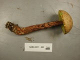
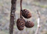
evidence. Museums hold 2,079 specimens
collected within 10 miles of Salem Street Burying Ground between 1898 and
1975: 902 Animalia, 665 Plantae, 448 Fungi, 27 Protozoa, 17 Bacteria, 12 Chromista, 8 Unrecorded. 12 distinct Species records are shown.
Collected by ?, A B Seymour, A B. Proper and others. Each is a
physical object with a catalogue
number, and each entry opens the museum's record. This is what was
collected and kept, not a survey of what lives here - nothing can be
concluded from a species being absent.
Regional context, not property-specific
evidence. The federal mineral resources record lists
11 workings within 5 miles of Salem Street Burying Ground: 9 plants, 2 past producers.
9 still produce. What was taken out: Iron, Lead, Tantalum, Niobium (Columbium). Distance is straight-line from the
map coordinates, so a quarry counted here may appear on a neighbouring
settlement's page as well.
Regional context, not property-specific
evidence. The National Weather Service names
Medford, the town this property stands in, in 20 storm reports between 1994 and 2025: 14 thunderstorm wind, 3 flood, 1 flash flood, 1 hail.
No death or injury is recorded in these reports. Each account below is quoted exactly as the forecast office
filed it, from the NOAA Storm Events Database, and each date
opens the federal record of that event.
Trees were downed on Corey Street and Riverside Avenue. A telephone pole was downed onto Massachusetts Avenue and wires on Lawrence Street were downed, all by thunderstorm winds.
At 12:52 AM EST, a large tree was down on a car and laying across Auburn Street in Medford. At the same time, a tree was reported down on Summer Street and a large tree was down on George Street.
In Winchester, a large tree was down on a house, which took the chimney off the house on Alden Lane. A tree was down on Cambridge Street by the boat club. A tree was down on wires on wires on the 30 block of Allen Road. Trees and wires were down on Ledyard Road. A tree was down on the 70 block of Lawson Road.
In Medford, multiple trees were reported downed. In Somerville, a tree was down on a house on Vernon Street and a large branch was down on power lines on Walker Street.
No historic map-sheet match is published
for this property yet. That does not mean no map exists. This record needs
a coordinate-quality review before it can be joined to a sheet boundary.
Browse the county's mapped places while that work is
pending.
Listed places nearby
6 within 8 miles
Other National Register properties close
enough to walk or drive between, ordered by distance from this one. Both
positions come from the same geocoding pass that matched these properties
to their map sheets.
Listing record. National Park Service National Register of Historic Places, listed-properties dataset, current to 2026-05-22.
Map join. Address geocoded through the United States Census geocoder, then tested against the published boundary of every sheet in the USGS Historical Topographic Map Collection.
How this page is made. Listing fields come from federal records; map-sheet coverage is a labelled coordinate-to-boundary calculation, not a source-field claim.
Wildfire. Short, Karen C. 2022. Spatial wildfire occurrence data for the United States, 1992-2020 [FPA_FOD_20221014]. 6th Edition. Fort Collins, CO: Forest Service Research Data Archive. https://doi.org/10.2737/RDS-2013-0009.6 Collected with United States Government funding and usable without additional permissions or fees.
Specimens. Global Biodiversity Information Facility (GBIF), https://www.gbif.org/. Only records licensed CC0 or CC BY are used. Records licensed CC BY-NC are excluded because this site carries advertising. Images are checked individually and any whose licence is non-commercial, no-derivatives or unreadable is refused.
Mines and quarries. USGS Mineral Resources Data System (MRDS) https://mrdata.usgs.gov/mrds/ A work of the United States government, no copyright under 17 U.S.C. 105.
Storms. NOAA National Centers for Environmental Information, Storm Events Database https://www.ncei.noaa.gov/stormevents/ A work of the United States government, no copyright under 17 U.S.C. 105. Narratives are quoted verbatim from the National Weather Service report and are not edited or summarised.
 Block
Block