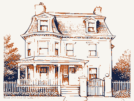
Listed on the National Register of Historic Places in
1982. A historic map-sheet match is not published yet. The record needs a coordinate-quality review before it can be joined to a sheet boundary.
From the record
“He began to work regularly in the tool factory at the age of seventeen, and after the death of his father, in 1871, entered into partnership with his uncle, Cyrus Wood, to continue the business, retaining the old name of William T. Cy:us Wood superintended the factory, and the junior partner looked after the correspondence and procuring of new business.”
Historic Homes and Places and Genealogical and Personal Memoirs Relating to the Families of Middlesex County, Massachusetts ; (1908). Machine-read text.
one of 1100 National Register listings in Middlesex County · listed in 1982 · category: Building · one of 3 National Historic Landmarks in Middlesex County.
National Register reference number.82001904- the number the National Park Service assigned this property when it was listed, and the key its nomination file is catalogued under at the National Archives.
Public Library. - To supplement the schools a good public library is a necessity. The Hon. Charles Hudson, after whom, as we have seen, the town was named, recognized this fact, and, in his letter thanking the people for the great compliment extended to him, made this proposition: "If the town of Hudson at a legal meeting called for that purpose, vote to establish a free town library for the use of all the inhabitants of the town, and shall appropriate or otherwise secure the sum of five hundred dollars, to be devoted to that object, they may call upon me, my executors or administrators, for the like sum of five hundred dollars, to be expended in furtherance of that object."
The town voted to accept and voted the necessary five hundred dollars. A committee, consisting of James T. Jo.slin, David B. Goodale and Lumau T. Jefts, was selected to carry the vote into effect. Tlie town received additional donations of 1100 from Mrs. Caroline Wood and $25 from Silas F. Manson. In November, 1868, the town voted $200 more. With this the trustees purchased 721 books for general circulation and about 200 volumes for reference. The library was opened in the room now known as Cochran's drug-store, with Ira B. Goodrich as its first librarian. Its circulation the first year was 5214 volumes to 461 different ])eople. In 1871 it was moved into the Savings Bank room, and in 1873 to its permanent home in the town hall building. During this year it received a bequest from Mrs. Emily Bailey of fifty dollars and a gift of twenty-seven volumes from Hon. Charles Hudson,. since which tiniethetown has madeliberal appropriations yearly, and the library has grown to some5000 volumes, with a circulation of nearly 17,000. The trustees in their last report say: "The Library is steadily growing in numbers, 350 new books having been added this year, and is as steadily growing in public favor. Considering the few hours per week the Library is open, the demand is an honor to the intelligence of the town. In two years 383 new names have been added to the list of patrons, and over 4000 more books have been drawn."
Regional context, not property-specific
evidence. The
federal wildfire occurrence database
lists 140 fires within 5 miles of Mossman, Col. Adelbert, House between
2015 and 2020, burning about 84 acres in total. 1 started naturally. 11 were recorded as arson.
Distance is straight-line from the map coordinates, so a fire counted
here may appear on a neighbouring settlement's page as well.
Reported cause
Fires
Debris and open burning
63
Missing data/not specified/undetermined
32
Recreation and ceremony
18
Arson/incendiarism
11
Smoking
6
Power generation/transmission/distribution
4
Misuse of fire by a minor
3
Natural
1
Fireworks
1
Equipment and vehicle use
1
The most recent of
them, most recent first, with the day each was reported and the service
that recorded it.
Regional context, not property-specific
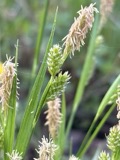
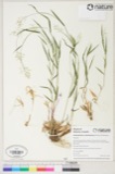
evidence. Museums hold 492 specimens
collected within 10 miles of Mossman, Col. Adelbert, House between 1898 and
1975: 338 Animalia, 143 Plantae, 11 Fungi. 12 distinct Species records are shown.
Collected by A. C. Gibson, A. F. Newton, Ahles, H.E. and others. Each is a
physical object with a catalogue
number, and each entry opens the museum's record. This is what was
collected and kept, not a survey of what lives here - nothing can be
concluded from a species being absent.
Regional context, not property-specific
evidence. The federal mineral resources record lists
16 workings within 5 miles of Mossman, Col. Adelbert, House: 12 past producers, 3 producers, 1 unknown.
3 still produce. What was taken out: Sand and Gravel, Construction, Stone, Dimension, Stone, Crushed/Broken. Distance is straight-line from the
map coordinates, so a quarry counted here may appear on a neighbouring
settlement's page as well.
Regional context, not property-specific
evidence. The National Weather Service names
Hudson, the town this property stands in, in 15 storm reports between 2003 and 2025: 7 thunderstorm wind, 6 hail, 1 heavy rain, 1 tornado.
No death or injury is recorded in these reports. Each account below is quoted exactly as the forecast office
filed it, from the NOAA Storm Events Database, and each date
opens the federal record of that event.
In Hudson, power lines in the Chestnut Hill Street area were downed by thunderstorm winds. In Stow, trees and wires on Red Acre, Boone, Randall, Birch Hill, and Gleason Dale Roads were downed by thunderstorm winds.
An EF1 tornado touched down in Stow, MA near Maple street and continued ENE over Bose Avenue causing significant tree damage. The tornado lifted somewhere near Harvest Drive and touched down again about 1.25 miles ENE just west of Packard road and continued across Carriage lane before lifting again. This tornado caused significant tree damage with several hard and softwood trees uprooted or snapped at the trunk.
No historic map-sheet match is published
for this property yet. That does not mean no map exists. This record needs
a coordinate-quality review before it can be joined to a sheet boundary.
Browse the county's mapped places while that work is
pending.
Listed places nearby
6 within 8 miles
Other National Register properties close
enough to walk or drive between, ordered by distance from this one. Both
positions come from the same geocoding pass that matched these properties
to their map sheets.
Listing record. National Park Service National Register of Historic Places, listed-properties dataset, current to 2026-05-22.
Map join. Address geocoded through the United States Census geocoder, then tested against the published boundary of every sheet in the USGS Historical Topographic Map Collection.
How this page is made. Listing fields come from federal records; map-sheet coverage is a labelled coordinate-to-boundary calculation, not a source-field claim.
Wildfire. Short, Karen C. 2022. Spatial wildfire occurrence data for the United States, 1992-2020 [FPA_FOD_20221014]. 6th Edition. Fort Collins, CO: Forest Service Research Data Archive. https://doi.org/10.2737/RDS-2013-0009.6 Collected with United States Government funding and usable without additional permissions or fees.
Specimens. Global Biodiversity Information Facility (GBIF), https://www.gbif.org/. Only records licensed CC0 or CC BY are used. Records licensed CC BY-NC are excluded because this site carries advertising. Images are checked individually and any whose licence is non-commercial, no-derivatives or unreadable is refused.
Mines and quarries. USGS Mineral Resources Data System (MRDS) https://mrdata.usgs.gov/mrds/ A work of the United States government, no copyright under 17 U.S.C. 105.
Storms. NOAA National Centers for Environmental Information, Storm Events Database https://www.ncei.noaa.gov/stormevents/ A work of the United States government, no copyright under 17 U.S.C. 105. Narratives are quoted verbatim from the National Weather Service report and are not edited or summarised.
 Block
Block