Listed on the National Register of Historic Places in
1982. A historic map-sheet match is not published yet. The record needs a coordinate-quality review before it can be joined to a sheet boundary.
From the record
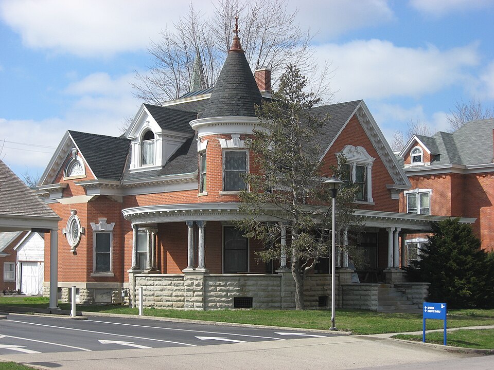
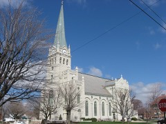
“The Marks-Family House is a historic house on the eastern side of Delphos, Ohio, United States. Erected along Franklin Street in 1902, it is a one-and-one-half-story house built in the Queen Anne style of architecture.”
Wikipedia article Marks-Family House, CC BY-SA 4.0.
one of 26 National Register listings in Allen County · listed in 1982 · category: Building.
Architectural style. Queen Anne style architecture in the United States
National Register reference number.82003537- the number the National Park Service assigned this property when it was listed, and the key its nomination file is catalogued under at the National Archives.
Mr. Harrison, in his paper on the settlement of Delphos, states that: ''About the year 1834, William Scott and William Brady opened the first road from the Auglaize Biver through the present site of Delphos to the Tillage of Van Wert It is stated that this road passed through what was then known as the ' ten-mile woods,' and that not a single cabin was seen in all that distance. It was a dreary and sickly region at that time. The great experiment of the introduction of slackwator navigation had been tried under the administration of Gh>v. De Witt Clinton in the Stat« of New York, and was gradually increasing its advocates in Ohio. As early as 1828 the United States gave to the State of Ohio certain lands, on the condition that the State would build a canal from Dayton to Defiance, on the Auglaize Biyer. These conditions were that the State should have all the even-numbered sections on the aboTe mentioned route for the construction of said canal. Some three routes were surveyed under the direction of Samuel Forrer, and immediately di^culty was experienced in ^fixing the precise location of the canaL Speculation was entered into, and the price of lands was greatly enhanced. Finally the present site was agreed upon, and in due time the work was commenced and -completed. These routes were surveyed in 1880, and the canal was completed about 1845. As soon as the location of the canal had been fully determined, there was quite a rush for lands. A number of Germans, who had settled in the neighborhood of old Fort .Jennings as early as 1834, at once discerned the rising of real estate in ^ what is now Marion Township. Ferdinand Bredeick immediately purchased a tract of land for himself and also another parcel of land for his brother, who was then in Germany. In this northwest part of Marion Township the following old settlers located : Ferdinand Bredeick, Theodore Wrocklage, Bernard Esch, John Bredeick, Conrad Loudeck, Oasper Oeise, Mathias Shroder, George Wilte, Conrad Wellman, Henry Lause, Henry Shroeder, Casper Mesker, Casper Luesmann, C. D. Geise M. Hemker, F. Beinemeyer, John Grothaus, D. Kariman, H. Linderman,and Mrs. Osenbach." In the foregoing record of land buyers, again in the history of Delphos, and lastly in the assessment roll for 1834, the names of the pioneers of this township are all given.
During the fall of 18^7 a school building was erected on Section 18, Washington Township, Van Wert Co., which was opened in the fall of that year with Miss Clarissa Gleason in charge. The following statistics for 1884 point out the advances made by the Marion Township Schools : The revenue for 1884 was $7,010. 19 ; expenditure, $6,733.81. There are thirteen school buildings, valued at $12,600; seventeen teachers are employed. The number of pupils enrolled ib 611. Just west of the county line, in Washington Township, Van Wert Co., is the Delphos Union School building. The building was erected in 1869, at a cost of oyer $30,000. In the following historical sketch of Delphos, a great deal relating to the settlement and progress of this township is to be found.
Regional context, not property-specific
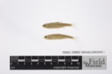
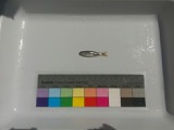
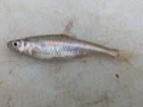
evidence. Museums hold 93 specimens
collected within 10 miles of Marks-Family House between 1865 and
1975: 91 Animalia, 2 Plantae. 12 distinct Species records are shown.
Collected by *ood, Almen N., Fischer, Roland L, Foster, T. (Todd) and others. Each is a
physical object with a catalogue
number, and each entry opens the museum's record. This is what was
collected and kept, not a survey of what lives here - nothing can be
concluded from a species being absent.
Regional context, not property-specific
evidence. The federal mineral resources record lists
3 workings within 5 miles of Marks-Family House: 1 past producer, 1 plant, 1 producer.
2 still produce. What was taken out: Stone, Crushed/Broken, Limestone, General. Distance is straight-line from the
map coordinates, so a quarry counted here may appear on a neighbouring
settlement's page as well.
Regional context, not property-specific
evidence. The National Weather Service names
Delphos, the town this property stands in, in 21 storm reports between 1998 and 2025: 10 thunderstorm wind, 9 hail, 1 tornado, 1 lightning.
No death or injury is recorded in these reports. Each account below is quoted exactly as the forecast office
filed it, from the NOAA Storm Events Database, and each date
opens the federal record of that event.
A swath of damage continued across the town of Delphos from Van Wert County into Allen County, near the intersection of West First Street and South Main Street. Tree damage was noted along the way, with minor clay roof pieces damaged on a McDonald's restaurant. As the wind exited the town, a home in the 9000 block of Lincoln Highway had the west side of its roof blown off. The strong wind then crossed US 30, flipping a semi and continuing east until severe damage occurred to a pole barn where the roof and debris was thrown around one tenth of a mile. No damage was observed after this point. Wind speeds are estimated in the 75 to 80 mph range.
No historic map-sheet match is published
for this property yet. That does not mean no map exists. This record needs
a coordinate-quality review before it can be joined to a sheet boundary.
Browse the county's mapped places while that work is
pending.
From the nomination file
1,377 words on record
When this property was proposed for the
National Register, someone wrote the case for it: what the building is,
and why it matters. That document is a federal record in the public domain.
It is quoted below word for word, never summarised. The text was read off the scanned case file by machine, so the
occasional stray character is the recogniser's and the 1970s
typewriter's.
Description of the property
stone and voussoirs. A wraparound porch encircles the Franklin Street facade and _fair and staircase are painted with trompe l'oeil stonework. The upper hall, leading - good glass windows recessed in compounded archivolt openings with Corinthian variant key- south, features oblique corners and angled windows.The truncated hip roof is to bedrooms, is painted with murals--English School type landscapes.Bedrooms The interior:is dominated.by a long.central hall leading to a high Areas of Significance-Check and justify below - prehistoric - archeology-prehistoric - -community planning . landscape architecture- - religion - archeology-historic - conservation _ science - agriculture .
literature _ sculpture _ architecture - social/ _ art _ commerce - theater X 1900- _ communications -other (specify) detail from the Queen Anne period, its elegant interior, and near-original condition. 1902 1800-1899 1600-1699 1500-1599 1400-1499 1700-1799 economics humanitarian philosophy Builder/Architect education politics/government transportation invention Period industry engineering exploration/settlement music Specific dates to see the building preserved. law 8.
Statement of significance
(in one paragraph) The Marks Family house is significant for its outstanding and rich architecural It has been excellently maintained. military nominated, at the owners' request, as it is endangered by encroaching commercial for commercial purposes which could effect contiguous properties.The owner wishes Although part ofa potential thematic grouping of brick houses in Delphos it is being 9.
Quoted from the National Register nomination
for reference 82003537, 13 pages, held by the National Archives in Record
Group 79. See the
catalogue record.
Listed places nearby
1 within 8 miles
Other National Register properties close
enough to walk or drive between, ordered by distance from this one. Both
positions come from the same geocoding pass that matched these properties
to their map sheets.
Listing record. National Park Service National Register of Historic Places, listed-properties dataset, current to 2026-05-22.
Map join. Address geocoded through the United States Census geocoder, then tested against the published boundary of every sheet in the USGS Historical Topographic Map Collection.
How this page is made. Listing fields come from federal records; map-sheet coverage is a labelled coordinate-to-boundary calculation, not a source-field claim.
Specimens. Global Biodiversity Information Facility (GBIF), https://www.gbif.org/. Only records licensed CC0 or CC BY are used. Records licensed CC BY-NC are excluded because this site carries advertising. Images are checked individually and any whose licence is non-commercial, no-derivatives or unreadable is refused.
Mines and quarries. USGS Mineral Resources Data System (MRDS) https://mrdata.usgs.gov/mrds/ A work of the United States government, no copyright under 17 U.S.C. 105.
Storms. NOAA National Centers for Environmental Information, Storm Events Database https://www.ncei.noaa.gov/stormevents/ A work of the United States government, no copyright under 17 U.S.C. 105. Narratives are quoted verbatim from the National Weather Service report and are not edited or summarised.
 Block
Block