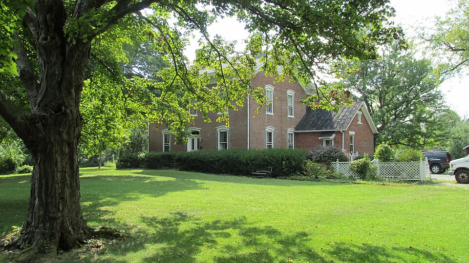
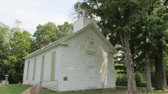
Listed on the National Register of Historic Places in
1982. A historic map-sheet match is not published yet. The record needs a coordinate-quality review before it can be joined to a sheet boundary.
From the record
one of 15 National Register listings in Clermont County · listed in 1982 · category: Building.
National Register reference number.82003555- the number the National Park Service assigned this property when it was listed, and the key its nomination file is catalogued under at the National Archives.
Regional context, not property-specific
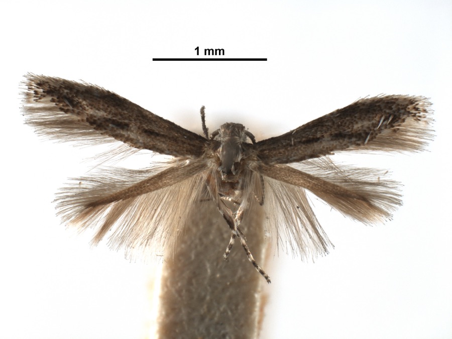
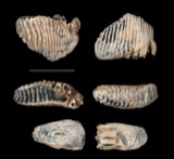
evidence. Museums hold 912 specimens
collected within 10 miles of McKever, Lewis, Farmhouse between 1866 and
1975: 623 Animalia, 241 Fungi, 37 Plantae, 11 Protozoa. 12 distinct Species records are shown.
Collected by A JOHN, A JOHN AND R KNOTTS, A JOHN AND T RITTER and others. Each is a
physical object with a catalogue
number, and each entry opens the museum's record. This is what was
collected and kept, not a survey of what lives here - nothing can be
concluded from a species being absent.
Regional context, not property-specific
evidence. The National Weather Service names
Williamsburg, the town this property stands in, in 25 storm reports between 1994 and 2023: 12 thunderstorm wind, 8 hail, 4 flash flood, 1 flood.
No death or injury is recorded in these reports. Each account below is quoted exactly as the forecast office
filed it, from the NOAA Storm Events Database, and each date
opens the federal record of that event.
The beginning of an enhanced area of wind damage occurred when a large tree fell on to a parked vehicle on Macedonia Road north of Bethel. The neighborhood of Concord Meadow Lane had numerous trees uprooted and damage to siding and roofing of a few houses. Additional similar damage was observed on Concord Hennings Mill Road to the east of Concord Meadow Lane. Further to the northeast, several trees were uprooted along State Route 133.||Widespread tree damage was noted on the south end of Santa Barbara Drive with numerous large hardwood trees uprooted and snapped, damaging some outbuildings. Similar damage was noted just to the northeast at the Williamsburg Junior Athletic Association Fields. Roofing material was blown off, outbuildings tipped over, and metal dugout awnings were destroyed. Soccer goals were pushed downfield and over a fence. A house across the street sustained damage to its siding. Wind speeds in the Santa Barbara Drive and athletic field areas were estimated to be around 90 miles per hour.
No historic map-sheet match is published
for this property yet. That does not mean no map exists. This record needs
a coordinate-quality review before it can be joined to a sheet boundary.
Browse the county's mapped places while that work is
pending.
From the nomination file
1,366 words on record
When this property was proposed for the
National Register, someone wrote the case for it: what the building is,
and why it matters. That document is a federal record in the public domain.
It is quoted below word for word, never summarised. The text was read off the scanned case file by machine, so the
occasional stray character is the recogniser's and the 1970s
typewriter's.
Description of the property
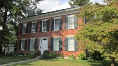
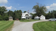
included for the following reasons; Physically they are considerably removed from the main house. Attached to the rear of the front wing is a two story brick pavilion with identical facade in 1905.The integrity of the rear verandah has been diminished by metal siding the front and side facades is symmetrical and reflects the vertical emphasis of the Check one 3.They rest on an adjacent parcel not owned by the Allgaier estate. excellent of rural Italianate architecture designed in the basic "T" plan.The fenestration on on the normally all header row (please refer to Photo #4).This type of wall treatment X good River in rural Clermont County, Ohio.
Built in 1871, the McKever House is an example ALTERATIONS: A tastefully designed one story brick living room was added to the north deteriorated unaltered Circular attic vents with louvers are employed in the gable ends while the pitched ga- Areas of Significance-Check and justify below - prehistoric .law _ science & agriculture _ literature _ sculpture X architecture - military _ social/ -music X 1800-1899 exploration/settlement = - philosophy _ theater - politics/government .transportation -other (specify) and as a physical manifestation of agrarian prosperity in Clermont County, Ohio.
Built in 1871, the McKever Farmhouse is a rare instance of brick Italianate architecture in Clermont County- Its symmetrical fenestration, decorative stone trim, and bracketed cor- four sons operated the then 277 acre farm. Today the house constitutes a significant 1500-1599 1600-1699 1400-1499 1700-1799 communications economics commerce industry humanitarian Builder/Architect archeology-historic education invention engineering Period art Specific dates 1900- conservation 1871 The Lewis McKever Farmhouse is significant as an example of rural Italianate architecture part of this pristine agrarian landscape. Statement of
Quoted from the National Register nomination
for reference 82003555, 14 pages, held by the National Archives in Record
Group 79. See the
catalogue record.
Listed places nearby
3 within 8 miles
Other National Register properties close
enough to walk or drive between, ordered by distance from this one. Both
positions come from the same geocoding pass that matched these properties
to their map sheets.
Listing record. National Park Service National Register of Historic Places, listed-properties dataset, current to 2026-05-22.
Map join. Address geocoded through the United States Census geocoder, then tested against the published boundary of every sheet in the USGS Historical Topographic Map Collection.
How this page is made. Listing fields come from federal records; map-sheet coverage is a labelled coordinate-to-boundary calculation, not a source-field claim.
Specimens. Global Biodiversity Information Facility (GBIF), https://www.gbif.org/. Only records licensed CC0 or CC BY are used. Records licensed CC BY-NC are excluded because this site carries advertising. Images are checked individually and any whose licence is non-commercial, no-derivatives or unreadable is refused.
Storms. NOAA National Centers for Environmental Information, Storm Events Database https://www.ncei.noaa.gov/stormevents/ A work of the United States government, no copyright under 17 U.S.C. 105. Narratives are quoted verbatim from the National Weather Service report and are not edited or summarised.
 Block
Block