Listed on the National Register of Historic Places in
1982. A historic map-sheet match is not published yet. The record needs a coordinate-quality review before it can be joined to a sheet boundary.
From the record
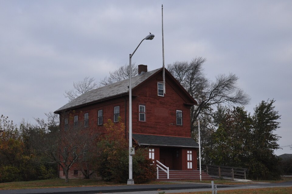
“The Forest Avenue School is a historic one-room schoolhouse in Brockton, Massachusetts. The school, originally located on Forest Avenue, was built in 1875 and operated until 1963.”
Wikipedia article Forest Avenue School, CC BY-SA 4.0.
one of 93 National Register listings in Plymouth County · listed in 1982 · category: Building · one of 1 National Historic Landmarks in Plymouth County.
National Register reference number.82004425- the number the National Park Service assigned this property when it was listed, and the key its nomination file is catalogued under at the National Archives.
The history of Brockton has been written, and is at last presented to the public, after an unexpected amount of labor. There is no. locality in New England which has undergone more rapid changes than this. In ISOO the auth(ir wrote an extended histor)' of the town of North Bridgewater, which has long since gone out of print, containing then about six thousand inhabitants. The rapid growth of the town, the change (jf name t(j Brockton, and afterwards its incorporation into a city, rendered the necessity for a new and enlarged naiTative work under the distinctive name of Brockton. The work has been subject to unavoidable delay owing to the extra amount of work in its preparation, and it is submitted to the citizens of Brockton and vicinity, with all its imperfections, with the hope that it may not be disappointing to those who are interested in and have by their encouragement and generous subscriptions been the means of its publication. Of the importance of works of this class, we may be pardoned for quoting from an eminent writer on kindred works: *
The undersigned citizens and legal voters in the town of North Bridgewater, while willing or desirous to change the corporate name of the town, respectfully beg leave to protest against adopting the name of Brockton, and ask to be heard by themselves or counsel thereon.
Regional context, not property-specific
evidence. The
federal wildfire occurrence database
lists 389 fires within 5 miles of Forest Avenue School between
2005 and 2020, burning about 159 acres in total. 5 started naturally. 8 were recorded as arson.
Distance is straight-line from the map coordinates, so a fire counted
here may appear on a neighbouring settlement's page as well.
Reported cause
Fires
Debris and open burning
197
Missing data/not specified/undetermined
124
Misuse of fire by a minor
29
Smoking
13
Recreation and ceremony
13
Arson/incendiarism
8
Natural
5
The most recent of
them, most recent first, with the day each was reported and the service
that recorded it.
Regional context, not property-specific
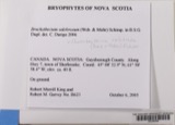
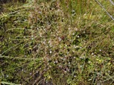
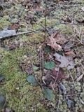
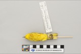
evidence. Museums hold 525 specimens
collected within 10 miles of Forest Avenue School between 1857 and
1975: 207 Plantae, 197 Fungi, 119 Animalia, 1 Protozoa, 1 Unrecorded. 12 distinct Species records are shown.
Collected by A. A. Eaton, A. B. Seymour, A. Clark and others. Each is a
physical object with a catalogue
number, and each entry opens the museum's record. This is what was
collected and kept, not a survey of what lives here - nothing can be
concluded from a species being absent.
Regional context, not property-specific
evidence. The federal mineral resources record lists
8 workings within 5 miles of Forest Avenue School: 6 past producers, 1 producer, 1 plant.
2 still produce. What was taken out: Sand and Gravel, Construction. Distance is straight-line from the
map coordinates, so a quarry counted here may appear on a neighbouring
settlement's page as well.
Regional context, not property-specific
evidence. The National Weather Service names
Brockton, the town this property stands in, in 26 storm reports between 1994 and 2023: 8 thunderstorm wind, 8 hail, 3 heavy rain, 3 lightning.
The reports record 60 injuries. Each account below is quoted exactly as the forecast office
filed it, from the NOAA Storm Events Database, and each date
opens the federal record of that event.
Numerous trees and wires were downed by thunderstorm winds throughout Brockton. This includes trees and wires on Warren Avenue in front of the Boys and Girls Club, near the high school, on Route 14, on French and Perkins Avenues, and on Ash Street. One of these trees fell on a dentists office on South Street in the Campello neighborhood.
A line of thunderstorms moved across parts of central and eastern Massachusetts with wind gusts to 40 to 50 mph. In Lowell, two children received minor injuries when a tree fell on them after it was uprooted by winds gusting to an estimated 50 mph. In Southboro, large tree limbs were downed. In Swampscott, a tree fell on an automobile. In Belmont, Cambridge, and Watertown, tree limbs and a few power lines were reported blown down. In Brockton, two large tree limbs were knocked down. In downtown Boston, a street sign was blown down and hit a man on the head.
No historic map-sheet match is published
for this property yet. That does not mean no map exists. This record needs
a coordinate-quality review before it can be joined to a sheet boundary.
Browse the county's mapped places while that work is
pending.
Named in the fire insurance atlases
Sanborn surveyors printed an index of the
town's establishments at the front of each atlas. This property is named in
one, read straight off the scanned sheet.
When this property was proposed for the
National Register, someone wrote the case for it: what the building is,
and why it matters. That document is a federal record in the public domain.
It is quoted below word for word, never summarised. The text was read off the scanned case file by machine, so the
occasional stray character is the recogniser's and the 1970s
typewriter's.
Description of the property
TheForest Avenue School was originally located at the busy intersection of Forest Avenue and West Street. It was moved two blocks to its present site in 1969 when a new branch library was scheduled to be built on its original site. The current site is on the grounds of Brockton's 6,000 student High School. Concord Avenue is a terraced drive that runs by the athletic fields to the high school complex. The schoolhouse is located on the inbound side of the terrace and is shaded by trees. Because it is 200 to 300 yards away from the high school itself, it retains its original sense of scale. The schoolhouse is a two and one half story, wood frame clapboard structure of rectangular plan. It presently sits on a new brick foundation and is enclosed by a gable roof.
condolss con eainosed double hbenesasha commoneshed Teof whechaare teached bya feight et The west elevatior five wooden steps. Two windows are located at the second story level with a sign "Forest Ave. School". A single smaller window lights the gable to which is attached a flag- The north and south elevations both contain five evenly spaced windows at each story. The second floor classroom retains nineteenth century fittings.
Statement of significance
(in one paragraph) landscape architecture... relig en law literature military musIc philosophy politics government science SCU0:u* socia humanitarian inealer transoortation other (specity) The Forest Avenue School possess integrity of design, materials and workmanship, anc as the oldest extant schoolbullding in te clty meets criterion A for its associatior with Brockton's early educationalsystem. When it opened in 1875, it stood in wha: was then a rural part of the city. The first floor was used for classes while the secor.d Iloor was used as piayspace on rainy days. classroom space and still contains its original fittings.
ins i ts The second floor was later converted to The school closed in 1963 and stood vacant for more than five years until the ciry issued a notice that it would be razed and a new branch library constructed on the site. A small group of concerned citizens formed the Little Red Schoolhouse Associatior to save the school. The group received permission from the city to move the school to its present site providing they could raise the necessary funds. The Association secured promises of money, material and labor from Brockton's merchants and trade unions and in 1969 succeeded in moving the school to the grounds of the new high school where : mom serves as an educational museum. 2 NATIONAL Substar EVALUATION/ RETURN Property:.
TORESt State, County: Federal Agency: GISTER OF HI TORIC PLACES HEET Avenue Schocl MA, Plxmouth United Department of the interior National Park Service resubmission nomination by person or local government owner objection appeal Working No.: 3:18 82-808 Fed. Reg. Date: Date Due: 4-15-52 5-2-82 Action: - ACCEPT RETURN 5/2/82 - REJECT.
Quoted from the National Register nomination
for reference 82004425, 19 pages, held by the National Archives in Record
Group 79. See the
catalogue record.
Listed places nearby
6 within 8 miles
Other National Register properties close
enough to walk or drive between, ordered by distance from this one. Both
positions come from the same geocoding pass that matched these properties
to their map sheets.
Listing record. National Park Service National Register of Historic Places, listed-properties dataset, current to 2026-05-22.
Map join. Address geocoded through the United States Census geocoder, then tested against the published boundary of every sheet in the USGS Historical Topographic Map Collection.
How this page is made. Listing fields come from federal records; map-sheet coverage is a labelled coordinate-to-boundary calculation, not a source-field claim.
Wildfire. Short, Karen C. 2022. Spatial wildfire occurrence data for the United States, 1992-2020 [FPA_FOD_20221014]. 6th Edition. Fort Collins, CO: Forest Service Research Data Archive. https://doi.org/10.2737/RDS-2013-0009.6 Collected with United States Government funding and usable without additional permissions or fees.
Specimens. Global Biodiversity Information Facility (GBIF), https://www.gbif.org/. Only records licensed CC0 or CC BY are used. Records licensed CC BY-NC are excluded because this site carries advertising. Images are checked individually and any whose licence is non-commercial, no-derivatives or unreadable is refused.
Mines and quarries. USGS Mineral Resources Data System (MRDS) https://mrdata.usgs.gov/mrds/ A work of the United States government, no copyright under 17 U.S.C. 105.
Storms. NOAA National Centers for Environmental Information, Storm Events Database https://www.ncei.noaa.gov/stormevents/ A work of the United States government, no copyright under 17 U.S.C. 105. Narratives are quoted verbatim from the National Weather Service report and are not edited or summarised.
 Block
Block